Where We Stand Today
Drought conditions are worsening across the state with 100% of Colorado reporting abnormally dry conditions or greater. A large portion of the state is actually in some sort of drought status ranging from moderate to severe and extreme drought. The snapshot below shows the latest drought monitor update from this past Thursday and it is beginning to pain a pretty dire picture:
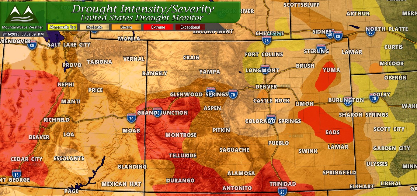
Utah and Colorado both reporting 100% of their states at “Abnormally Dry” or worse drought conditions.
Nearly all of Colorado and Utah are both experiencing serious drought conditions. This is a pattern that is consistent all across the Western U.S. as most states along the intermountain West and West Coast are experiencing the same conditions.
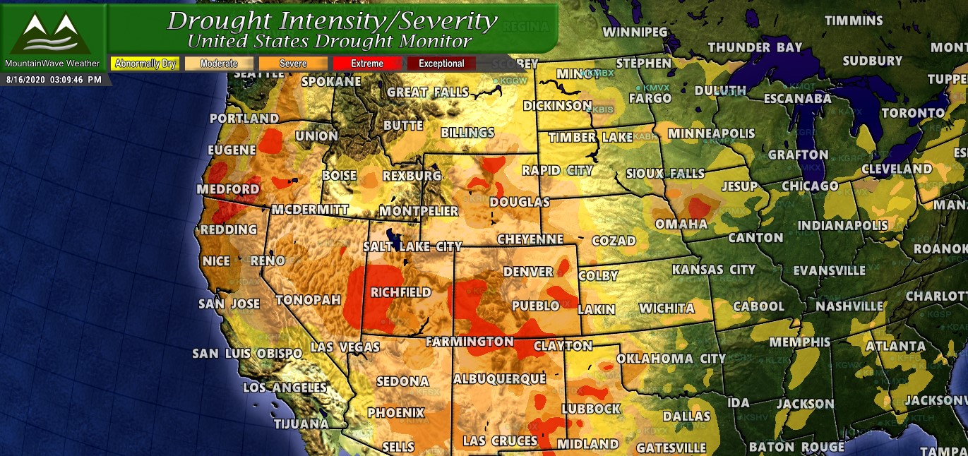
Joining Colorado in drought conditions are the states of California, Nevada, Utah, Arizona, New Mexico, Texas, Wyoming, Montana, Washington, Oregon, and Idaho – drought conditions are beginning to expand out onto the plains states as well.
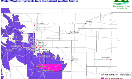
Closer to Home
If we zoom into our home area along the Palmer Divide you can see the only places hanging onto Abnormally Dry are areas along the higher elevations of the Palmer Divide including Western Elbert County and Southern Douglas County along with Northern El Paso and Teller Counties. These areas have hung on just a bit longer due to a few lucky storms that brought those regions rain in July. Most other areas missed this beneficial moisture sadly.
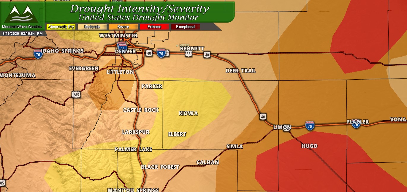
There are indications that the yellow “abnormally dry” areas will very soon be upgraded to moderate drought or worse in the near future (more on that a bit later.)
If you need a refresher of what the different drought levels mean you can read that in our earlier July 2020 Drought Update for Colorado and the Palmer Divide.
Short Term Outlook… Any Relief In Sight?
6-10 Days
The outlook is not good for any meaningful moisture or break in scorching hot temperatures for the next week or so. The 6-10 CPC outlooks are posted below and are in line with my thinking over the next 7-10 days. I think it is very likely we are warmer and drier than average and this data reflects this.
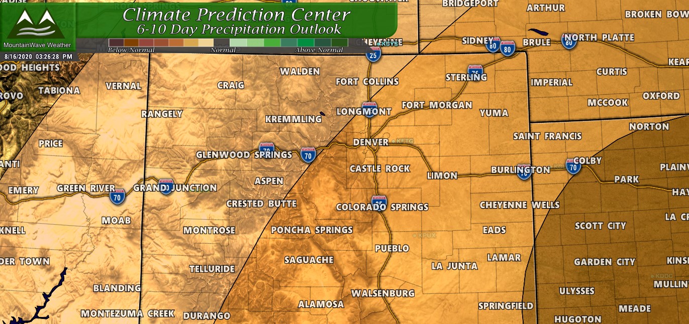
CPC’s 6-10 Day Outlook matches our thinking very closely at MountainWave Weather for the forecast for the next week or so. Drier than average conditions are highly likely for nearly all of Colorado.

In addition to drier than average conditions being likely, we also expect temperatures to remain above average. The probability of the next 6-10 days finishing above average for temperature is quite high.
Our verdict?
Expect more of the same for at least the next 10 days in Colorado. Hot and dry conditions will contribute to our high fire danger and will not offer much relief for firefighting efforts across the state.
8-14 Days

Our verdict?
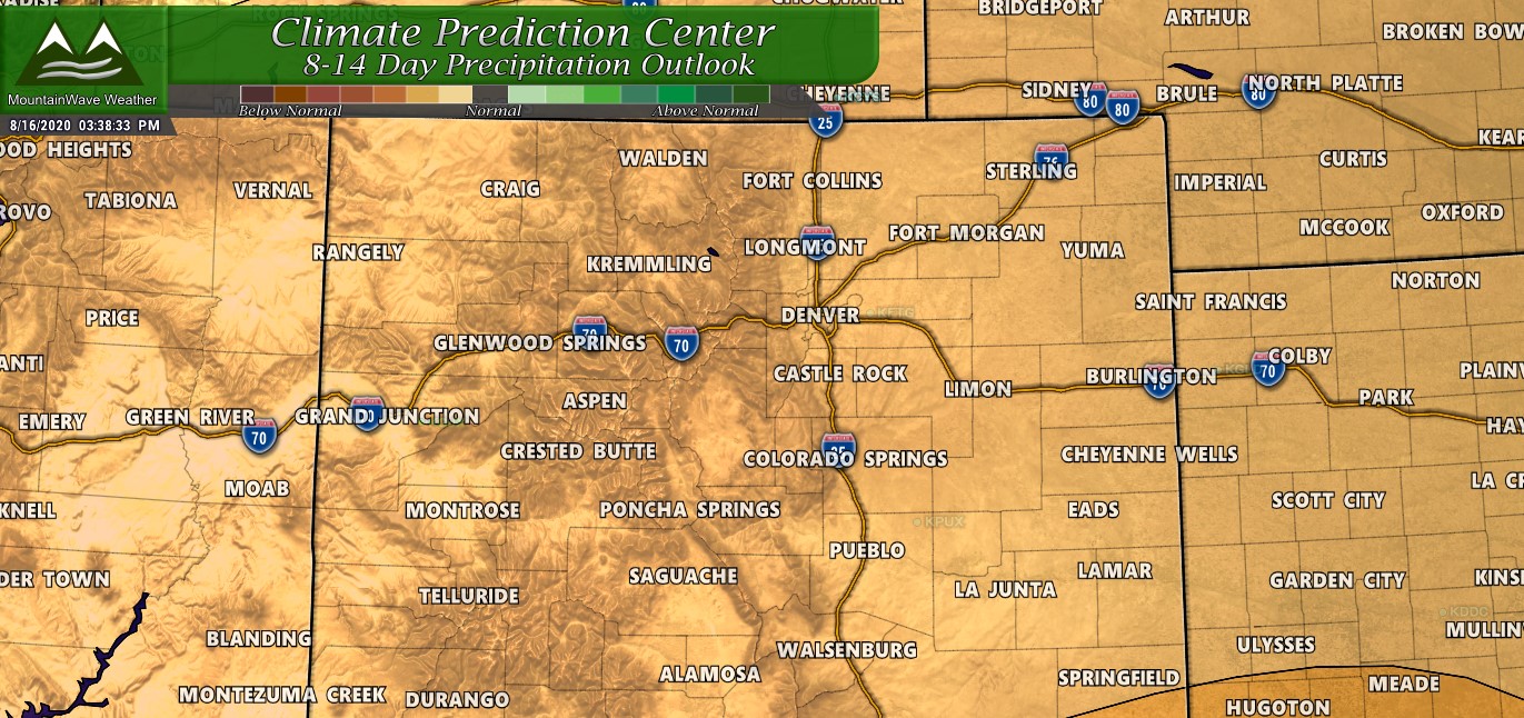
At the risk of sounding like a broken record; our outlook for the next 2 weeks (14 days) is not a whole lot different from the 7-10 day outlook. It is very likely that we continue with this very warm and very dry pattern through the end of the month. The only thing we can say that catches our eye is that some models pick up on a weather pattern change by the end of the month.
The problem with that is that it is a long ways out and there’s not very good model agreement so confidence of that change is very low right now. When we get into patterns like this it becomes very difficult to break out of them in any meaningful sort of way.
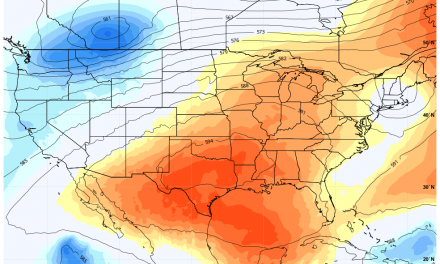
Any Improvement in Medium/Long Term?
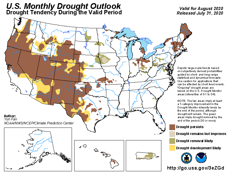
The CPC releases a monthly drought outlook product that expalains their thinking on which areas will see drought development, drought improvement or no change. The image below says it all and we agree with the CPC; drought conditions are very likely to worsen over at least the next 30 days for Colorado. Keep in mind this outlook was released on July 31 so some areas have already had their drought status upgraded… others will shortly.
To verify this… let’s dive into some models!
We’ll look at the Euro and the GFS and remember the further away we get the fuzzier the details are but we look for patterns and consistency between the two models. If we see consistency between both it gives us greater confidence and we can get further higher confidence when other short range models come into play later down the road.
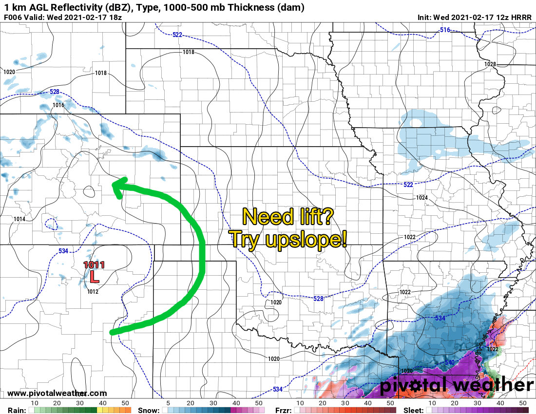
Euro
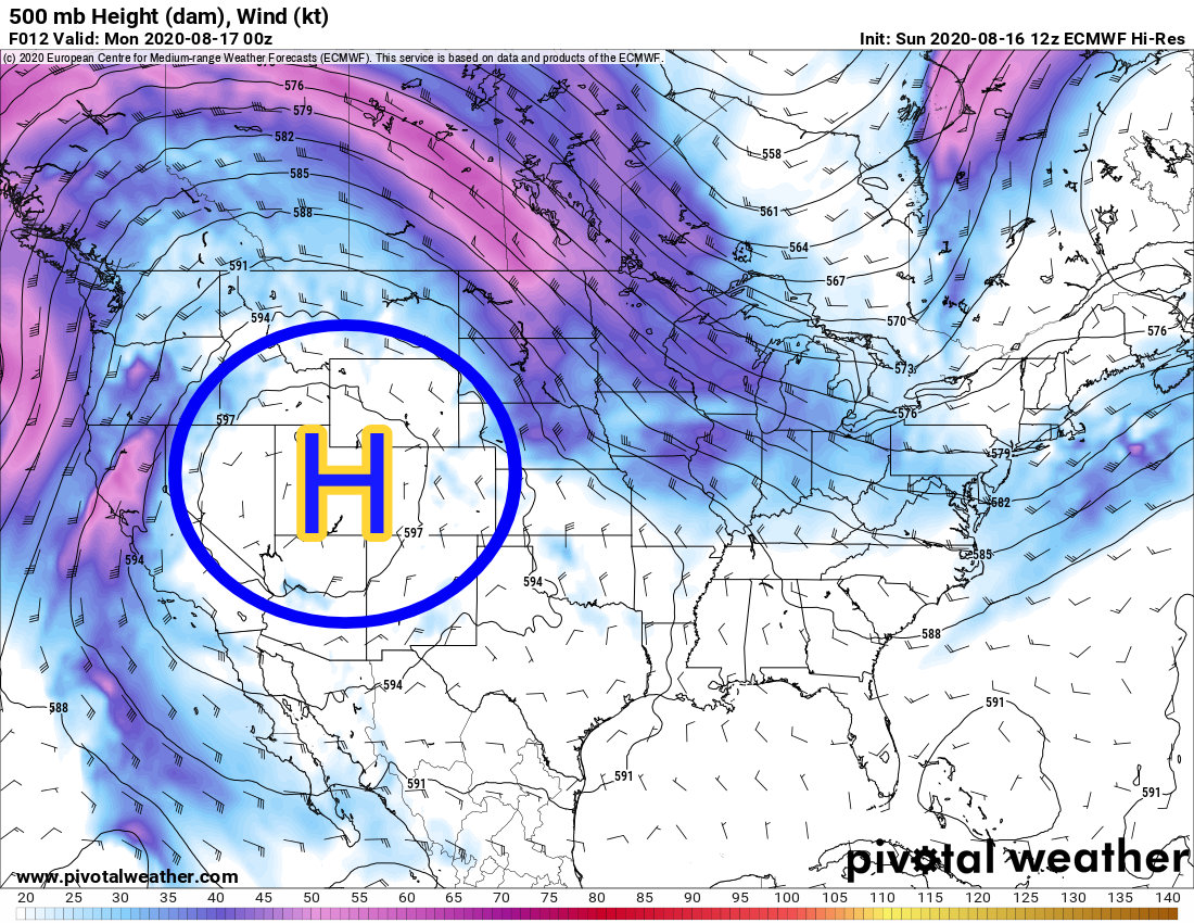
The Euro as seen today at 500mb (upper air shows us ridges and troughs): we have strong high pressure anchored over the west keeping most of the storminess and moisture well to our North. Clockwise flow is bringing hot dry air out of the desert Southwest, across California into Idaho, Montana, Wyoming and into Colorado along Northwesterly flow.
Ideally if we are looking for a weather pattern change we would want to see the high pressure break down and allow troughs (storm systems and cold fronts) move into Colorado. Let’s see what happens:
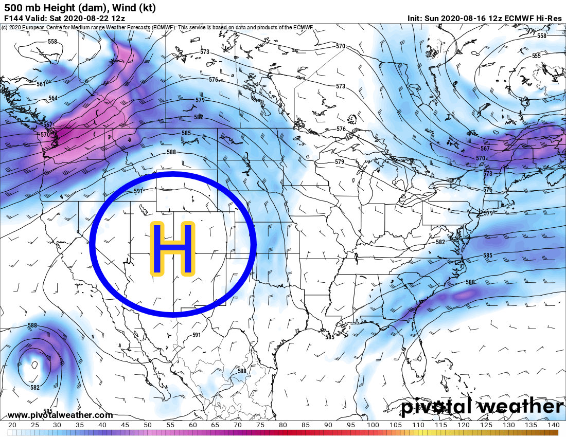
7 days out on August 22, 2020… not much to say here other than this looks exactly the same as to what we’ve experienced the past few weeks around here. Let’s fast forward a bit more…
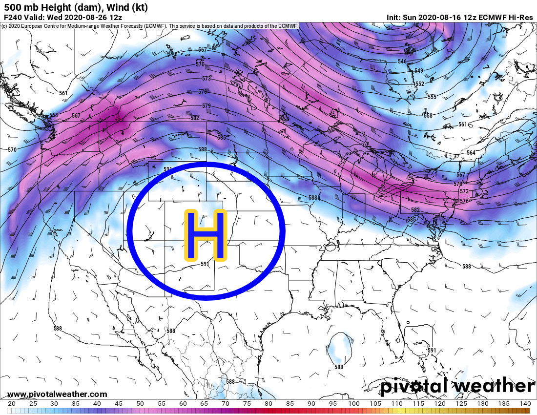
Here is the outer range of the Euro at Wednesday August 26. No change here either as you can see the high pressure shifts slightly but still remains anchored over Colorado.
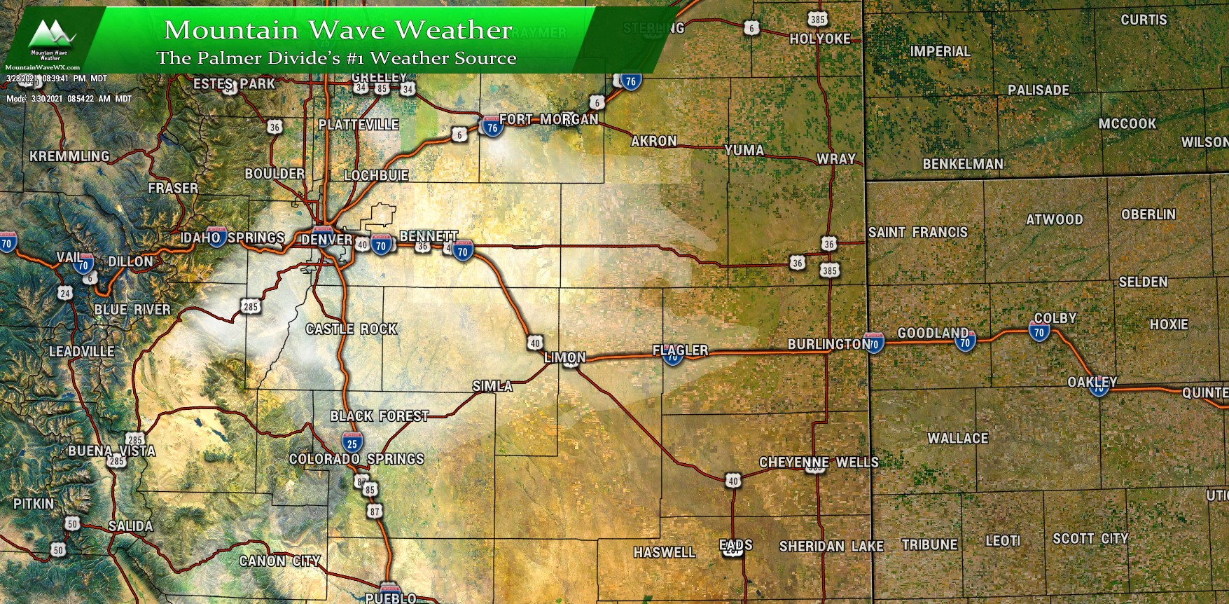
GFS
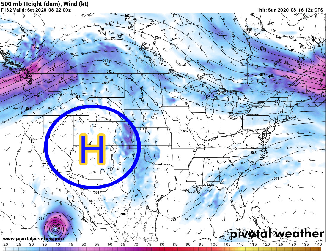
Staying in lock-step with the Euro snapshots from above, here is the GFS on Saturday August 22. Notice that like the Euro, it has a strong high pressure ridge over much of the Western United States. This is bad news for those of us looking for a pattern change… let’s move a bit further forward.

As we get to Wednesday August 26 we see the same thing going on. The GFS goes out a bit further than the Euro so we can see all the way to the end of the month.
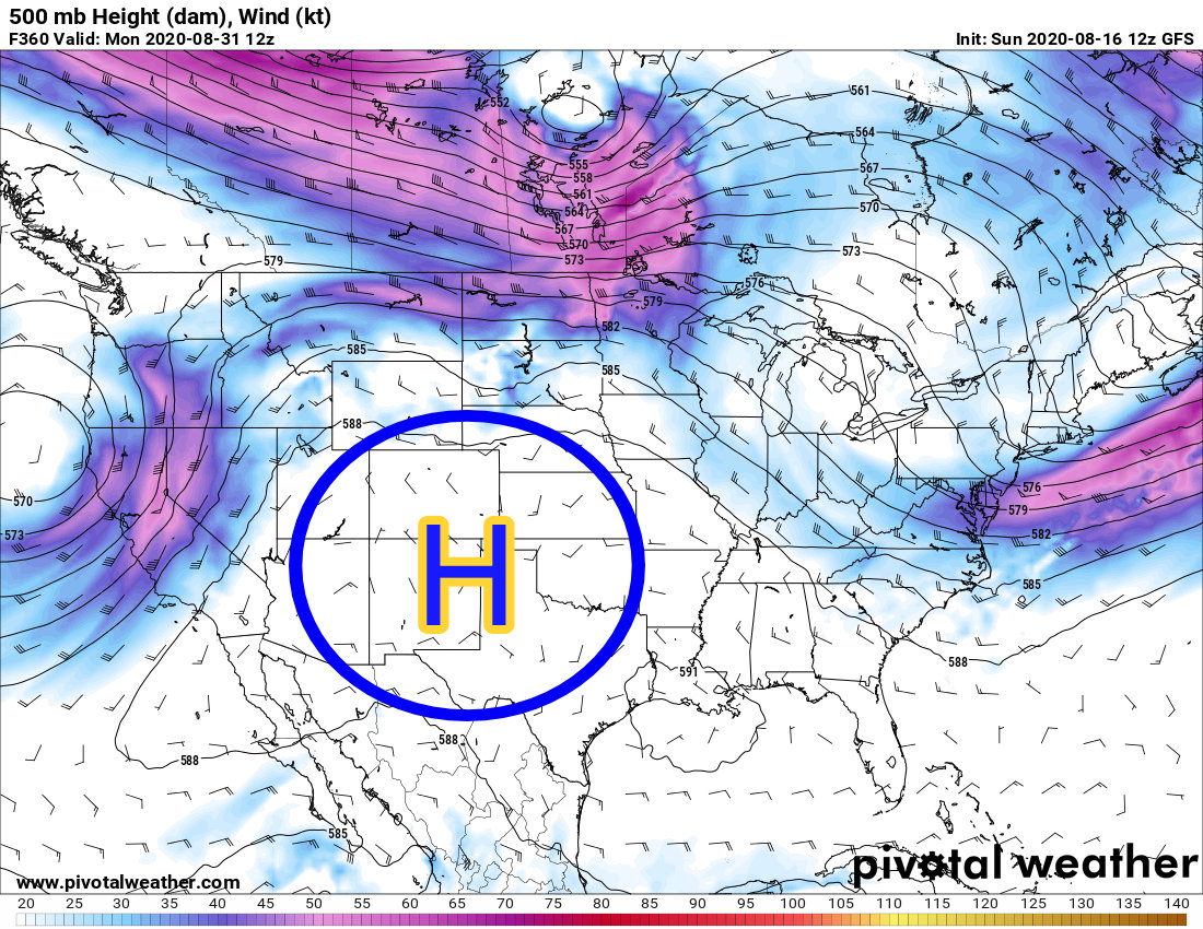
Monday August 31 upper level pattern… need I say more?
Summary
I know there’s a lot of information here to digest, but I’ll wrap up what we are seeing on the models and let the drought graphics just speak for themselves. Given the information we are seeing on our longer range models and just given the overall pattern it is unlikely we see a large scale weather pattern shift at all during the month of August. When we get into weather patterns like this it is extremely hard to break out of them; “drought begets drought”, is a saying one of the Mets I follow often says.
If we throw in the CFS (candian model) we can look out even further all the way into mid-September… I won’t elaborate on that model too much because at that time range it gets wildly inaccurate… but the vibe it gives off is more ridging and thus warm and dry conditions into September.
I won’t call that an official forecast until I see better data around it, but it is concerning that we see some indications of a warmer and drier signal for at least the next 30 days or longer. We will keep everyone updated as we get more information in over the coming weeks. I haven’t even talked about La Nina yet and that is something we may have to recon with this fall and winter as well… more on that to come!
