Not that nearly every storm this year hasn’t thrown a curveball or anything, but today’s storm system will actually see spring-like characteristics in the atmosphere as the main driver of our snowfall chances this afternoon. I do want to stress though, for 80-90% of folks along the front range, this storm will be a non-event with meager amounts of snow (if any) but we have to mention the possibilities because for those areas outside of that majority – there is a chance for quick hitting, moderate to heavy snow.
Let’s look at the latest details.
Weather Alerts Ahead of the Storm
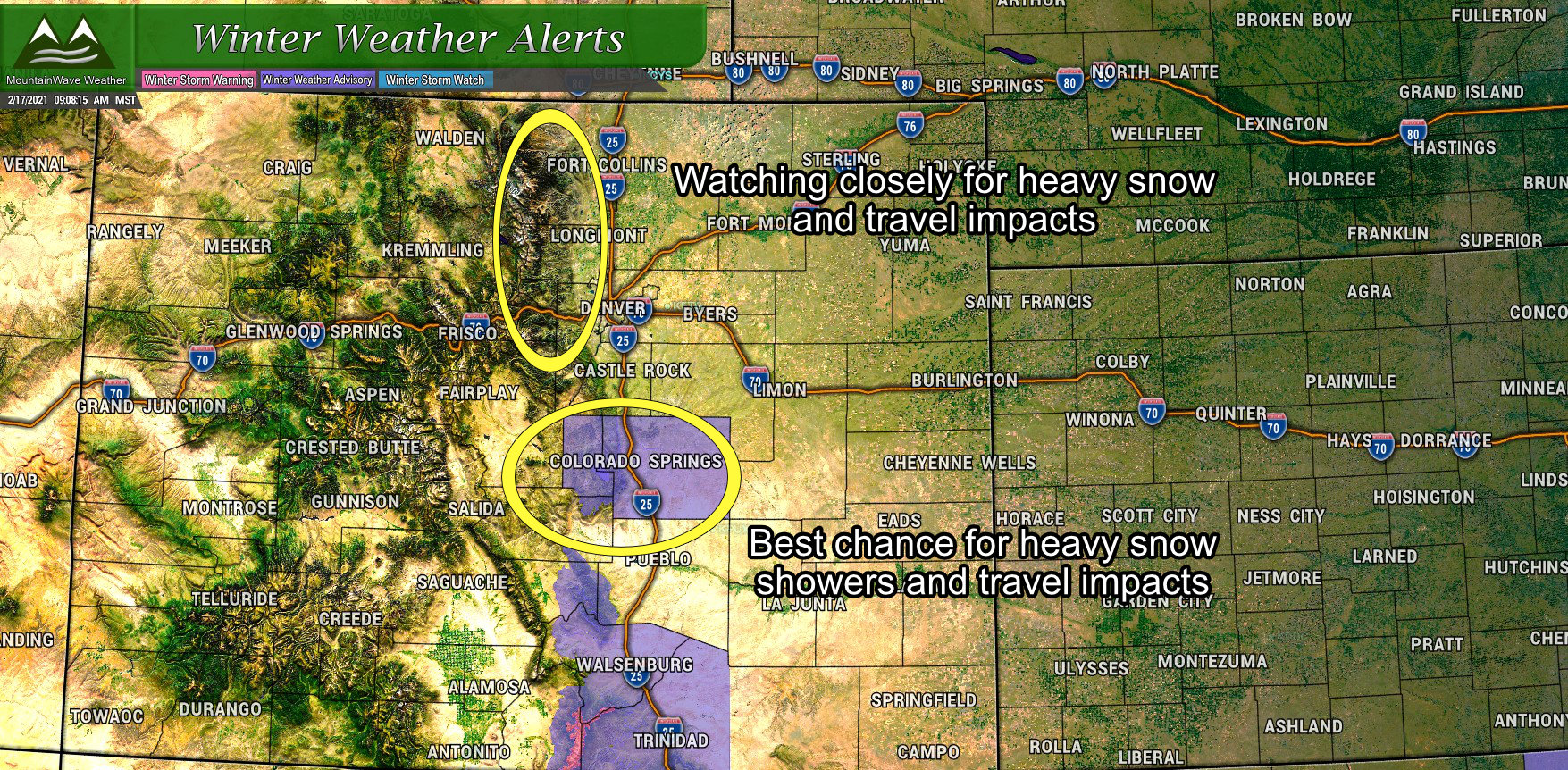
Ahead of this storm the NWS has issued a Winter Weather Advisory for areas along the Southern Palmer Divide and into Colorado Springs. This advisory goes into effect Wednesday afternoon at 2PM and will last through 5AM Thursday. This is one of the areas of concern that has the best chance of seeing those “surprise” heavy snow showers.
Anywhere between 2-7 inches of snow is expected depending on where the heavier snow sets up so do expect travel impacts from areas South of Castle Rock, into Colorado Springs and West of Colorado Springs in the afternoon, evening and overnight hours.
The second area of concern that will be closely watched is the foothills West of Denver and the I-25 corridor. While models are handling this system poor in general, we can’t ignore that with systems like this, terrain favored areas where this is better potential for lift are where you could likely see heavier snow.
A Taste of Spring – Storm Setup and Analysis
A little bit of weather 101 for today: recall that convection is basically the tendency for warmer and less dense air to rise into colder more dense air. Convection is something we often see during spring and summer along the Colorado front range, but can it really happen in the winter?
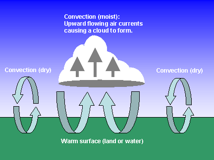
The basic idea behind convection
Absolutely! Convection can occur whenever the atmosphere aloft is colder than the atmosphere below and a sufficient lifting mechanism is introduced. As we all know, one of the best lifting mechanisms we have in Colorado is our terrain and upslope flow.
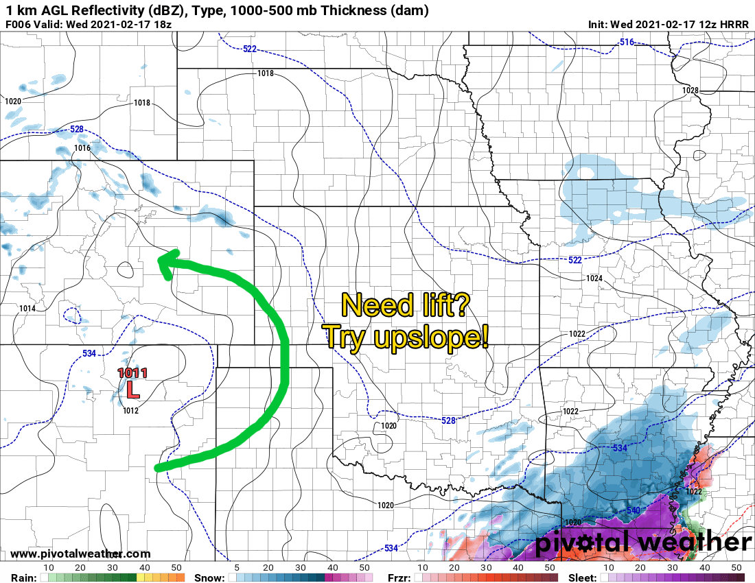
This afternoon a surface low will set up over Eastern New Mexico and provide weak upslope as we go later into the afternoon and evening hours. This should give us just the boost we need to wring a bit of moisture out of the atmosphere. We can also use our old friend, the Skew-T to get an idea of what the atmospheric setup may look like at that time and derive a picture for a forecast.
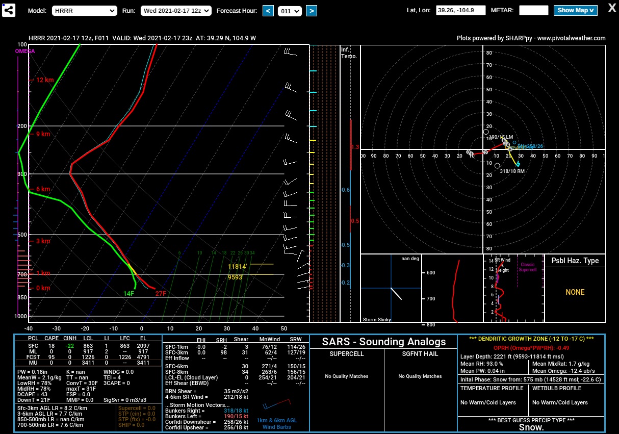
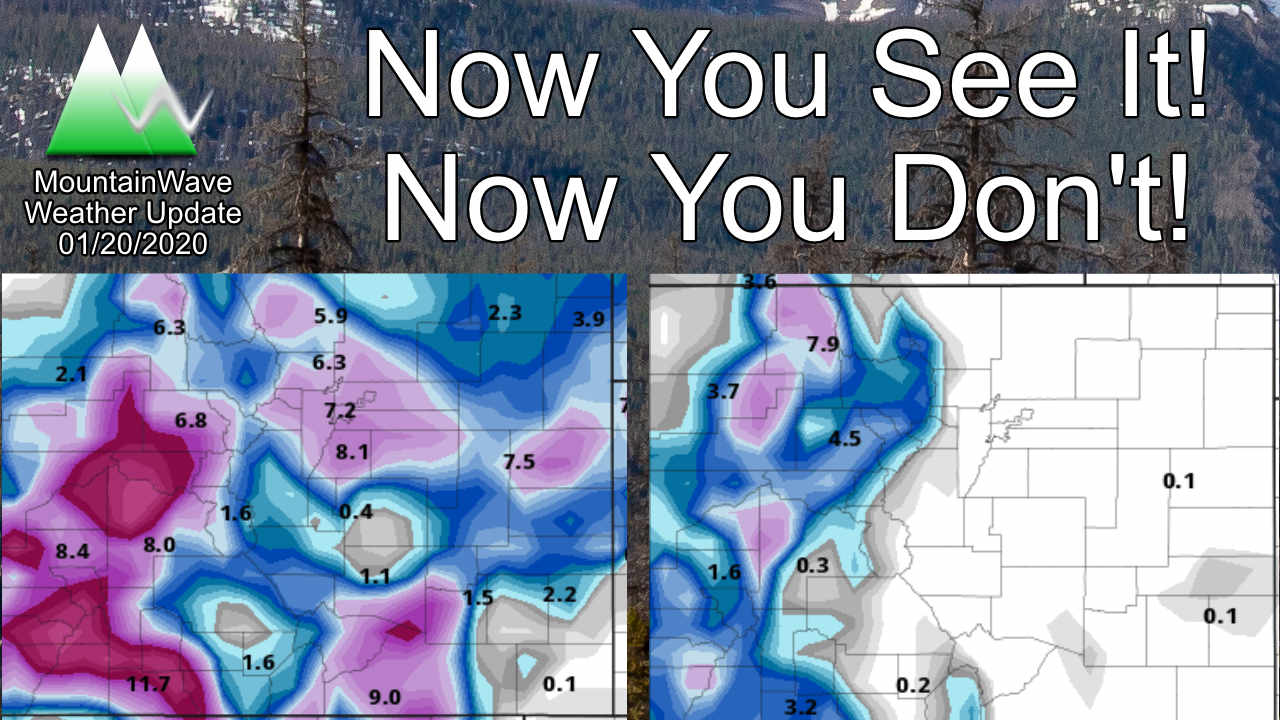
Nam3K Simulated Sounding for 4PM – Southern Douglas County
This image tells us a few things:
- Atmosphere is saturated above the surface so moisture is present
- There is lifting (upslope) due to eastward winds, but it is weak!
- There is a bit of instability meaning air that is lifted will tend to want to keep rising (forecast CAPE of 95 j/kg)
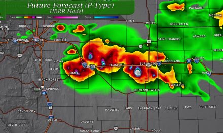
Long story short, there is a bit of moisture for snow, there is weak upslope and some convective lift. The nature of the snow showers will probably be farily light to scattered for most folks but a few lucky ones could get caught under moderate to heavy snow.
Snowfall Forecast/ Timing
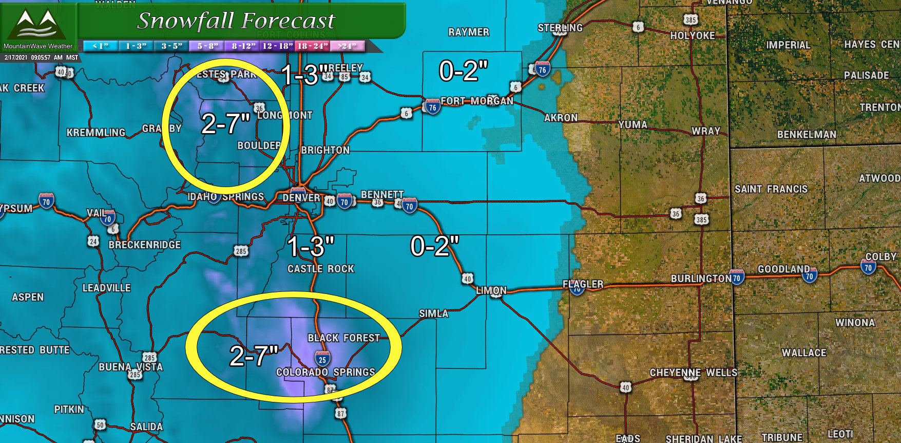
Here’s the rough ranges of snowfall expected with a few areas identified that will need closer watching. As of right now this doesn’t look to be a large snow producing storm for most of us, but those areas caught under convective snow showers could see decent accumulation. Unfortunately, we just can’t predict exactly where those areas will be – we can only see areas that have the best “chance.”
As for timing:
- Snow showers possible after 12pm – they will be scattered
- More widespread snow after 3PM
- Snow will continue through the evening and overnight hours – it looks mostly gone by Thursday morning 6AM or so
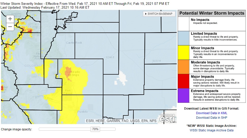 Winter Storm Severity Index shows possible minor to moderate impacts, especially South of Castle Rock, towards the springs and through El Paso and Teller Counties. Depending on where the heavier snow showers set up, don’t be surprised to see tricky travel conditions outside of those areas though!
