A storm will spin its way into the four-corners region by Thursday. Some leftover clouds from Wednesday (when a short wave moves just to our North) may limit temperatures on Thursday, meaning we could see less of a chance of convective-based snow showers (thunderstorms with snow, very heavy localized bursts of snow)
The main winter weather highlights are in the foothills and mountains right now, but one area to watch for additional highlights will be the Palmer Divide. A favorable Northerly/Northeasterly upslope component with this storm could mean higher snow totals for many areas South of Denver and North of Colorado Springs.
I’ll be sure to pass along any highlights that get issued for the Palmer Divide.
For now, here’s my thinking on this storm:
Current Weather Highlights
There are two areas of Winter Storm Watches, a Northern and Southern. I’ve highlighted and provided details for both below:
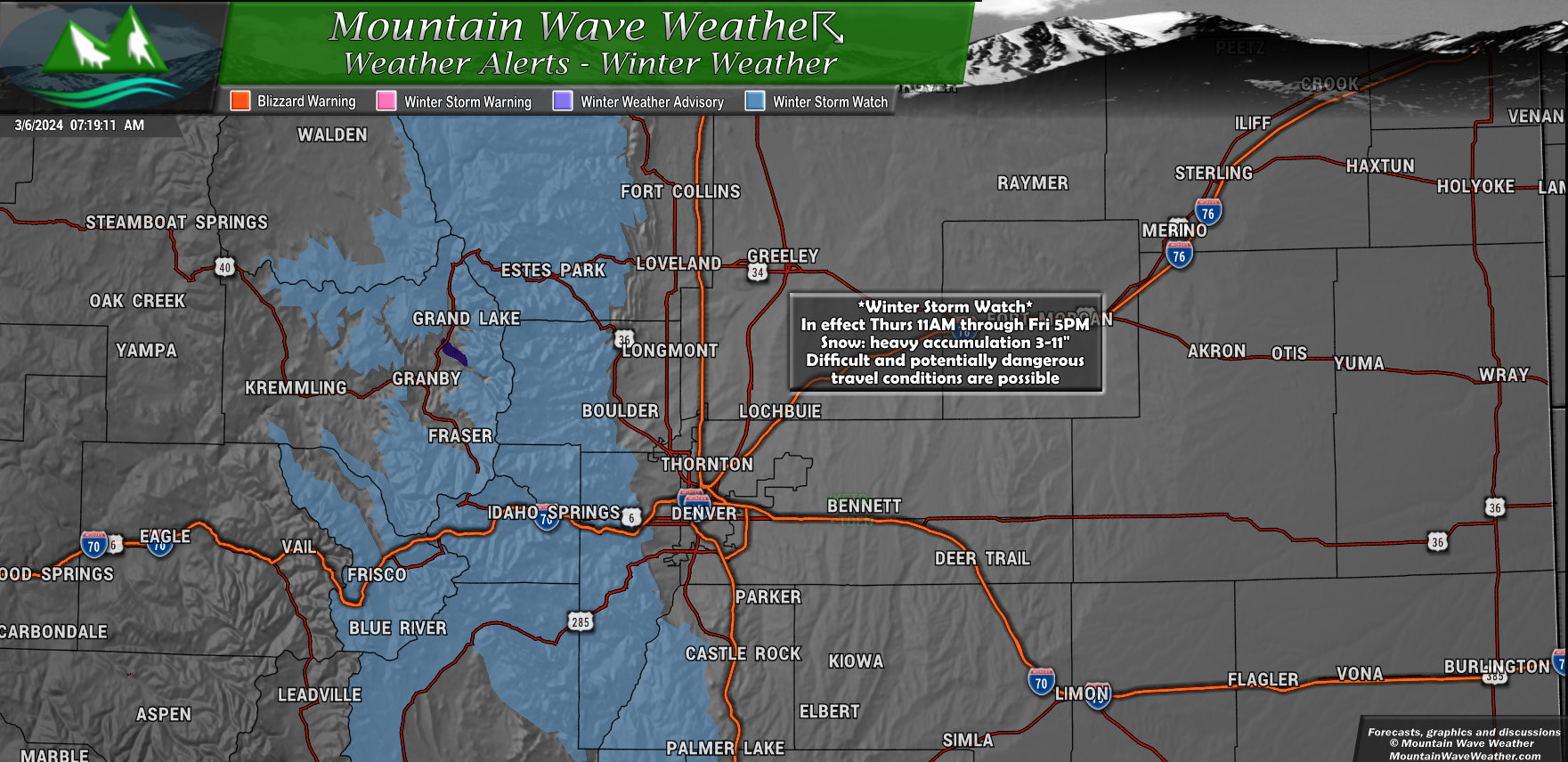
A Winter Storm Watch is in effect from Thursday morning through Friday afternoon for the following areas:
- Rocky Mountain National Park and the Medicine Bow Range
- Mountains of Summit County, the Mosquito Range, and the Indian Peaks
- Northern and Southern Front Range Foothills
Here’s what to expect:
- Heavy snow possible: Accumulations of 3 to 11 inches.
- Snow-covered roads: Hazardous travel conditions likely, especially impacting Thursday evening and Friday morning commutes.
Stay safe!
- Monitor the latest forecasts for updates on this situation.
- Be prepared for winter driving conditions if you must travel.
- Allow extra time for your commute and consider delaying non-essential travel.
Stay informed and weather-aware!
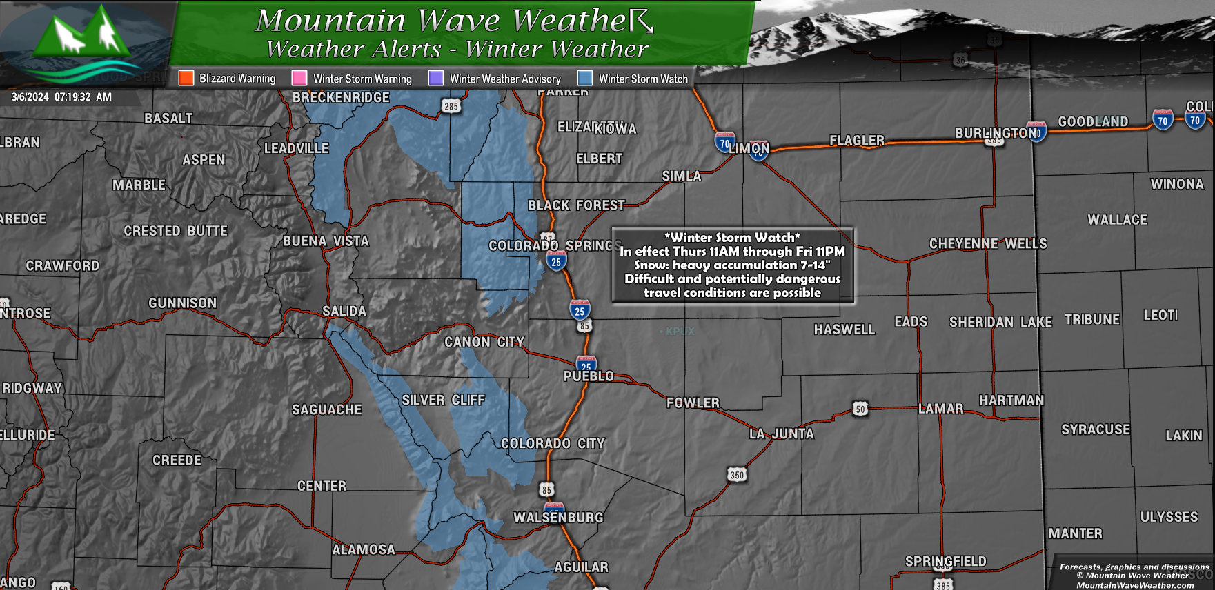
A Winter Storm Watch is in effect from Thursday morning through Friday evening for the following areas:
- Wet Mountains
- Sangre de Cristo Range
- Pikes Peak
- Teller County
Here’s what to expect:
- Heavy snow possible: Accumulations of 7 to 14 inches.
- Difficult travel conditions: The hazardous conditions could impact commutes on Thursday and Friday.
Stay safe!
- Monitor the latest forecasts for updates on this situation.
- Be prepared for winter driving conditions if you must travel.
- Allow extra time for your commute and consider delaying non-essential travel.
Stay informed and weather-aware!
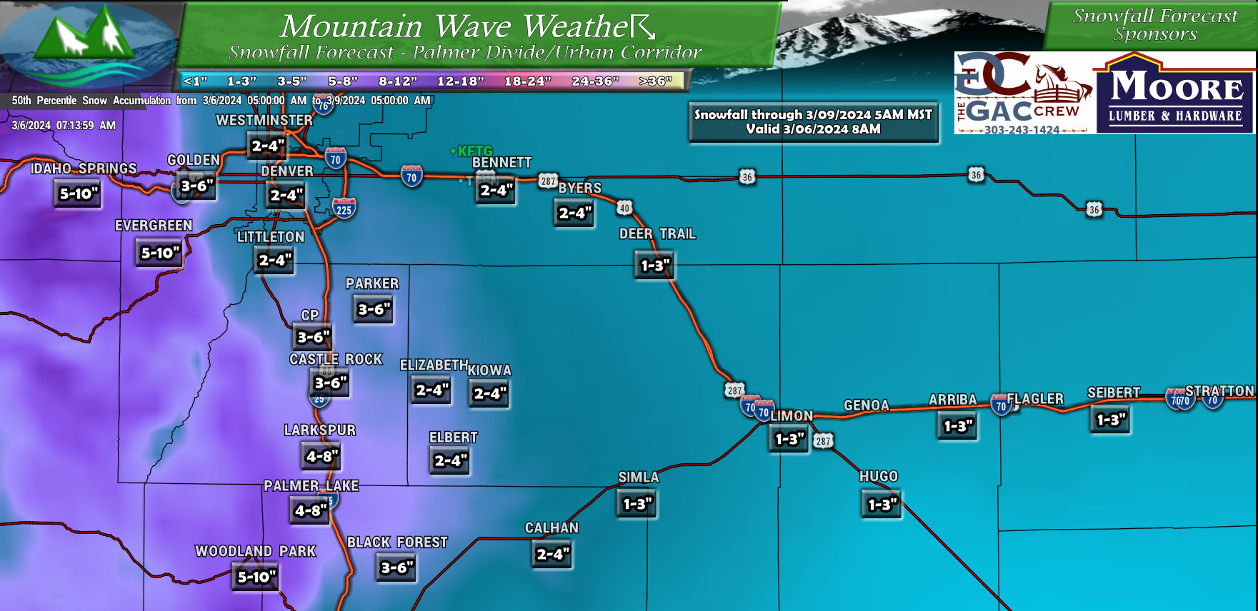
Preliminary Snowfall Forecast
There’s still some model uncertainty due to how the upslope sets up, the temperatures and potentially some convective instability (means there could be isolated spots of higher or lower snow over small geographic areas)
As such, treat these snowfall forecasts as preliminary. Changes will likely be made to the forecast through Wednesday and Thursday.
Denver/Palmer Divide
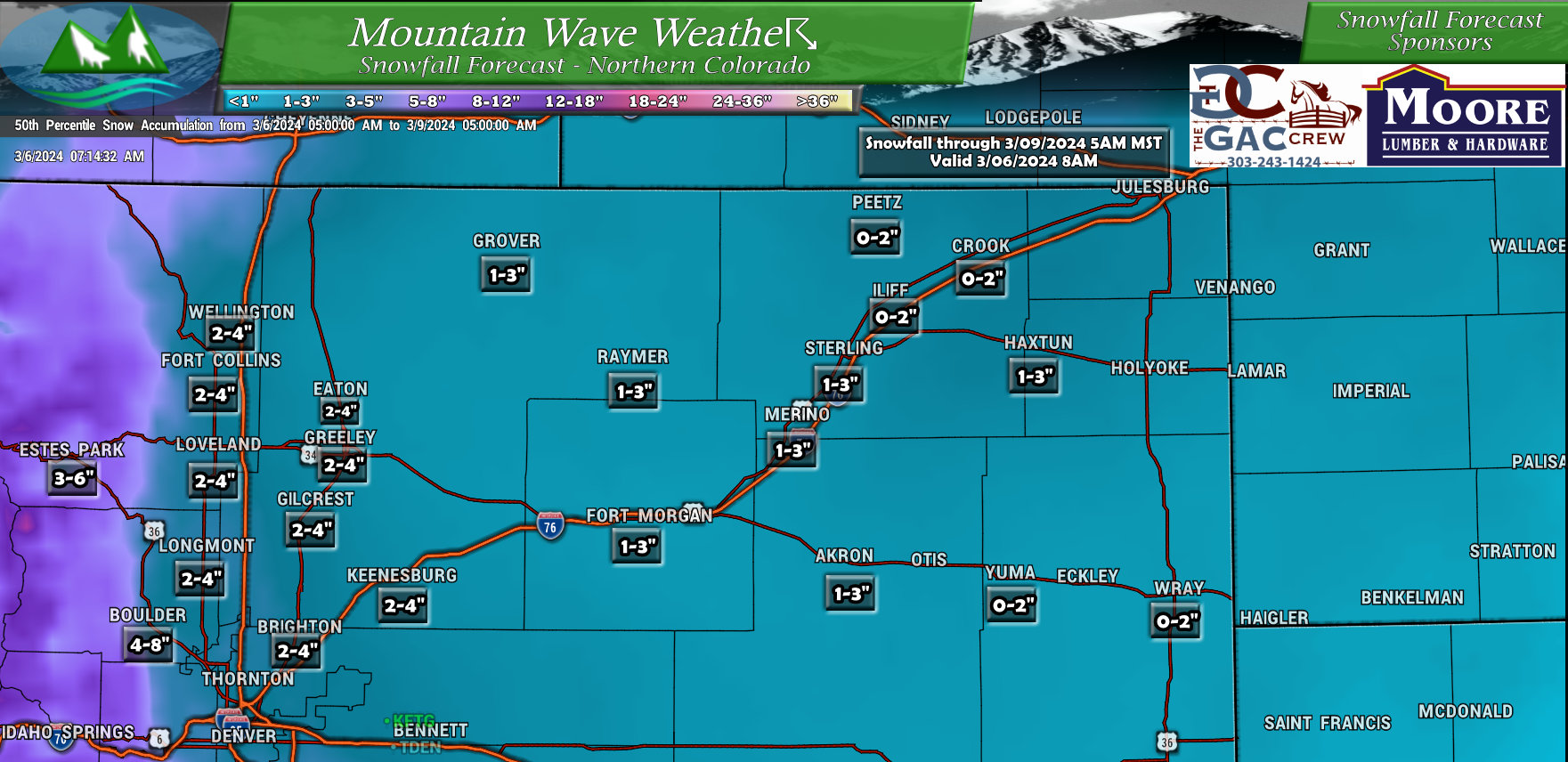
Northeastern Colorado
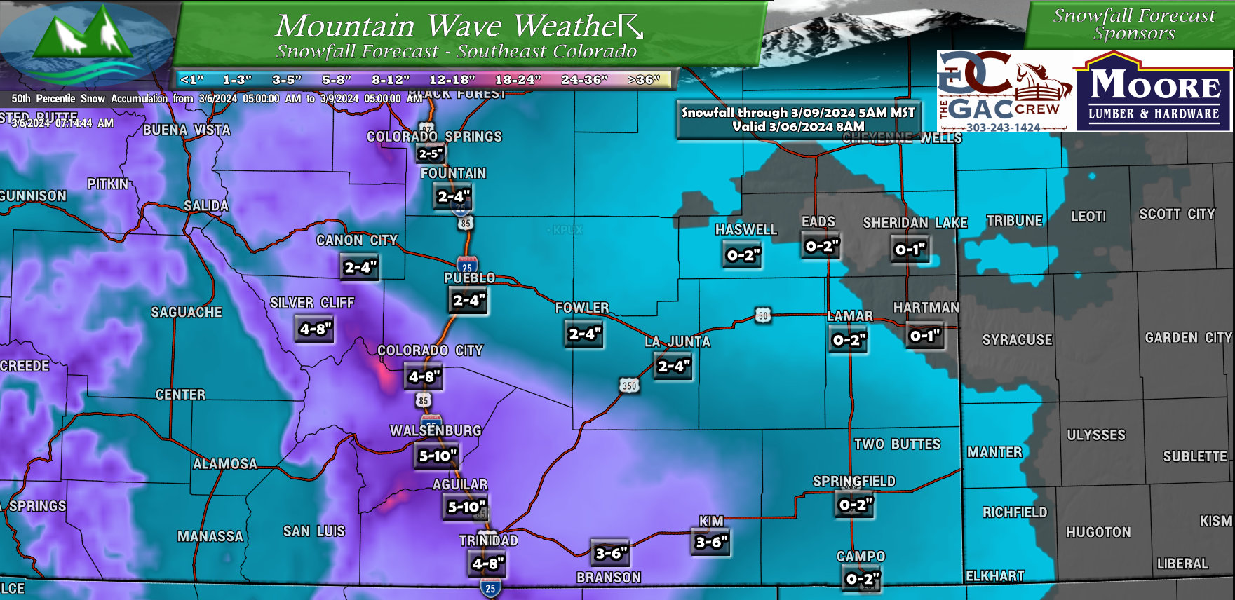
Southeastern Colorado
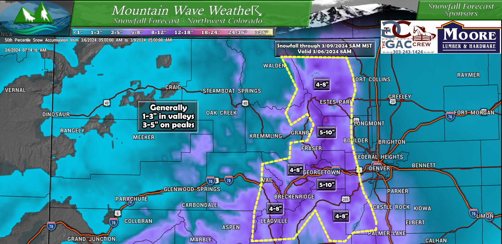
Northwestern Colorado
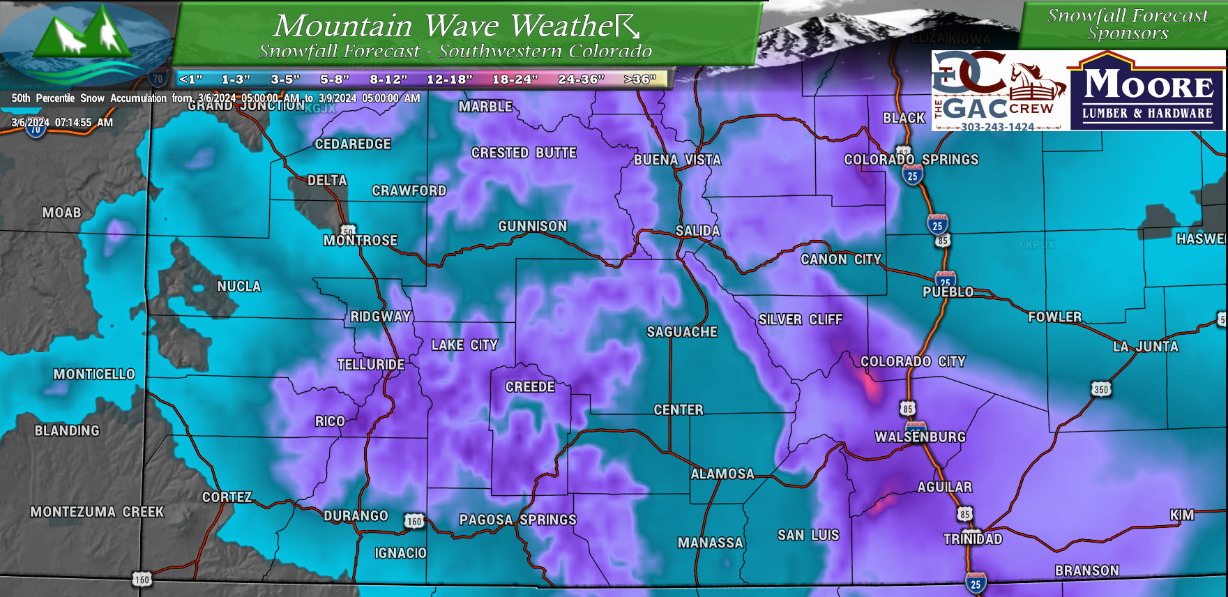
Southwestern Colorado
Timing and Impacts
Here’s what to expect:
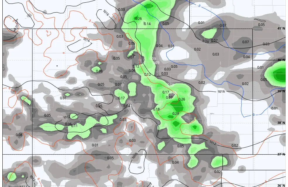
- Today and tonight: Scattered showers are possible, with rain on the plains and very light snow possible in the mountains. For the plains overall, the nature of any showers will be very isolated so not everyone will see showers.
- Thursday afternoon through Friday: Moderate snowfall is expected in the mountains and foothills.
- Plains: Rain will likely change to snow on Thursday afternoon, turning heavier in the late evenign and overnight hours. Heaviest accumulation looks likely near the foothills and potentially impacting commutes on Friday morning.
Summary and Preparation
Although there’s no watches issued for the Palmer Divide – this storm could be a good sized “medium sized” storm with decent snowfall accumulation.
Due to temperatures, snowfall would likely be of the “heavier” and “wetter” variety we typically see as we go into March.
Winds overall will be from the North or Northeast with this storm system.
For ranching/ag interests, I’d prepare for a period of moderate to heavy snow Thursday night and into Friday morning. It doesn’t look like this storm will be “major” at this point but will have to keep an eye on it. Enough snow could fall to cause a few headaches.
For travel, most likely impacts would be overnight Thursday and into Friday morning, especially between South of Denver and about Monument.
Temperatures will be marginal in the 20’s – so we don’t see a cold or “arctic” blast that would concern me too much about animals.
I’ll be sure to pass along any updates as needed on Wednesday and Thursday, stay tuned!
