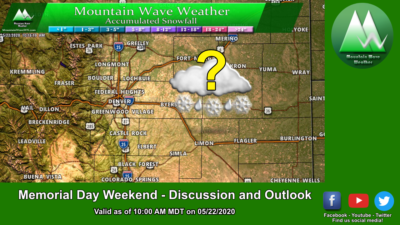
Will this storm be a doozy? Time will tell, but we need to start preparing in case the heavy snowfall forecast verifies on this one!
The highlights of this week’s storm:
Details:
- Two weather systems will bring in cold air and moisture.
- Favorable conditions for snowfall with good mid-level lapse rates and easterly upslope flow.
- Rain may mix with snow initially, but a transition to all snow is expected later Wednesday for Denver and surrounding areas.
- Convective activity may help cool temperatures and accelerate snowfall.
Here’s the rest of the information to help you get prepared for this storm!
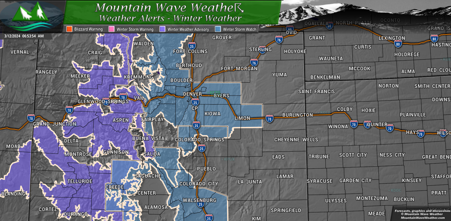
Winter Weather Highlights
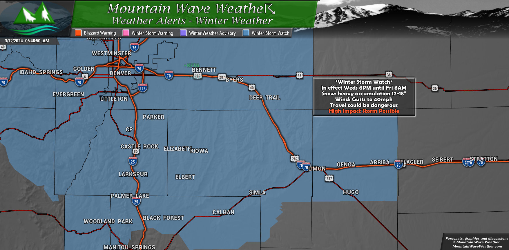
The National Weather Service has issued a *Winter Storm Watch* for the Palmer Divide, Denver Metro Area and Northern El Paso County. This includes Elizabeth, Elbert, Monument, Simla, Calhan, Larkspur, Kiowa, Fondis, Black Forest, Lone Tree, Highlands Ranch, Parker, Castle Pines, and Castle Rock along the Palmer Divide.
Here’s what you can expect:
- Timing: Wednesday evening through late Thursday night.
- Snowfall: Heavy snow possible, with accumulations between 12 and 18 inches.
- Winds: Gusts up to 40 mph possible.
- Impacts: Travel could be very difficult or impossible, especially during the Wednesday evening and Thursday morning commutes.
What to do:
- Keep an eye on the latest forecasts for updates as the storm gets closer.
- Be aware that there’s still some uncertainty about the exact details of the storm, but significant snowfall is becoming more likely.
- Take steps to prepare for a winter storm, such as having a well-stocked emergency kit and a plan for how you’ll get around if the roads are bad.
Stay safe!
For more info:
- Visit the National Weather Service website: https://www.weather.gov/bou/
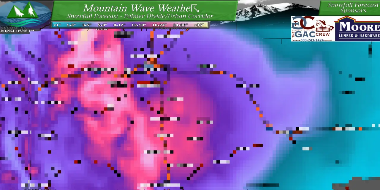
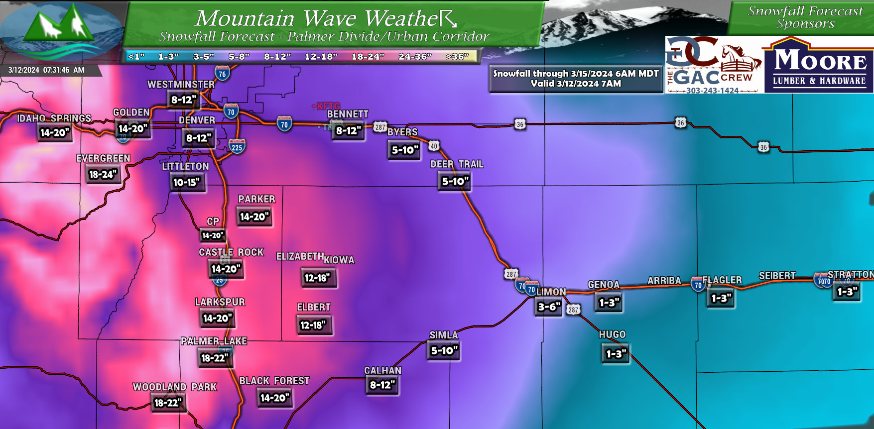
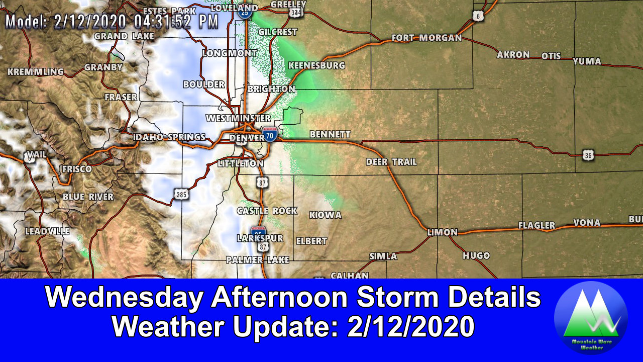
Preliminary Snowfall Forecast
Here’s our first crack at the snowfall forecast. Remember these numbers a preliminary and will change on Tuesday depending on how the data comes in and how things trend, so take note more of the areas favored for higher snow amounts rather than the actual number itself which may change. For now though, this is our current thinking on snowfall…
Denver/Palmer Divide
With strong and sustained NE upslope flow, areas in the “upslope notch” such as the Denver Front Range Foothills and Palmer Divide are favored for heavier snow amounts. Again, the actual numbers may shift, but the maps are a good tool at showing the areas favored for higher snow amounts overall with this type of storm setup.
Northeastern Colorado
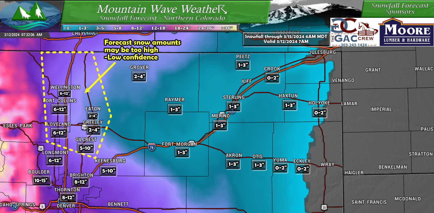
Areas close to the foothills and into Denver have the best chance of higher snowfall. I’ve highlighted the Northern Urban/I-25 corridor as a region where this particular model may be over-doing it on snowfall. Areas North and East of Denver may experience a very sharp drop-off for snow (strong gradient) especially as you move further East into the lower elevations. This storm is not particularly cold so elevation will play a role on who sees snow stick or melt below 5,000 feet.
Southeastern Colorado
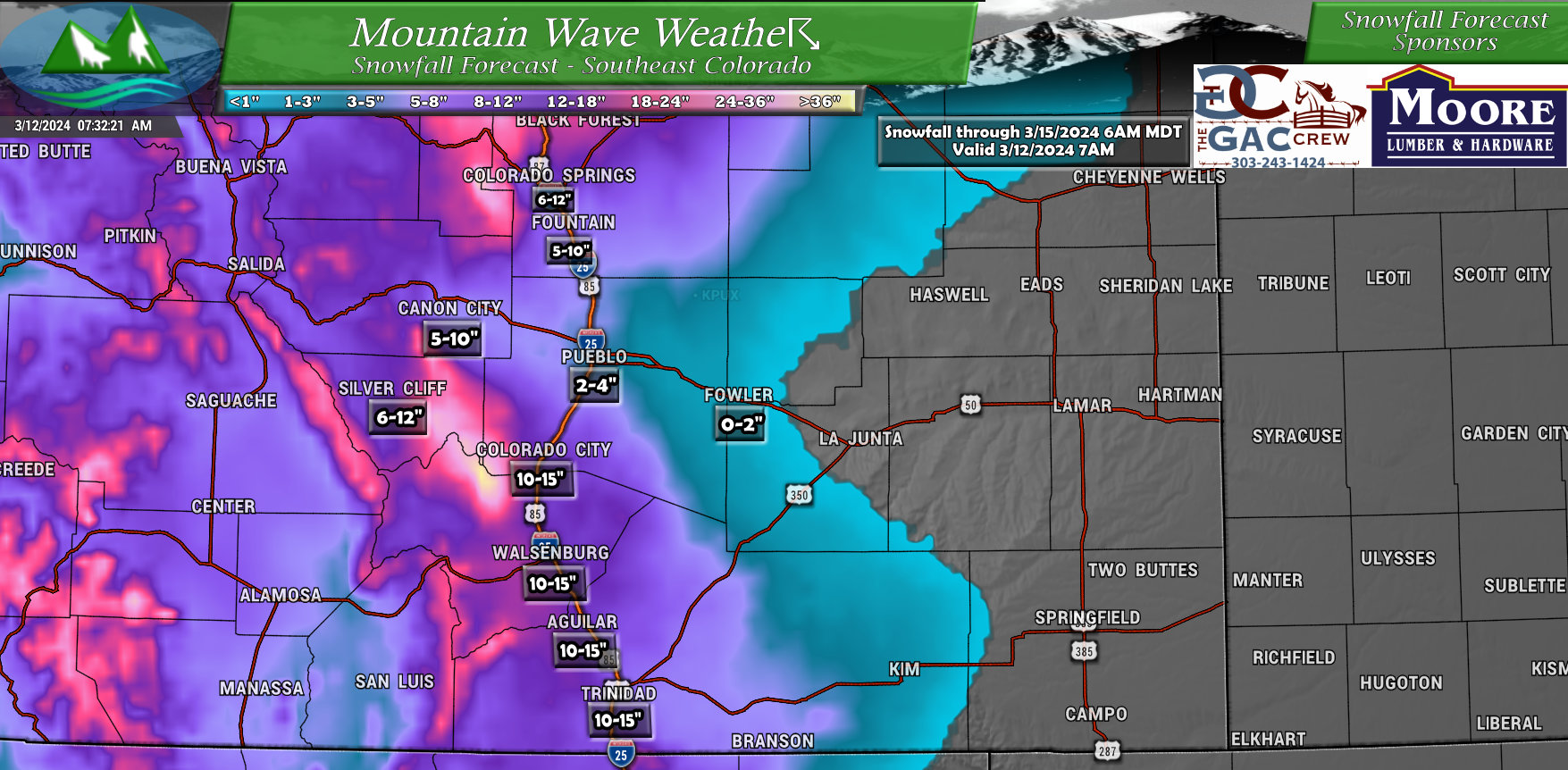
Similar pattern sets up for Southeastern Colorado. As the low forms on the Southeastern plains, those areas typically see more rain than snow or get “dry slotted” completely. This seems to be the case here. Heavier snow amounts will be confined to the higher terrain along I-25 and into the mountains and foothills West of I-25.
Here’s a quick look at the mountain regions:
Northwestern Colorado
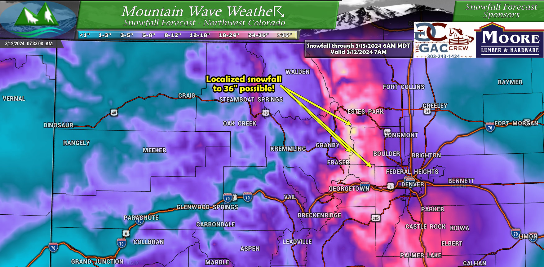
Biggest story for the Northern and Central Mountains will be isolated pockets of snowfall up to 36″, especially right along the Continental Divide.
Southwestern Colorado
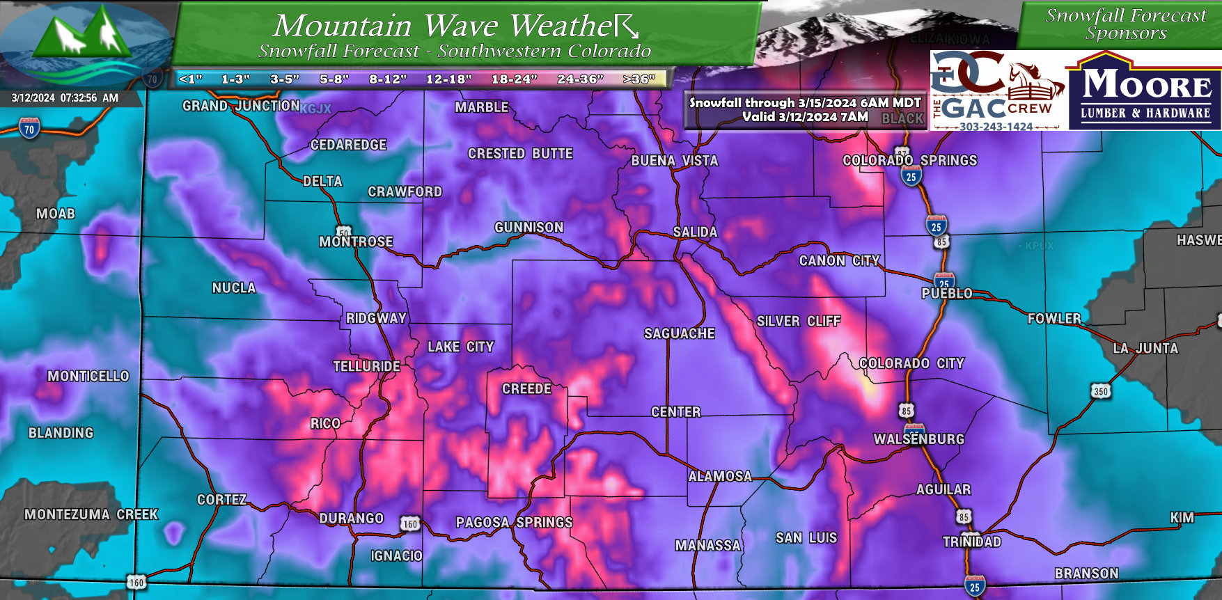
Southern and Southwestern mountains will also do fairly well with this storm. Mountain areas have the best shot at higher accumulations while the valleys will do lesser – but overall good snow for the Southwestern part of the state from this one.
Timing and Impacts
Timing: Wednesday evening through Thursday evening is the main window for snowfall.
Areas Impacted:
- Highest Snowfall (12+ inches): Front Range Mountains, Foothills, and Palmer Divide.
- Moderate Snowfall (8+ inches): Denver Western and Southwestern Suburbs
- Uncertainties: Northeast Colorado, North Colorado East of I-25 especially East of a Greeley, Eaton, Pierce line
Impacts: Significant snowfall expected, leading to hazardous travel conditions. Across the Palmer Divide, major impacts to travel and infrastructure are possible.
Frequently Asked Questions
I have a flight at DIA, will it get cancelled? Should I change it?
One of the most common questions I get and the answer is the same: if you’re concerned contact your airline. I believe many airlines are already rescheduling flights.
I don’t work for the airport and don’t forecast for them, I’m not in the room when they make decisions about flights or whether the airport closes or not.
I need to drive to XYZ, should I change plans? Will I be OK driving there?
If you are planning on driving anywhere through the foothills, Palmer Divide or parts of Southern/Southwestern Denver, travel Thursday could be not only difficult but potentially dangerous. I would not recommend travel on Thursday.
I have XYZ scheduled, should I cancel AND I own XYZ business, should I close for this storm?
We are not at the “change plans” or “cancel plans” stage yet. Why? Because there is still enough uncertainty in this storm that snowfall amounts could come in much lesser, the storm could fall apart, the track could shift, etc…
We ARE in the “make preparations” and “have a plan ready” stage. If that includes putting things in motion to re-schedule or notifying your employees that you’ll make the call about opening or closing Thursday morning – I’d absolutely encourage that.
When will we have high confidence on this storm AKA when will we definitely know if it WILL or WILL NOT happen?
Due to the unusual setup with this storm, if the models continue to hold solid on Tuesday and Wednesday, it is possible we won’t know for sure until late Wednesday when the storm is beginning to arrive. That’s the weather game folks, there are no certainties. My job is to make sure you are prepared for the worst case scenario… should it happen.
If it doesn’t, at worst you were “inconvenienced”… and I’m ok with that.
Summary
That’s it for now, lots of data coming in on Tuesday including some higher resolution models this afternoon.
Those will either confirm what we are seeing or if the forecast is beginning to falter, they will give us our first notification of that.
Stay tuned for smaller updates and tweaks to the forecast on social media and larger updates here on the website.

