Wanted to just update a couple of quick things as the storm starts to roll in across the area.
Winter Weather Highlights
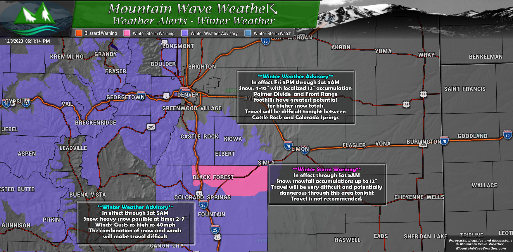
A ***Winter Storm Warning*** has been issued for Southern sections of the Palmer Divide. This mainly includes Northern areas of El Paso County such as Black Forest and Monument. Snow accumulation up to 12″ is possible in some areas around that region. The heavy snow and potential for gusty winds Friday night will make for dangerous travel conditions.
A **Winter Weather Advisory** is in effect for Douglas and Elbert Counties along with the front range foothills West of Denver. Note: Golden and Boulder have been added to the advisory.
Snowfall Forecast
Palmer Divide/Denver Metro Area
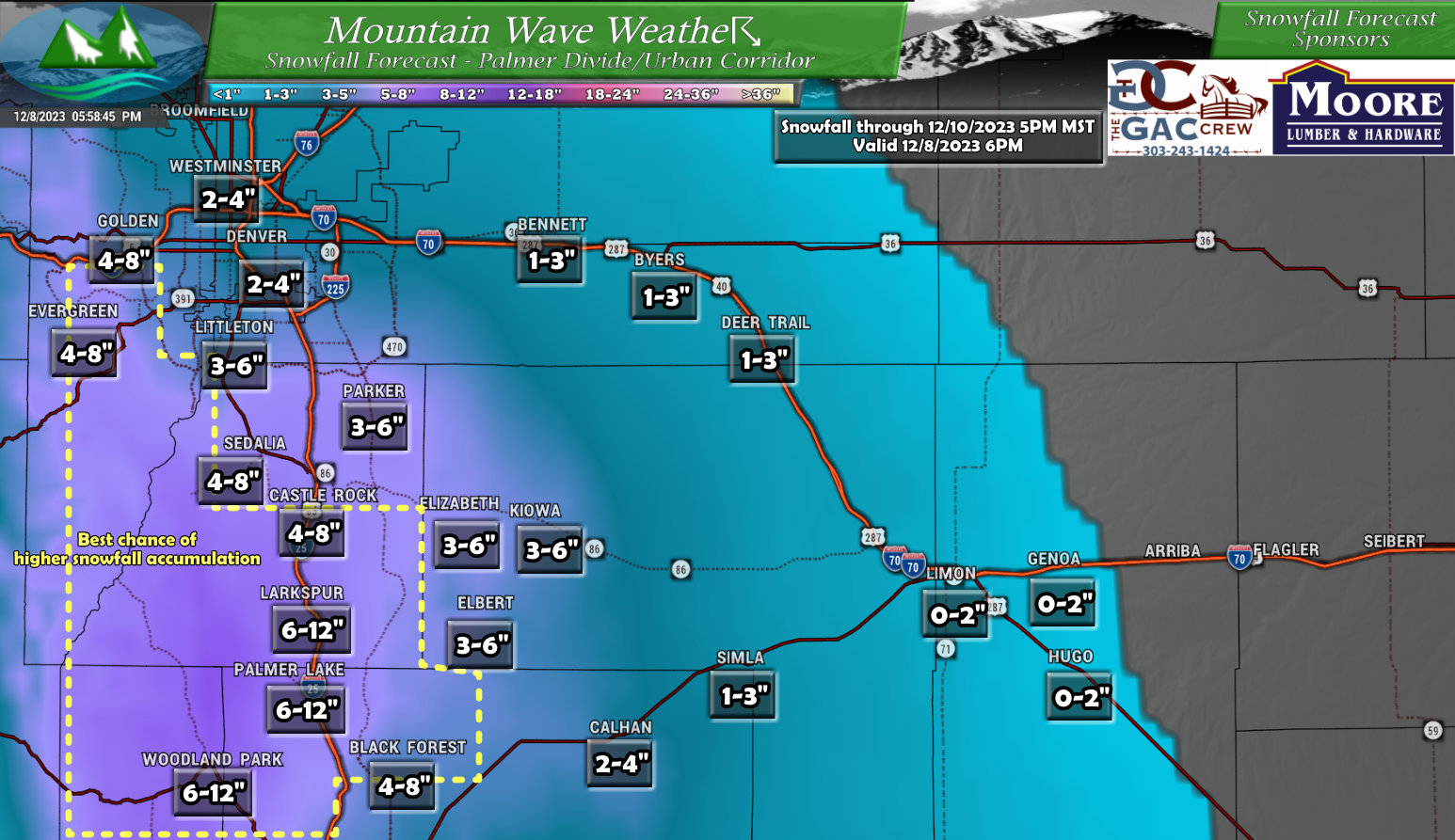
I’ve updated snowfall accumulation, particularly across parts of Elbert, Douglas and El Paso counties. These areas reflect the best chance of higher snowfall accumulation and have all been bumped up a bit (not too much from my last post, but higher so that the higher end of the range accounts for some of the higher totals that could be seen.)
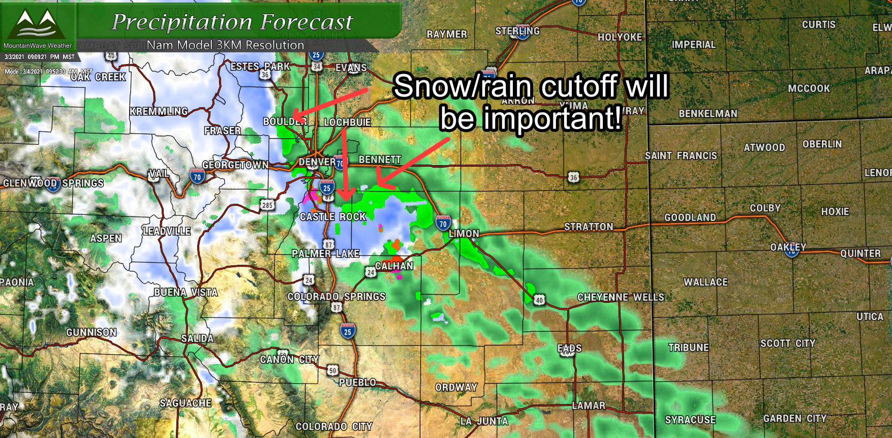
Models have started to agree pretty well on location of the heaviest snowfall tonight, the bullseye has been painted pretty well over the Palmer Divide and especially areas just South and Southwest of Castle Rock to the West of Larkspur, Monument, Black Forest, Woodland Park and down into the Pikes Peak Region.
The areas within the yellow dash also have the best chance of seeing some localized snowfall accumulation at or around 12 inches.
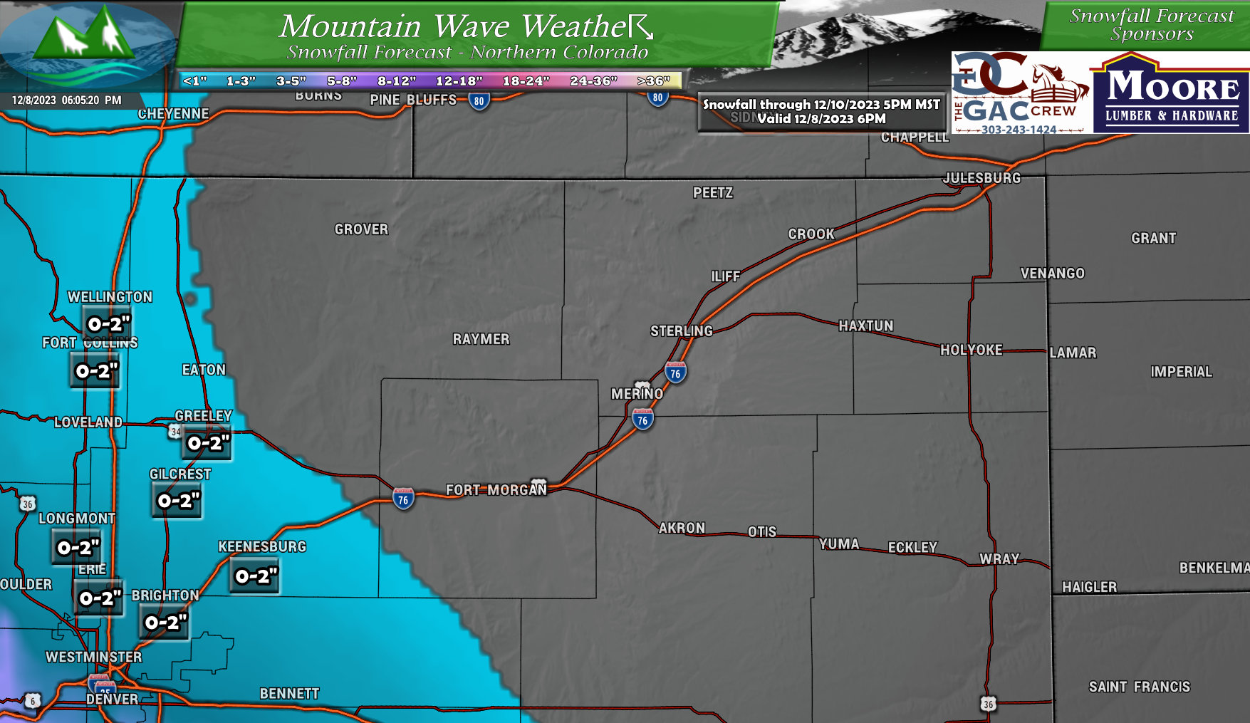
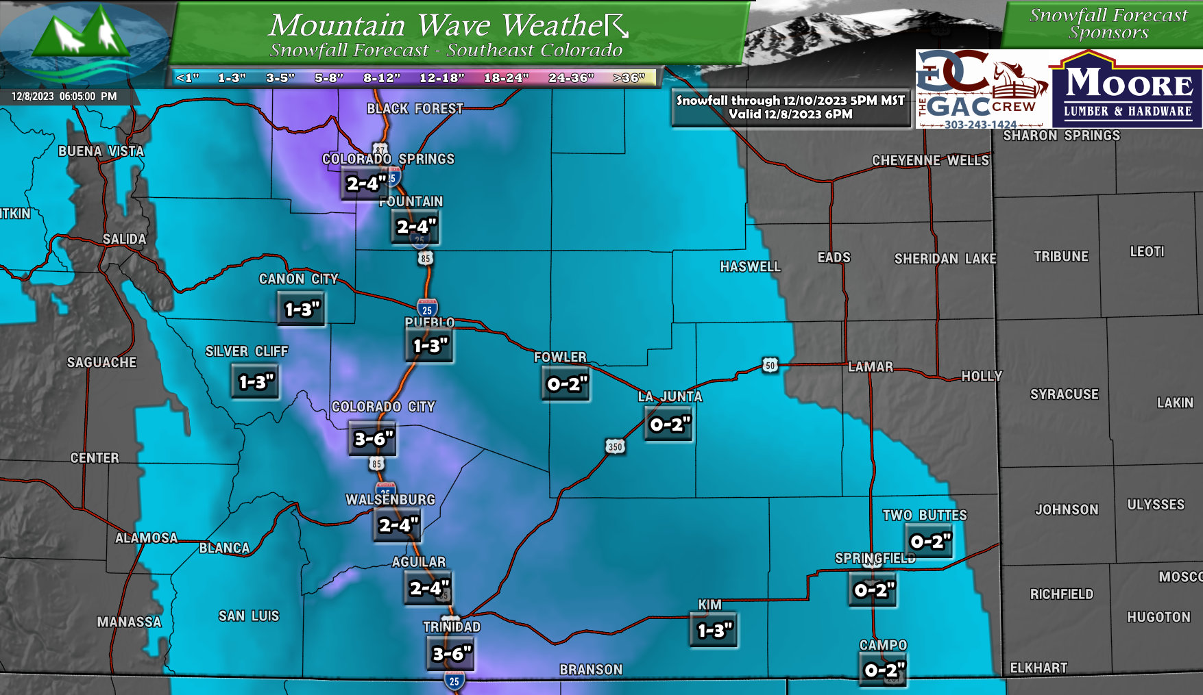
Here’s the rest of Eastern Colorado, minor changes to both of these regions with mainly just a re-positioning on who sees what type of snow accumulation:
Northeastern Colorado
Southeastern Colorado
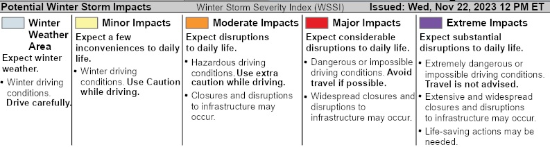
Travel Impact Areas – Winter Storm Severity Index
Here’s a quick look at areas where you’re most likely to see travel impacts due to blowing snow, heavy snow accumulation, icy roads and poor visibility. Refer to the legend to see what types of impacts are expected at which levels.
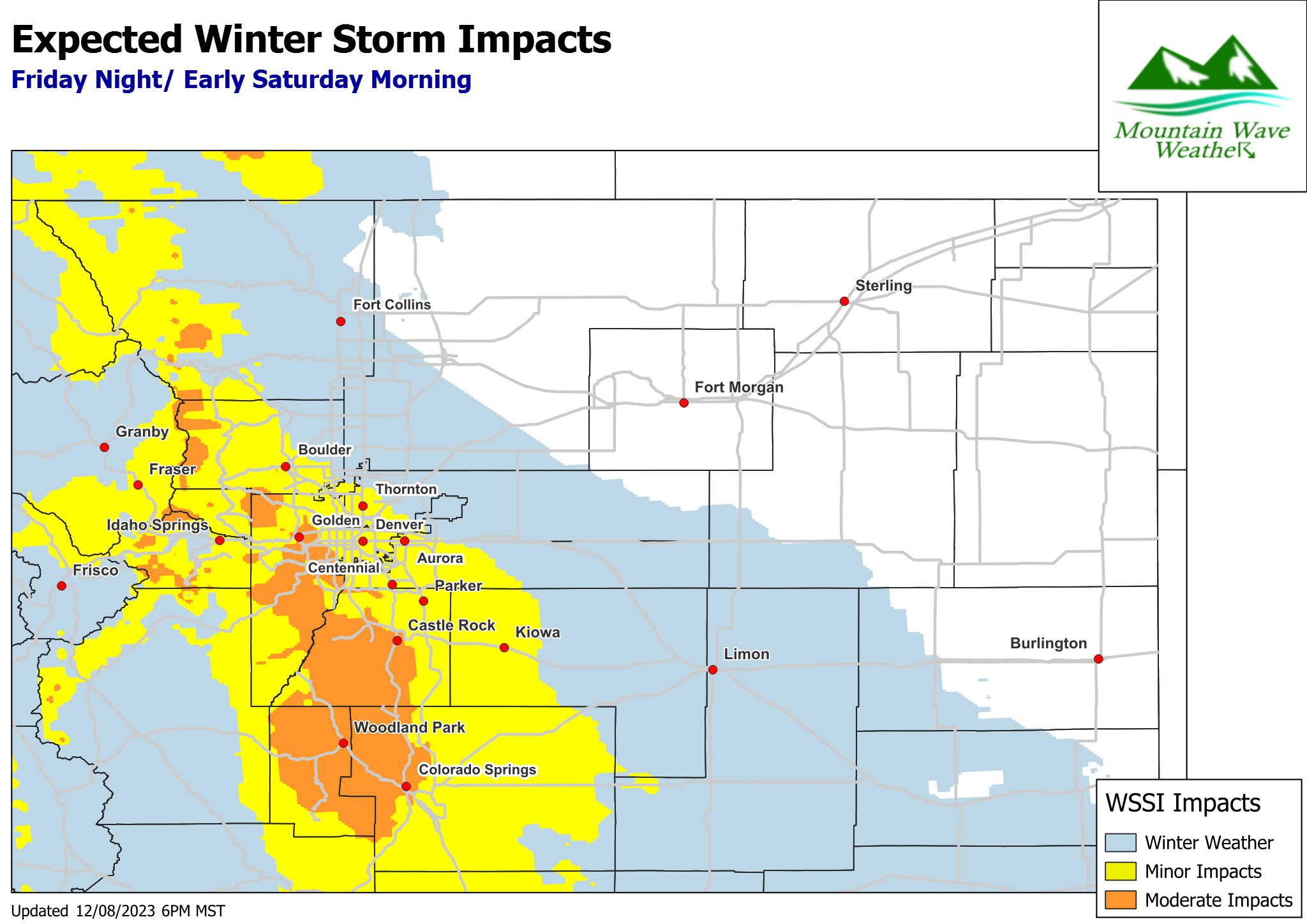
Mainly you’ll want to be on high alert from about Castle Rock to about Colorado Springs. Heavy snowfall at times is expected but winds will also be gusty too, this means travel could get quite treacherous overnight in the “gap” stretch of I-25.
Elsewhere, in the yellow minor impacts are expected but don’t sleep on this one.
Overall message here is to be ready for rapidly changing road conditions if you are out and about tonight and into early tomorrow morning.
