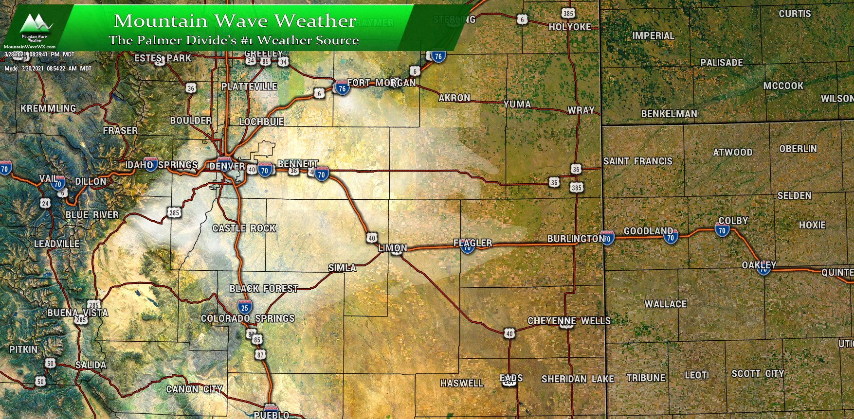
Spring is a time of transition for Colorado’s Weather and we will see a bit of that starting this week. The outlook has a bit of everything; strong winds, high fire danger, cold temperatures and even a shot of snow is possible. Here’s the latest look at what to expect over the next week or so.
Weather Alerts/Warnings/Highlights
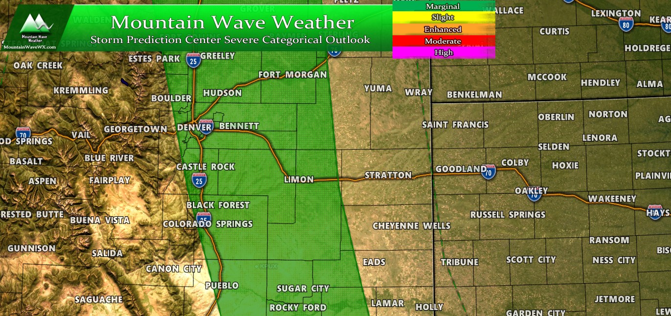
As we start off the week we have a host of weather highlights issued for dry conditions and chances for significant wind as well. Here’s the details:
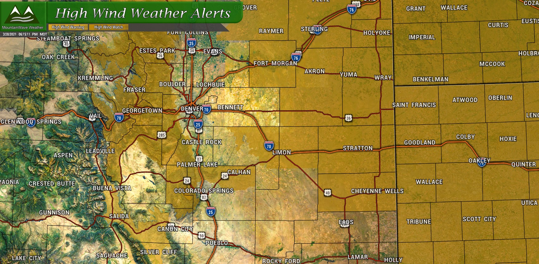
High Wind Watch
* WHAT...West winds 30 to 45 mph with gusts up to 75 mph
  possible.

* WHERE...Rocky Mountain National Park and the Medicine Bow
  Range, The Mountains of Summit County, the Mosquito Range, and
  the Indian Peaks, The Northern Front Range Foothills and The
  Southern Front Range Foothills.

* WHEN...From late tonight through Monday afternoon.

* IMPACTS...Strong winds will blow unsecured objects around. Tree
  limbs could be blown down and a few power outages may result.
  Travel will be difficult for high profile vehicles.

PRECAUTIONARY/PREPAREDNESS ACTIONS...

Monitor the latest forecasts and warnings for updates on this
situation. Fasten loose objects or shelter objects in a safe
location prior to the onset of winds.
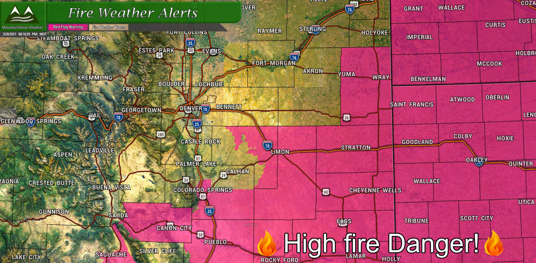
Red Flag Warning
The National Weather Service in Denver has issued a Red Flag
Warning for wind and low relative humidity, which is in effect
from noon to 7 PM MDT Monday. The Fire Weather Watch is no longer
in effect.

* Affected Area...Fire Weather Zones 246 and 247.

* Timing...Monday afternoon and early evening.

* Winds...West 15 to 25 mph with gusts up to 40 mph.

* Relative Humidity...As low as 11 percent.

* Impacts...Strong winds combined with low relative humidity may
  cause new fire starts to rapidly spread and grow.

PRECAUTIONARY/PREPAREDNESS ACTIONS...

A Red Flag Warning means that critical fire weather conditions
are either occurring now....or will shortly. A combination of
strong winds...low relative humidity...and warm temperatures can
contribute to extreme fire behavior.
Strong Cold Front will Bring Wind – Chance of Snow
Here’s a quick look at the forecast for the next week or so to give you an idea of what we will be looking at.
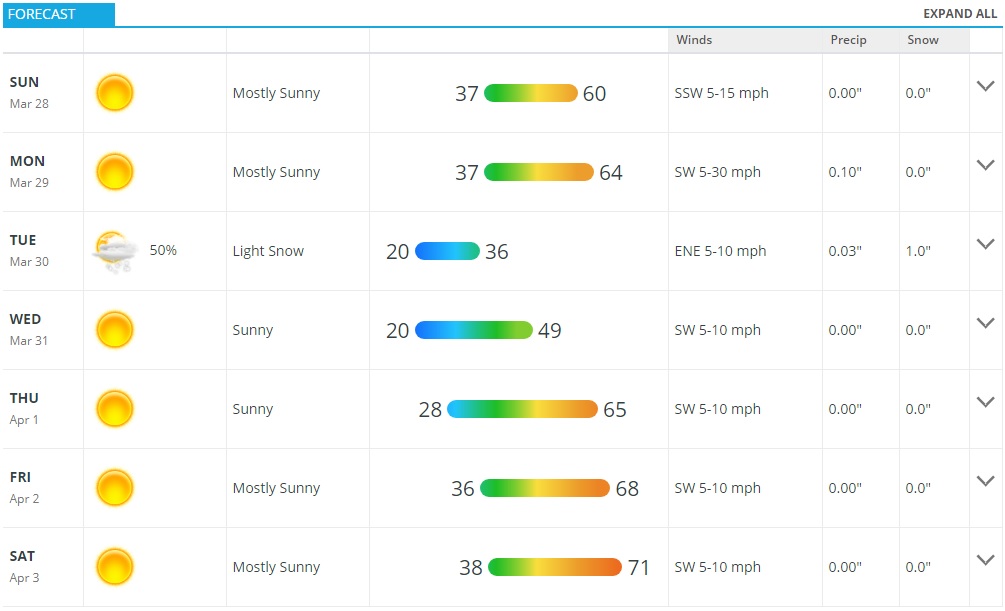
Monday will start out fairly nice temperature-wise but don’t let that number fool you. In advanced of a fairly strong cold front a Mountain Wave will set up late tonight and into early tomorrow across the front range. Other than being the name of this operation I run – you can be fairly certain a lot of areas will see strong winds. Some areas could see 50-60+mph, so expect sporadic power outages and travel difficulty for lightweight and high profile vehicles is all possible.
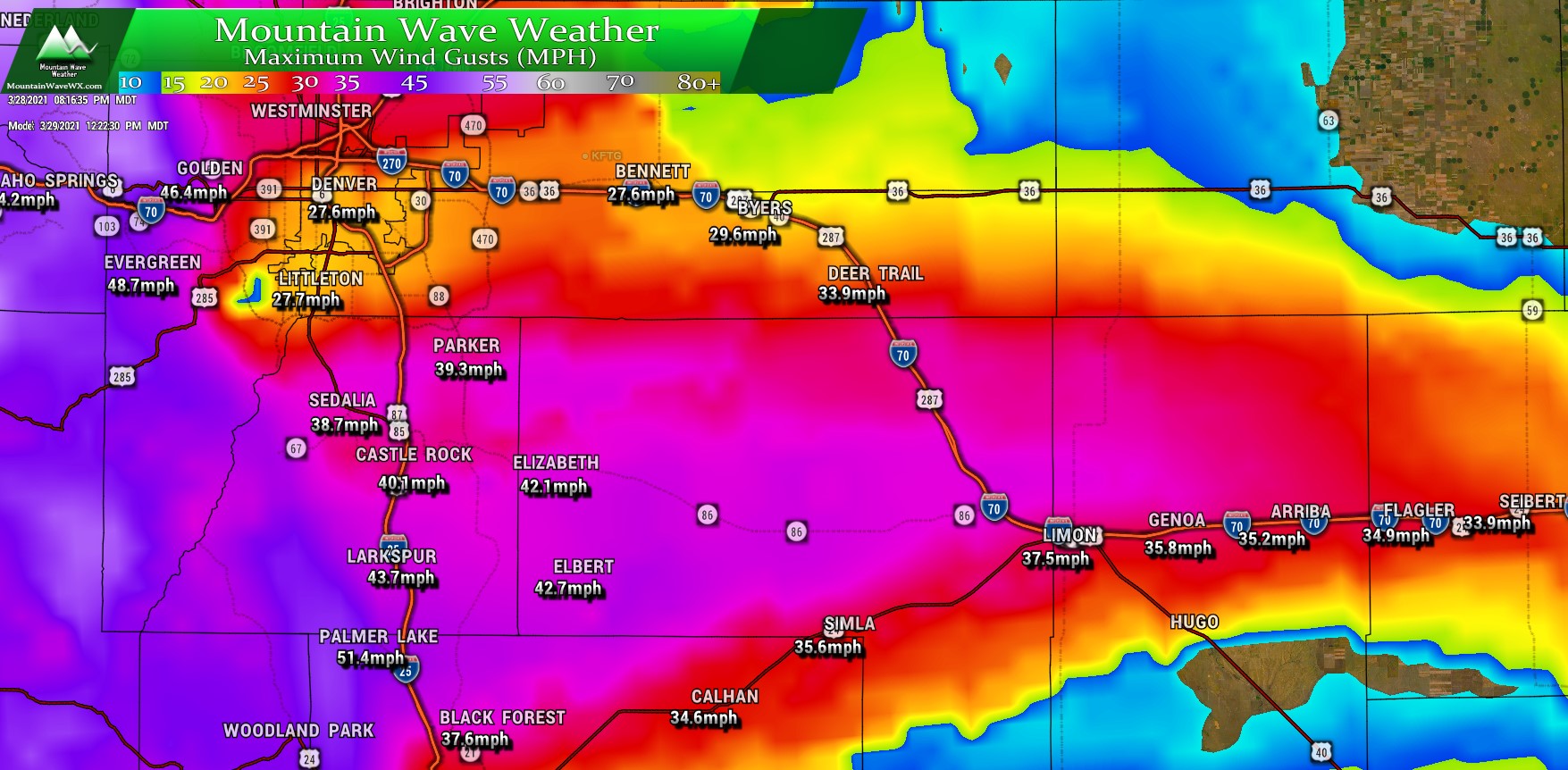
Forecast wind gusts around lunchtime on Monday 3/29/2021
The Nam3k shown above is pretty in line with most model’s thinking on the winds. Most areas across the Palmer Divide will see wind gusts in the 35-45mph throughout the day. The strongest winds in our area look to be into the foothills consisting of Western Douglas County, Jefferson County and Teller County. Those areas will likely be upgraded to High Wind Warnings as they could see the 50-60+mph wind gusts I mentioned earlier.
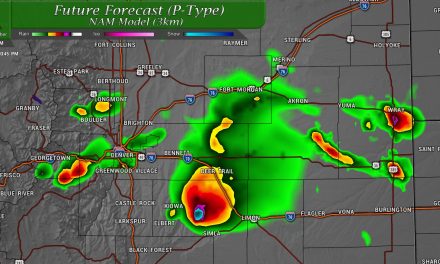
What About Snowfall?
Moisture overall looks pretty meager with this storm, it looks like any lift that comes through with the front doesn’t stick around for very long and moisture comes to an end fairly quickly. We’ve gone with generally light snowfall totals across the Palmer Divide so we don’t expect too much of an impact with this one.

As far as timing, look for snow to move through the area late Monday night and into Tuesday morning. It will be worth keeping an eye out for any slick spots on the roads but due to the warmer ground temperatures and light nature of the snow, it doesn’t look like we will see too much in terms of widespread impacts.
As with most spring snow-related events, keep an eye on this one in case it throws any curveballs… any difference in temperatures could make this storm a bit more of a headache for drivers Tuesday morning… we will keep an eye on that. For what’s its worth, the Euro has a touch more snow than the ranges shown above, we will see if any of the other models come in line with that or not through the day Monday.
Eye Towards Next Weekend
If you want a sneak peak at what could be on tap for next weekend, here’s a quick look:
Looks like strong ridging builds back in across the United States by next weekend and many models are hinting at some very warm temperatures. Current guidance has the Denver Metro Area’s high temperatures well into the 70’s next weekend. Should this verify, we could be looking at our first “nice” weekend in some time with warm temperatures and dry conditions.
We will keep an eye on that for any changes as it’s still a little ways out, but our warm/dry weather fans will probably be fairly happy late this week and into the weekend.
