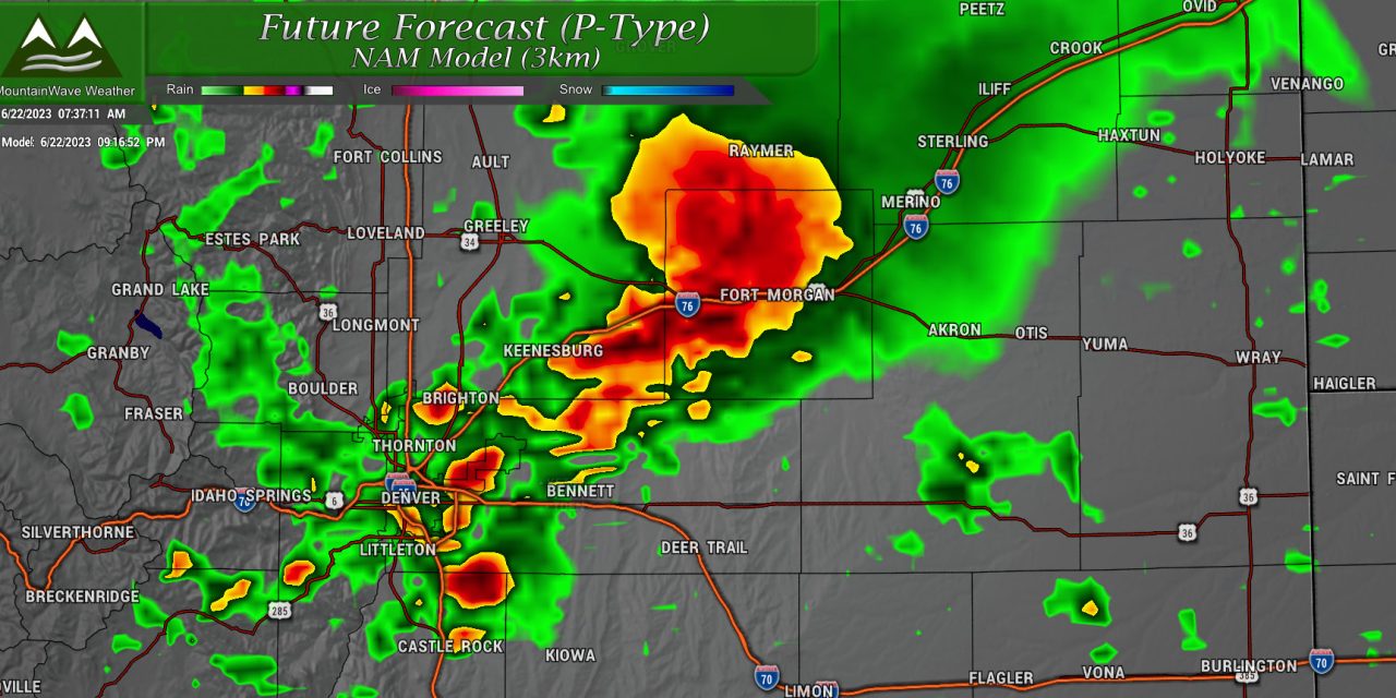
TODAY’S SETUP
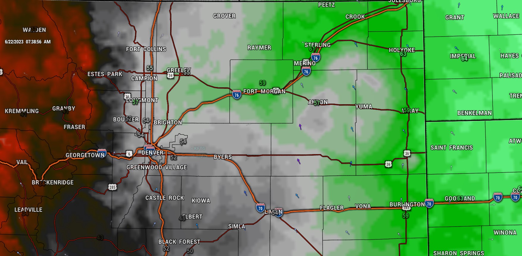
Dewpoints are a bit lower this morning, a result of the storms pulling a lot of that moisture out of the atmosphere – but we do expect much of that moisture to recover this afternoon with Southeasterly and Easterly flow bringing moisture back into the area. Dewpoints should be back in the 50’s and 60’s by late today which will provide ample fuel for large thunderstorms.
Dewpoints this high are more common during the monsoon season than June.
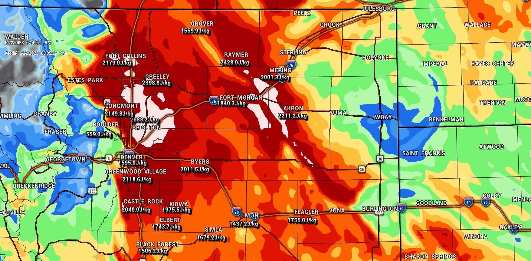
Let’s take a look at instability – values will be quite high again today with large values along the I-25 corridor especially around and North of Denver. Across the Palmer Divide, we will see high values as well around 1500-2000 j/kg. As I mentioned yesterday, 750-1000 j/kg is sufficient for severe storms in Colorado, values in the 2000+ range are quite high and mean storms that form will have ample instability to work with as they build this afternoon.
SPC OUTLOOK AREAS
If you need a reminder of what these categories mean: here’s an explainer!
Categorical
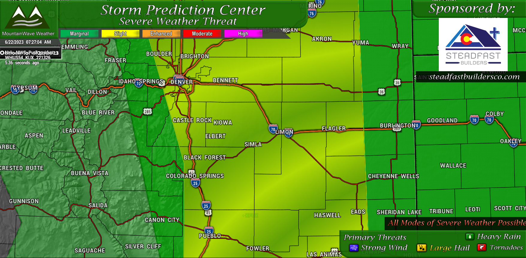
All modes of severe weather will be possible today in a corridor from roughly just a few miles West of I-25 to areas near the Eastern border with Kansas. The SPC has outlined a “Slight Risk” which means severe thunderstorm will be possible but a major “widespread” event where everyone sees a severe storm is not expected. Severe storms will be spotty in nature.
Tornado
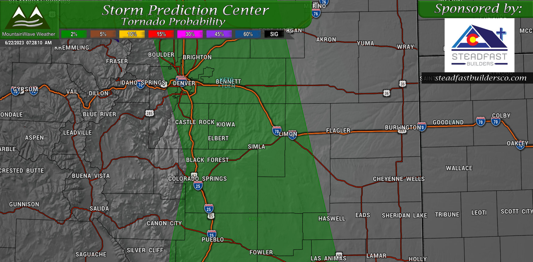
A low risk of tornadoes is possible across the Slight Risk area today – probabilities are around 2% that you will see a tornado within 25 miles of a point.
Hail
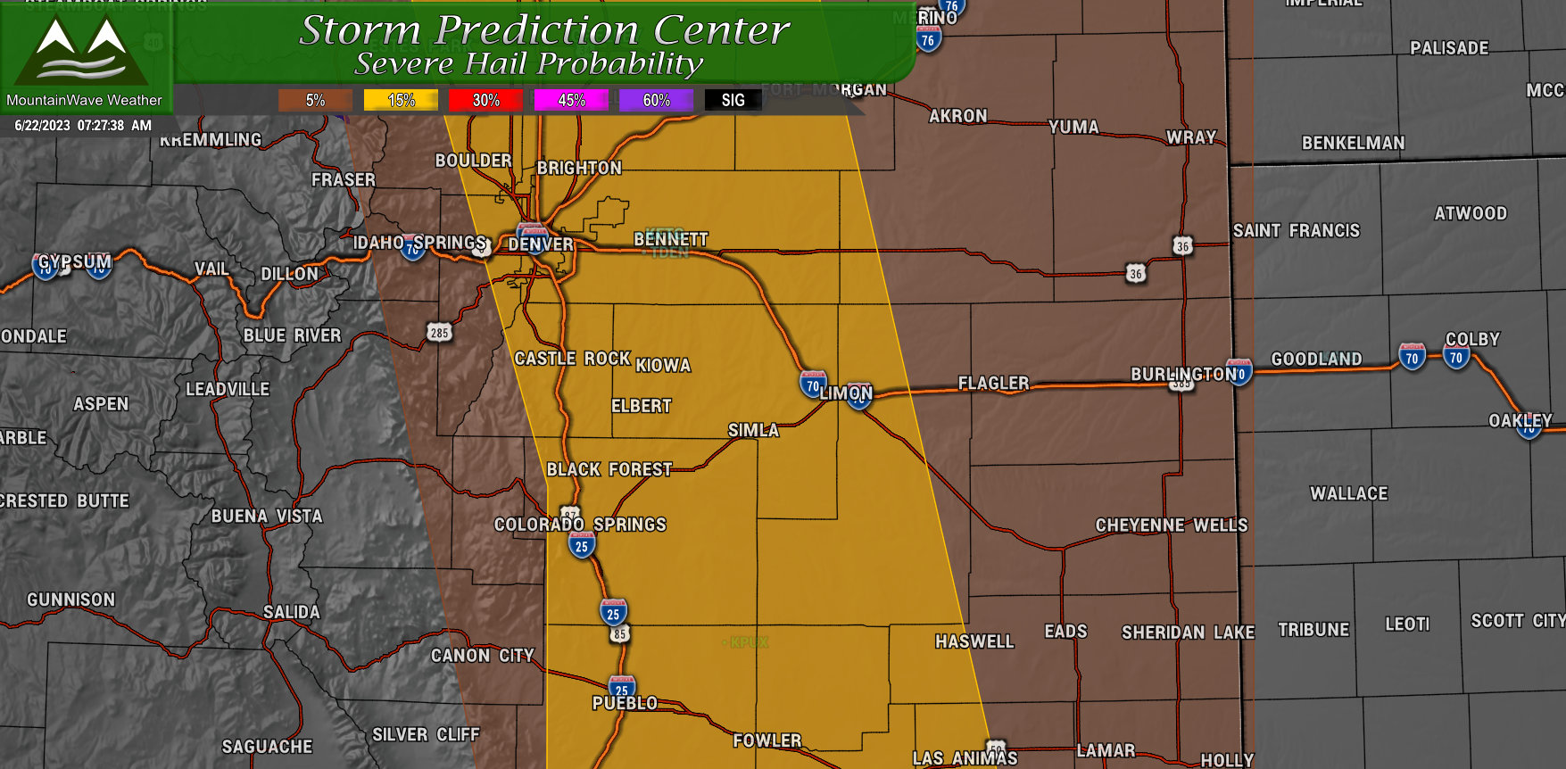
Hail again is going to be the primary threat today. Higher chances of hail exist in the Slight Risk area, shown in yellow above. 15% probability is the number today, so not a high number again by any means, but one worth watching.
Significant Hail
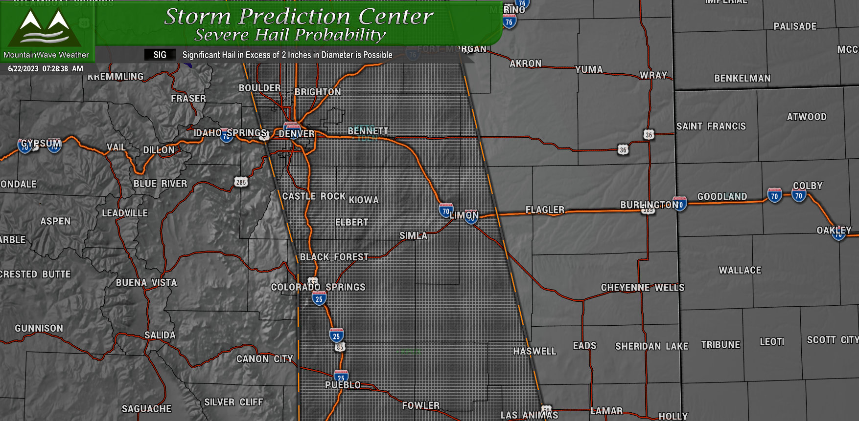
Areas in the Slight Risk area will also have the potential for “Significant Hail” or hail above 2 inches in diameter today. Hail growing to that size can cause significant property damage or cause injuries to people caught outdoors.
DISCUSSION, TIMING AND PREPAREDNESS
Threats and Preparedness
- Large Hail
- Strong Winds
- Heavy Rain
- Tornadoes
Have a way to get weather alerts and pay very close attention to your favorite reliable weather source. If you are outdoors today, know where you would go if you receive a severe weather alert.
Timeline
Palmer Divide
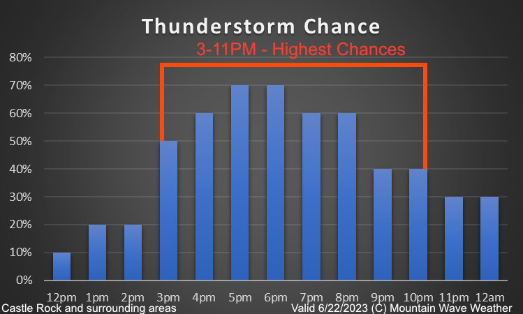
Primetime for storms along the Palmer Divide looks to be that 3PM to 11Pm timeframe. That will also be the most likely window you will see severe weather – again there is no guarantee your area sees any severe weather… there is just a chance. See the probabilities above if you need further clarification on your odds of seeing a severe storm.
That’s it for this morning. As always I’ll be posting information as I can and as needed – once things get rolling most updates will come on Facebook so be sure to check there to see what’s going on.
Happy Thursday!

