
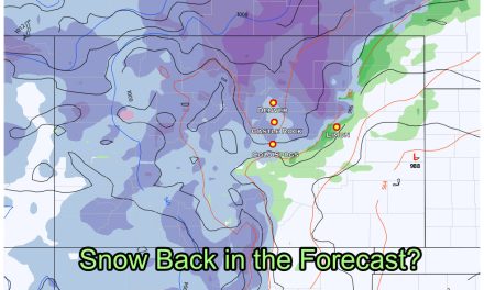
We made a splash a week or so ago when we talked about the chance for a white Christmas around here. When we see weather data that far out and make a prediction; the odds are 50/50 at best. Long range weather outlooks beyond 7-10 days or so – the odds of those being right are about on par with flipping a coin. Still, we can see some things come together and keep an eye on data, patterns and trends and make a forecast.
The Odds Game
One tool we can use to see a bit further than standard models is the product the Climate Prediction Center outputs for the 6-10 day and 8-14 day outlooks. They also have some pretty handy season and monthly outlooks that are fun to look at. Since our area of concern now falls within the next 7 or so days we will stick to those.
Please make note: the way these products work is they show the probability for above and below average temperature and precipitation… they are not a look at what IS going to happen. They are a look at the probability of what COULD happen. As such, do not treat these as a concrete forecast product, they need to be used in conjunction with other data and meteorological experience. I’ll be happy to take care of that stuff for you today!
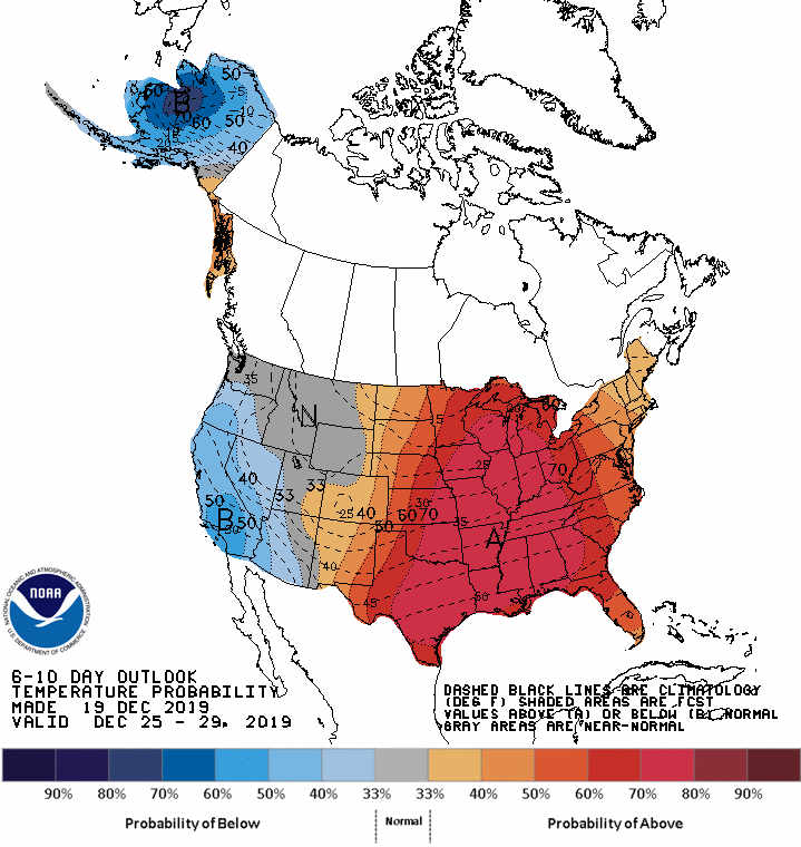
CPC 6-10 Day Outlook Temperature Probability
CPC 6-10 Day Outlook Precipitation Probability
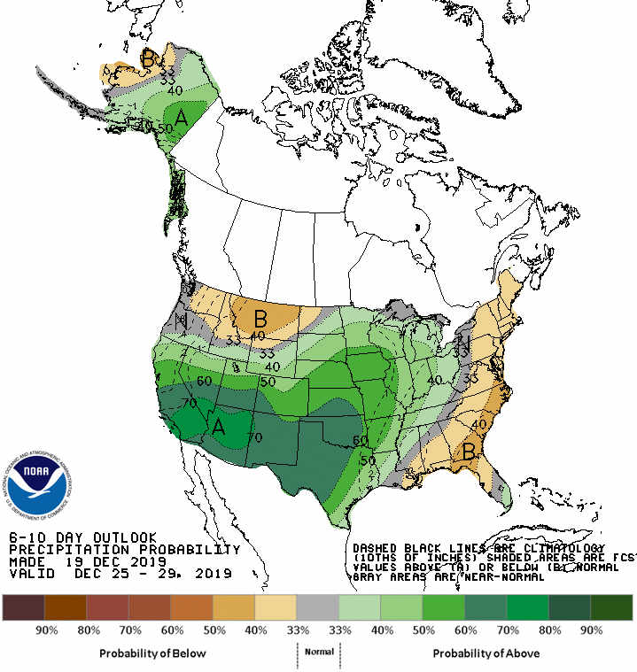
The breakdown:
- Equal chances means
- 33% probability for below normal, 33% probability for normal, 33% probability for above normal
What does this mean in our case with the precipitation image above?
It means the period between December 25 – December 29 has a 25% probability for below normal precipitation, 25% probability for normal precipitation and a 50% probability for above normal! That’s great news! What this basically tells us is we can expect a higher than average chance to see some sort of wet signal set up in this time frame!
Since we are on the very edge of this outlook, we can only read so much into it… at some point models have to become a factor. In this case we are on the very fringes of what they can reliably see, but they are worth a look anyways!
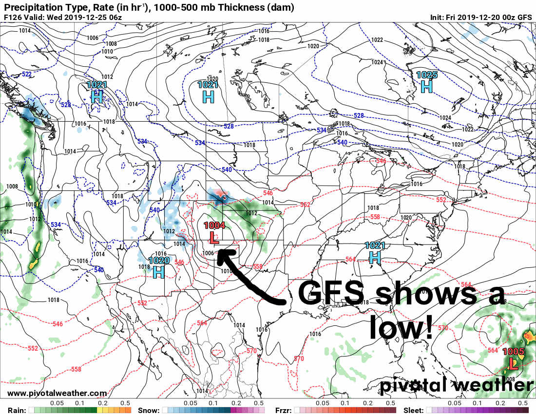
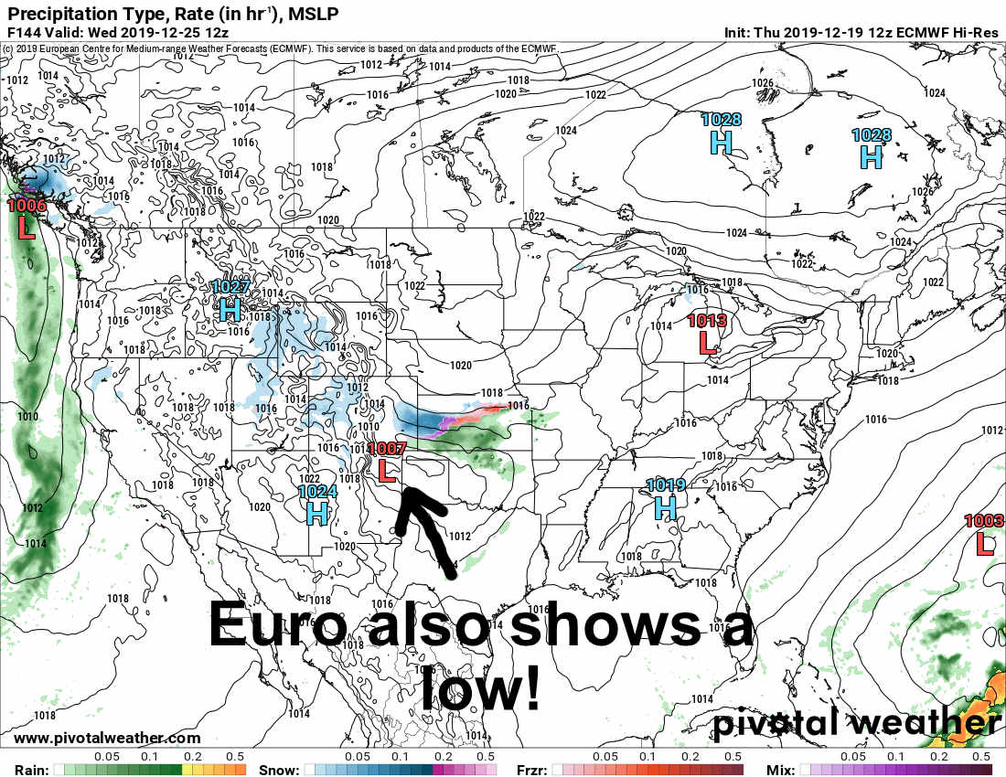
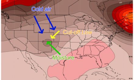
Models Take Over
At this point in time we are a long ways out on our main 2 models we can see. Both of them at this point don’t have stellar reliability at this range for fine details; as I say again and again… all we can see is overall patterns at this point.
GFS
EURO
 The takeaway from the above:
- Notice both models show troughs in the area of Colorado, this is good consistency for this far out
- Note that both models don’t have the trough in the same area
- This means everything for storms in Colorado. Exactly where that low sets up is the difference between seeing snow or nothing at all! Unfortunately we can’t get any better details on positioning this far out, will have to stay tuned for how this evolved!
- Timing is different
- GFS tends to favor an earlier event possibly impacting late Christmas Eve into Christmas Morning
- Euro tends to pull the storm in later, effecting more later in the day Christmas Day
Please note: neither model is very excited about snow accumulation at this point… but this far out that doesn’t concern us much anyways. We won’t get a good forecast on snow accumulation until late Sunday/ early Monday at best.
Wrapping It All Up
Models are showing “something” POSSIBLE for the Christmas Eve/Christmas Day timeframe. I know that sounds vague but we simply can’t get any more detail than that at this point. The good news is there’s a chance; if the models were both showing nothing around this timeframe we’d be a lot less excited about the CHANCE for snow.

So there’s at least a chance! Right now I’d put snow possibility around 10-20% for Christmas this year, sounds low but keep in mind it’s early yet and a lot can change. The good news is that there is at least a chance!
We will have to keep an eye on this over the next few days to see how the forecast evolves.
Stay tuned!

