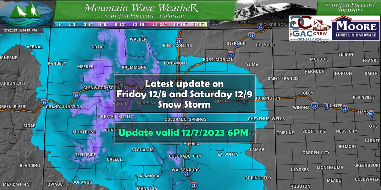
A tricky storm forecast this one, models have very little agreement on any aspect of the snowfall forecast. This means that anythign could happen with this storm, but we’ll show our best educated guess on what we think this will look like for Friday.
Here’s why models have been fairly useless and are not helping with the forecast at all:
Take Castle Rock as the point we are looking at with these models:
Euro (det): 10 inches
Euro(ens): 4 inches
GFS (det): 7 inches
GFS(ens): 4 inches
NBM: 1.8 inches
Nam3k: 8 inches
So what do we do in this case? We take a blend of the models we think are handling things the best right now. While the Euro is usually one of the best with snowfall forecasts, it’s not always right. In this case, I think it’s overdoing the snowfall. I always lean heavier on the ensembles because they are good at filtering out the noise. National Blend is typically somewhat reliable and if things don’t set up right I can see that as a good solution. Nam3k, bounces a lot and I think it’s a bit overdone in this case along with the Euro.
My thoughts on snowfall in Castle Rock for example would be right in the 3-6″ range, it accounts for some of the higher end stuff (but with less weight) and factors in the ensembles which have been steadier without any large jumps up or down.
Here’s my thoughts on snow for the rest of the state, timing and impacts:
Current Winter Weather Highlights and Discussion
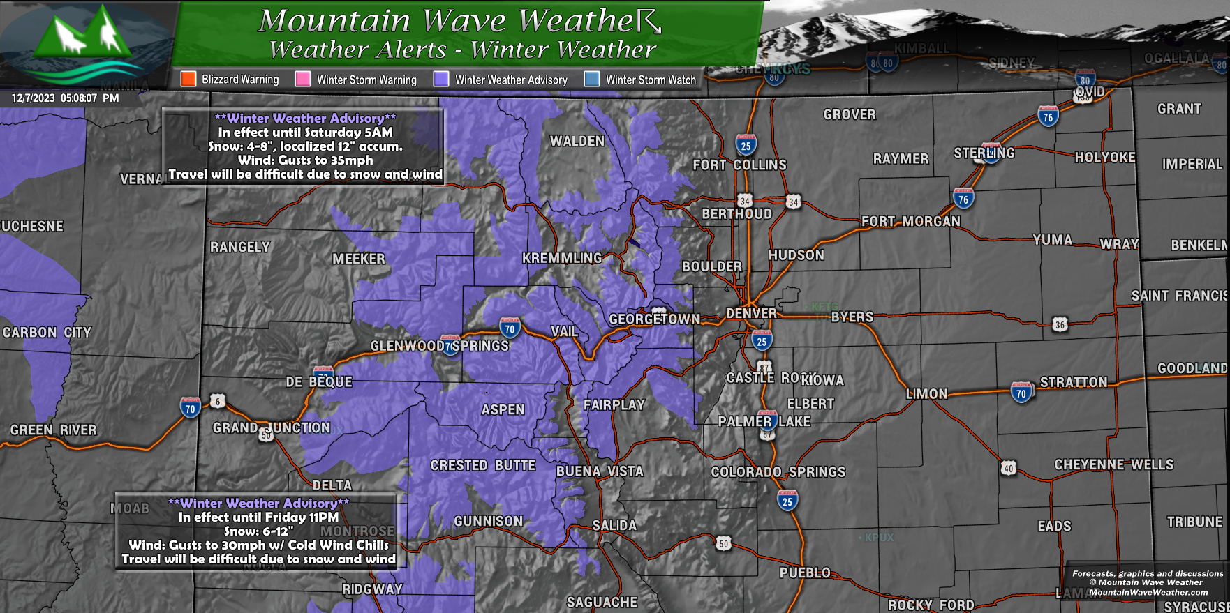
2 **Winter Weather Advisories posted for the mountain areas. Once for the Northern and Central Mountains that runs until 5PM Saturday
These areas will see 4-8″ of snow with localized areas up to 12″ with 35mph winds. Blowing snow and poor visibility combined with at time heavy falling snow will make for difficult travel conditions.
The second advisory is the for the Southern and Southwestern Mountains where 6-12′ is possible with 30mph winds. Like the other advisory, the combination of wind and snow will make for difficult travel conditions. This advisory runs until Friday night at 11PM.
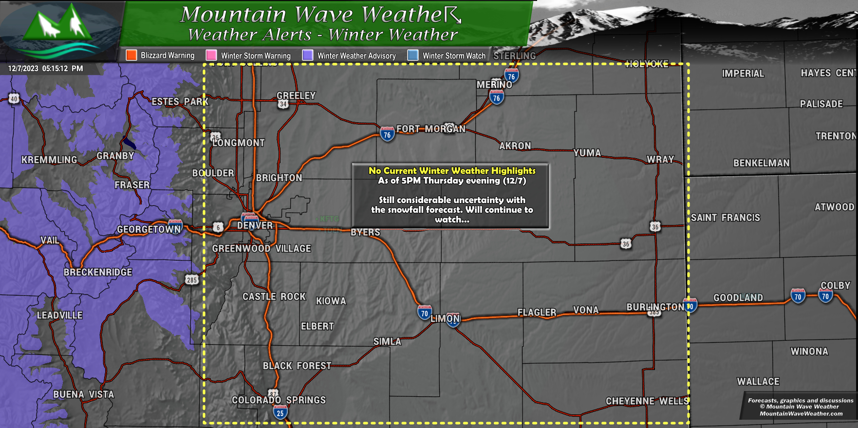
Currently there are no winter weather highlights for Northeastern or Central Colorado (East of the Continental Divide)
The NWS has cited “considerable uncertainty in the snowfall forecast” as a main reason why they haven’t pulled the trigger on any highlights. If we see data come into better alignment this may change late Thursday night or early Friday morning – but time will tell.
Snowfall Forecast and Discussion
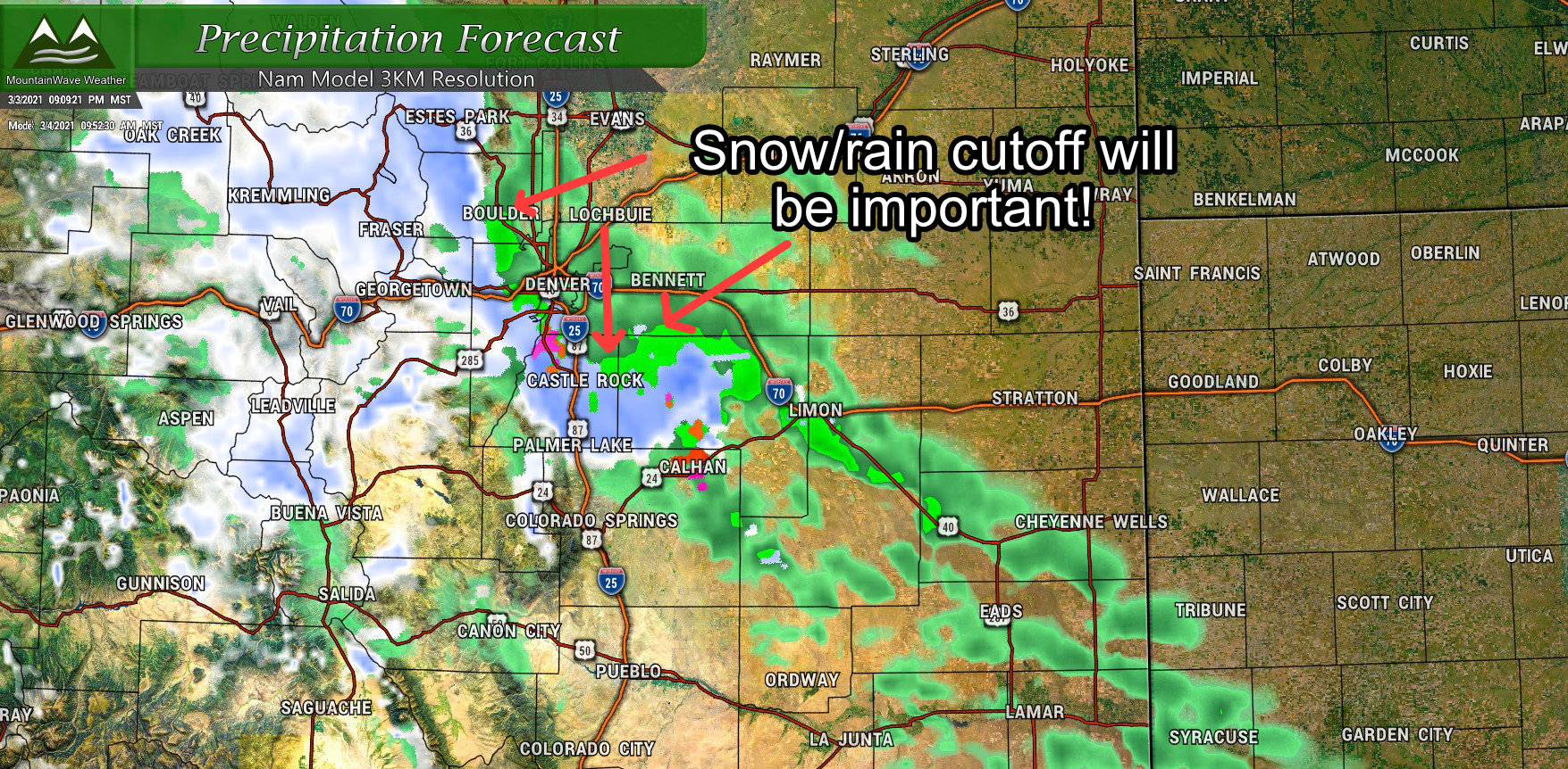
Palmer Divide/Denver Metro Area
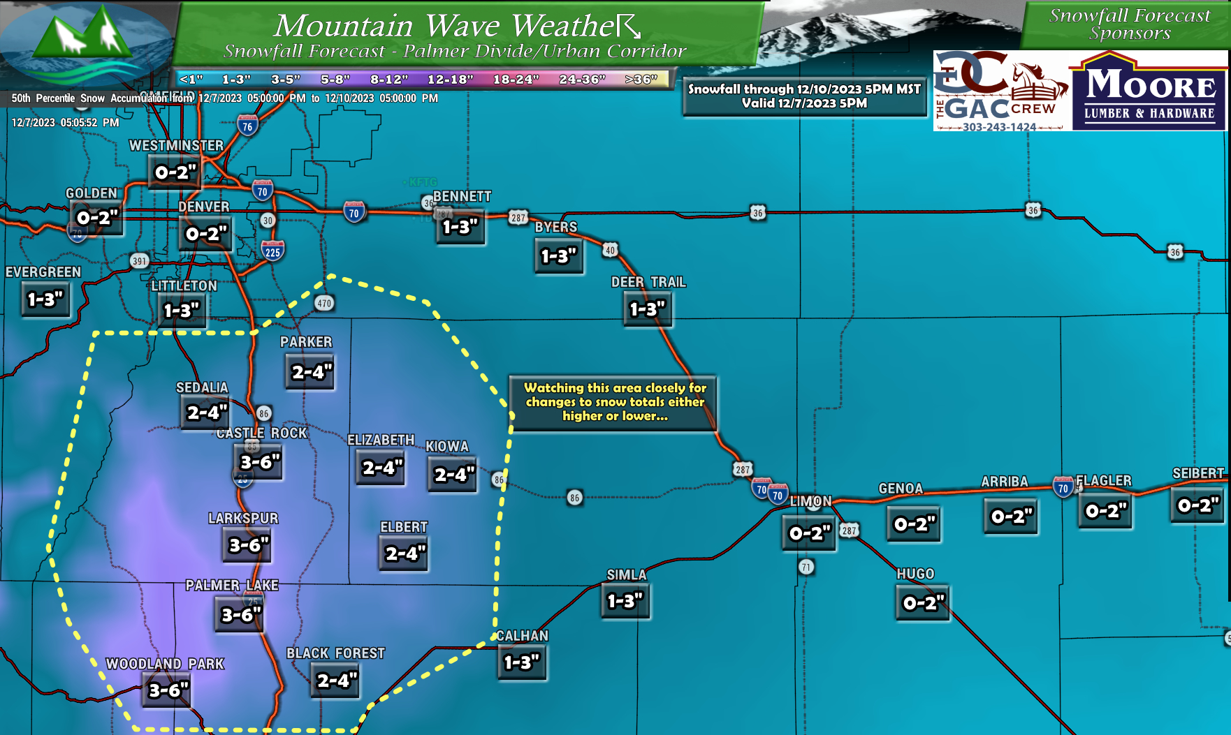
Here’s my best thinking on snow along the Palmer Divide and Denver Metro Area. I don’t see much snow falling in Denver out of this one, temperatures will be marginal, especially early on Friday. Along the Palmer Divide, models have been painting an area there with heavier snow… but some models show little to nothing. All in all, model confidence has been next to nil on this entire storm. The snowfall numbers you see above are a blend between the higher snowfall models and the lower snowfall models… I’m not really leaning one way or another at the moment, but we will have to see how it turns out.
Here’s the maps for the rest of the state:
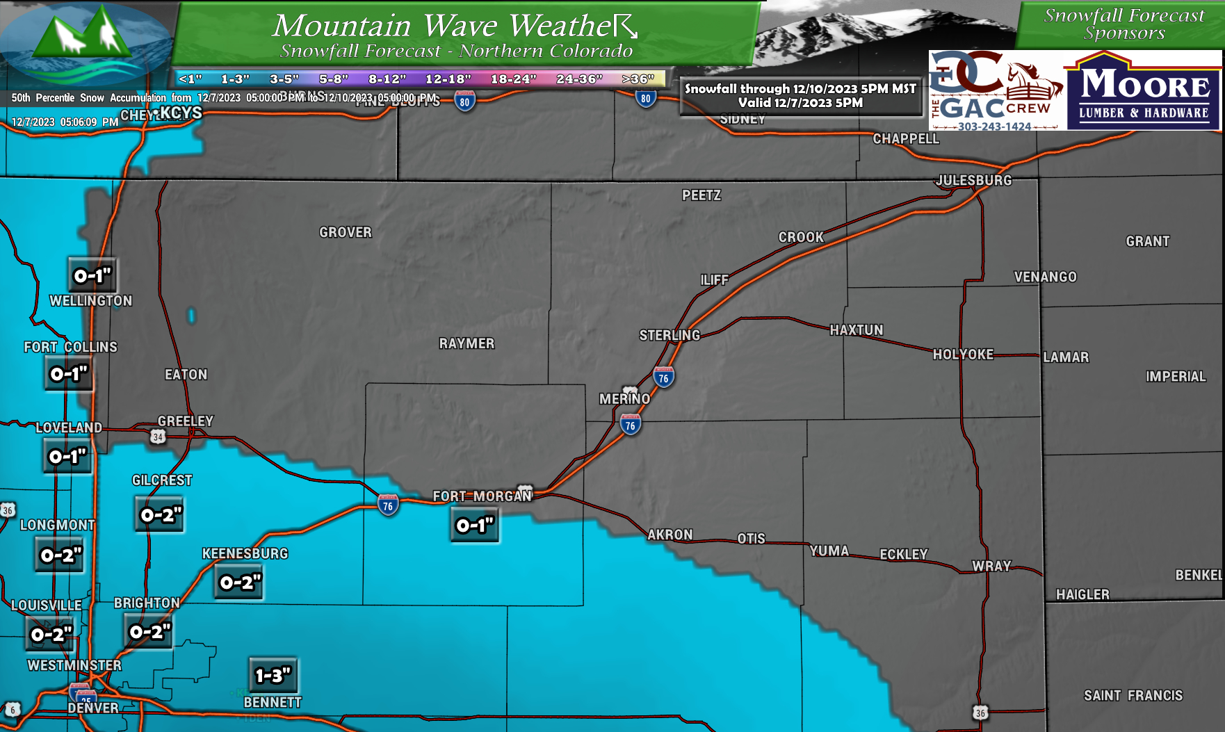
Northeastern Colorado
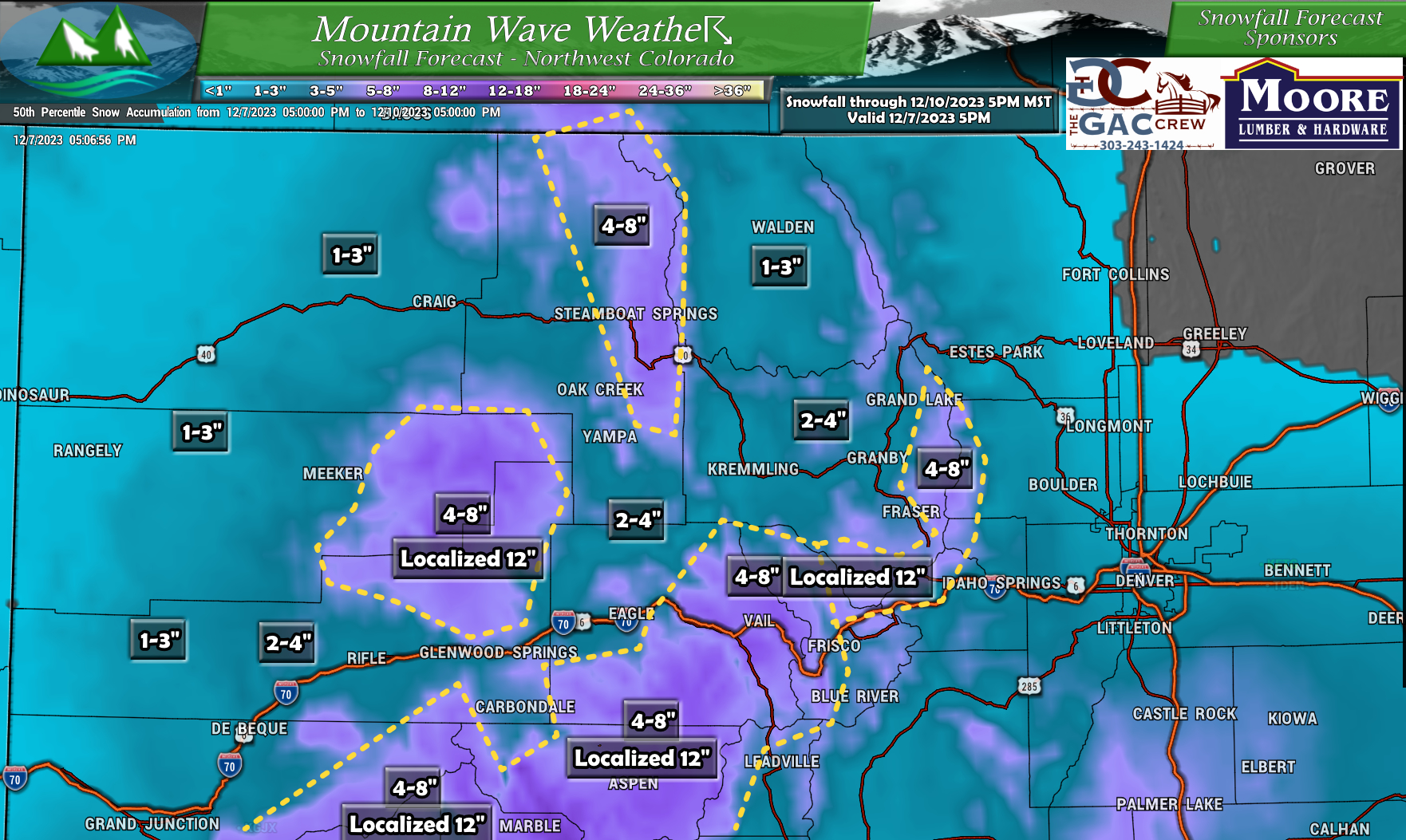
Northwestern Colorado
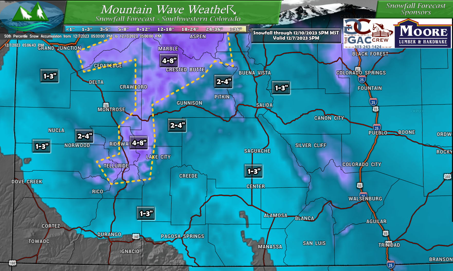
Southwestern Colorado
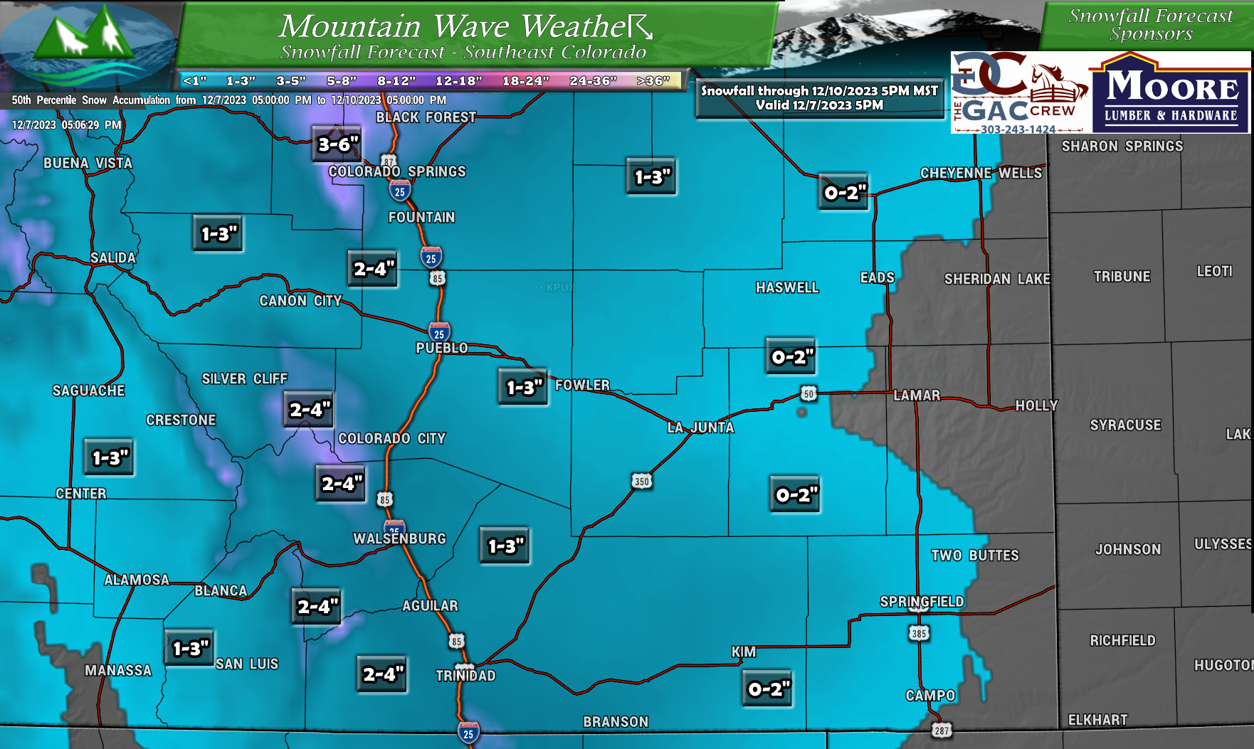
Southeastern Colorado
Expected Timing and Impacts
For timing, there’s 2 waves moving through with this system that will effect us during different parts of the day:
- Friday morning
- Front moves through, enough lift and moisture to create snow showers
- Generally expected to be light accumulations
- Some impacts to roads are possible, but major travel issues are not expected with this first wave
- Note: under heavier bands of snow, some roads may become slick
- Friday afternoon
- Expect a lull in the snow
- Temperatures will continue to drop throughout the day
- Friday evening/overnight
- A stronger push of cold air and moisture
- Still questions about where the best lift sets up and where down-sloping kills a lot of the snowfall potential
- General consensus is that the Palmer Divide and areas Southwest of Denver have the best chance of seeing higher end snowfall
Expect possible impacts to the Friday morning and Friday evening commute.
Lingering impacts possible on Saturday morning as well depending on when the snow ends.
