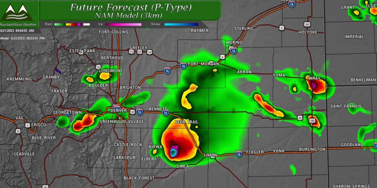
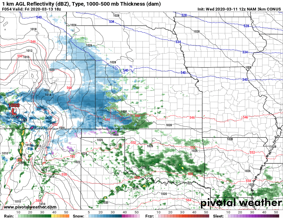
Today's Setup
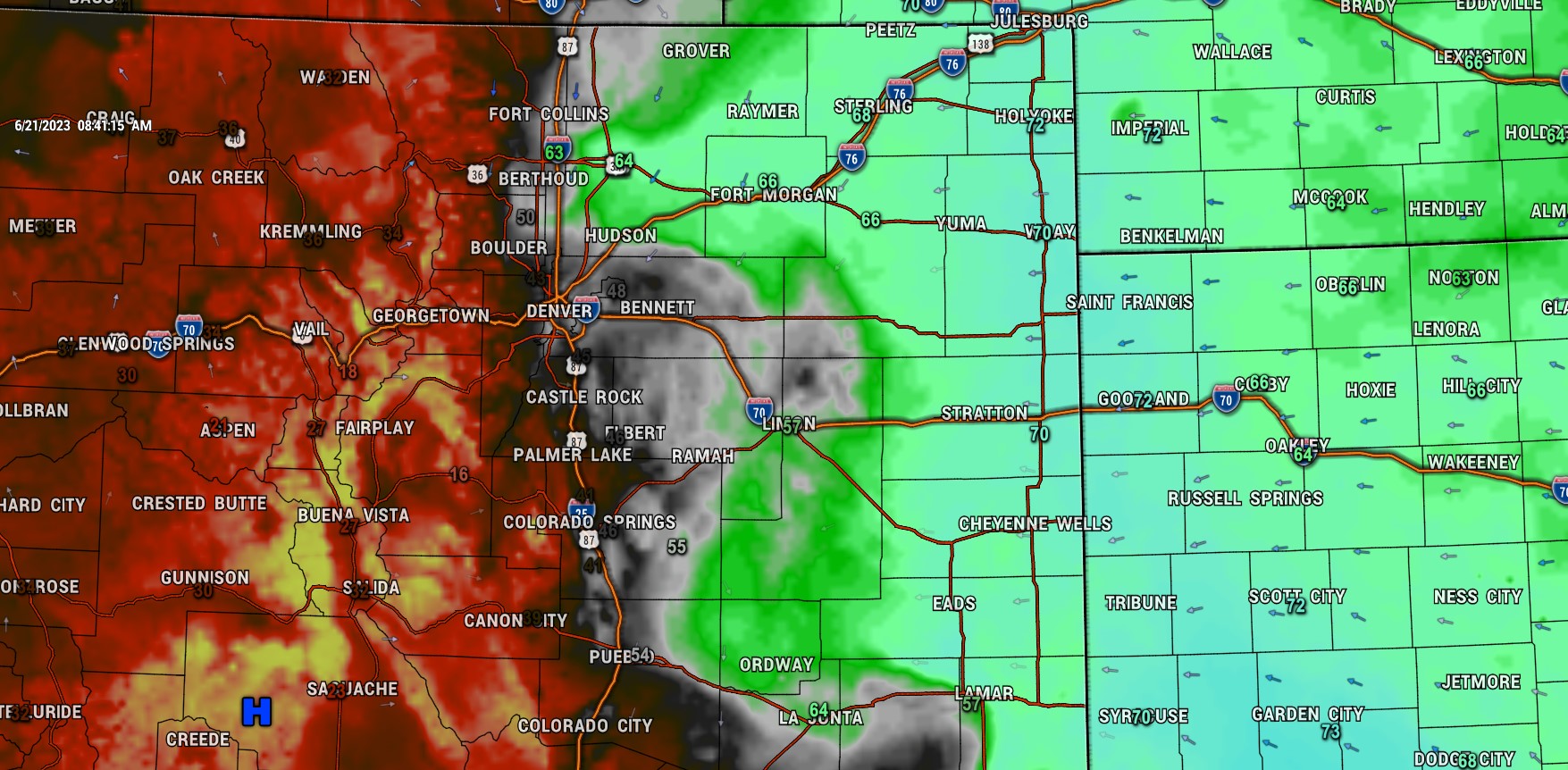
The atmosphere is juiced up today - we are seeing high dewpoints in much of Eastern Colorado in the upper 60's and even a few 70's. That much moisture in the air is relatively rare for Colorado so today could be a very interesting setup.
Easterly flow is acting like a conveyor belt, transporting moisture into the area with a dryline setup just East of the I-25 corridor this morning. Typically that dryline will shift a bit further East during the day and serve as a focus for thunderstorm development.
Instability is also projected to be quite high along the front range:
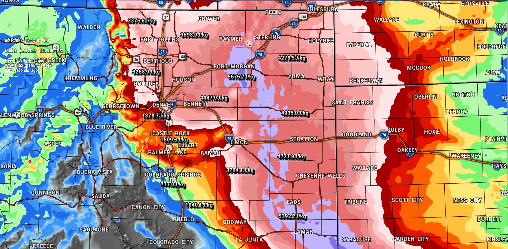
CAPE or convective available potential energy is the amount of fuel available to a developing thunderstorm. More specifically, it describes the instability of the atmosphere and provides an approximation of updraft strength within a thunderstorm. A higher value of CAPE means the atmosphere is more unstable and would therefore produce a stronger updraft.
Typical values on a standard severe weather day in Colorado are between 1,000-2000 j/kg... we can see strong to severe storms with values as low as 500-750 j/kg... today we see values in the Northeastern part of the state as high as 3,000-5,000 j/kg.
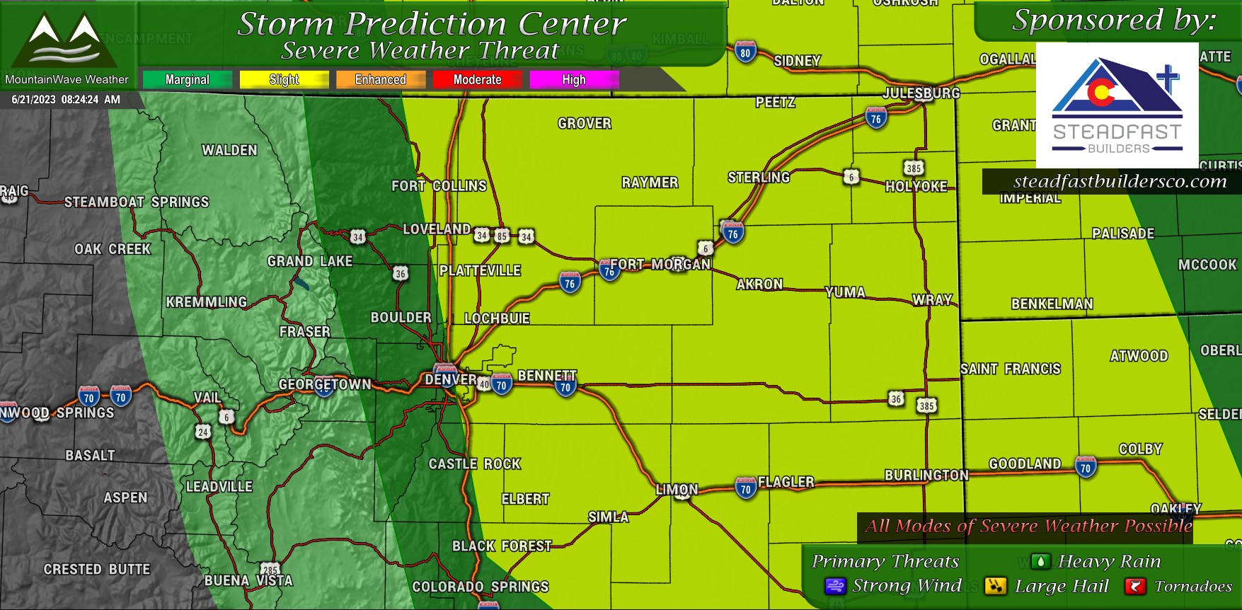
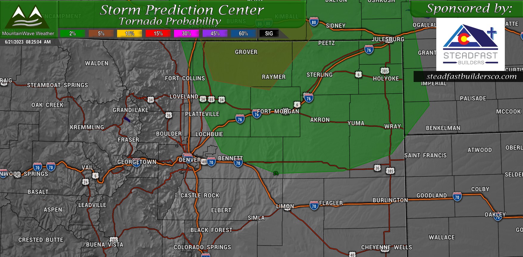
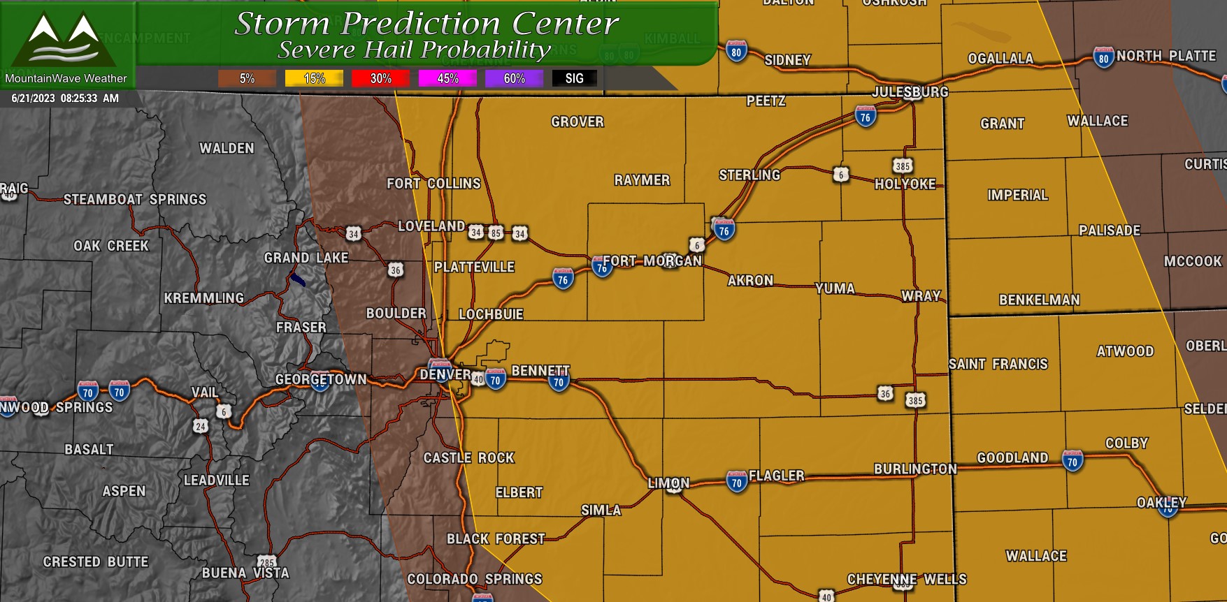
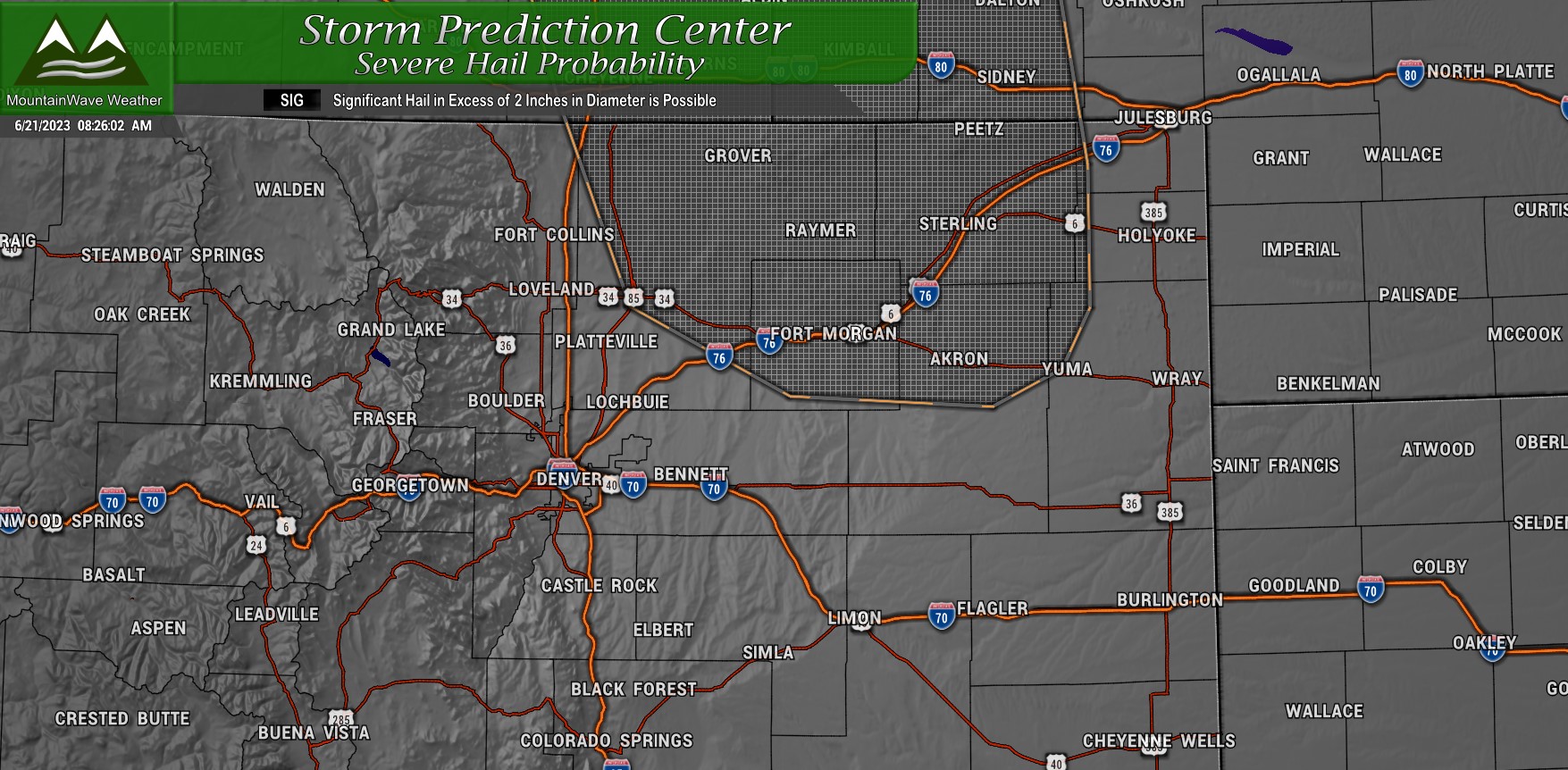
SPC Outlook Areas
Categorical
Tornado
Hail
Significant Hail
Threats
While all modes of severe weather are possible today, I think the one that will be most notable and potentially most damaging is the potential for large hail.

The area outlined in the SPC Significant Hail Graphic above will be the area most likely to see the largest hail, but the truth is anyone in the highlighted 15% or 5% areas could see a random severe storm with large hail. As such, while most of us won't see hail - some of us will and some of it could be quite large. Factor that into your plans this afternoon and evening if you're out and about or concerned about property damage.
Discussion, Timing and Preparedness
Let's look real quick at the ingredients we need for a basic thunderstorm and see how we measure up with those ingredients:
- Moisture
- Very high - dewpoints high and low level moisture high due to Easterly and Southeasterly flow
- Instability
- Very high - strong temperature gradient with warm temperatures at the surface and cooling temperatures aloft as a cold front moves through this afternoon
- Lift
- High, but with question marks - upslope will provide lift along with the front and potentially daytime heating. Still questions on how strong all of these are though...
Now let's look at the additional ingredients for a supercell thunderstorm and see how those look:
- Intense instability to support strong updrafts
- Very high - CAPE values will be very high supporting very strong updrafts with thunderstorms that form, especially to the East
- Wind shear
- Adequate - Models suggest bulk shear in the 35-45kt range, generally anything above 30kts is sufficient for supercell thunderstorms to survive and thrive
So all in all, could be an explosive day for thunderstorms, especially as you go Eastwards.
As for timing, prime time looks to be between 3PM and 11PM for storms this afternoon and evening.
Be prepared! If you are outdoors or bopping around this afternoon and evening, have a way to receive weather alerts and know what to do if severe weather threatens.
Next update comes around lunchtime on Facebook.
Stay tuned!
