Interesting weather week we have on tap as we should see our first “colder” fall storm roll through the area starting on Wednesday with effects lasting through Thursday. There’s still some work to be done to figure out who will see snow and how much, but I’ll post a few details on our thinking for that subject below.
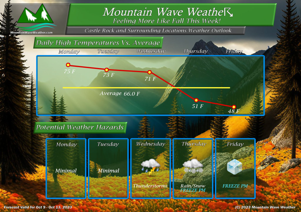
I would like to point out that regardless of the snow/rain and where it fall… the primary weather hazard to watch out for this week is freezing temperatures. It is likely Wednesday night/Thursday morning and Thursday night/Friday morning could see several hours of below freezing temperatures. Some upper elevations of the Palmer Divide could see “Hard Freeze” conditions, but the jury is still out a bit on if it gets that cold and for how long.
Keep that in mind, freezing weather preparations should be completed by Wednesday afternoon.
Current Weather Alerts
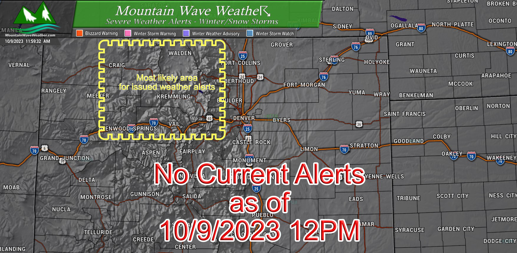
No current weather alerts issued for this storm as of the writing of this post.
Two areas to watch though;
Northern and Central Mountains: will likely see at least an advisory, Northern mountains especially have a chance for some areas to pick up significant snowfall accumulations
Denver Metro/Urban Corridor/ Palmer Divide: these areas may see some sort of alert for Freezing Weather.
Will pass along any updates as needed…
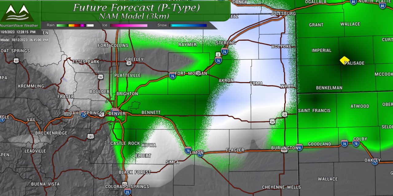
Snow in the Forecast?
It does look likely that some areas East of the Divide will see snow. The best chance is to the North along the Wyoming/Colorado border… but some foothills locations and Palmer Divide locations are in play for this storm as well.
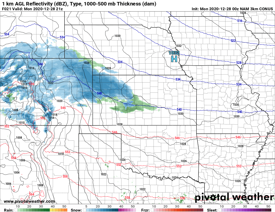
The Setup
Models have been consistent on swinging the main area of low pressure through Northern Colorado late Wednesday and strengthening it into a closed low over Northeastern Colorado by Thursday morning and tracking it off to the East.
Here’s a quick look at the models:
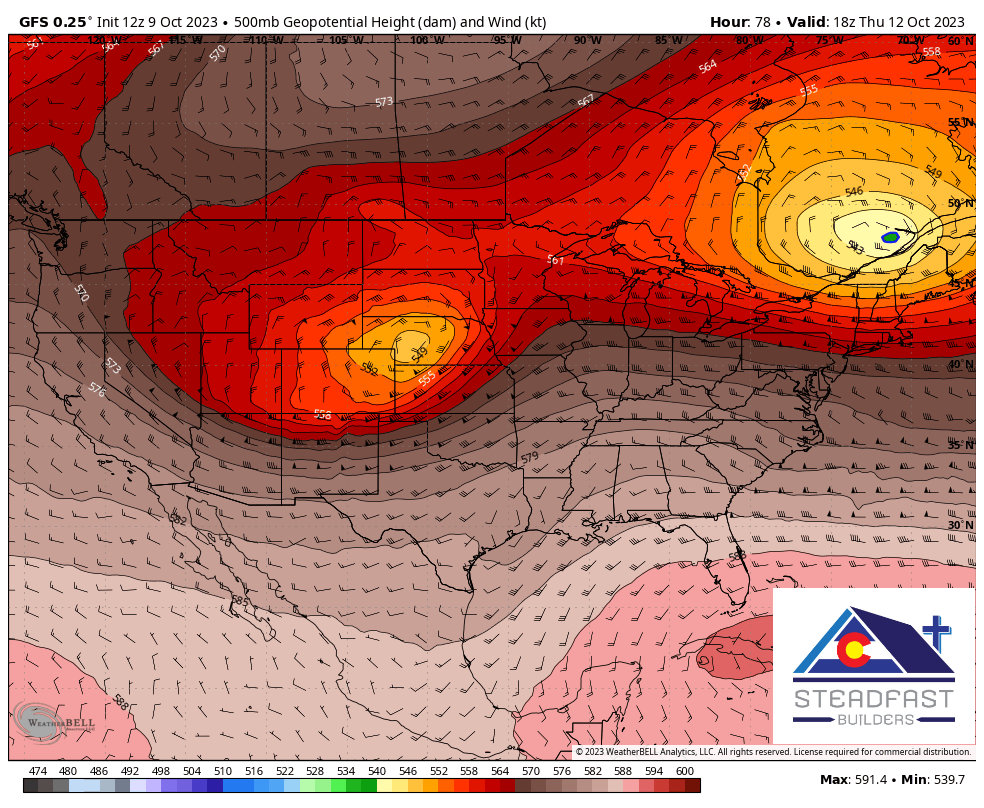
GFS model – 500mb heights and winds
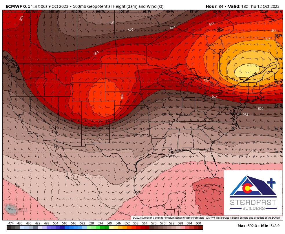
European model – 500mb heights and winds
You’ll notice the usual slight differences in timing/position/track, etc… but relatively decent agreement at this stage of the game.
As it is right now, a storm with this track and strengthening Northeast of us doesn’t equal a big snow producer for Eastern Colorado. The mountains in Northwestern Colorado especially do better with storms like these.
The kicker here is that some of the later model runs are showing a trend to bring this system a bit further South. If that should happen, we would see more cold air and better upslope conditions along Denver and the Front Range. This is not set in stone yet, but is something we’ll be watching especially as the higher resolution models come in this afternoon.
Potential Snowfall
I’m just going to show one model for now for context on what we’re looking at ballpark with snowfall areas at this point. Please don’t “lock on: to specific numbers for snow right now, that’s not how it works at this point in the game.
And as I usually do at the start of every snow season, I’ll mention this: THIS IS A MODEL, NOT A FORECAST. I post these to give context and information to what I’m seeing the forecasting process, I will always mention that you shouldn’t be focused on concrete numbers this early in a forecast.
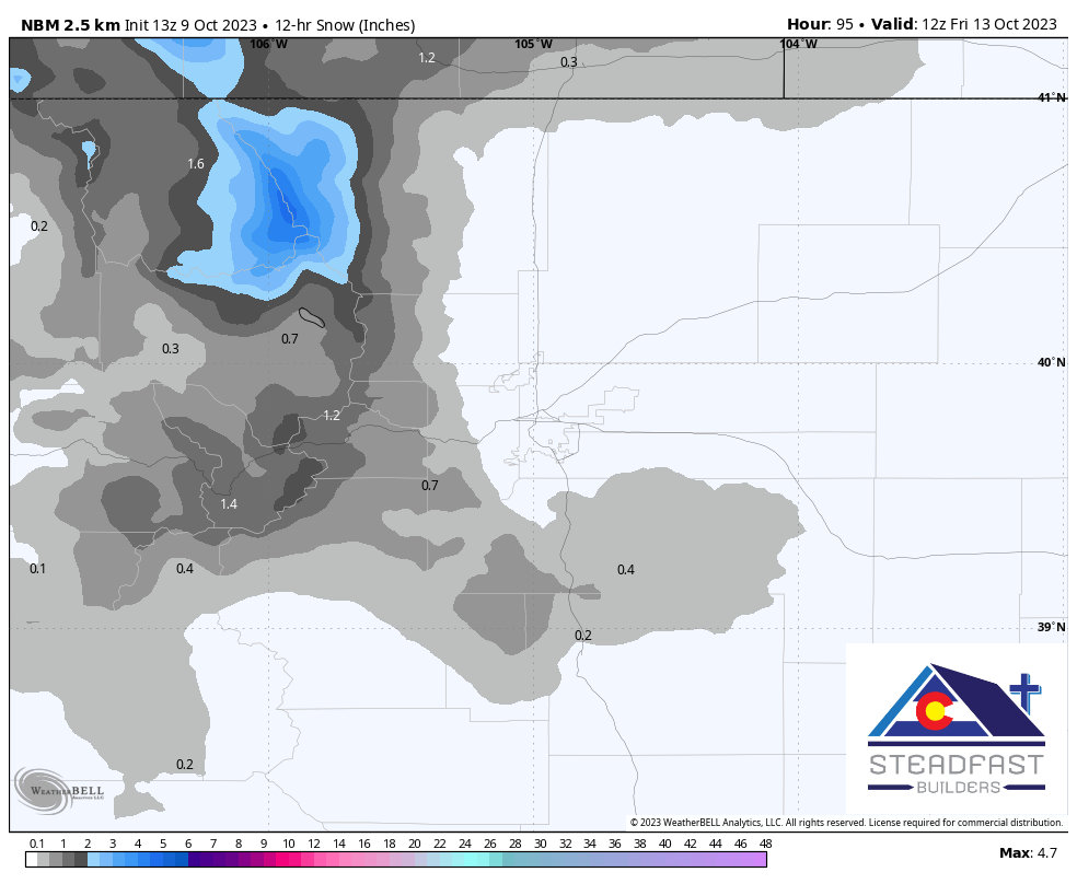
By the way, this is the Blend of Models – it does a better job at filtering out some of the high/low outliers in a modeling suite.
When we look at the overall trend for snowfall with models, we see the primary areas to keep an eye on are the Northern and Central Mountains, the Front Range Foothills and the Palmer Divide reaching out to the plains. Given the warmer conditions we’ve had, I would favor higher elevation areas for seeing any actual “snow accumulation” and lower areas seeing a mix of precipitation but little or no accumulation.
So, Let’s Sum Up What We Have Right Now…
What: Potential cold air storm with upslope
Precipitation: Rain and Snow… still figuring out details where that dividing line is going to be. Any snow accumulation is favored at higher elevations at this time.
When: Wednesday PM through Thursday PM
Preparation/Hazards:
- Snowfall is still a question mark – not enough data to ascertain any travel impacts
- Freezing temperatures – likely. Be sure to have all preparations completed for freezing temperatures by Wednesday afternoon
High resolution models will be coming into range later on Monday, this should give us a bit more detail on what we are dealing with. Stay tuned for further updates!
