This Weekend’s Weather Setup – One for the Record Books?
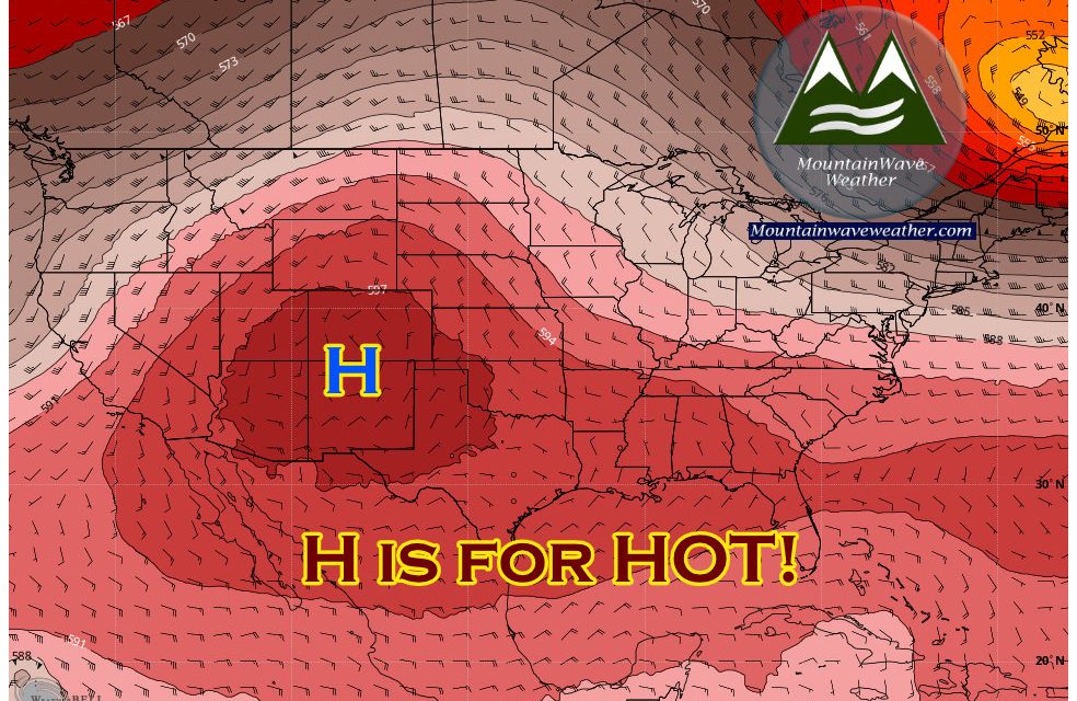
An unusually strong ridge of high pressure is building across the Southwest this weekend including Colorado and it means things are going to get toasty around here! This ridge will do a couple of things to our overall weather pattern:
- Funnel hot, dry desert air into Colorado from the Southwest and West
- It will effectively shut down our main source of monsoon moisture
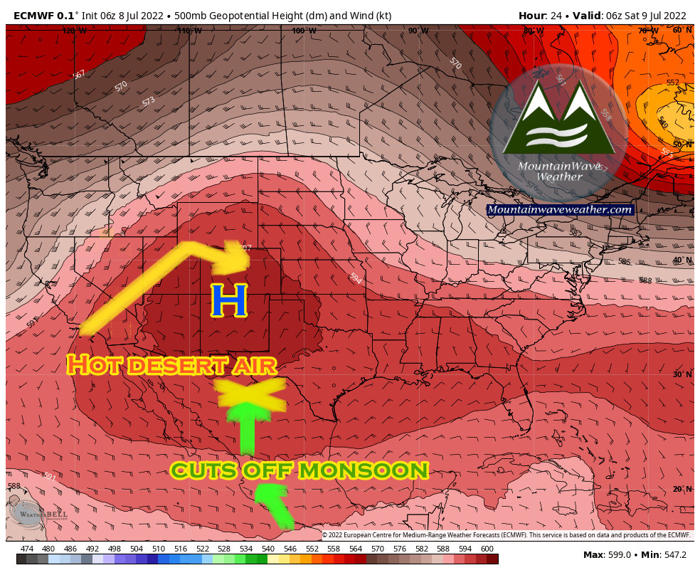
This doesn’t mean that thunderstorms won’t be a possibility… but they will be much more widely scattered than we’ve seen the past few days. If your particular area sees any rain this weekend, probably best to go grab a lottery ticket – seeing rain is a stroke of true luck this weekend.
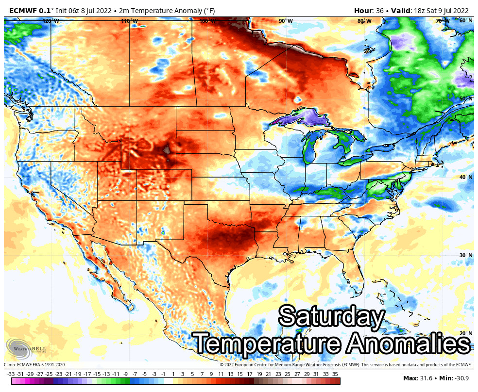
Temperature Anomaly
We look at graphics like this to see not exactly how hot it will get, but how much above or below the average temperature for this time of year our temperatures will be. For these I took the daily high temperatures and compared them to what is normal.
Anything orange or red is above normal.
Saturday
Sunday
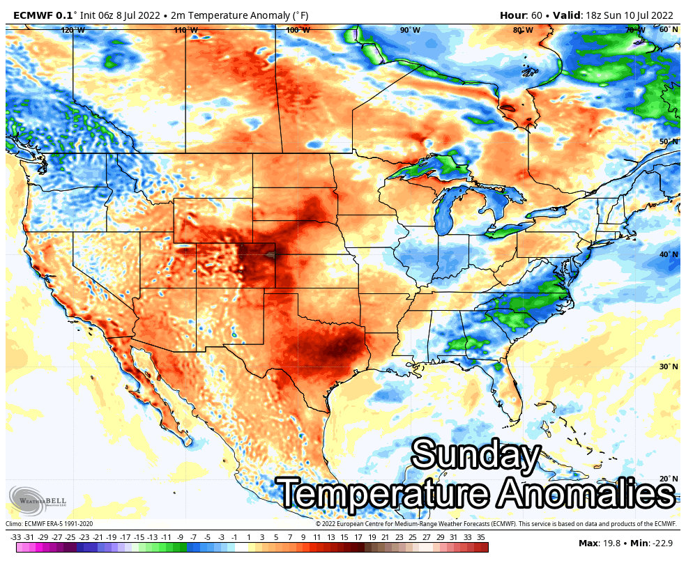
You can see the areas that will see the biggest impact from this ridge; mainly most of Texas and a lot of Colorado as well. I suspect we will see many daily record highs broken especially in Texas and some parts of Eastern Colorado – many temperatures will be running 10-15 degrees above normal. For reference, Denver’s daily average high around this time of year is 88-90 degrees… so add about 10-12 to that!
Ok we get it, this weekend is going to be hot… but how hot?
A Look at Temperatures
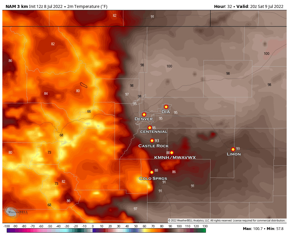
Saturday
High temperatures on Saturday look toasty with many areas across Eastern Colorado flirting with the century mark. Look for temperatures in the upper 80’s to low 90’s along the Palmer Divide. These temperatures are a bit above normal for this time of year, but it is summer so hot temperatures are not unheard of!
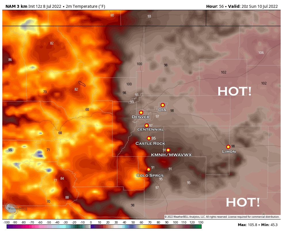
Sunday
By Sunday, we will crank up the thermostat just a bit more. Low to mid 100’s will be likely across the plains with the metro area into the upper 90’s to low 100’s. The Palmer Divide will see temperatures in the mid to upper 90’s with higher elevation areas seeing very warm low 90’s. The theme for Sunday is HOT!
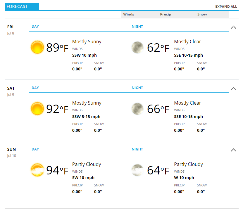
Castle Rock/Palmer Divide Forecast
The Castle Rock forecast is attached below for Friday – Sunday. As always, add or subtract a degree or two depending on your elevation. For what it’s worth, I think the high temperatures are a bit underdone, see the graphics above more temperatures more inline with my thinking.
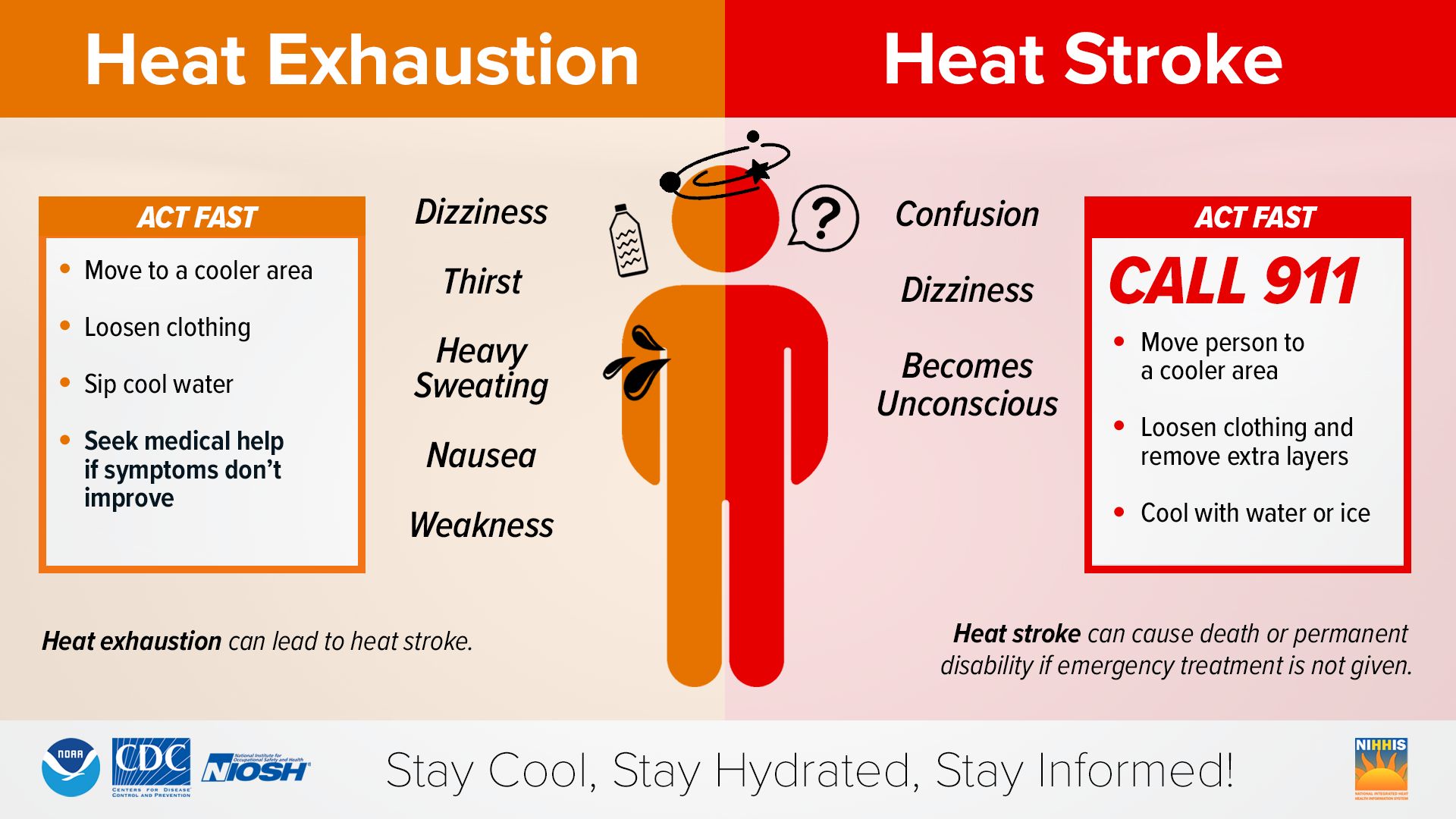
Make Sure You Know Your Heat Safety!
Stay cool this weekend!
