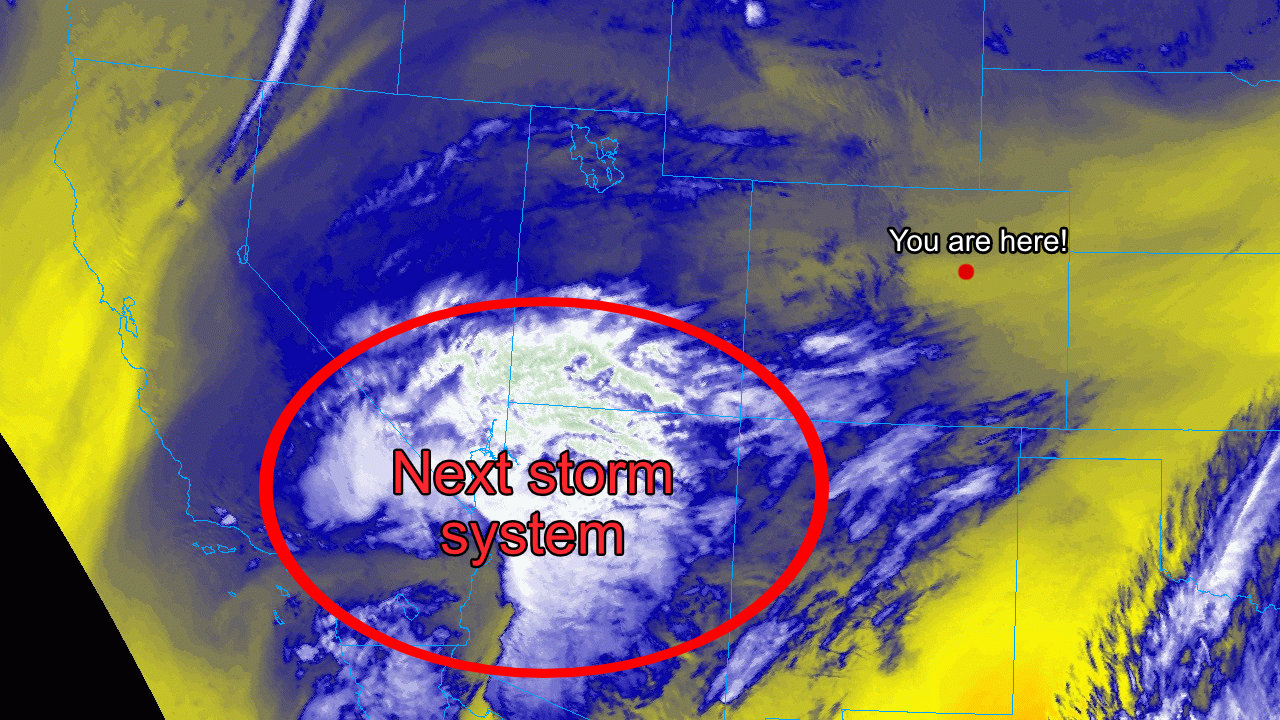
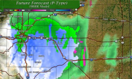
A storm that didn't look like much this morning is beginning to come into greater focus this evening with the track continueing to evolve. We still don't see much impact for Denver and the Northern Front Range (keep in mind the forecast is fluid and this could change) but we are starting to notice models zero in a bit more in the Palmer Divide.
Lot's to digest tonight, here's the latest!
Winter Weather Highlights
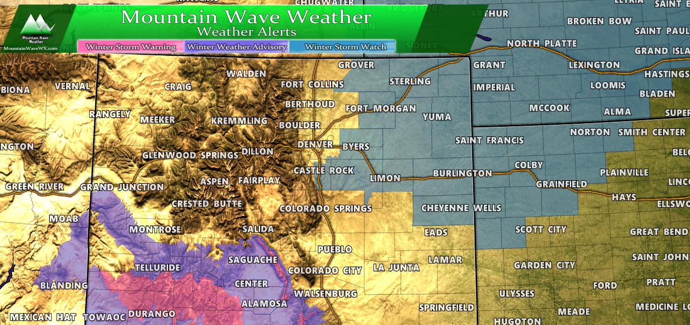
Colorado Winter Weather Highlights as of 6PM Thursday 12/26/2019
A Winter Storm Watch for Northeastern and East Central Colorado from 6PM Friday 12/27/2019 through Midnight Saturday or 12AM Sunday 12/29/2019. Expect storm total snowfall of 5-10 inches with winds in excess of 45 miles per hour. The combination of falling and blowing snow will make travel difficult. Road closures will be possible in some areas. A Winter Storm Watch means the National Weather Service is keeping a close eye on the forecast for this area and will issues when severe winter weather looks imminent.

Palmer Divide Winter Weather Highlights as of 6PM Thursday 12/26/2019
A Winter Storm Watch has been issued for Palmer Divide locations above 6,000 feet in elevation. This watch has been issued for the potential of 4-8 inches of snowfall with 50MPH wind gusts possible. If this were to verify, Blizzard Conditions could be possible on Saturday for some areas along the Palmer Divide.
Palmer Divide cities included in this watch:
- Castle Rock
- Elbert
- Elizabeth
- Fondis
- Simla
- Kiowa
- Larkspur
A watch simply means "we are keeping an eye on it" it does not mean any severe winter weather is imminent or occurring. That being said, there is growing confidence that this storm will impact the area through the day Saturday. Those with agriculture and travel interests along the Palmer Divide should pay close attention to the forecast and either start preparations or be ready to do so on Friday.
Snowfall Forecasts and Modelling
The National Weather Service has issued the Watch today, I imagine more out of an abundance of caution in case this storm track continues to shift more favorably. Right now, I'm not seeing a whole lot of support in any models outside of the goofy GFS that this will be a decent snow event. Nearly every other major model has the Palmer Divide picking up a couple inches of snow at best. If I take an average of the highs and lows, blend in the ensembles here's a rough draft of what I get...
Here's a few tidbits about this forecast:
- I went more conservative on snowfall numbers because I don't see strong support for higher end snowfall totals in a lot of the models yet.
- The reason I went a bit lower is because we still don't have strong confidence in the track and therefore which areas see a big impact (I can add if any to this statement)
- These are preliminary totals and I promise you they will change by Friday sometime (either higher or lower) as we get better information. This is simply a snapshot of what we see in the data tonight.
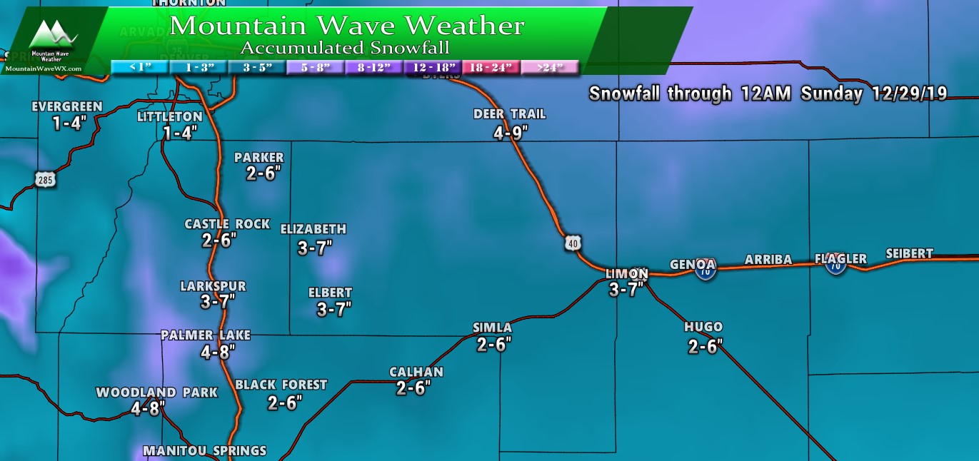
Palmer Divide region
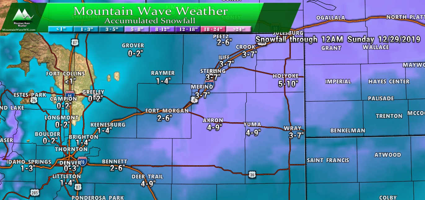
Northeastern Colorado
For those wondering about the Mountains... they won't see a ton of snow out of this event but they will see some.
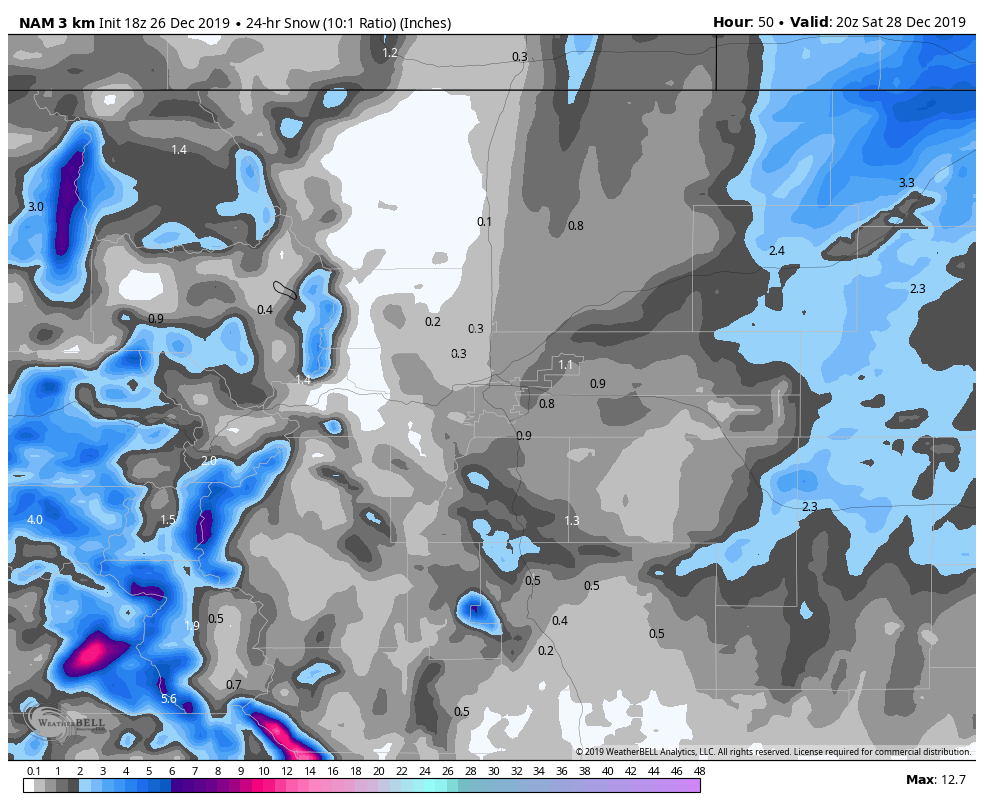 For those curious, here's the Nam3k. Southwestern Mountains will certainly be favored for snowfall but the central and Northern Mountains will pick up a couple of inches in some spots. There are currently no winter weather highlights for the Northern or Central mountains this weekend. There are for the Southwestern mountains.
Other Concern... The Wind
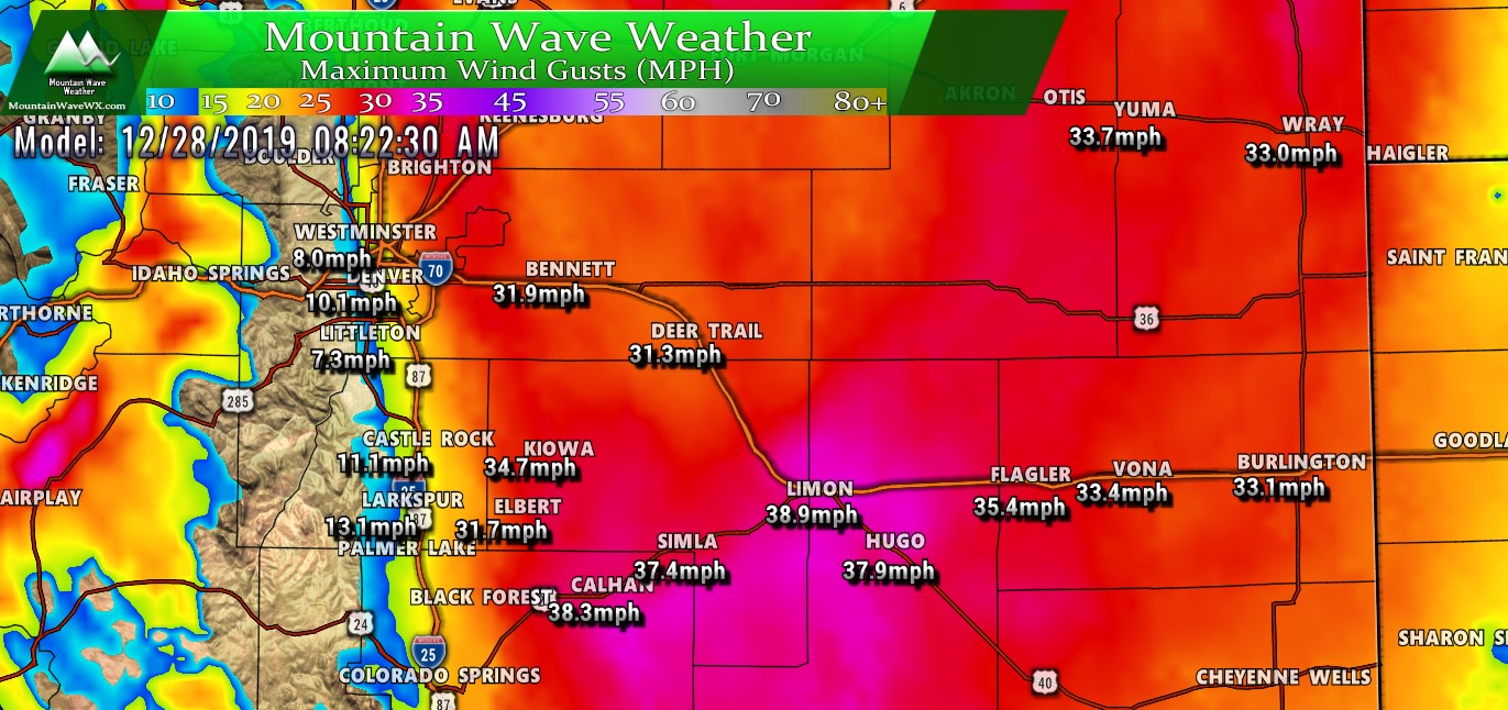
The other concern with this storm system will be the wind. As we all know, it doesn't take a lot of snow in combination with strong wind to create travel issues. Visibility becomes a problem along with roads glazing and icing over. If we see higher snow totals drifting could also be a problem.
With the data we see right now, the impacts (again there's uncertainty so take as a ''keep an eye on it" statement) would be at their worst well East of the I-25 corridor. That means for the Palmer Divide, Elbert County could see the brunt of this along with areas North and East.
The snapshot above shows peak wind gusts around 8AM Saturday morning, keep in mind snow could be falling during this time.
This is another factor with this storm that we will have to keep a close eye on!
Summary
Still a ton of uncertainty on the models tonight... which means they are not handling it well. What does that mean? It basically means all we can do is make educated guesses right now on what this storm will actually do... but there's equal chances we will be right as we could be wrong.
In this case, I would recommend to plan for the worst and hope for the best. We'd rather not have people caught off guard.
Here's the quick bulletpoints
- Tons of uncertainty
- Forecast will change several times on Friday, best thing to do is stay tuned!
- Highest impact locations (can change)
- Assuming this thing verifies I'd expect highest impacts in Northeastern Colorado and Palmer Divide locations East of the Douglas County/ Elbert County Line
- Whether Castle Rock sees anything decent with this is still up in the air along with most other locations right along the I-25 corridor
- Timing (can change)
- Friday night looks ok until you get later, thinking past 9PM for this thing to start ramping up
- Saturday looks like the brunt of the storm, Saturday morning through Saturday night will be interesting
- Travel Impacts
- Right now, no reason to believe DIA sees major impacts... but given the uncertainty we still see; my advice is check with your flights before you leave starting Friday Night through Saturday Night
- Highest road impacts look East of Denver and the I-25 corridor
- There will be some road impacts in Southern Colorado near the border of New Mexico
I know everything sounds fuzzy on the forecast right but what I'm trying to communicate is a lot of this stuff is up in the air. I'd rather fine tune the details as I get them rather than spit out a bad forecast based on a bunch of junk
Stay tuned for more updates, I suspect I'll have several up on Friday and one or two early Saturday.
