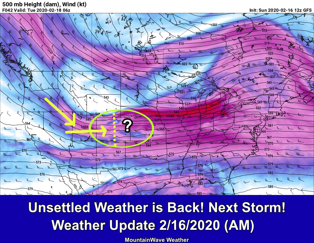
We’ve got a interesting looking storm system moving through this weekend. There are going to be a couple of factors we are watching closely for the forecast over the next few days. The long and short of that is:
- Snowfall is possible
- Questions:
- Who sees how much
- When most of it falls
- Very cold temperatures are possible
- Questions:
- When does the cold front move through
- How far South does that cold air punch?
- Exactly how cold does it get?
While we are still a few days out to answering these questions, we can take a look at what data we have now and at least get a good idea of what we should start preparing for. Let’s take a look at the first bullet point in regards to snow, then we’ll follow with the temperatures:
Note: if you want to skip the analysis and see the quick bullet points and summary, that is at the bottom of this article.
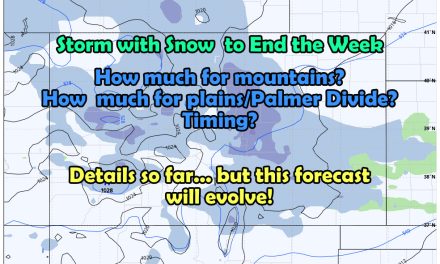
Snowfall – Models and Outlook
I’ll preface all of the below with this statement (as always and since it’s a new forecast year and people tend to forget): I AM SHOWING MODELS. THESE ARE NOT A FORECAST, THEY ARE A TOOL THAT IS USED IN CONJUNCTION WITH OTHER THINGS TO CREATE A FORECAST. BE WARY OF ANYONE POSTING MODELS WITHOUT THIS CONTEXT.
All model snapshots below carry an additional warning about this.
Deterministic Models
One con of using deterministic models is that they can tend to bounce around a lot or show outliers. How do we compensate for that? I’ll explain in a bit, but for now lets look at what these guys are saying. I’ve attached snapshots of the big 3 models we have at our disposal right now; the GFS, the Euro and the Canadian.
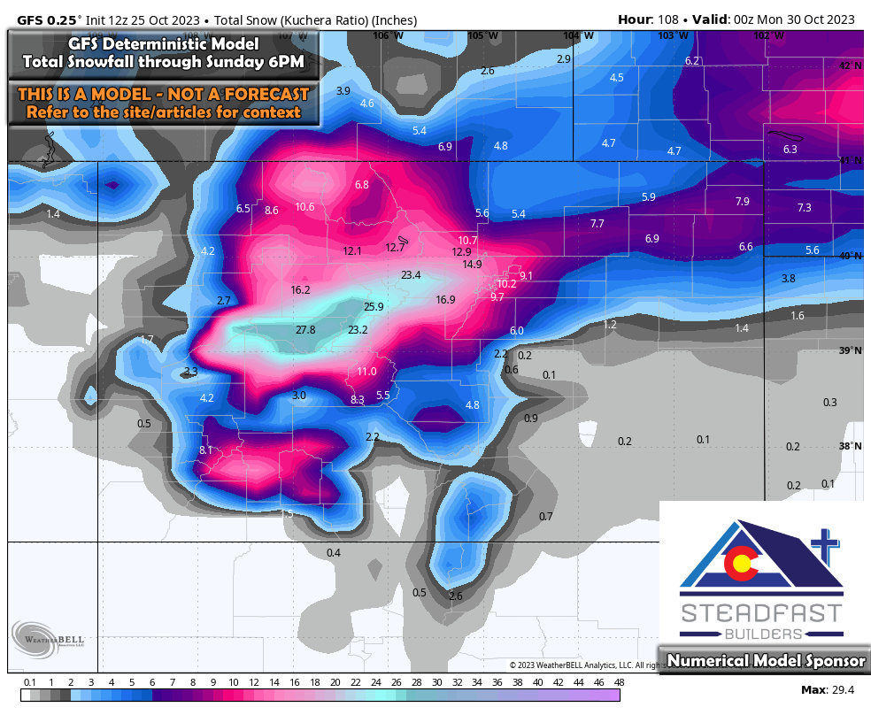
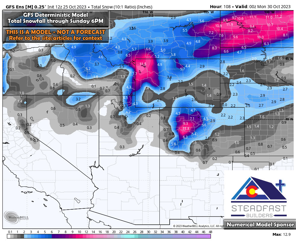
GFS
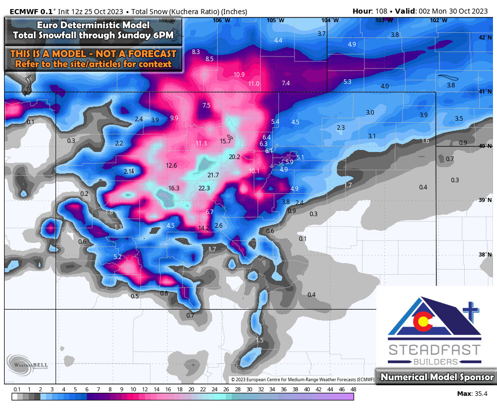
Euro
Canadian
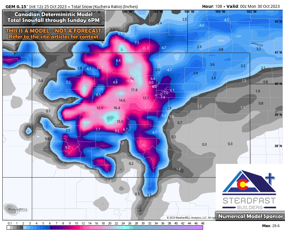 What do we see here? At this point its not recommended to get caught up on specific numbers. Those likely will change, but what we can take away is the areas favored for snow (heavier and lighter) and the fact that accumulating snow looks more likely for the front range. The mountains look like they’ll do fairly well also.
But, how do we smooth out the jumps and outliers that the deterministic models are often prone to? We look at the ensembles, these products are maps generated from many model runs and a mean is taken. This tends to bump out large swings high and low (outliers) in a snow or precipitation forecast and they don’t jump as much. Viewed over a longer period of time, they can show tends upwards or downwards and then as we get closer to the storm’s arrival we can use the deterministic to nail down the details.
Here’s the latest from the ensembles:
GFS
Euro
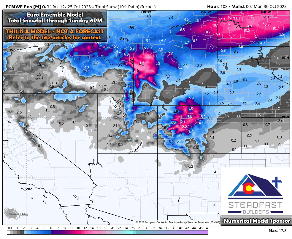 You’ll notice the snowfall expected by the ensembles is lesser… that’s ok. Like I said, this is a mean of several different model runs put together. What does this tell us? Mainly it tells us right now that snow is possible, the mountains are favored and the Eastern plains have a shot as well. When I look at the last several runs of these products I can see the overall trend for snow has gone up slightly so that gives me something to watch over the next few days.
Cold Air – Freezing and Hard Freeze Conditions
If you’ve followed me on social media this week, I’ve been harping about getting winterization done and preparing your animals or plants for bitter cold temperatures if you’re in that business. Here’s why:
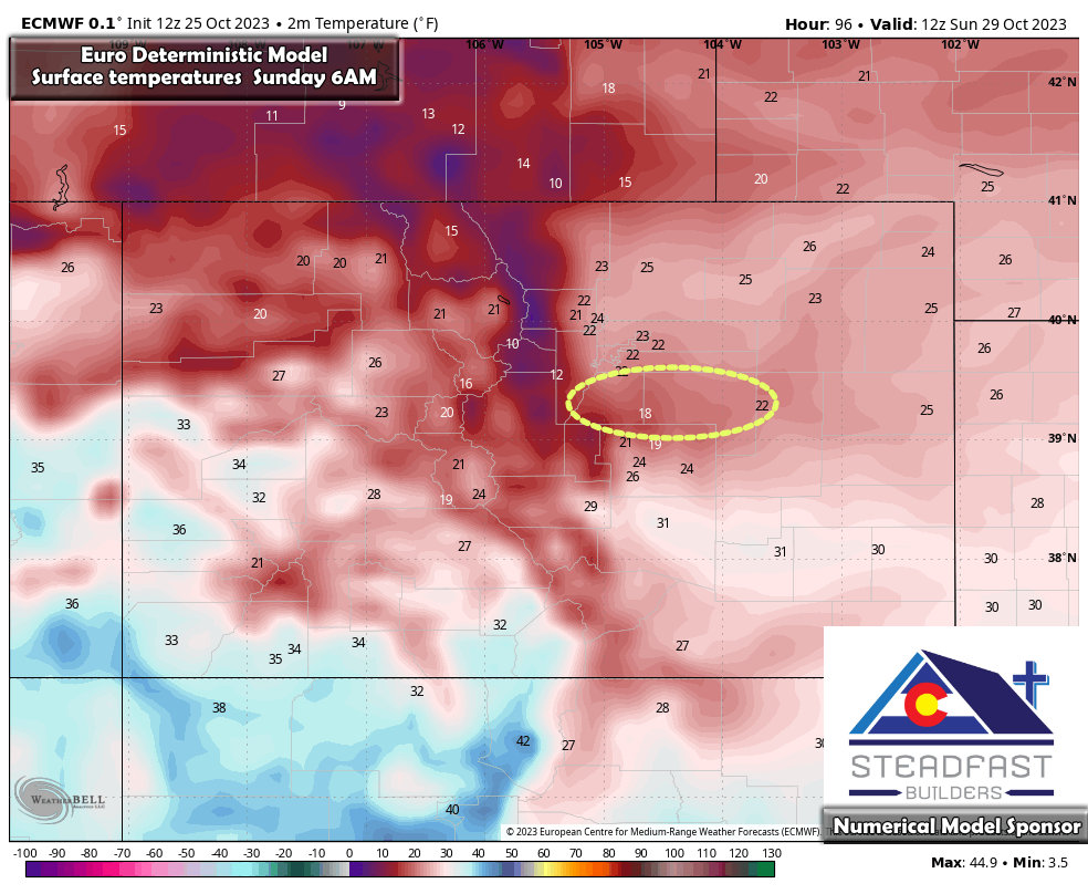
Sunday morning temperatures – most Palmer Divide locations in the teens
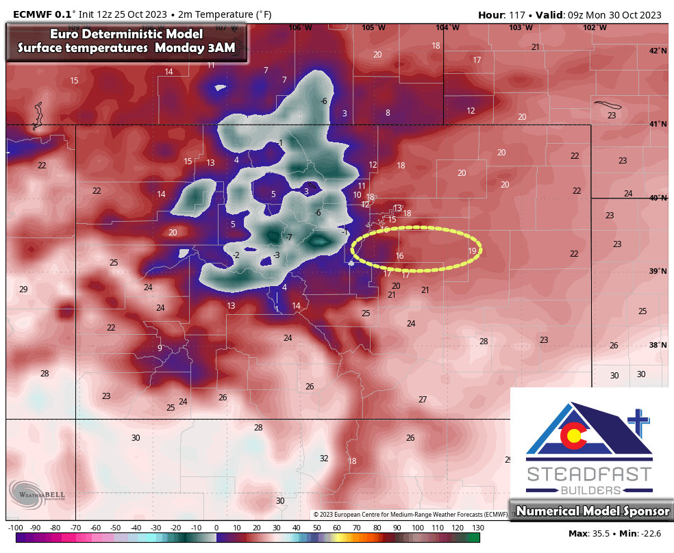
Monday morning temperatures – most Palmer Divide locations in the teens
Again, at this point the forecast dont focus on specific numbers… just look at the big picture.
Teens is not the coldest we will see all fall and winter, but it will be a shock to the system for a lot of people after many weeks of well above average temperatures.
I’ll be able to nail down exactly how cold it gets in a few days as we get more short term/ higher resolution model data in.
Summary – What to Watch – What to Prepare For
Let’s review the questions from the top with what we know now…
- Snowfall (Possible)
- Accumulating snow is possible for Denver and the Palmer Divide. Mountains will likely see decent amounts of snow accumulation.
- There is a small chance this could be a medium or so sized storm in terms of snowfall for the Front Range (medium sized meaning some areas see more than 1-3 inches) This is something I’ll have to keep monitoring over the next few days.
- Still lots of questions on if the timing works with energy and cold air to give us the upslope we need
- Forecast confidence is still on the low side of medium around this parameter at this point
- Temperatures (Possible)
- Cold temperatures well below freezing are possible
- High temperatures on Sunday may only get to around freezing
- Temperatures will be cold enough that winterization needs to be a thought before then
- Those with animals will need to be prepared for colder temperatures (warm place, lots of food, de-icers for stock tanks)
- Forecast confidence is medium on this aspect
Timing?
I know this is the next question I’ll get so here’s the details. We don’t have specifics yet on when snow starts or stops or exactly when the cold front slides in just yet. That being said, we are zero-ing in on Thursday for the first cold front, with a cooler but calm Friday. Saturday and Sunday are in play for the second shot of cold air and potential snow.
More details will be coming on that information.
