Forecasting a specific weather event is akin to looking at a machine with 100 different levers and trying to figure out exactly what position those levers will be in at a certain date and time. As the forecast evolves, levers move up and down, and in turn effect other levers that move up in down in response.
Weather forecasting is trying to describe the state of the atmosphere at an exact point in time – it’s not easy to do but we’ve gotten fairly well at it over the years but it still finds ways to humble us.
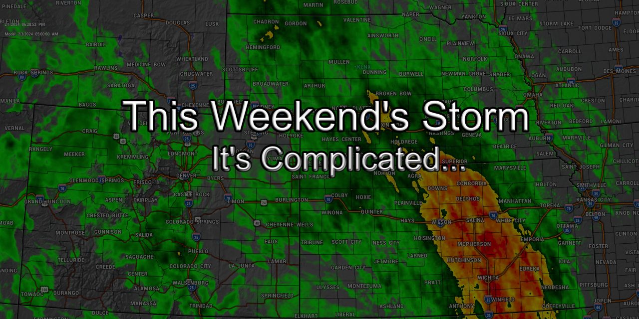
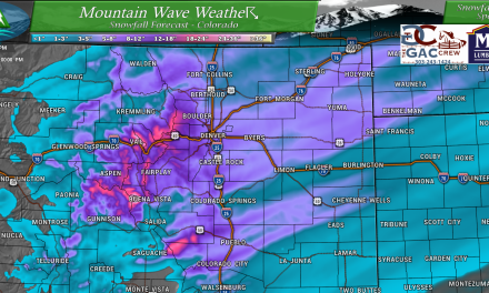
Much can be said about our next storm system, it’s one of the more difficult storms I’ve had to forecast in awhile – in what has been an entire season full of tricky forecasts. Why is that so? Storms are evolving differently and behaving differently than they use to. A lot of weather forecasting relies on pattern recognition and using past atmospheric setups to predict what an incoming storm will do or look like.
What happens when you have very little historical data to pull from? That’s the case with this next storm – this is the type of storm we see typically in March or April. The atmosphere is warmer (and thusly can hold more moisture), the sun angle is higher, etc…
What happens when you place that exact same type of setup in early February, when we don’t have a lot of historical observation to pull from with storms of this type? Chaos, and that’s why you’ve seen so many different forecasts from each meteorologists and some flat out admitting they have no idea how this thing will behave.
Let’s take a look at some of the important levers that are moving in flux and influencing this storm – and how they make this storm very difficult to forecast.
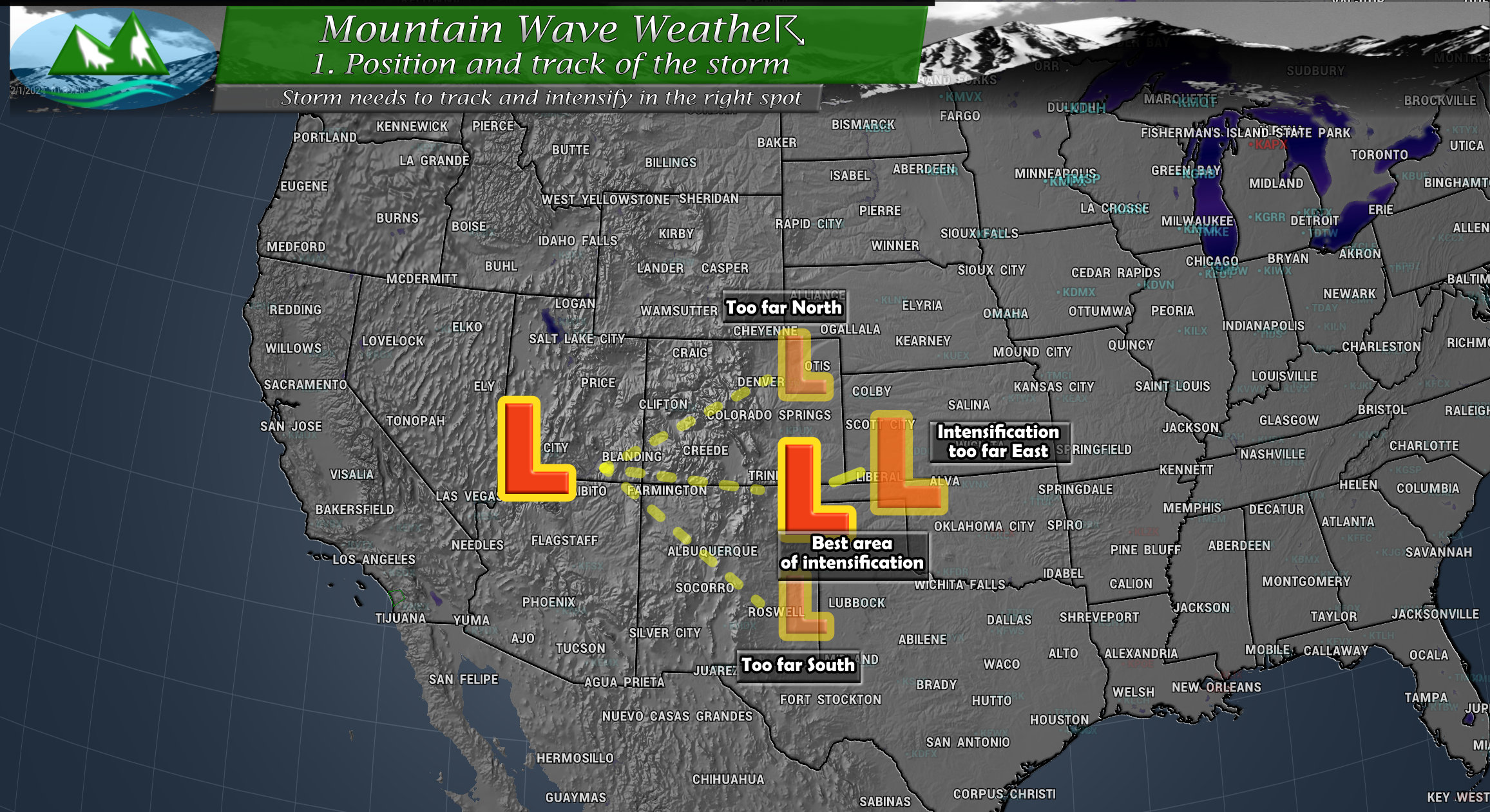
1. Storm Track and Position of the Low When It Intensifies
If you’ve followed weather forecasting in Colorado for awhile, you know that where the storm tracks and how it evolves and where it intensifies is critical to a snowstorm forecast along the front range of Colorado. If the track shifts too far North or South, that means the storm’s energy passes too far North or South and misses the critical upslope component needed for a bigger snow along the front range of Colorado.
Even if we get the perfect track, the storm must then intensify in the right spot. Too far West and it won’t be strong enough to tap into the moisture or cold air it needs (and will remain weak) and too far East means the moisture misses us and never establishes a good upslope component.
For the record, the best track is typically across the four-corners region, along the border of New Mexico and a slight Northeastward turn into Southeastern Colorado. The best intensification spot is as it makes that Northeastward turn and moves into Southeastern Colorado.
Like I mentioned with the levers above – if this doesn’t all come together the storm has a much harder time at materializing and having a bigger impact on Colorado.
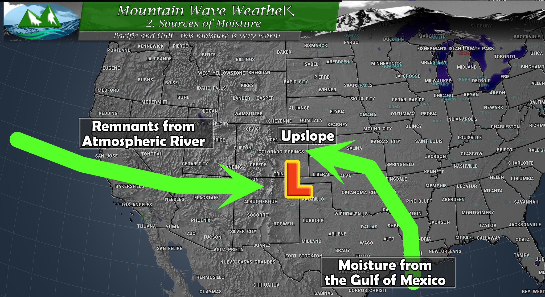
2. Moisture Source
When we see storms like this, tapping into moisture from the Gulf of Mexico is pretty common if the storm maintains a good track and a good position of intensification. That’s not an unusual aspect of this storm, what is unusual is the secondary moisture source in the form of remnants of a Pacific Atmospheric River event from California.
Both of these sources of moisture are warm/tropical air and will need to be cooled significantly to allow for snow along the front range. This can happen fairly often with the typical moisture source from the Southeast, but if we add another from the West/Southwest… will we have enough cooling to cool both of those moisture sources and upslope? Not a lot of history to draw on here so we just have to monitor and see what happens.
Cold air support is already a concern (see below) but it may not be (see further below)
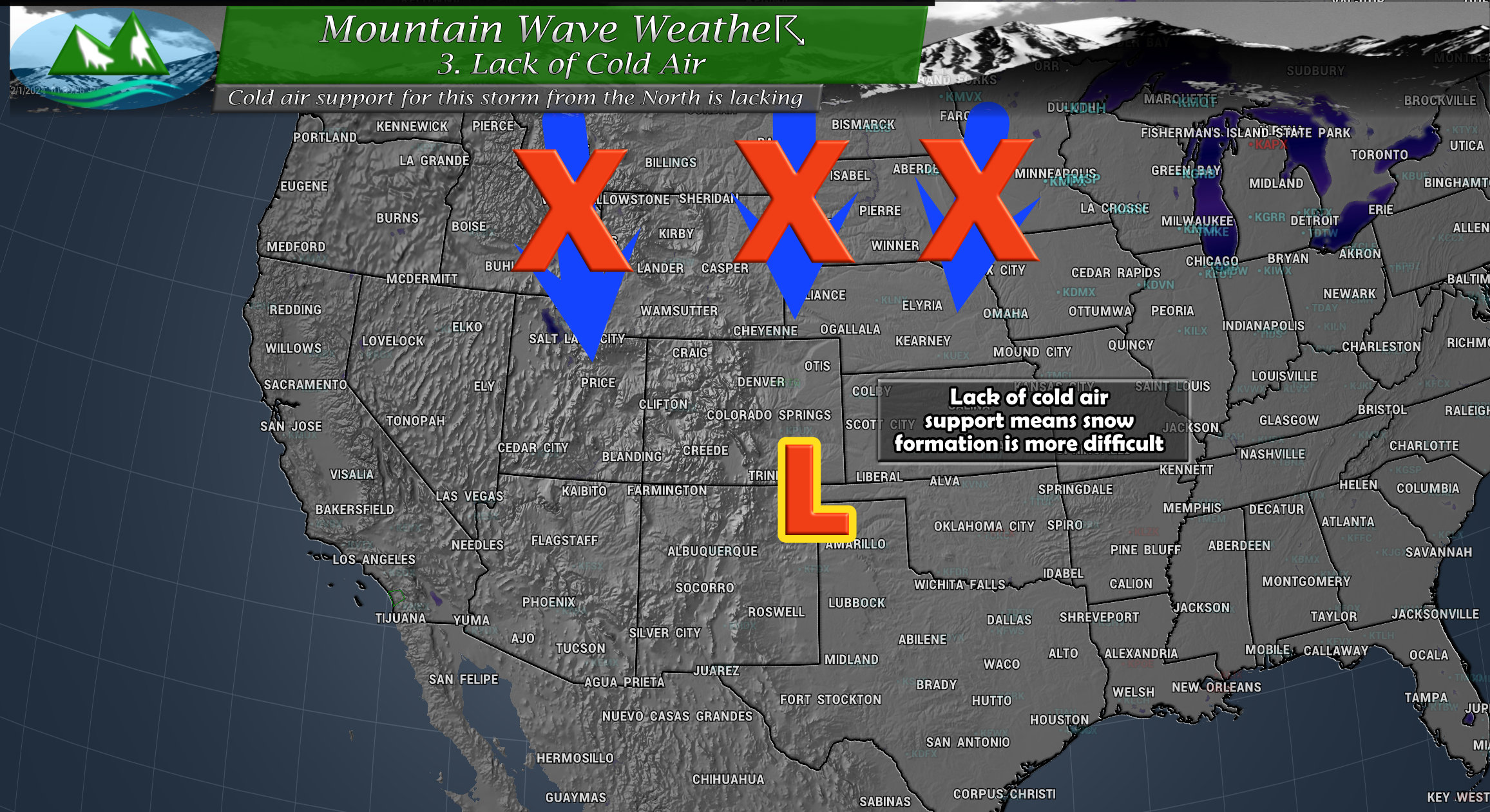
3. Lack of Cold Air
One major concern amongst meteorologists is the lack of cold air support with this storm. It doesn’t have a lot of cold air coming down from Canada (more on why in the next bit) so that means temperatures will be marginal for snow.
Between 2. and 3. any snow that falls will be among the very heavy/wet variety akin to what we typically see in March/April snowstorms. There will be a very sharp gradient in snowfall (largely based on elevation) and the difference of a couple hundred feet in elevation can be the difference between 1-3 slushy inches of snow and 8-12 inches of snow.
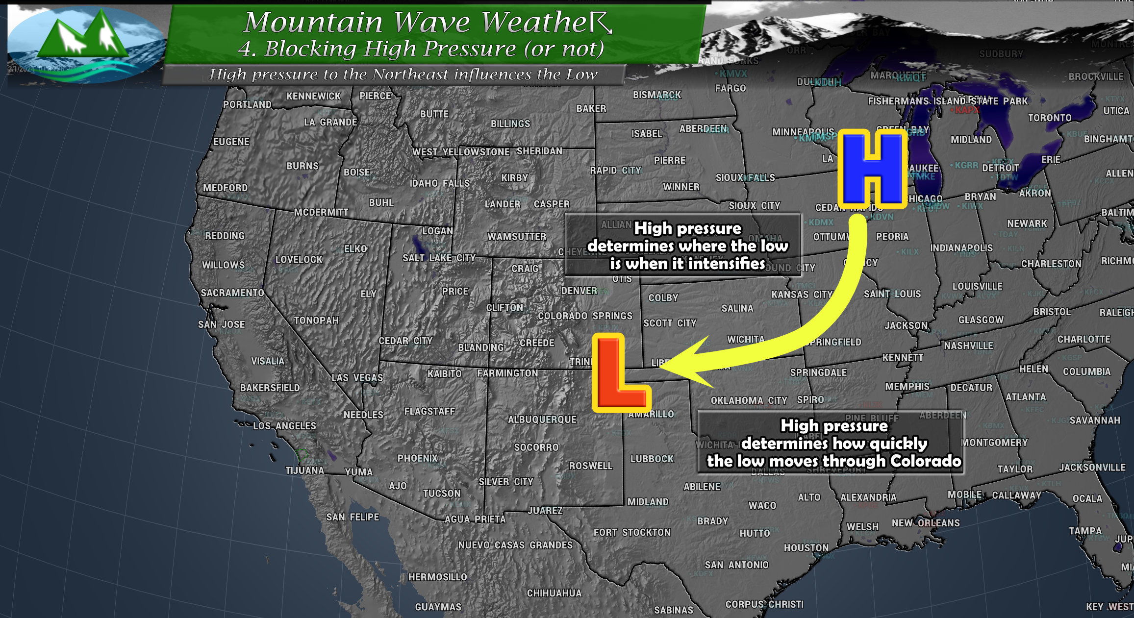
4. High Pressure/Omega Block
Typically when we have storms like this, it’s enough to track and monitor the low pressure system as your main source of energy and you know roughly if it will move through quickly or slowly. A slower storm means longer time for precipitation to fall and accumulate while a quicker storm means you get less as the energy pulls of to the East.
With this storm, we have a blocking high pressure system to the Northeast that will influence our low pressure system. The High could allow the low to stall out, or it could nudge the storm further West or allow it to move quickly East… this all depends on what that high pressure system does and how it interacts with our storm. So in reality, we are tracking a low pressure system and a high pressure system, the intensity, track and effects of both on eachother will make a big difference in the forecast.
Complicated Enough Yet…? But Wait, There’s More!
All of those mechanisms (levers) must be accounted for, predicted and be in the right spots at the right time for a large impact storm system. There are a few other things we have to watch that just add to the overload with this forecast.
Barrier Jet/Cold Air Damming
A barrier jet occurs along Colorado’s Front Range when northeasterly winds hit the foothills and mountains and turn Southwards towards the Palmer Divide and down the I-25 corridor. This forms a type of mini “jet stream” at the surface and traps cold air (pools it) at the surface as it cannot rise up and over the mountains.
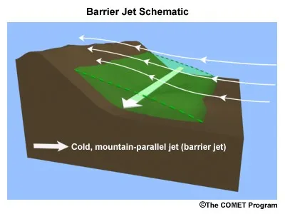 The formation of a barrier jet causes a couple of things to happen:
- Cold air damming: cold air pools along the base of the mountains as it is trapped and unable to rise over the mountains
- This can actually allow the atmosphere to cool much more than anticipated (which can result in a surprise upward tick in snowfall accumulation)
- Enhanced lift: the effect of air crossing above the cold air dam allows for an extra source of lift beyond what we consider traditional upslope flow. Enhanced lift means more efficient wringing out of moisture of the air and heavier snowfall rates
Notice that all three points result in enhanced snowfall – that’s what we need to be very careful of with this storm. Should all the levers described above end up in the right positions and we throw in the additional levers of the barrier jet and cold air damming… you can see how this storm has the potential to be BIG!
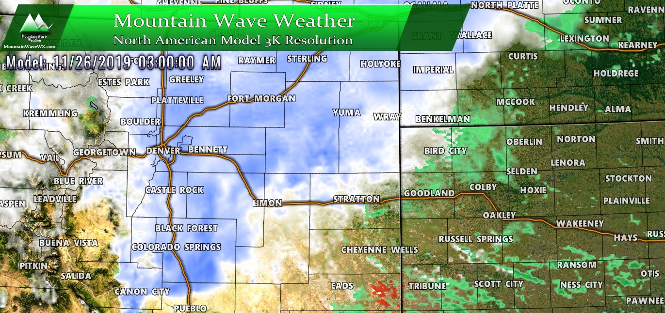
For what it’s worth – not all models show a barrier jet and cold air damming, but some do.
Summary – This Storm Will Remain Complicated
Why haven’t we just pulled the trigger and just said, “get ready for a big storm” yet?
The levers I’m most concerned about with this storm are the temperatures and where the low intensifies. Models still don’t agree on how this all evolves and it makes it very difficult to nail down one direction or another.
People have asked me what “I think” or my “gut instinct” would be with this storm and it is: big snowfall is possible but I’m more confident with those areas above 6,000 or 6,5000 feet in elevation than I am with those below. Until I see more indication of a barrier jet that can allow the cold air to stack up at lower elevations and/or temperatures come in cooler than expected – I can’t say with much confidence you’ll see much below those elevations.
But due to the possibility higher elevations see a big/high impact storm, I’ve recommended folks with ag interests or those that need additional time to prepare for a storm like this to do so. If nothing happens, no big deal – but if this thing goes beast mode it’ll be better to be prepared than not.
