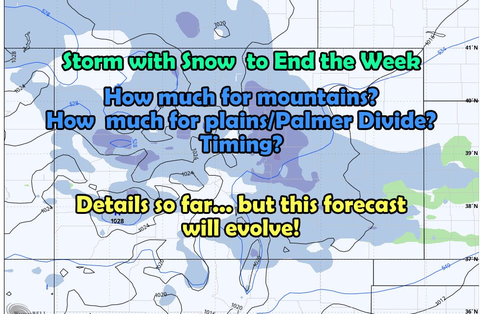
A storm system is heading our way for the end of the week with colder temperatures and chances for snow on Friday and Saturday.
While there’s still a little ways to go and models aren’t quite agreement yet on track/timing/intensity – we at least have enough information to start putting some hazy details together of what we might be looking at.
With that, let’s get started with Thursday…
Current Weather Highlights
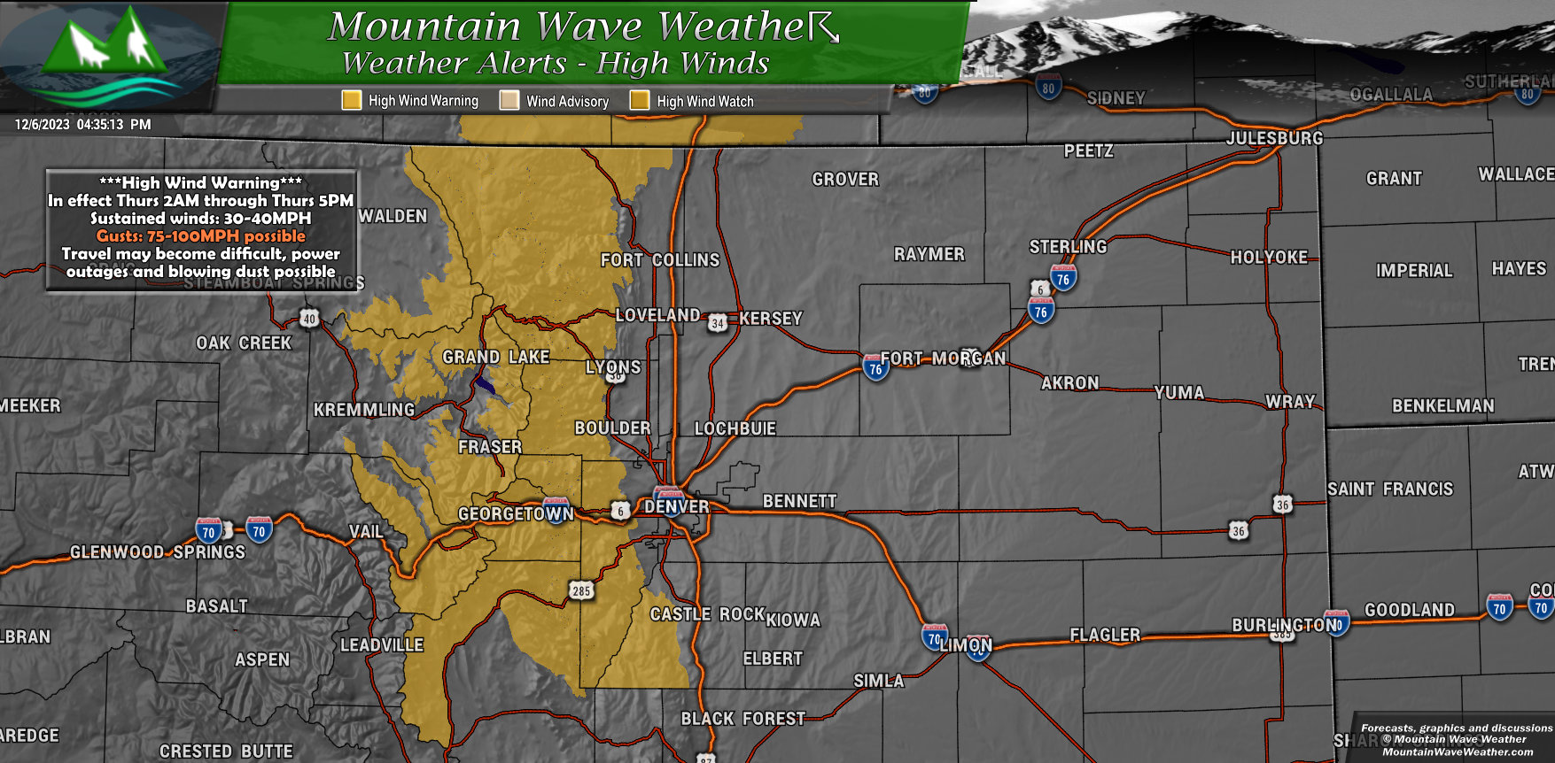
A ***High Wind Warning*** will be in effect most of the day Thursday for foothills locations and along the Palmer Divide. Winds will be very strong, sustained around 30-40mph, but the big concern is the gusts. Some modeling shows wind gusts between 80-100mph.
If you live in or around the warning area, you’d do well to make sure anything lightweight/lose that could blow away is in or tied down tonight. Strong winds will start up a little after midnight and should last through a good portion of the day.
Don’t be surprised to see sections of Western and even Central Douglas county get in on the wind action tomorrow as well.
Preliminary Snowfall
Snowfall is still very much in the air on exact totals, but we do have insight on which areas have a higher chance of seeing more accumulation out of this storm. With that, don’t take the numbers as gospel, but use them as a guide to which areas will likely see higher versus lesser snow overall.
As always, the forecast is fluid at this point – so keep an eye out for continued updates.
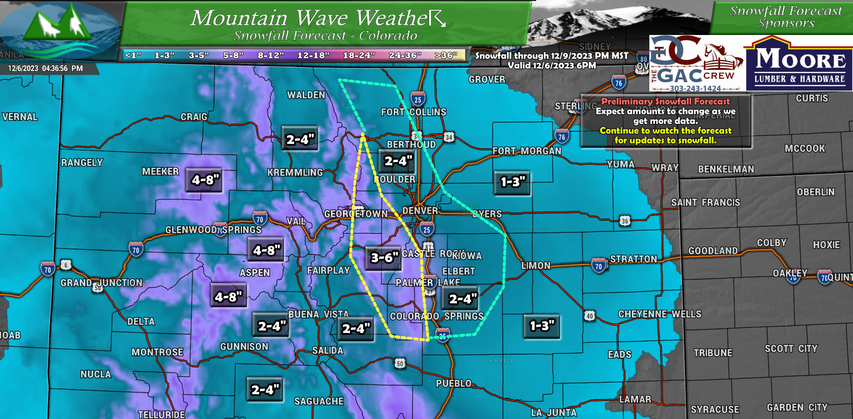
Areas that likely see a better chance at higher snowfall accumulation:
- Front range foothills
- Mountain areas along the Continental Divide
- Western sections of the Palmer Divide (think West of Castle Rock/Sedalia, etc…)
- Pikes Peak region into Teller County
- Areas North of Glenwood Springs and in/around Aspen
Areas that still have considerable uncertainty in the snowfall forecast and may yet still see higher or lower accumulation
- Denver metro area
- Boulder/Estes Park, areas North of Denver and West of I-25
- Palmer Divide along and immediately East of I-25
Areas with more confidence for lower snow amounts:
- Eastern plains
- Areas as you go further North of Denver
As far as timing for the snow, looks likely on Friday and potentially Saturday. I’ll work to get more details on this over the coming days.
Summary
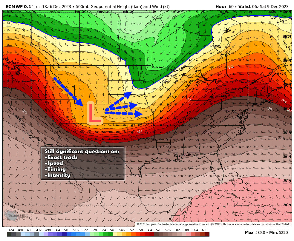
Lots of moving parts remaining with this forecast, one in particular I’m watching is does this setup in a good position for an upslope snow event or is the lift more from the jet stream?
Upslope means more consistant snow across a wider area
Jet induced lift means banded snowfall and lots of variability in snowfall over relatively small geographic areas.
For reference, a lot of our snow storms have had lift more from the jet this year than from upslope set up by where the low pressure is.
Always fun to figure out, I’ll have more details over the next few days as more data comes in. Stay tuned!
