This weekend’s storm continues to evolve, not a ton of huge changes from yesterday but I do have an initial snowfall forecast posted along with some thoughts about a few uncertainties and wildcards we could see with this storm.
As always, if you just want the nitty-gritty details on the timing and impacts, those are at the end of the article.
Current Weather Highlights
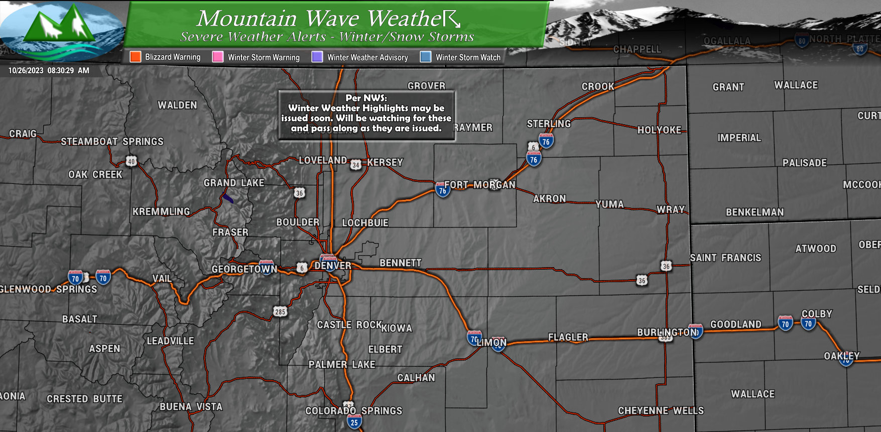
No current winter weather highlights with this storm as of 9AM this morning. Why am I posting then? NWS has said in their latest update that heavy snow in the mountains will likely meet Winter Storm Warning criteria and snowfall amounts and intensity along the Urban Corridor will likely meet Winter Weather Advisory criteria.
Therefore, I’ll have those in any future updates here once they are issued. I’ve posted it as a heads up so you can stay ahead of those and expect them.
Initial/Preliminary Snowfall Forecast
Here’s my initial thoughts on snowfall amounts: remember this is a preliminary forecast and it will changed based on data coming in today and tomorrow. With that in mind, it’s best not to focus too much on specific amounts yet and just look at areas that are likely to see heavier snowfall accumulation vs areas that will see lighter.
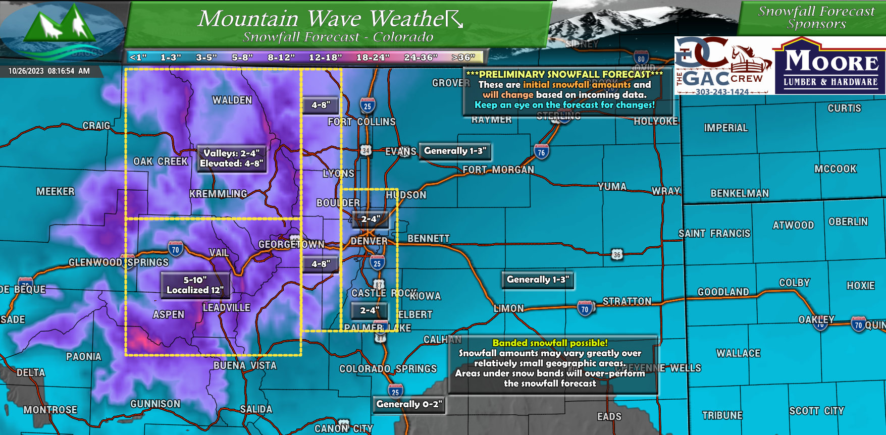
Deterministic models are going nuts with this storm, but I’m not sold on those just yet. I think there is a strong enough chance for snowfall banding (see more below) and the deterministic models don’t do well at forecasting exactly where those snowfall bands set up. It is possible they are just jumping snow totals up across the board since they can’t resolve things too well yet. This is why the shorter range and higher resolution model data coming in late today and tomorrow will be very important. It will help us figure out if my hunch is correct or not.
Analysis/Thoughts/Discussion
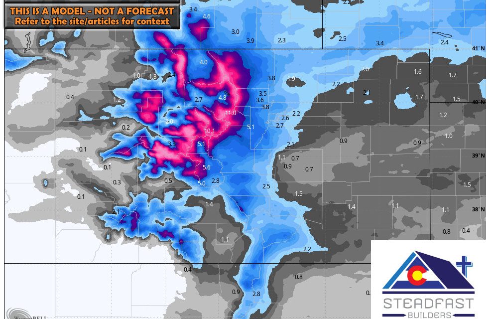
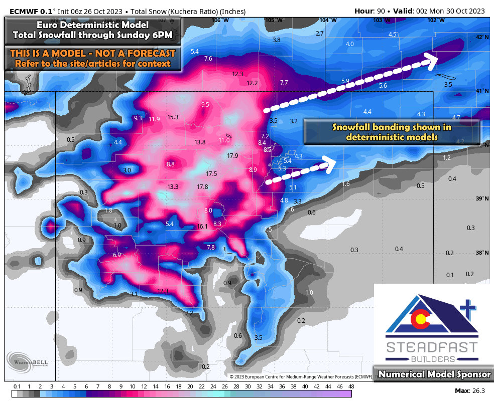
Here’s a quick look at the Euro deterministic model. We can see things have increased slightly for snowfall across especially the Palmer Divide. This gives us a bit more confidence in the snowfall event but still not a ton of confidence on individual numbers. Why?
We can see strong evidence of banding showing up on deterministic models. These features are hard to predict, models don’t handle them well and it’s very difficult to figure out where they set up and how intense they become. If your area sits under one of these bands for a decent period of time, your actual snowfall will likely overperform the forecast… while areas just a few miles away will be in range or even underperform.
See how that throws a monkey-wrench into nailing down a forecast?
To help smooth things out a bit, we can take a look at the Ensemble product:
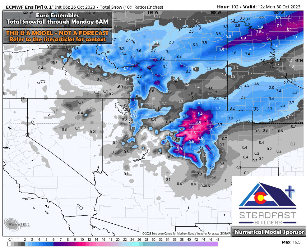
Ensembles have trended slightly higher for snowfall along the front range as well. So overall the trend is slightly upward since yesterday, this is what we will continue watching with more data throughout the day today.
Timing and Preparation/ Final Thoughts
Cold Air
- First cold front comes in Thursday afternoon. It will cool things off but isn’t the coldest of the air
- Second shot of cold air comes Saturday morning with the front and storm system
- Be prepared for cold temperatures Saturday and Sunday with cool temperatures on Monday and Tuesday
- Highs Saturday: Mid 30’s – Highs Sunday: Mid 20’s
- Livestock/Ag folks: Overnight temperatures in the low teens and potentially single digits Saturday night through Monday morning. Make sure animals and property are prepared!
Snowfall
- Current working timeframe for snowfall is Saturday mid day through Sunday late morning
- We will work to narrow down this timeframe more in the coming days
Travel Impacts
- Mountains: Significant travel impacts possible due to falling snow, wind and heavy snow accumulation. Roads will be icy and snow packed
- Urban corridor/Palmer Divide: Most roads should fair ok. Watch for slick spots overnights due to ice. Snowfall later in the day Saturday could cause some roads to become slushy and slick. Be prepared for rapidly changing road conditions later on Saturday
- Air travel: This storm will not likely close the airport. Some travel delays are possible though, check with your airline for details.
Stay tuned for more updates throughout the day today and tomorrow!
