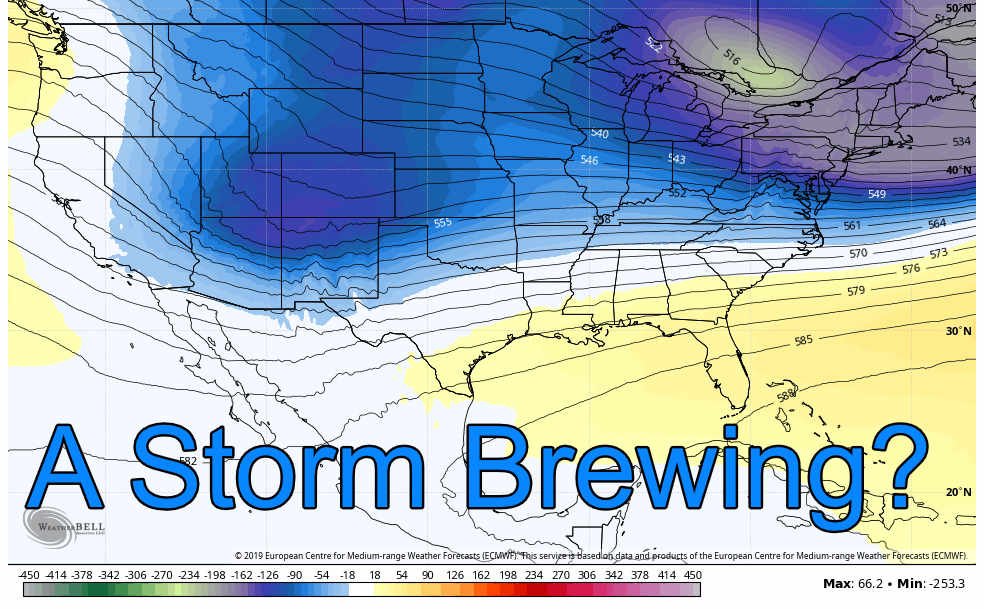
After a quiet stretch of weather that will continue for the rest of this week, we’re already eyeing some changes on the horizon. Here’s the outlook
Today – Thursday
500mb height and vorticity 12/201/2019
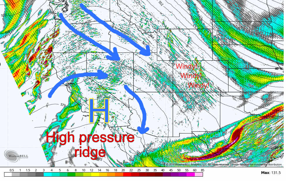
A high pressure ridge to the Southwest will dominate our weather in Colorado for most of the week. High pressure generally means quiet weather with fair conditions. Temperatures won’t be super warm, but will be seasonal through the week with Tuesday-Thursday looking like upper 40’s to low 50’s across Denver and most areas along the Palmer Divide.
The mountains have been receiving a bit of snow from the Northwesterly flow, but it looks like most of the snow will end up there shortly. Due to the high pressure and low pressure creating a gradient, strong winds will be possible in the high country.
By later Wednesday we see the ridge breaking down and changing conditions in the western part of the state.
500mb height and vorticity Wednesday evening
This break down and change in the weather pattern will signal a change for our weather in Colorado going later into the week.
Snowfall Discussion
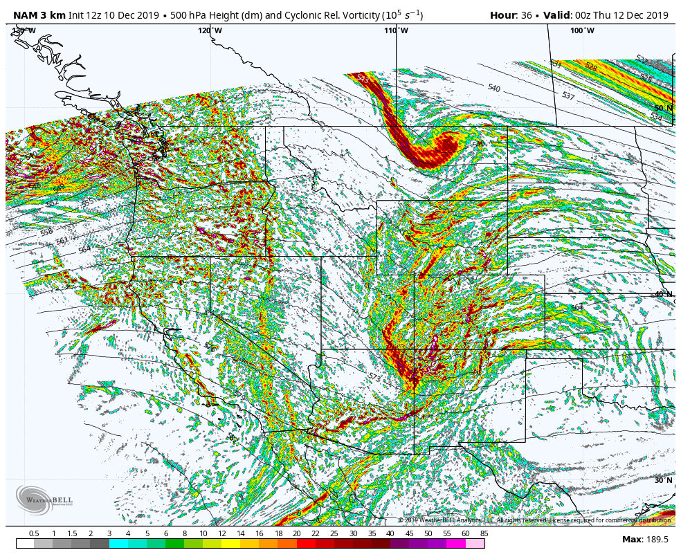
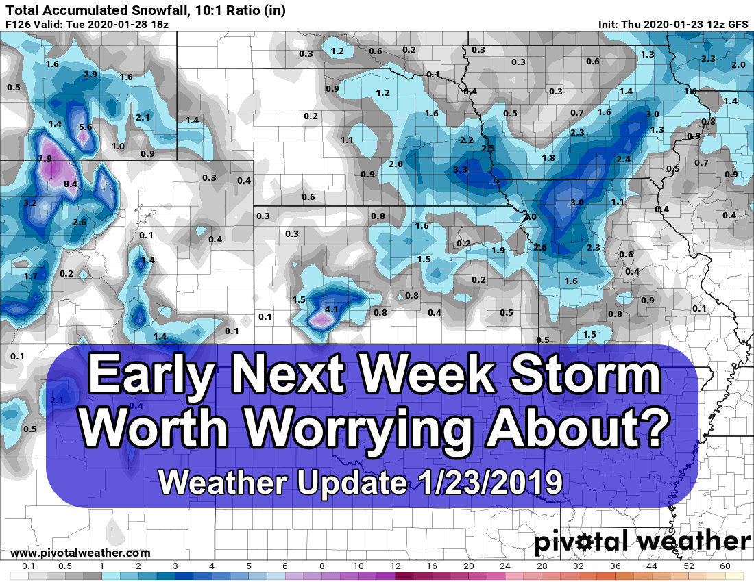
As it stands with the data we are seeing today, there is a ton of uncertainty about snowfall around the front range of Colorado. Our two best models at this time-range are worlds apart so we don’t have a lot of details on that just yet. Even timing is up in the air, the best I can advise right now is keep checking back for updates throughout the week.
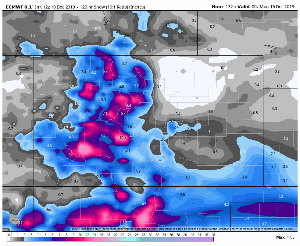
Euro projected snowfall through late Sunday
Any way you hash it, the mountains look like big winners out of this storm. Despite the model disagreement about snow along the front range, nearly all models put a big bullseye over the mountains this weekend. Keep in mind, if you have travel planned to the mountains, the timeframe for that looks between Thursday and Sunday… snow will be amazing, skiing will be amazing… travel may not be so amazing.
What We Know
- Snow looks likely in the mountains from Thursday – Sunday
- Some areas could see significant snowfall amounts
- High winds may be a concern
- Travel difficulties will be possible
- Some sort of impact possible for front range
- Snow is possible
- Colder temperatures will be likely
What We Don’t Know
- Mainly focuses around front range impacts
- Timing
- Looks like we should be keeping an eye on late Friday through late Sunday (I know its a big range, but right now there’s a ton of model uncertainty on that)
- Some models show impacts into Monday… see? Lots of uncertainty!
- Snowfall
- Battle of the models; some have a dusting, some have 5-8 inches for the Palmer Divide region
- Could end up nothing, anywhere in between or higher… absolutely no model agreement on that right now!
What To Do?
At this time we are at the point in the forecast where we can see something is setting up, but we cannot get any finer details just yet.
This means the storm is still quite up in the air for the front range, but mountains have a higher confidence level on seeing snow.
For now, keep an eye on the forecast, we will (as always) release several through this week as we get better information!

Trackbacks/Pingbacks