A lot of talk online about a storm system next week and what it may mean for Colorado’s Front Range. If you’ve been living under a rock the past several week; it has been incredibly dry for many areas East of the Divide since late November.
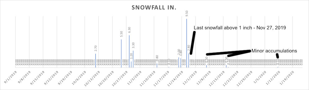
Recorded snowfall for this season so far in Castle Rock, Colorado (WY 2019-2020)
If we look at the Palmer Divide area, more specifically Castle Rock – we can see our last “decent” snow accumulation was November 27, 2019. This was part of a bigger storm that brought over a foot of snow to the region, along with several storms prior that added up to a decently wet fall. Since then moisture has been pretty hard to come by. mainly consisting of a few storms that brought anywhere between a trace to .5 inches.
Despite all that though, we are still above average on snowfall for the season… for now. If we continue to see dry conditions it won’t be long before we drop below average!
Last recorded snowfall was on 1/12/2020 for Castle Rock with 0.1 inch measured. Hardly exciting…
So What of This Storm Early Next Week?
As with most storms this far out in the timeframe we don’t have specific details just yet but we have some things coming a bit more into focus. Here’s the quick run down of what we know and what we still need to wait and see on:
Timing
- Days to keep an eye on right now are on Monday and Tuesday
- GFS has snow mid morning Monday through Monday evening
- EURO has snow later Monday afternoon into the overnight hours Monday
- Both models show a fairily quick/progressive storm – neither have any snowfall lingering into Tuesday morning
*As always, the timeframes above could shift a few hours +/-… but this is the data we see as of today.
Snowfall Amounts
- Higher Amounts (I use this term loosely… not really seeing “HIGH” snowfall totals for any areas East of the Divide)
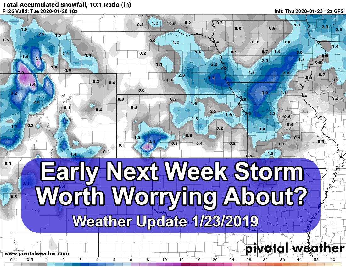
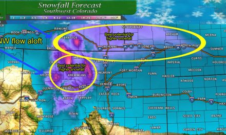
- Both models paint the Palmer Divide as the region most likely to see snowfall accumulations
- That being said, neither model shows more than 2 inches of accumulation for most areas
- Areas West of Colorado Springs (Pikes Peak) could see decent accumulation
- Lower Amounts
- Denver looks to get little to no accumulation
- Areas North of Denver look unlikely to see much snow accumulation either
Impacts
- A bit early to tell on this one as of yet. This won’t be a particularly powerful storm as it moves through our area. Not only that, but there’s not a ton of moisture or cold air with it as well. This means that impacts (at least at this time) look minimal in terms of travel conditions.
Models
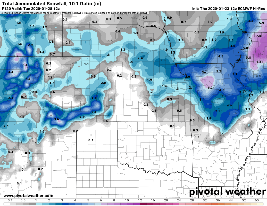
Euro shows up to 1.5 or 2 inches of snow mainly along the Palmer Divide
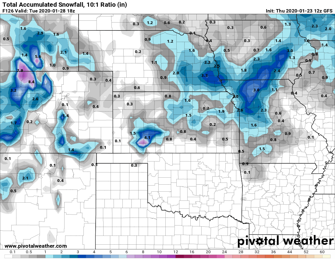
GFS shows very little to no snow accumulation for most areas – Palmer Divide could see under 0.5 inches
Note!
Do not get caught up in amounts and locations just yet! Focus on the overlying pattern here:
- It is weak in Colorado
- It doesn’t strengthen until well East of Colorado
- It doesn’t have a lot of moisture
- It doesn’t have a lot of cold air
All of the above are not things you want to see if you’re hoping for a “big” snow storm.
Summary
At least it’s something… I will keep an eye on this storm but right now I’m not too excited about it. I know we need the moisture but anything under an inch of snow (depending on the liquid ratio) is pretty useless around here.
Could this storm surprise us? Absolutely! It’s Colorado! But keep in mind when we see larger snow storms it’s usually in the midst of an active weather pattern. We are certainly not in that pattern right now and it doesn’t look like we shift in the foreseeable future – this means that if you play the odds game, the odds are much, much higher for a low-to-no snowfall/impact event out of this one.
