Would you believe it? At one point in the model world we had a pretty significant storm setting up for this week, but as we’ve continued through model runs into today the storm system has all but fallen apart for Eastern Colorado. Now it looks like many areas East of the Continental Divide will be left high and dry (excuse the weather pun) as we go through this week. All of this continues our relatively calm and tranquil weather pattern through this week and the way things are looking we may only have one more good chance at a good storm by the end of January!
The Storm That Was – Then Wasn’t
An excellent example on why weather forecasting is more than just looking at models!
At one point towards the middle of last week, models were picking up on a very interesting looking storm that could effect the area this week.
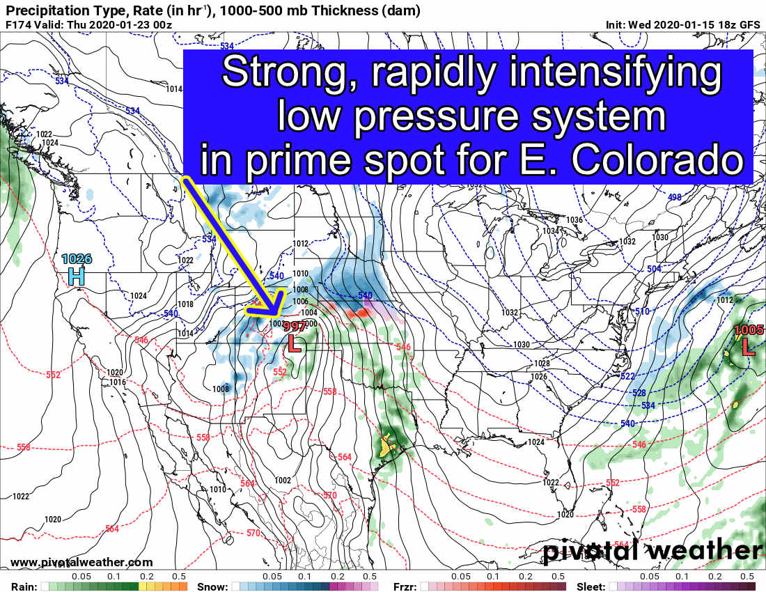
GFS surface pressure and precip/precip type initialized at 06Z on Wednesday (tuesday night 11PM run)
The GFS picked up on a strong low pressure system digging into the mountain west and crossing over Southern Colorado before rapidly inensifying over Southeastern Colorado. This is a prime spot for a big snow event – type storm. This is exactly what we look for in a “blizzard”-like storm for Eastern Colorado. A few folks even asked about it last week but I cautioned to be patient and wait for more data (there was a reason to this beyond the ‘it’s too early’ line I normally use.)
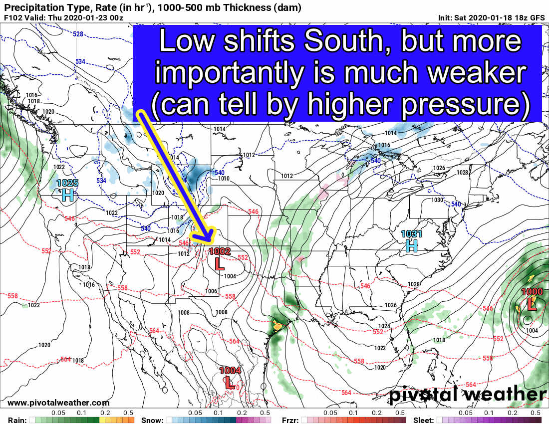
GFS surface pressure and precip/precip type initialized at 18Z on Saturday (Saturday at 11AM run)
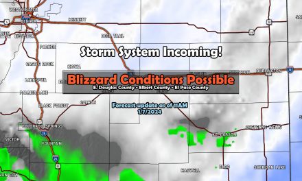
By Saturday morning the models began to push the system further South and noticeably decreased the pressure associated with it; meaning a much weaker than originally anticipated storm system. The GFS and the EURO to a degree at this far out in the forecast time frame cannot tell you specific details but they can pick up on larger and longer scale patterns so I’m not saying they’re useless by any means. As I watched this unfold over the weekend, I wasn’t completely surprised and hence why I didn’t get too excited about this last week.

GFS surface pressure and precip/precip type initialized at 12Z on Monday (Monday at 5AM run)
As we came into this mornings models, the storm is pretty much non-existent for the Colorado Front range. Again, I’m not surprised… why?
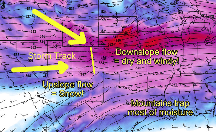
As I spoke about this week, we are still predominantly under a “split” jet stream pattern aloft. It’s one thing to look at surface high and low pressure systems but in weather to make a good forecast you have to look at the complete picture. We still see a strong split pattern with Westerly and Northwesterly flow during the week which is not a good pattern to be in if you want to see snow East of the Divide. The mountains will continue to receive batches of snow here and there, but the front range will remain overall dry.
What Does That Mean for This Week’s Weather?
If you support us as an Ascent or Peak Member you can view your detailed weekly forecast here!
Otherwise, I’ll spell it out pretty simply! Here’s the EURO’s thoughts on total snowfall through next Sunday…
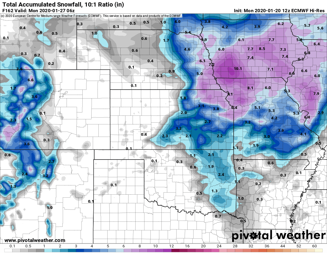
Depressing isn’t it? (If you’re a snow lover anyways…)
With the current pattern we are in, it’s tough to get snow in our area. We tend to see a lot of westerly winds (down-sloping) with these types of storms and it dries the air out at lower levels of the atmosphere. It’s hard to make snow when that happens! Still, I think it’s possible a few areas could see light snow showers or flurries, but accumulation to any extend will be hard to come by late Wednesday and into Thursday.
Expect above average temperatures along the Palmer Divide and most of the front range, generally in the 50’s. Thursday will be a cooler day with passage of this disturbance, but we rebound quickly by Friday.
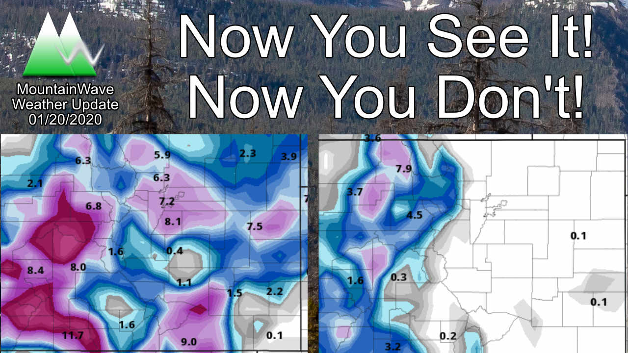
Tracking Our Snow – How Dry Has it Been?
For this I’ll showcase a new feature coming soon for supporters, the snow tracker keeps an eye on where we are this year compared to average. Right now for Castle Rock but other locations will be added eventually.
Palmer Divide Snow Tracker – A New Feature Coming Soon for Supporters!
The last measurable snowfall in Castle Rock was around January 12, 2020 with about a trace or less than .1 inches. In many circles this doesn’t even count as a measurable snowfall event so keep that in mind. If you want to look at our last decent snowfall in the area that honor goes back to our larger storm at the end of November. Since that time we have had no snowfall events over 1 inch. That is dry!
Luckily, as you can see above we are still running above average on total snowfall for Castle Rock through January 19, 2020. We can chalk this up mainly in part to the exceptional fall we had in terms of snowfall. As we enter some of our snowier months, we will need to start seeing consistent storms again otherwise we will very quickly fall back below average.
We may have one more shot at a decent snowstorm right around the last couple days of the month. Stay tuned for details on that!
