As our weather pattern looks likely to shift later this week we have a regular “battle of the models” setup building and there’s not a ton of agreement from either. This means that whatever we end up seeing later this week (a bigger storm or a smaller storm) is going to be a tricky forecast. Due to how the prevailing winds have been aloft and how storms have trended on us this year (nearly all underperformers rather than overperformers) we will remain cautious about getting too excited about any of our chances of snow this week.
Here’s a quick breakdown of where we sit as of this evening’s data…
Models Disagree on Timing, Storm Placement and Storm Intensity
When models disagree this much it becomes harder to get a good beat on what is going on – we have to fall back and look at what storms have done this year so far with similar dynamics aloft – along with doing some meteorology.
There looks to be two potentials for snow this week for the front range based on what we can see today… both the GFS and Euro differ drastically on which (if any) of the two will provide decent amounts of snow.
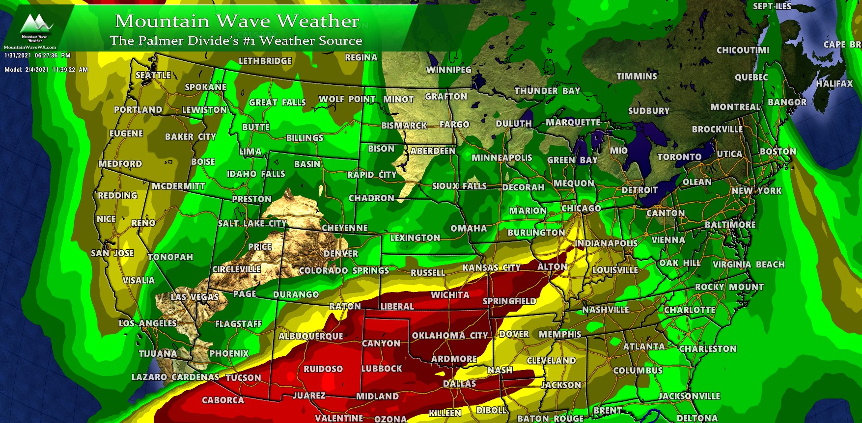
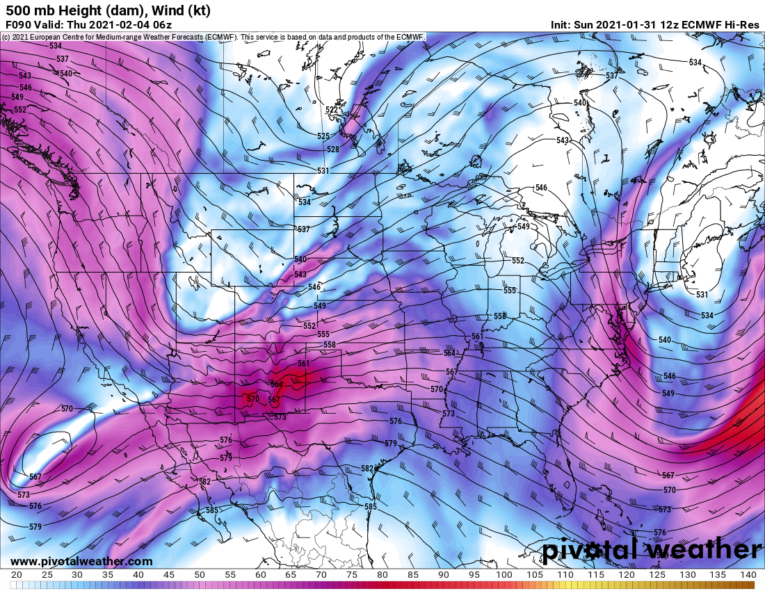
GFS
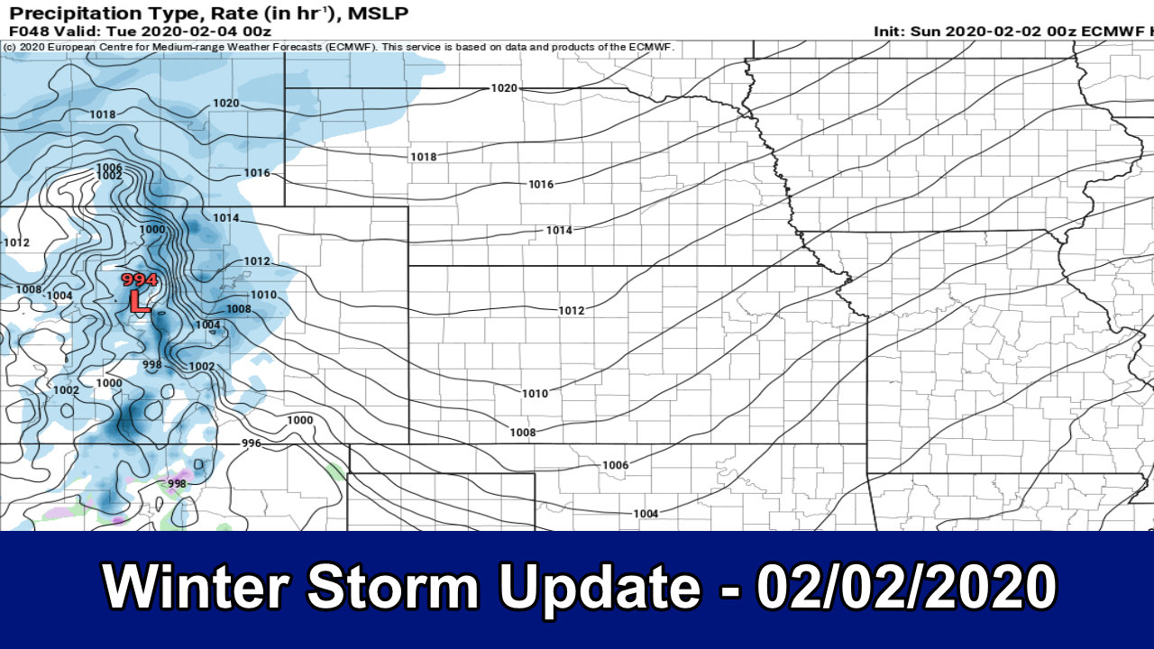
Let’s take a look at how the GFS has this storm evolving over the middle of the week.
The GFS has the low sliding across the mountain West and through Utah and into great Basin area Wednesday and into late Wednesday. Along with this we would expect cold air to filter in from the North – for what it’s worth cold air looks likely for most areas of Colorado with this storm, while snow is more of a question mark. For a good storm we would want this low to stay strong, fairly well defined and move across the four-corners area and across to Southeastern Colorado.
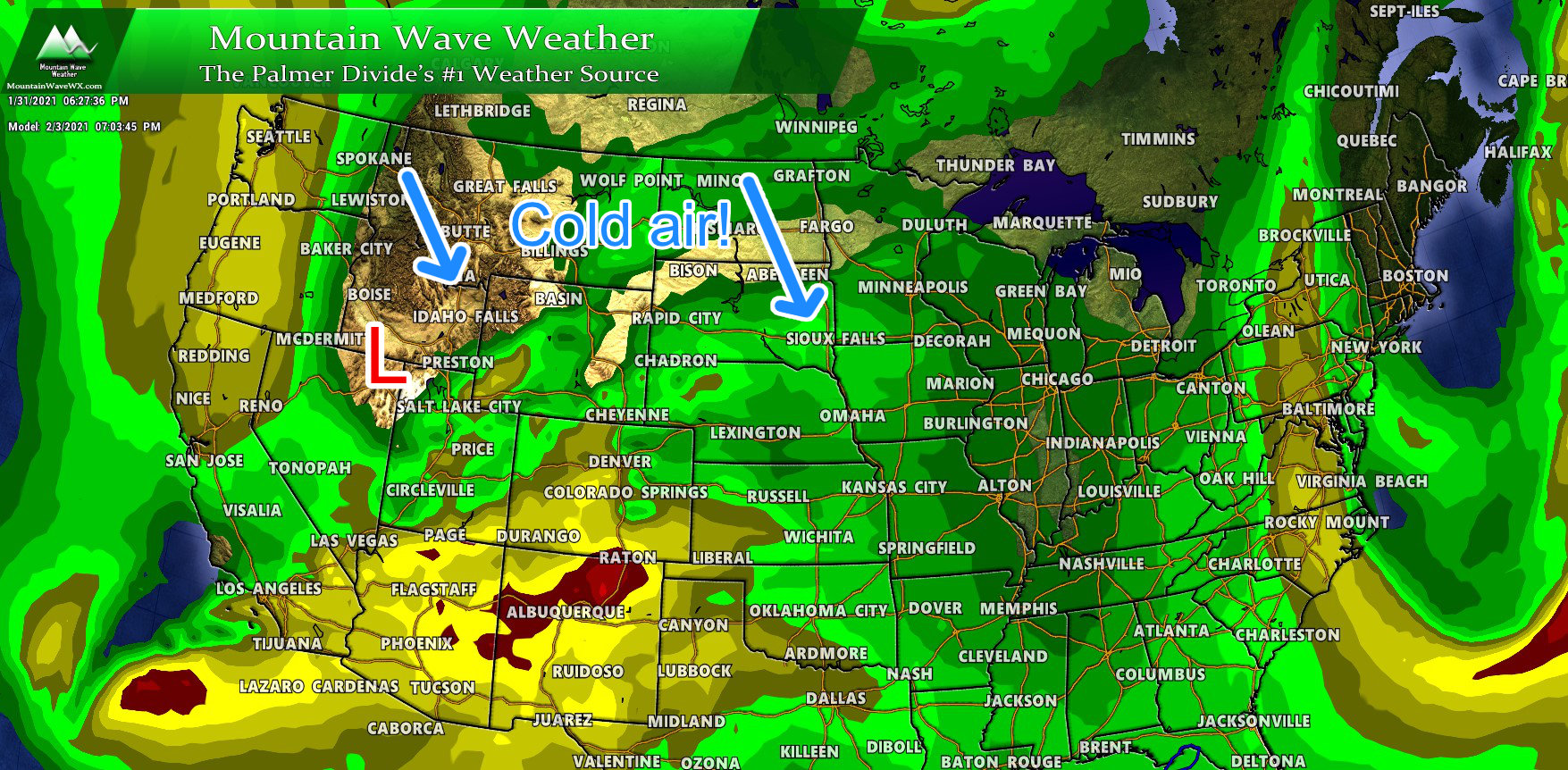
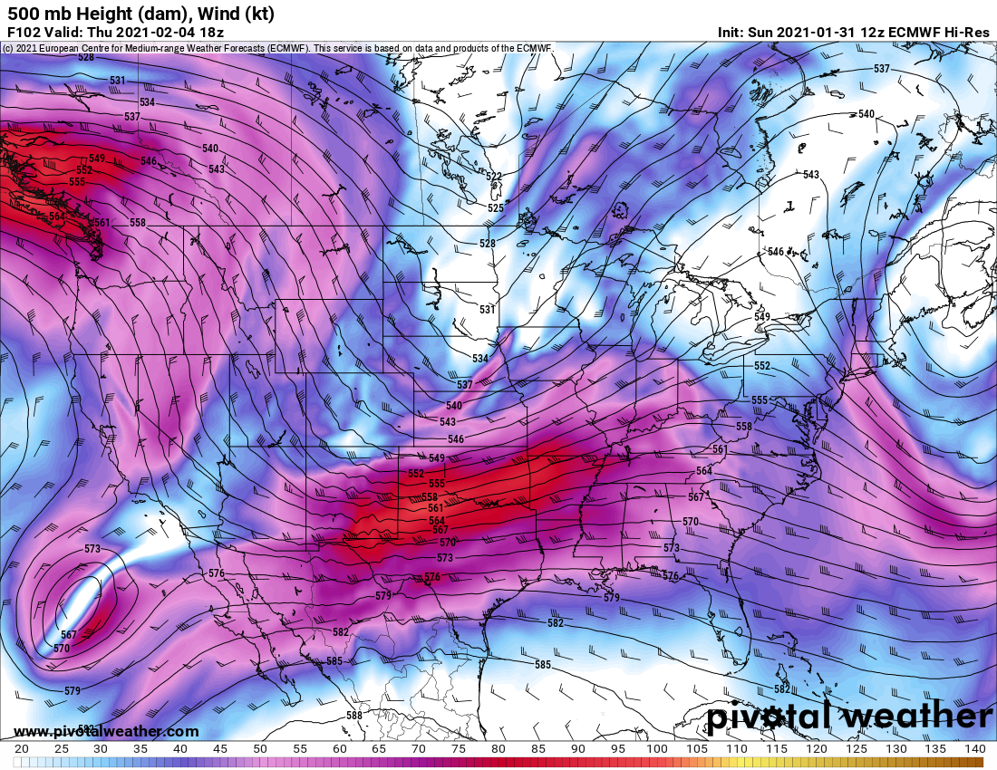
but watch what happens…
The low shreds as it moves Southward and falls apart altogether. This all occurs rather quickly and is not exactly what we want to see if we want a larger and more impactful snowstorm East of the Divide. From this point, what is left of the low scoots off to the East and the jet stream transitions back to Northwesterly flow. This may be ok for our mountains to see more snow, but is not a productive pattern for areas East of the Divide as we tend to see more downslope than upslope.
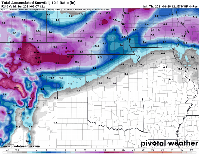
Speaking of which, look at the model trends on snowfall for the past few days…
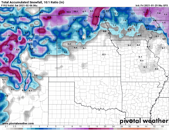
Notice how we’ve transitioned from a 5-10 inch storm to a 0-3 inch storm in just a few runs. This is why I caution people about reading too much into the social media folks posting “hype” model snapshots. That far in advance snowfall maps are fairly useless and don’t’ accomplish much more than to drive traffic to websites.
Euro
Let’s take a look at what the Euro thinks… you may notice some similarities with the GFS in terms of how snowfall is trending but there are still a lot of disagreements on timing and positioning.
 The Euro brings the low down the mountain west much like the GFS but it has it transition through Colorado a bit more slowly. It does also show the low shredding off a bit as it moves through (the main takeaway for this here is that neither model shows a good setup for heavy snowfall accumulation East of the Divide for Wednesday-Thursday storm)
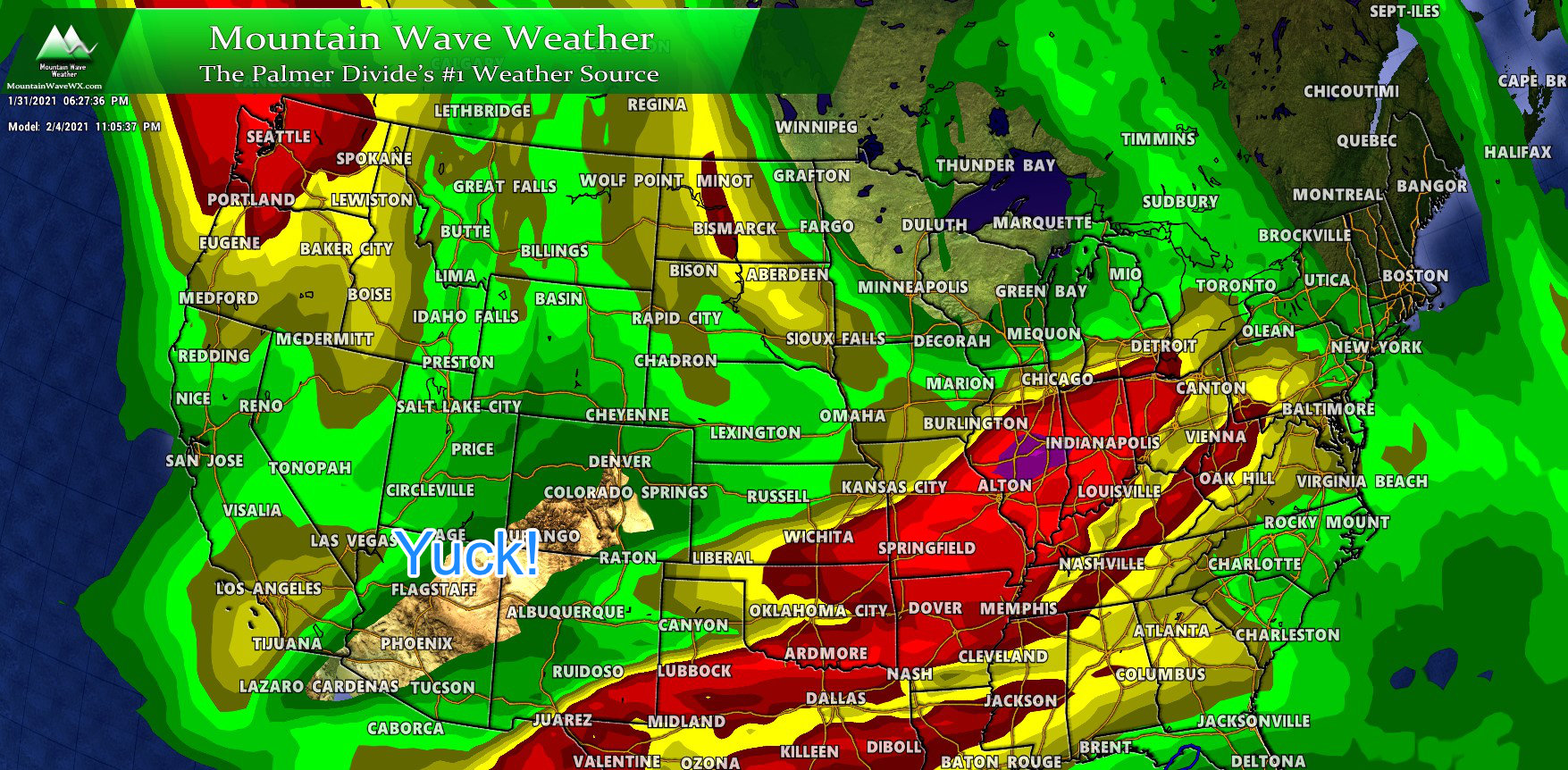
The one thing the Euro also shows is that the low stays a bit more pronounced as it moves through Colorado but even still it doesn’t hold together for long.
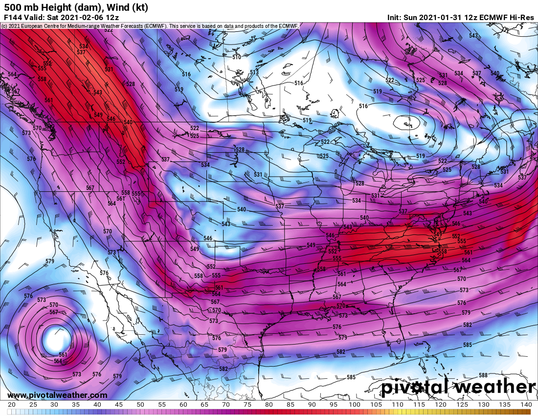
Notice by late Friday/ early Saturday is still has the upper level low lingering over the area. The positioning and timing after the front is interesting here – the GFS doesn’t show this feature at all but the Euro does. If we were to see a more significant snowfall event from this storm, this is closer to what we’d want to see but there are still concerns. Notice the finger of the jet stream splitting off to the North. This “split” in upper level flow rarely leads to good snowfall conditions for us.
Here’s the snow trends in the past few model runs from the Euro:
Again, snowfall has trended down and timing has trended later.
With All This Uncertainty, What To Do This Week?
Here’s what we know and what to prepare for this week:
- 1 to 2 chances of snow are possible
- First chance looks late Wednesday into Thursday
- Second shot looks late Friday into Saturday
- Snowfall totals are still completely up in the air
- We don’t have enough model confidence to make a good call yet on what snowfall looks like
- Even though models have trended lighter, we will have to keep an eye for any shifts in track
- Could we see a larger storm out of this? Possible but not yet likely…
- Watch for possible impacts
- See timing above for chances of snow
- Keep an eye on the forecast for updates, we will keep you ahead of anything you need to know about
- Arctic Air
- Temperatures look very cold once this series of storms begins to slide through…
- Be prepared for that very cold air – confidence is higher in the cold temperatures
Forecast confidence is low to at best medium for snow, remember this if you see any crazy forecasts over the next day or two. If you see big snowfall maps up, they’re likely hype.
Summary
This storm will evolve a lot over the next few days. Best to prepare for it beforehand and be ready if it does materialize – we will likely have a lot of updates out over the next few days so please stay tuned!
Note: we have to keep a close eye on both of these waves for curve-balls… the pattern has shifted and while the operational models show the snow backing off, the ensembles and probabilistic models still show decent chances of higher accumulations so that’s something we have to keep an eye on until we see otherwise. Even though it’s been quiet this year, don’t sleep on these storms!


Thanks John ! Always enjoy your insight!