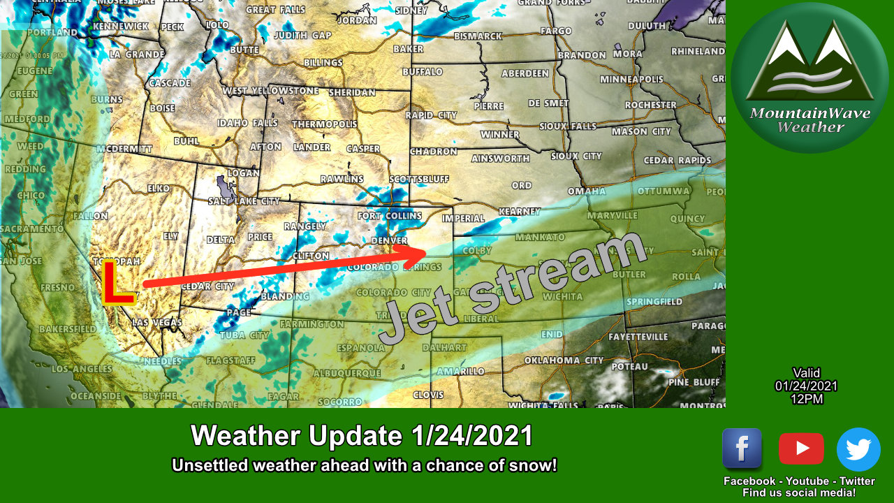
A set of disturbances riding the jet stream to our West and South will move through Colorado over the next couple of days. This is one of those classic type storms that will tend to shred a bit as it moves across the mountains and re-strengthen East of the hills. The main problem with this storm is that re-strengthening will happen to the East of Colorado so we don’t see a ton of snow in our future for a good portion of the state.
The silver lining with this storm I suppose is that it has a better chance of bringing us a bit more snow than we’ve seen with the past several storms, still nothing major but at least it’s something!
Here’s the details!
Winter Weather Highlights (Update 12PM 1/24/2021)

As of 12PM today the only winter weather alerts out are a handful of Winter Weather Advisories for Southwestern Colorado. This region as the best shot at seeing higher snowfall accumulations and tricky travel conditions, but don’t rule out the Easter plains either. As you get closer to Kansas and Nebraska higher snow amounts will fall and stronger winds will be encountered. You can see from the warnings issues out in those directions that travel will likely be pretty tough.
Snowfall Forecast (Through Tuesday 5PM)
Palmer Divide Region
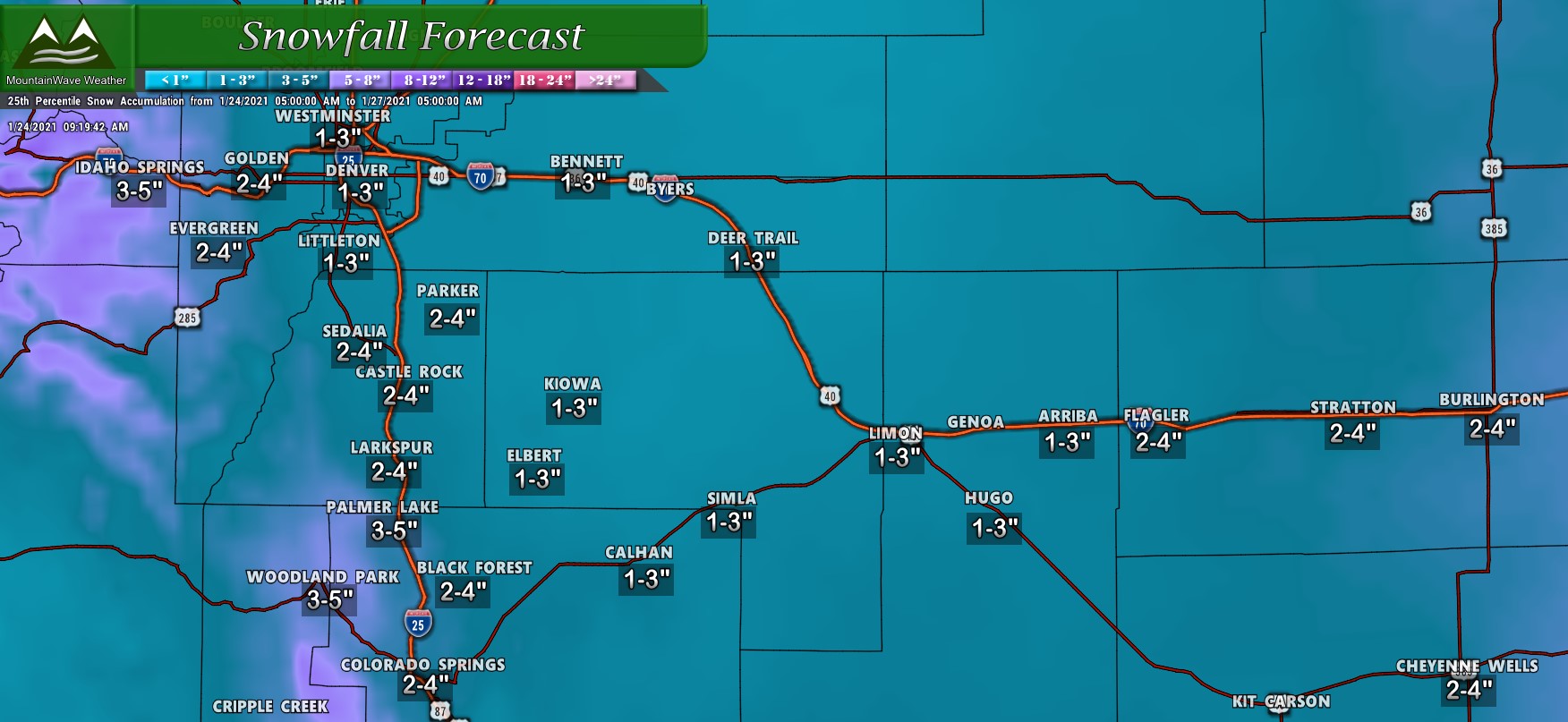
For the Palmer Divide, snowfall amounts will still remain fairly light but it does look like we have a better shot at more snow than we’ve seen with the past several storms. That being said, this still doesn’t look like a major storm; models tend to light right around the 3 inch range for most of the higher elevation areas with closer to 1 or 2 for lower elevations.
Northern Colorado Region
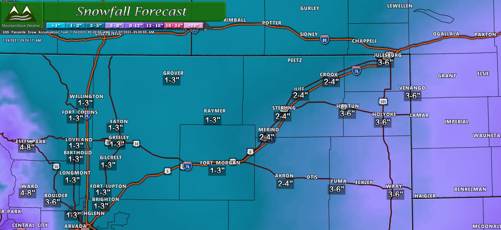
For Northern Colorado, we don’t see much of a big snow maker along the I-25 corridor North of Denver. Most of the heavier snowfall will occur further East into Kansas and Nebraska. Still worth keeping an eye on in case a bit more of that snow backs off to the West, be prepared for tricky travel conditions in Eastern and Northeastern Colorado especially late Monday and into early Tuesday.
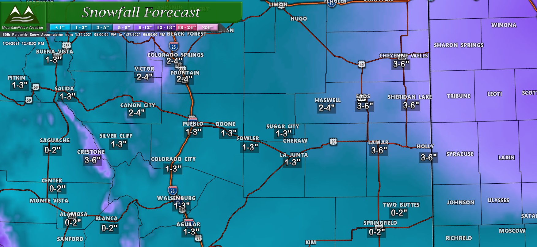
Southern Colorado Region
Timing/Impacts
Sunday Night
Light snow showers will be possible late Sunday but accumulation looks minor. Little to no travel impacts expected
Monday
Light snow showers through the day, as the strongest part of the storm system builds to the East waves of snow may move Westward. Not expecting much in the way of accumulation during the day on Monday, but keep an eye out just in case!
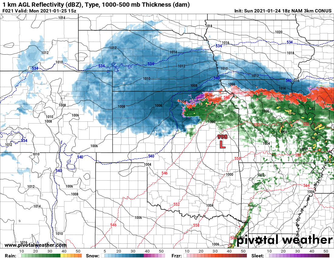
Look at how strong this storm gets East of Colorado on Monday morning! Areas in Kansas and Nebraska will see heavy snow and strong winds. The Eastern plains of Colorado may see some of this as well with much less snow and wind towards the front range.
Monday Night
Waves of snow move Westward as the storm wraps moisture around from the East. Low level winds look mainly out of the East and Northeast meaning upslope flow will establish in some areas. There should be enough moisture left over and lift on the back side of the storm system for snow showers along the front range.
Travel impacts look to be mainly slick conditions along the roads, the cold temperatures will overcome pavement and cause ice, slush and snowpack. Main areas to watch for higher travel impacts are South of Denver along the Palmer Divide and especially South of Castle Rock into Monument.
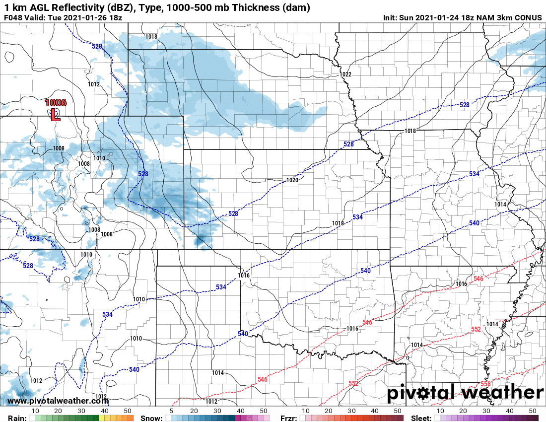
Tuesday Morning
Many models show snow lingering across Eastern Colorado through Tuesday mid-day as a new surface low sets up over Southern Wyoming. This weak feature will keep enough lift around to squeeze out a bit more moisture through early in the day on Tuesday. Any lingering travel effects from Monday night may linger into Tuesday morning.
We don’t see any evidence of major impacts with this storm, there isn’t a ton of wind or snow with it so just keep in mind roads may become icy and snow packed in spots and take it slow. Since no weather highlights have been issued for the front range, we can expect the storm overall to be pretty minor with minor travel impacts.
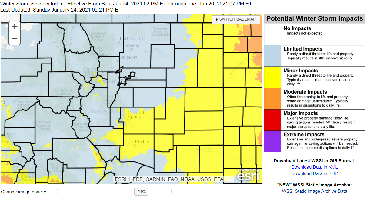
Winter Storm Severity Index shows the areas between Southern Douglas County and into the Springs and Pueblo as most likely to see more impacts to travel – overall still minor though.
Summary
With the storm track to the South we will have a few shots at picking up some of these storms, but the we still don’t see any large/major/impactful storms for Eastern Colorado in our immediate future. Nevertheless, with how bad our drought is getting we should be grateful for any moisture we can get at this point.
