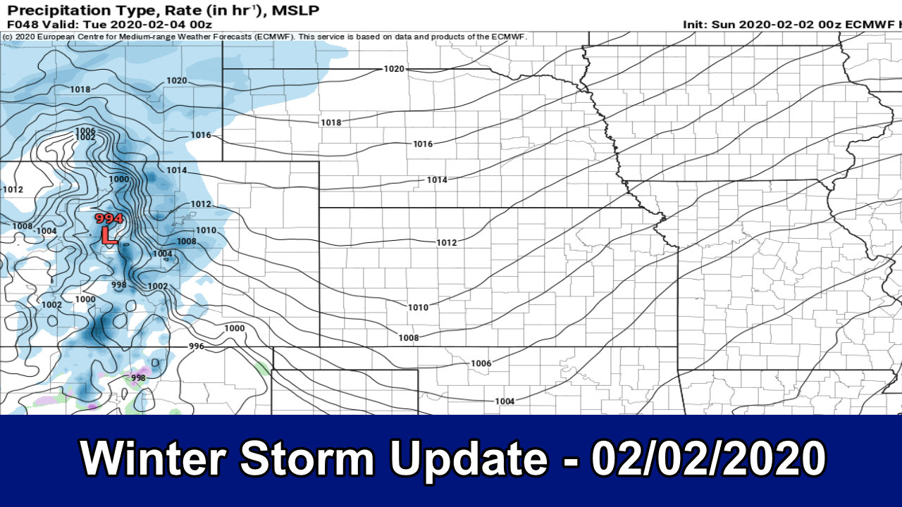
A complex storm system taking shape in our near future, we will see highs in the 70’s on Sunday afternoon and by Tuesday morning our lows may be around or below zero in some places. Aside from the massive temperature swing, we have some snow in the forecast and it may be enough to make things tricky late Monday through Tuesday. Here’s our latest look at the data, forecast, timing and anything else you may need to know for this storm!
Update on Winter Weather Highlights
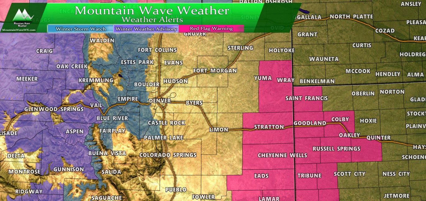
Weather highlights as of 9:00AM – 02/02/2020
Here’s a look at the Winter Weather Highlights as of around 9AM this morning. You’ll notice the Winter Storm Watch issued only runs along the front range foothills. This area could see 7-14 inches and strong winds late Monday afternoon. You may also notice that currently there are no highlihgts for the Denver Metro Area and Palmer Divide; I suspect these will get issued a bit later today as NWS may be waiting on a few more model runs.
I’m not expert on issuing weather watches and warnings, but it seems to me if the models stay consistent on this storm many areas will see enough snow/wind/impacts to warrant some type of winter weather warning. Keep an eye out for watches issued by Sunday afternoon.
Additionally, there is a Red Flag Warning for Southeastern Colorado, along the boarder and into Kansas from 11AM-5Pm today. Strong winds accompanying near record warm temperatures and low humidity means extreme fire growth is possible in those areas.
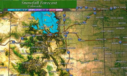
A Look at Snowfall
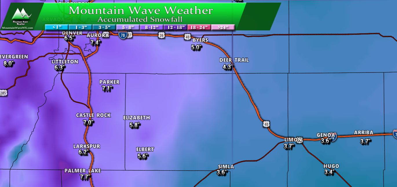
Palmer Divide Region – snowfall expected through Tuesday PM
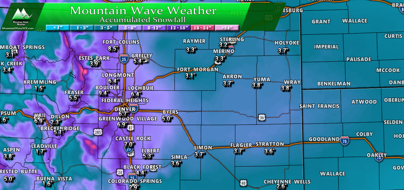
Colorado – snowfall expected through Tuesday PM
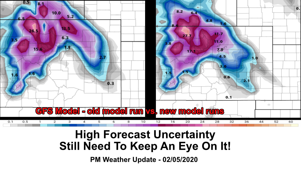
As we zoom out you can see the higher impact areas take shape with snowfall across Colorado. While the models still differ a bit on timing, severity and what regions get hardest hit, they do generally agree on the heavier snow areas being in the Colorado Front Range Foothills and Palmer Divide (especially Western Palmer Divide.) Those are the areas we will be watching most through the day Sunday and into early Monday for forecast changes to snowfall, whether upwards or downwards.
Expected Accumulation Ranges Per Area
| City | 24-48+ hour Forecast Range |
|---|---|
| Castle Rock | 5-9 |
| Parker | 5-9 |
| Highlands Ranch | 5-9 |
| Elbert | 4-8 |
| Elizabeth | 4-8 |
| Kiowa | 4-8 |
| Centennial | 5-9 |
| Denver | 4-9 |
| Larkspur | 5-10 |
| Monument | 5-10 |
| Black Forest | 4-9 |
| Littleton | 3-7 |
We are just outside the 24 hour period for this storm as the impacts look most likely from snowfall in the afternoon Monday and into Monday evening. Given the data that came in last night and the consistency this morning along with the arctic air mass (extreme cold) moving in with this storm it makes sense that snowfall estimates trend higher. As more data comes in today and early tomorrow we will make any additional adjustments to the forecast as needed but this is a good take at where we are right now.
Forecast/Hazards/Timelines/Impacts (The Need to Know Planning Stuff!)
Impacts
Snowfall/Travel Impacts
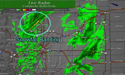
- Highest areas of concern for larger impacts from snowfall are right along the front range foothills and along the Palmer Divide. Especially keep an eye on areas like Lincoln Avenue South on I-25 to Castle Rock and continuing South from Castle Rock to Monument.
- Snowfall could be significant in some areas (6+ inches or more) that could cause travel impacts
- Roads are expected to become icy and snowpacked causing moderate to possibly high travel impacts
Timing
- Monday Morning
- Cold front looks to move in very early Monday morning (before dawn) dropping temperatures substantially
- Potential for freezing drizzle early Monday morning and spotty snow showers for some areas throughout the morning
- Depending on how intense the precip/ how warm the ground stays… there may be minor impacts in terms of slick roads in spots Monday morning
- Monday Afternoon/Evening
- Models show snow kicking in for many areas by
- Heavier snow is possible by late Monday afternoon into the evening hours
- This may substantially impact the Monday evening commute depending on timing
- Moderate to light snow continues overnight Monday – expect road impacts to continue
- Tuesday Morning
- The Euro shows the storm slowing down and lingering into Tuesday morning while other models do not. This is something we will have to keep an eye on.
- If this verifies, we would expect travel impacts to linger into Tuesday morning and possibly Tuesday evening
Summary
We still expect some changes to the forecast over the next 12+ hours so make sure to keep a close eye on the forecast. For now, this thing looks pretty well on track. Expect impacts mainly to the Monday evening and Tuesday morning commute, those will be your most likely higher impact time frames. Keep a close eye on icy roads for Monday morning with the freezing drizzle and if the storm lingers into Tuesday expect some impacts to that commute possibly as well.
Next update looks likely late this evening or tonight. Will be away for a bit today but that should give the models time to chew through a bit more data and I can review the results/changes if any later today. For today, enjoy the Super Bowl and especially enjoy the 70+ degree day we have on tap!
