Article Video Available Here and on YouTube!
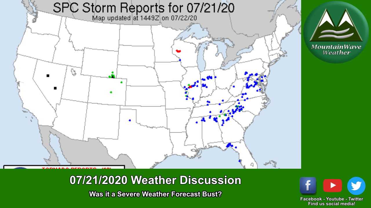
An interesting setup yesterday with an ample amount of CAPE (instability) lifting due to heating and terrain along with moisture streaming in from the Southeast prompted a “Slight” Risk for severe weather. Allt he ingredients looked good and models were consistent, but when it was all said and done – very few places saw any severe weather and those that did saw only short lived severe storms. So the big question of the day is; was this a busted severe weather forecast?
Let’s take a look!
How the Day Started
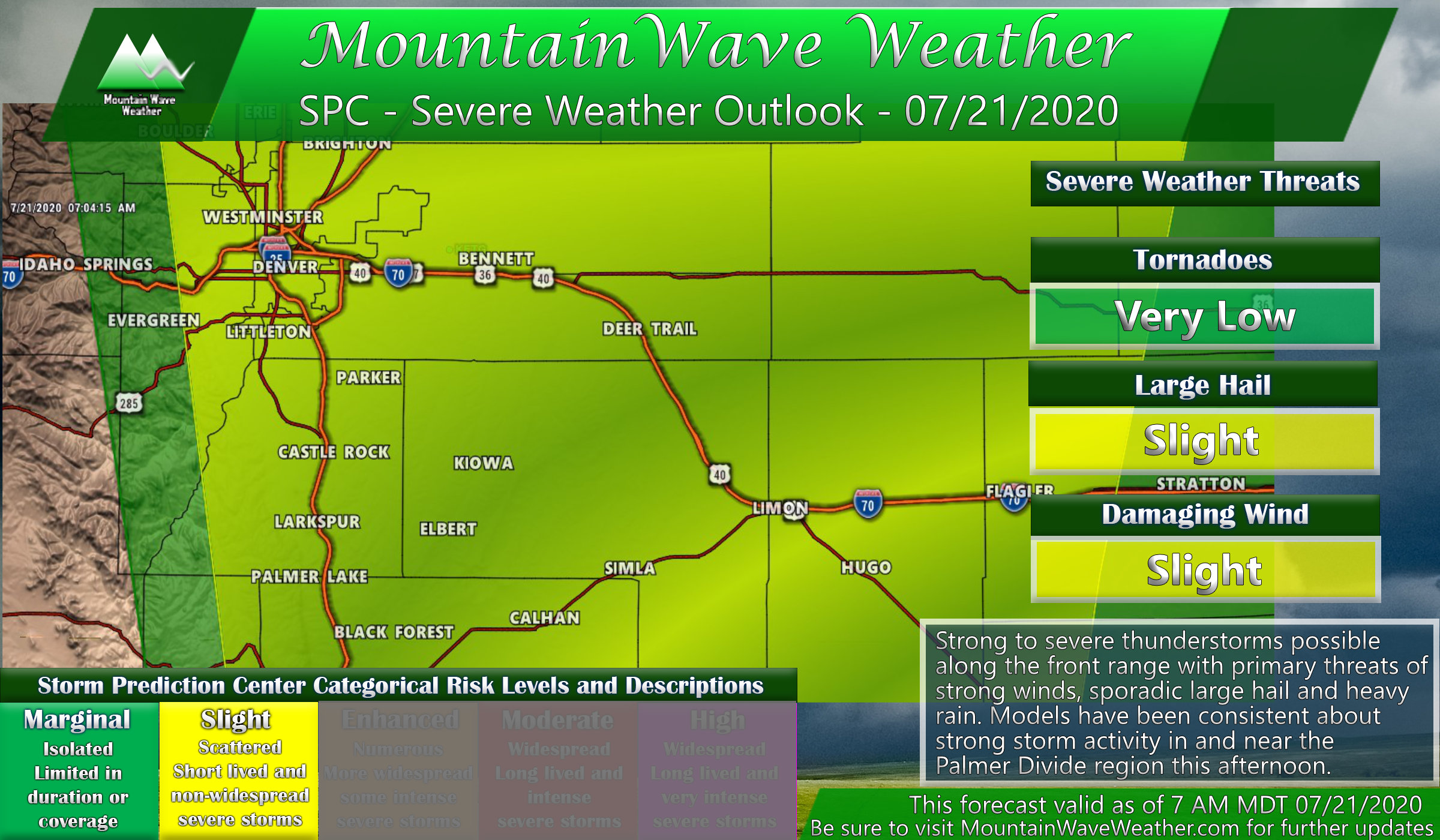
The Storm Prediction Center in Oklahoma initially posted a Slight (yellow) and Marginal (green) risk for much of the front range including areas North of Denver, the Palmer Divide and Pikes Peak region. The yellow/slight risk area is a 2 on a scale of 5 meaning it’s a lower end threat but one that can’t be ignored. Colorado has featured a lot of bigger severe weather events on Slight risk days, so we tend to take notice of these as long as the other ingredients all add up.
Our forecast: we saw good support for a slight risk day in the morning as forecast CAPE was high, moisture was strong (higher dewpoints/muggy feeling) with primary threats of large hail and damaging wind. We mentioned this in our morning forecast.
Models – More Support and Consistency
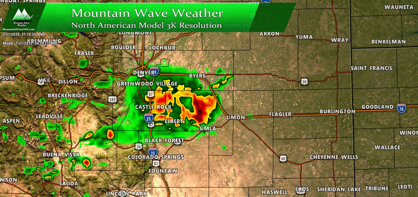
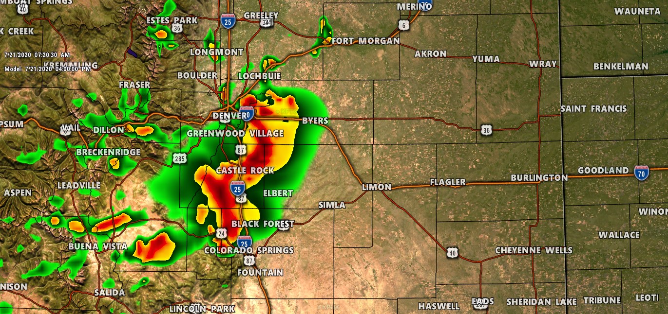
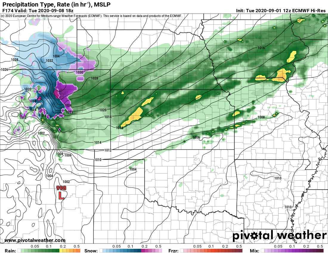
Models lended more support to a severe weather setup primarily along the Palmer Divide. The NAM3K model snapshot below from around 7AM showed a large thunderstorm complex over Douglas and Elbert Counties around 4PM in the afternoon.
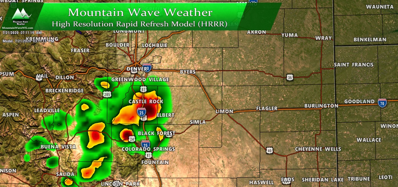
The HRRR gave us more support to the scenario above as it showed similarities to the Nam3K model above, but with an earlier timeframe and the storms forming still over the Palmer Divide but trending storm activity a bit further South and West.
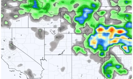
Finally the WRF model showed a large thunderstorm complex reaching from Denver to the Springs with additional scattered thunderstorm activity further South and West. As we now know, this didn’t turn out to be very accurate outside of the further South and West storm bias.
Showtime! Storms Fire… But…
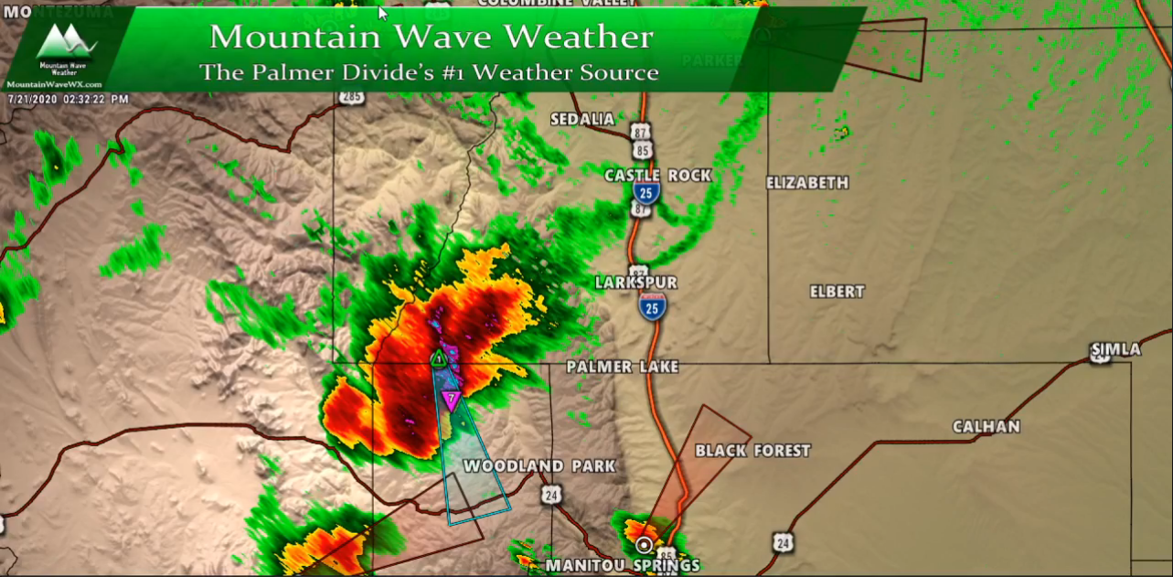
When storms finally began to fire, a rather nasty looking storm blew up quickly over Southwestern Douglas County with storms around it struggling to take off. This was one signal that the atmosphere may not have been as loaded up as we thought. Another interesting thing is that this storm grew so quickly it may have begun to monopolize the atmosphere around it. We see this often with big storms, they take a large portion of the moisture and energy in the atmosphere for themselves and additional storms nearby have a hard time forming and sustaining due to the lack of moisture and energy.
This storm made its way Southeast towards the foothills West of the Springs, it eventually became severe for a short time with large hail and gusty winds – then began to die off relatively quickly.
Boundary Play?
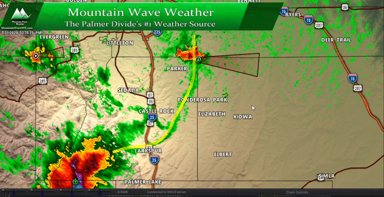
Even as the large storm to the South raged on some pop-up storms formed along a boundary that setup between roughly Larkspur and Aurora. On severe weather days we watch boundaries very closely as they can provide a lot of extra lift to help thunderstorms grow and become severe… and even spawn tornadoes. For yesterday though, while some storms formed along this boundary – they had a difficult time staying alive after they drifted off of it.
The Results/Summary
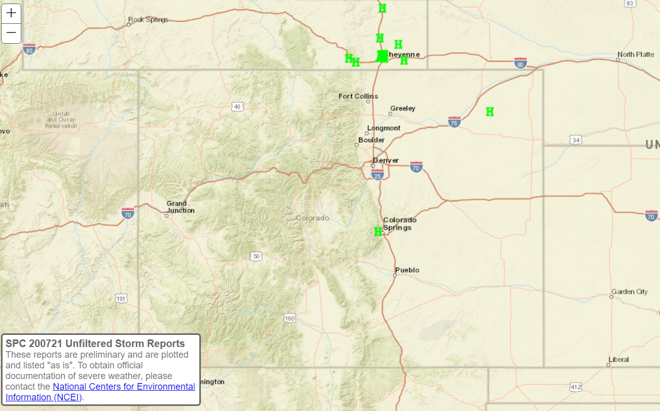
The 24 hour severe weather report doesn’t lie; yesterday was a forecast bust. We didn’t expect a huge severe weather outbreak day, but we did expect more than we saw. The only hail report received anywhere near the Palmer Divide was the storm West of the Springs. The thing with weather is that all the ingredients can be there and everything can line up perfectly but mother nature still likes to throw us a curve ball and remind us who’s in charge.
As a forecaster I like to look back at these scenarios and figure out what may have caused them not to go our way. I think that’s the only way you can get better! Hopefully you enjoyed this look at our storm system yesterday, if you have any questions or comments feel free to post on this site or on Facebook.
Thank you for following along and thank you for the support!

Thanks so much!