While the weather looks relatively quiet around Castle Rock and surrounding areas, we can't ignore that the temperatures are beginning to warm and the weather pattern is beginning to change. As we transition later into spring we begin to see thunderstorms enter the picture once again and with the increased heat, moisture at the surface and strong winds aloft we can see these storms turn severe. This is the first in a series of posts exploring everything thunderstorm!
Thunderstorm 101
A thunderstorm needs 3 basin ingredients to form:
- Moisture
- We don't see a lot of thunderstorms around here on very dry days or in periods of very dry soil conditions (drought)
- Moisture is needed to aid in cloud development and thus thunderstorm development
- Instability
- The atmosphere needs to be unstable for a parcel of air to rise into the atmosphere
- This basically means the air aloft must be cooler than the air below it. This allows air to rise and condense to form clouds (with moisture)
- Lifting mechanism
- If we have the first 2 ingredients we need to be able to lift the air
- Daytime heating allows the air to lift and condense into clouds and if conditions are right, eventually form thunderstorms
- A frontal passage can also cause lift (we see strong cold fronts do this in springtime in Colorado
- Wind/Terrain (this is unique to mountainous or hilly areas)
Colorado's Unique Source of Lift
In Colorado, due to our terrain we can get another source of lift... the terrain. We can often see thunderstorms develop when we have winds out of the East or Southeast, a phenomena we often call "upslope" or "upslope flow." This is the same feature that allows us to have big snow storms in the winter and early spring months.
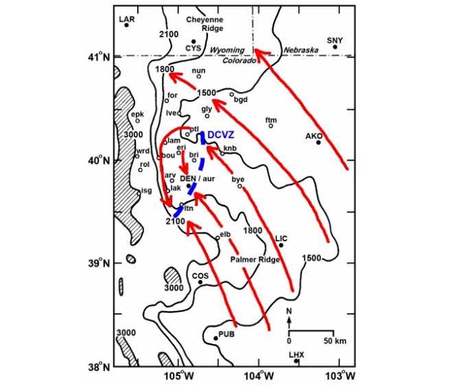
The Denver Convergence Vorticity Zone. Credit: Al Pietrycha, Drs. Bruce Lee and Paul Markowski
Due to the terrain along the front range of Colorado we often see what is called the Denver Convergence Vorticity Zone or DCVZ for short. This is a situation where winds out of the Southeast flow into the area, are effected by the terrain in and around Denver and turned Northwesterly. That wind then crashes into the winds coming out of the Southeast and creates an intense area of lift along the Palmer Divide, Eastern Denver and Northeastward towards the airport.
Thunderstorm Lifecycle
Believe it or not, thunderstorms have a unique life cycle; just like everything else. They are born, they mature and they die. The nice thing is that you can tell what stage a thunderstorm is at just simply by observing it.
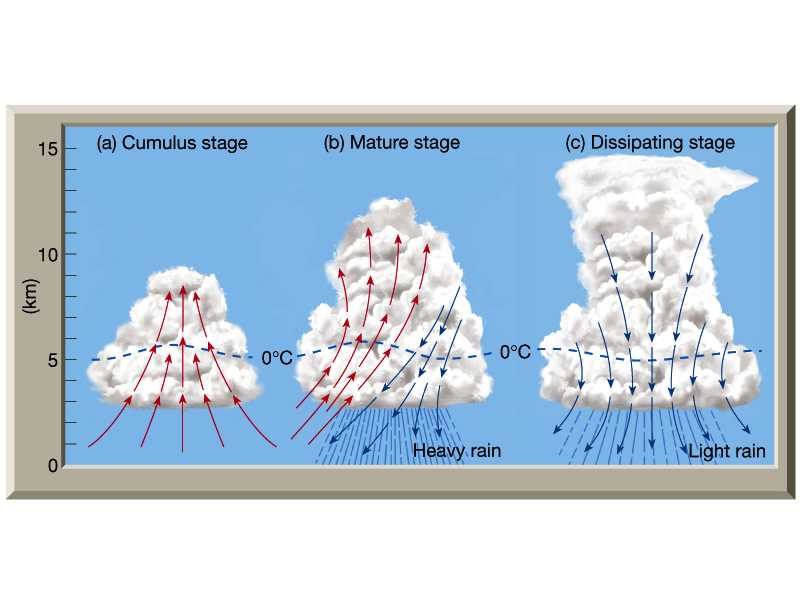
Lifecycle of a thunderstorm
If you see these storms out in the field, here's how to tell what stage it's in and a few things to look at that will help figure you figure it out.
Cumulus Stage (also called Towering Cumulus or Maturing Stage)
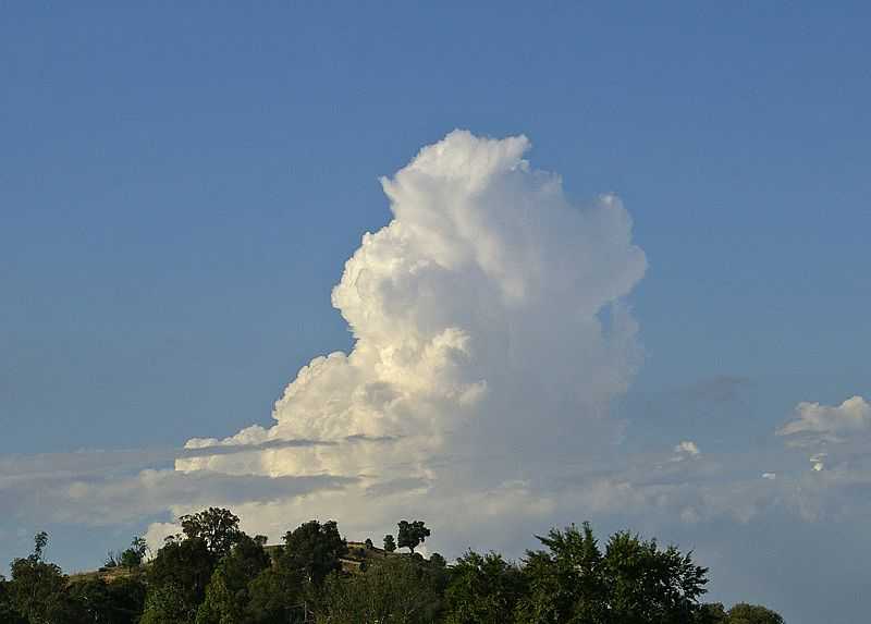
Credit: Atmos.Arizona.Edu
This is the early stage of thunderstorm development. If the moisture, instability and lift are just right, you will begin to see clouds that look like big, puffy cotton balls. At this stage, the warm air and moisture at the surface are bubbling up into the atmosphere, cooling and condensing into a large cloud.
- Look for puffy edges around the cloud
- Look for rapid growth (in Colorado storms can fire in a matter of minutes!)
- Look for vertical (upwards) development. Clouds that remain very flat or grow horizontally may signal there is something in the atmosphere prohibiting growth.
Mature Stage

Credit: http://www.physicalgeography.net
At this stage the storm is considered mature. It has a decent amount of warm air and moisture rising into it (in what is called the updraft) and may have rain falling out. At this point the storm is healthy, everything is balanced and the storm may continue to grow.
- Look for a very large cloud structure
- Look for an "anvil" appearance on the front edge of the storm
- There may be additional clouds behind the storm flowing into the updraft
- Thunder and lightning may be prevalent once the storm reaches a certain height
Dissipating Stage
Credit: http://weatherblog.nbcactionnews.com/
Once the storm reaches the dissipating stage, its source of warm and moist air is cut off. With no source to longer feed it, the storm begins to die off. We will often see large amounts of rain and wind under the storm once it reaches this stage as the cold air begins to fall out of it.
- Look for a rising base, the bottom of the cloud will begin to rise as colder air fills in beneath it
- Edges of the storm will have a softer, frayed look. The storm will no longer have sharp or puffy edges, especially on the rear of the storm.
- The top anvil area will begin to look very soft and feathery
Pop Quiz
I showed some general pictures above of each stage of a thunderstorm but not every storm looks the same Each storm builds in a different environment, looks different and you may even have different angles of sight or distances when observing storms. That's why it's important to recognize the features of the storm that will tell what stage it is in.
So for this exercise, use the pointers above to see if you can tell which stages these storms are in. Post your answers in either the comments on the site here or on facebook... I'll have the answers with our next storm post (Probably around Thursday)
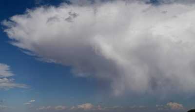
Which stage are these storms at?
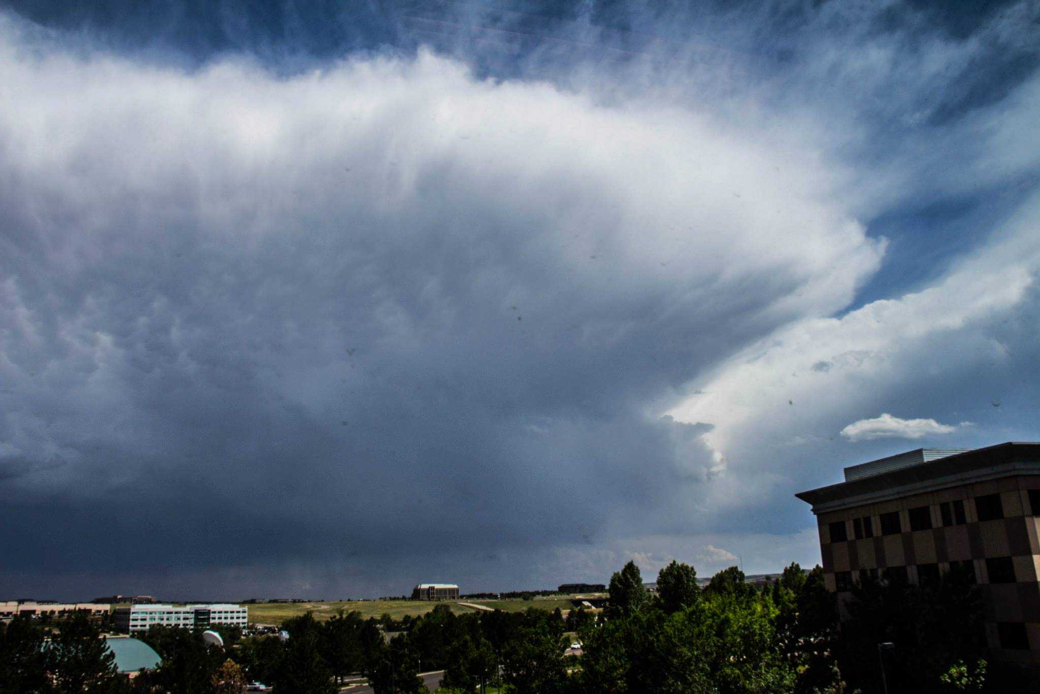
Storm 1

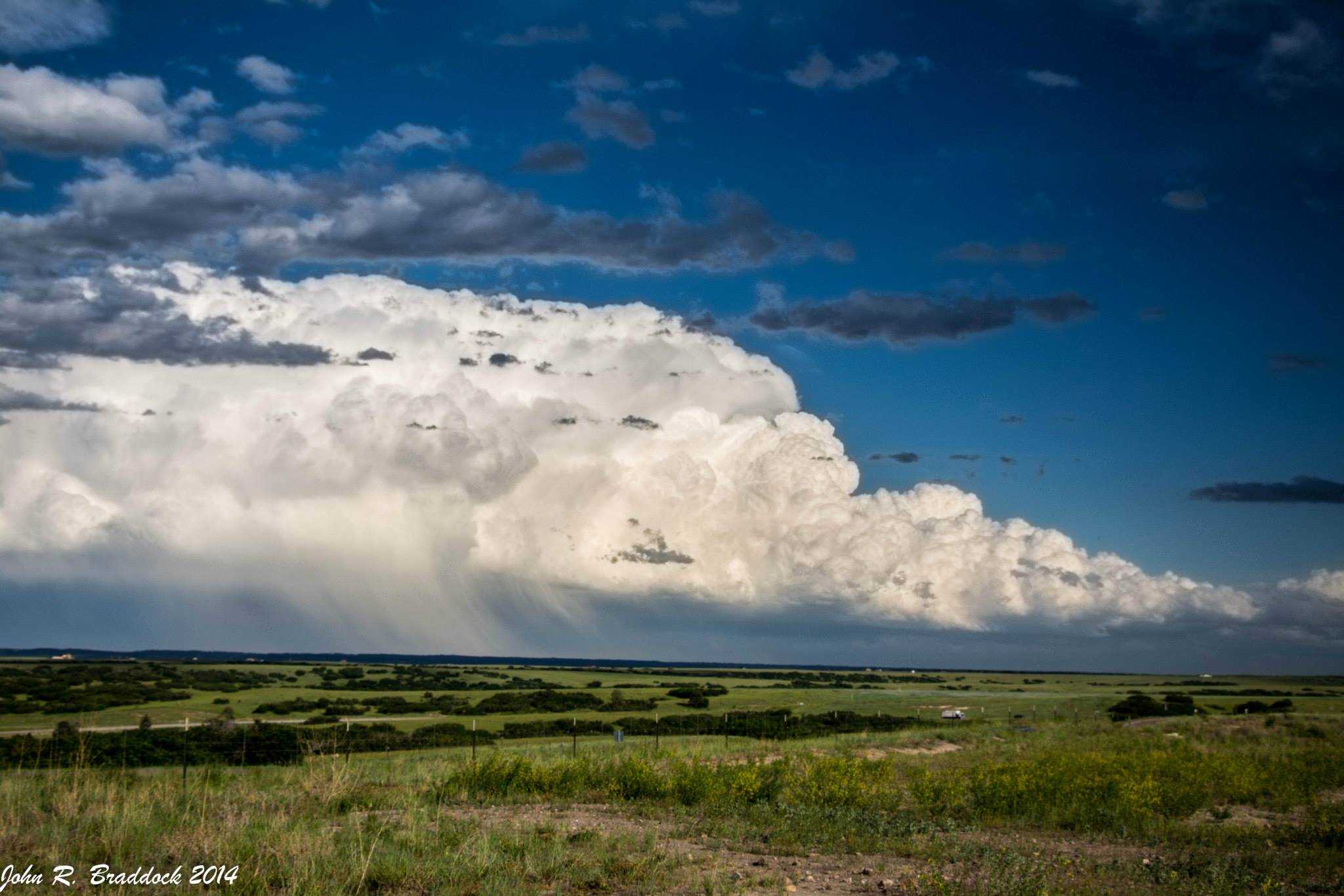
Storm 2

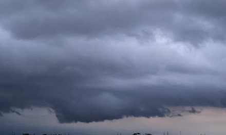
Storm 3
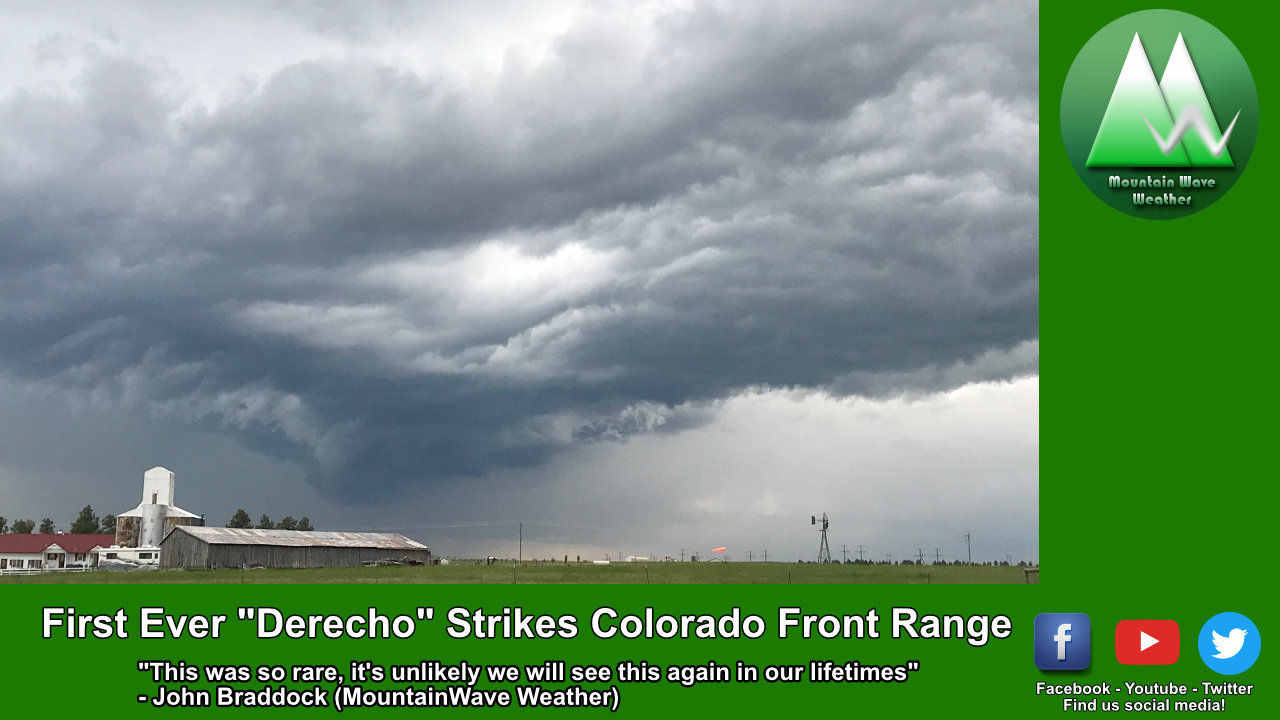
Bonus: Storm 4-- this one can be tricky 😉
Good luck and stay tuned for more thunderstorm and severe weather posts coming in the near future!


Trackbacks/Pingbacks