As our storm continues to move out late this morning and into this afternoon, wanted to take a quick recap of the storm and the forecast.
I like to occasionally go back and review forecast vs actual results… the part I don’t post about is going back and reviewing the model data and observations to try and recognize patterns or tendencies for future storms. I won’t bore you with all that, but I will say what I thought went well with this forecast and what didn’t along with a bit of info about why.
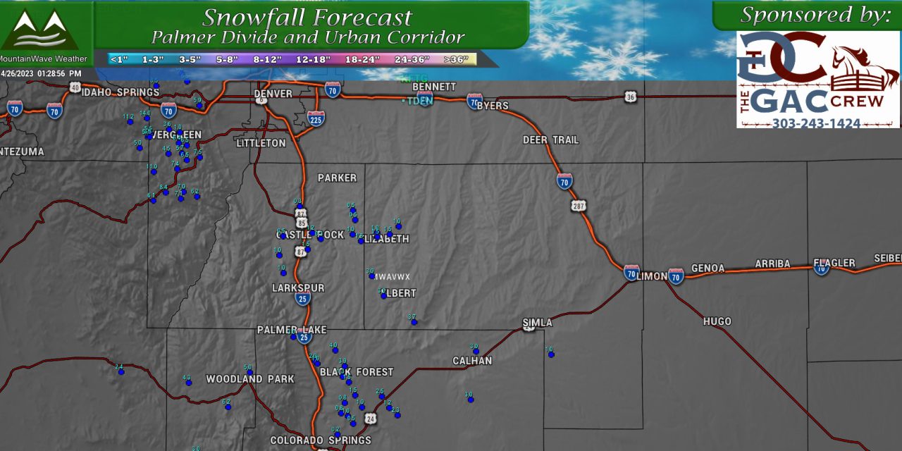
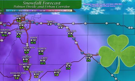
Snowfall Forecast (lower than expected)
Definitely a mixed bag in terms of who saw snowfall and how much… the temperatures played a major part (as we knew they would.) I’d say most of the areas along the Palmer Divide underperformed the forecast, especially those areas right around or below 6,800-7,000 feet in elevation.
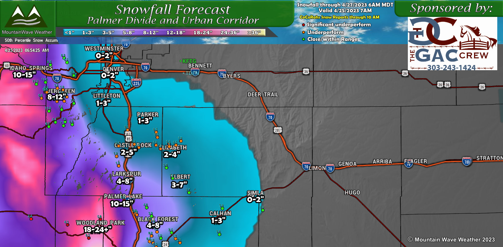
I’ve attached my last snowfall forecast map with CoCoRahs data filled in, sorry the numbers are so small – it’s a new bit of code I’m working on so that will get better as I get some fixes in. The repots have been color coded so that regardless on if you can see the number – you should be able to see which areas met their forecast range and those that underperformed or significantly underperformed.
No data points in Denver? That’s really because they didn’t get any snow accumulation.
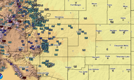
Total Precipitation (Good)
The total precipitation graphic below ran through 7AM so many places may have picked up a bit more since then… most of the heavy precipitation had ended as of this morning.
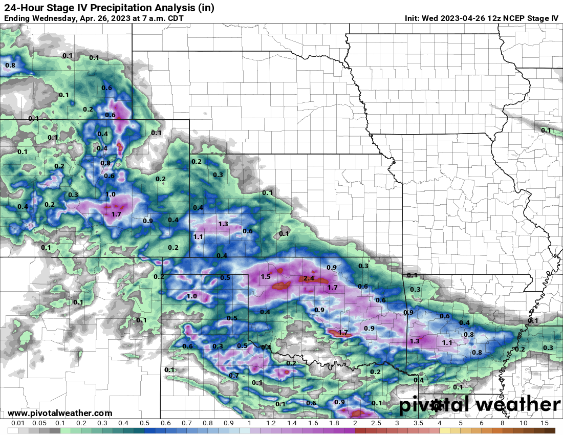
You can see a lot of the areas that were expected to do well in terms of total liquid precipitation did, even if it wasn’t as much snow as we had anticipated for some areas. Some of the hotspots for the most rain/snow/liquid were along and South of the Palmer Divide, the Front Range Foothills (especially South and West of Denver) and areas Southwards between Colorado Springs and Pueblo. Additionally, some of the drought-stricken areas in Southeastern Colorado and into Western Kansas picked up well over an inch in precipitation in some cases. Great news for them!
Impacts (Less than Expected) and Timing (Good)
This was our last timing and impact graphic posted about the storm:
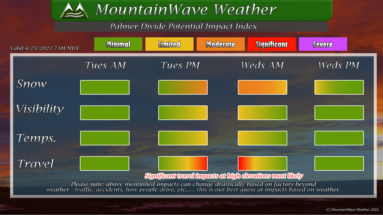 Overall the timing matched up fairly well with the rain, snow and timing on transition to snow at the higher elevation s(7,000+ft) while lower elevations saw a rain/snow mix that lasted a bit later and affected total snowfall accumulation. Pretty happy with the timing aspect of this forecast, I think it checked all the boxes.
In terms of impacts, they were less than expected… many of the roads stayed wet meaning that while we saw some limited impacts in a few select spots of the Palmer Divide, most of the impacts were minimal – rather than some of the moderate or significant impacts we were expecting.
Summary – Overall Grade
I’d say that despite the lower than anticipated snowfall and lower impacts along the Palmer Divide, the forecast played out fairly close to expected. I can look at the past several forecast posts and count several times where I mentioned “temperature and elevation will the biggest wildcard factors with this storm” and that’s indeed how it played out.
The only discrepancy was the storm overall shifting a bit further South than expected, but it didn’t dramatically affect what we ultimately saw besides dropping the numbers a bit. In the end, the most of the areas that were supposed to get a decent amount of moisture either reached that or came very close – regardless of whether it was ultimately rain or snow.
Another storm coming in on Thursday and into Friday – I’ll be in forecast mode for that one starting Wednesday night. Stay tuned for updates!
