I asked many folks to put on their science hats yesterday (4/19/2023) and offer some guesses why we were seeing fog with the arrival of a strong cold front. In fact, this is common with a lot of powerful cold fronts that move in to the area in the Spring, Fall and even sometimes the summer.
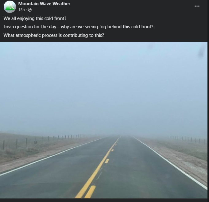
Many folks that answered were pretty close to spot on, some mentioned:
- Cold air inversion – it has to do with colder air, but not an inversion
- Humidity – yup, but why?
- Dewpoint – yup, but why?
- Pirate ghosts – not sure about this one but I do love the Pirates of the Caribbean movies!
So with those in mind, let’s take a look!
A quick disclaimer, I pulled this data from my weather station at the Ranch. Your times/temperatures/other numbers at your location may be slightly different, but the mechanism is the same.
Find the Cold Front and Confirm Its Arrival
We know a cold front moved through… how? It got colder, but let’s try to pinpoint the rough timing of when the front moved through. For this we’ll do a bit of weather detective work.
We know that cold fronts are typically accompanied by a couple of things: a change in temperature of the air, a change in wind direction and precipitation.
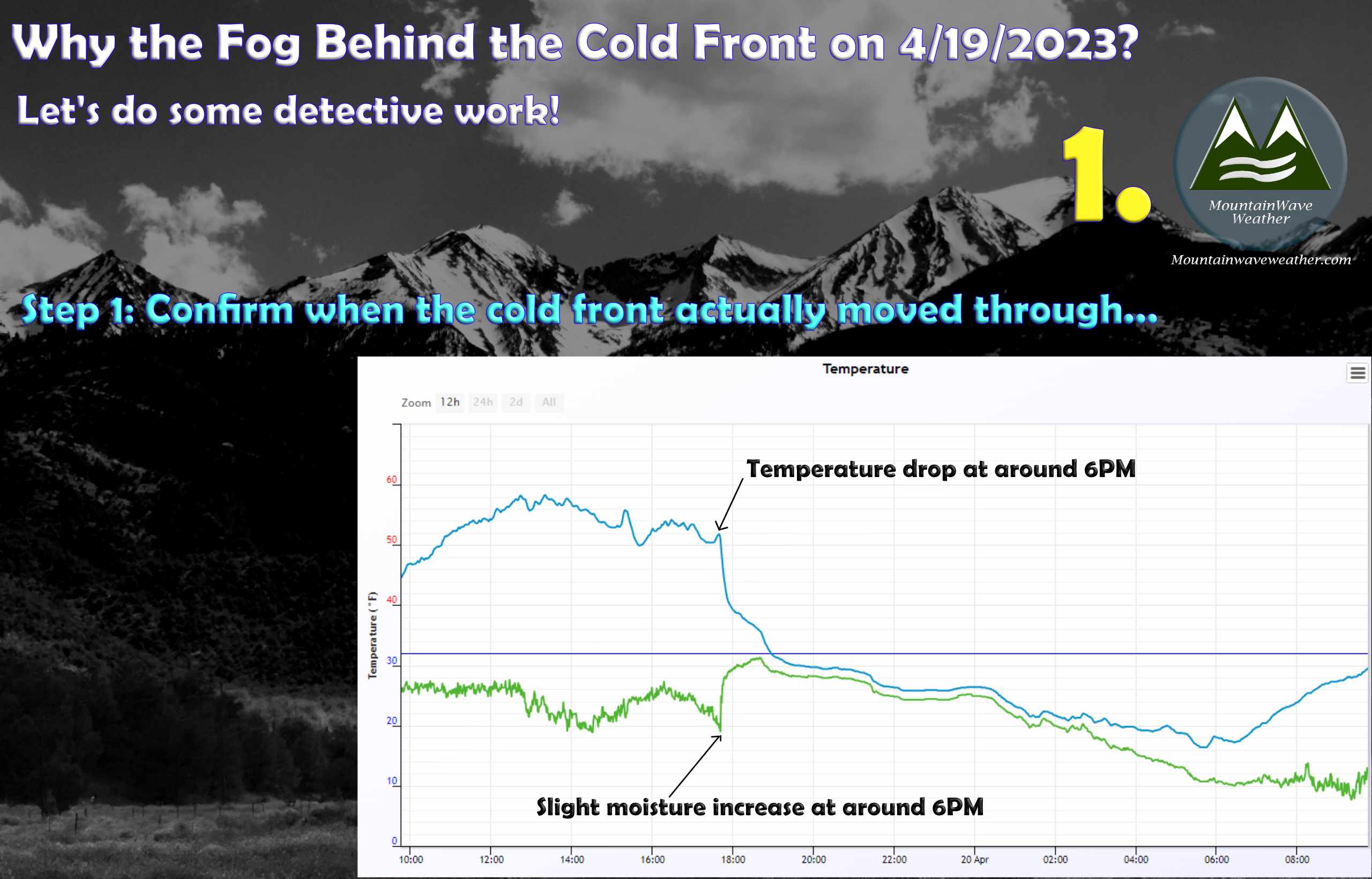
Looking at the first chart, we can see temperature start to plummet around 6PM. But that alone doesn’t totally confirm the cold front’s arrival, we need a bit more data…
Let’s look at wind direction around that time, just to confirm that is indeed the timeframe we should be looking at.
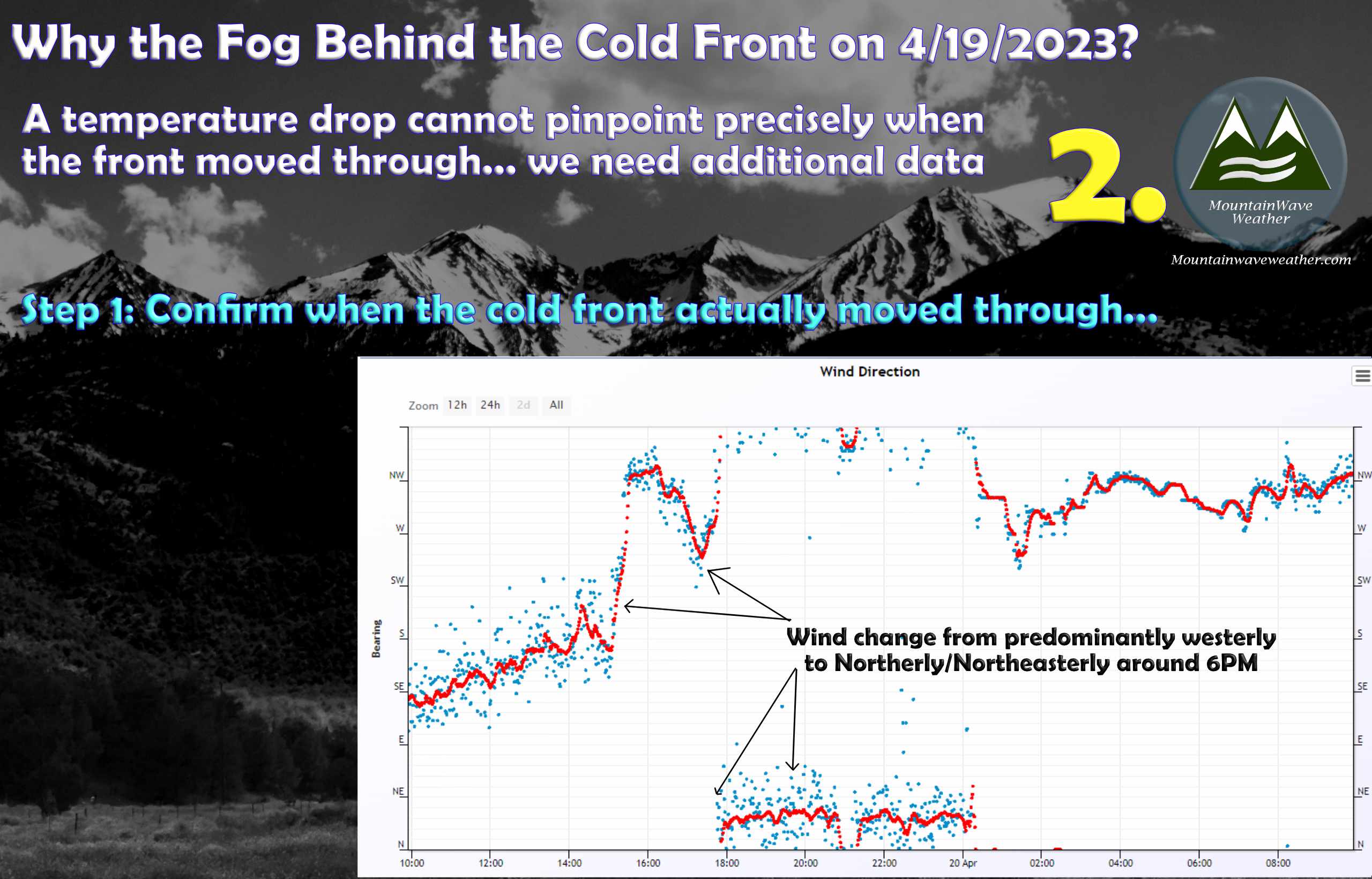
At my location, we see a very noticeable wind shift right around the time the temperatures drop. That’s good news, we can say with reasonable confidence that the front arrived at my location around 6PM. This will help us zero in on the other data we need.
Measuring Moisture in the Air
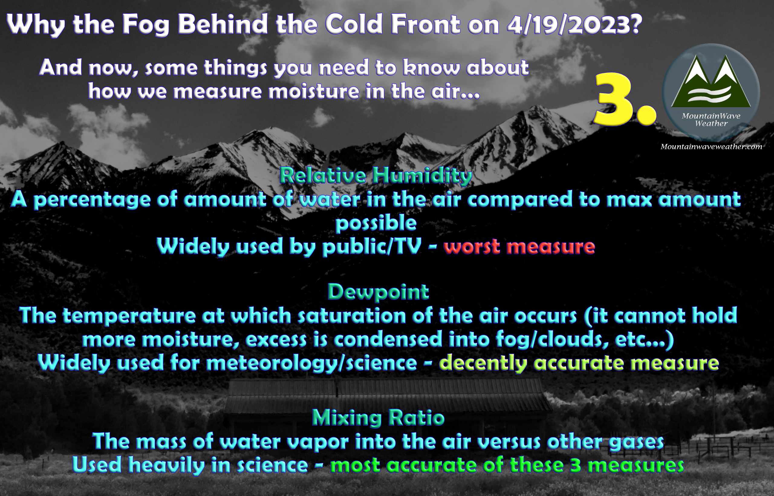 There are a ton of ways to measure moisture in the air but we’ll focus in on the three most common. This is important to know as fog/clouds develop based on the moisture in the air.
- Relative Humidity
- Describes how close air is to saturation typically in a percentage
- Widely used in media and the public
- It’s actually the WORST measure (we’ll get into why_
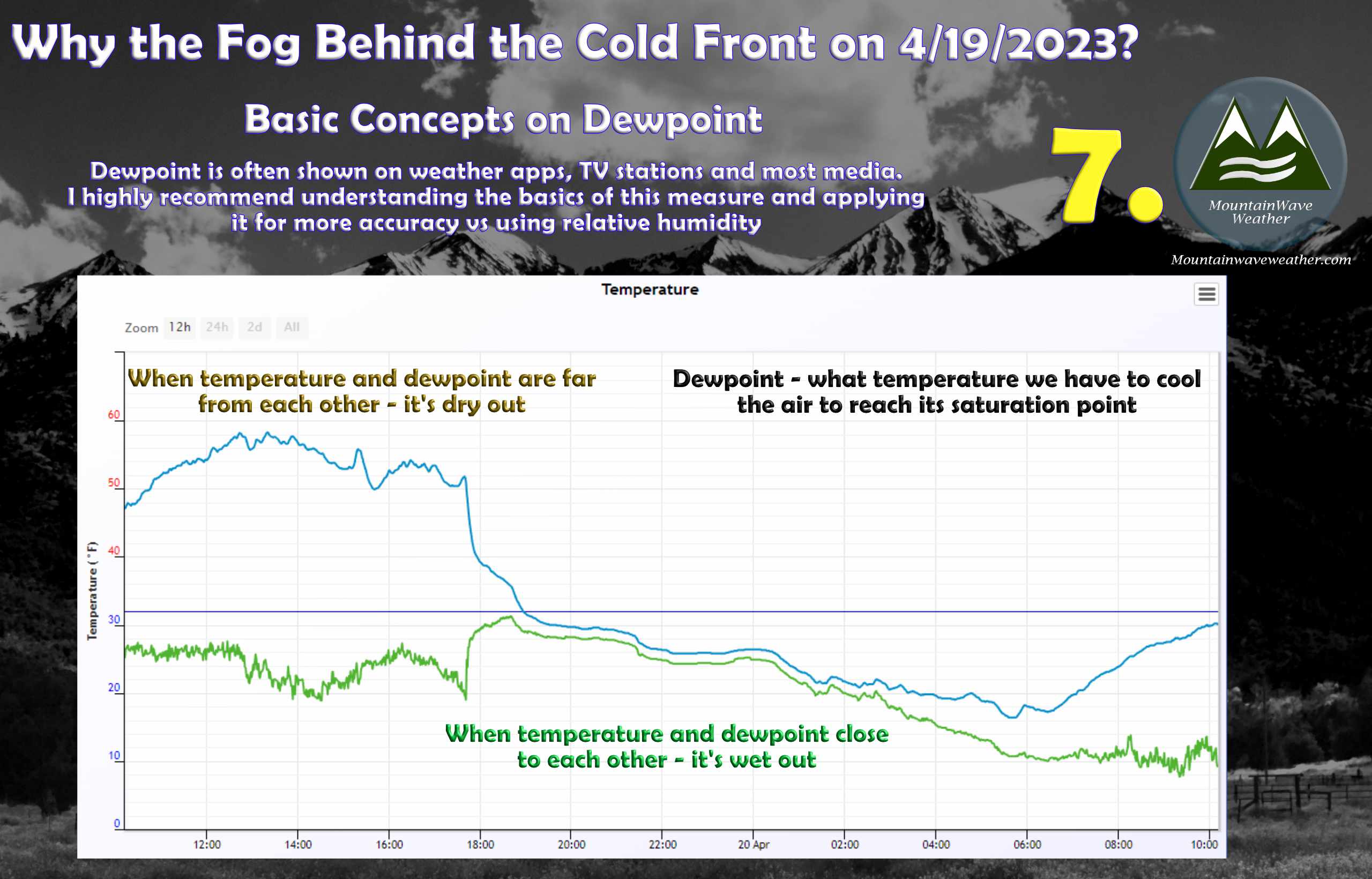
- Dewpoint
- The temperature we would need to cool the air to for it to saturate
- Widely used in meteorology and science
- Dewpoint is a decent measure of moisture in the air
- Mixing Ratio
- Measures the mass of water vapor vs other gases in the air
- Not used in the public, heavily used in science… lots of math
- Most accurate of the three
Why is relative humidity so bad at measuring water vapor in the atmosphere?
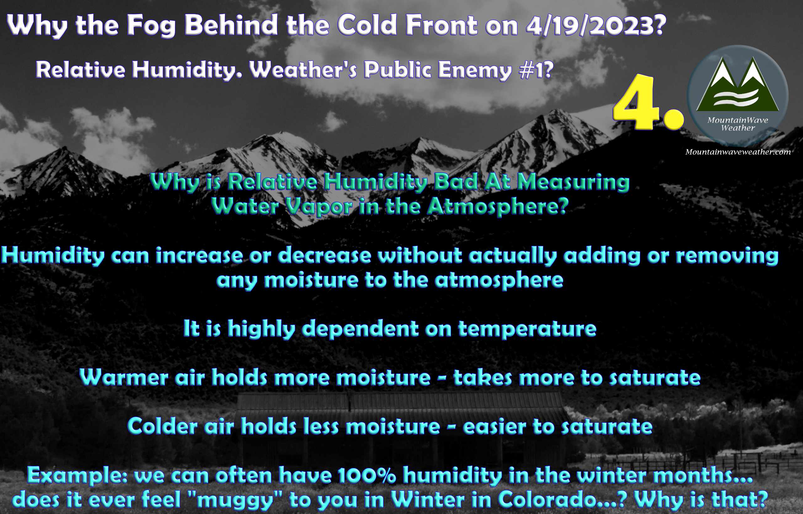
The biggest problem with relative humidity is we can manipulate that percentage just by changing the temperature. We can actually increase or decrease relative humidity without actually adding or subtracting any moisture to/from the air.
Why is it so dry in Colorado in the winter months, despite having relative humidity reach 90-100% occasionally? It’s because there is not a lot of actual moisture in the air, the air is cooler meaning it can’t hold as much moisture before it becomes saturated.
If you need proof, check my data below…
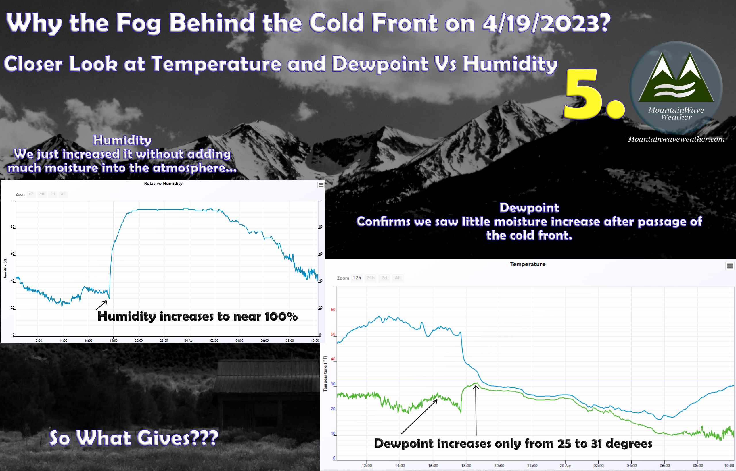
At the time of the cold front moving through, the relative humidity quickly increased to 100%, but if you look at the dewpoint – we actually didn’t add that much water to the air. This is typical of cold fronts from the North and Northwest – they don’t typically bring a lot of moisture into our area with out some sort of help.
See the problem there? We increased the humidity without adding much moisture… why is that?
Dewpoint to Save the Day!
If we look at the dewpoint we can see more clearly why we would have fog and low clouds behind this cold front. While we didn’t increase moisture much, we did cool the air significantly behind the front. This means the air could hold less moisture overall and became close to saturated. See the graphic below for more details.
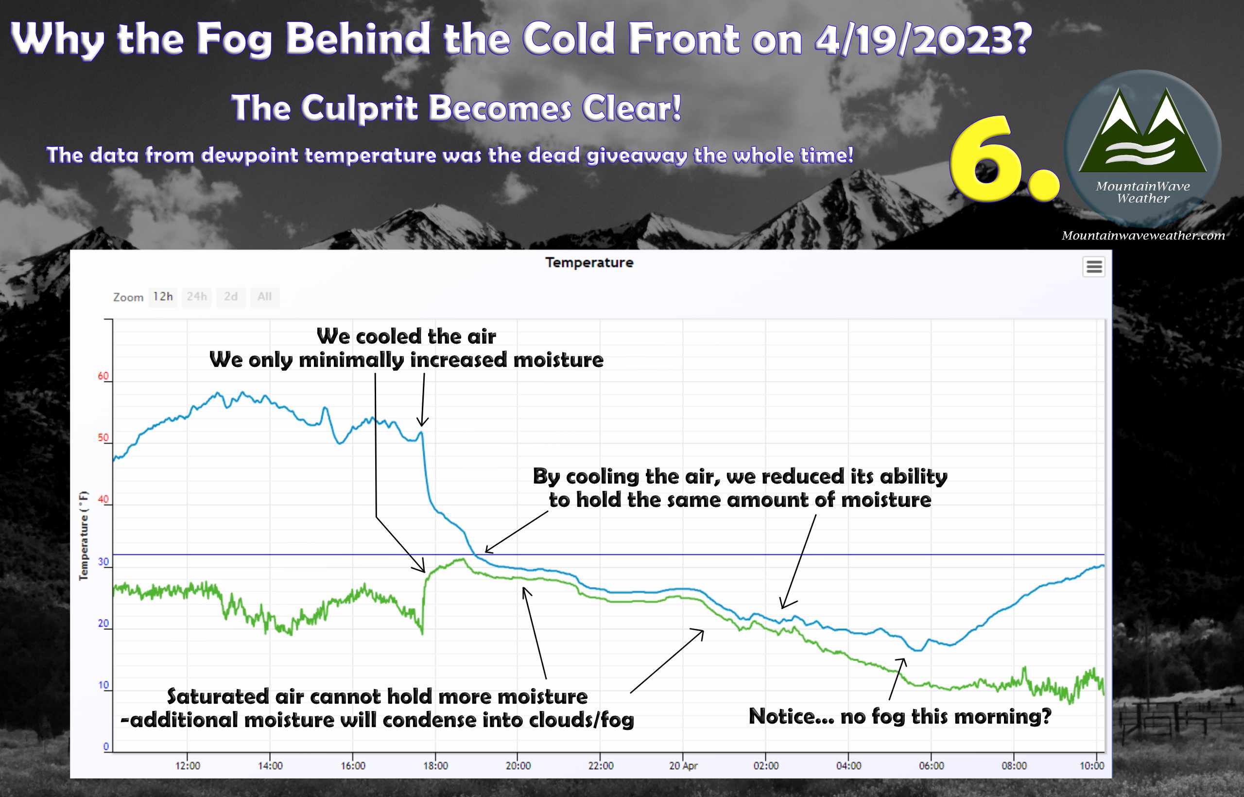
Notice, we didn’t have fog or low clouds this morning? Look what happened to the temperature and dewpoint earlier this morning… we started removing moisture and slowly increasing the temperature, meaning the air cold hold more water vapor and became further away from saturation.
A Quick Explainer on Dewpoint
It’s important to understand dewpoint and I recommend the public learn more about it… at least on a basic level. 100% humidity doesn’t always mean lots of moisture in the air, but a dewpoint and temperature close to each other does tell you with a better degree of accuracy when the air is closer to its saturation point in addition to how much moisture is in the air.
A high relative humidity can mean air is closer to saturation, but not how much moisture is in the air
A high dewpoint tells you how close you are to saturation and how much moisture is in the air
It’s a much better measure that I wish was more commonly used… no one needs to know the math behind it – just the basic concept.
Why Do We Use Relative Humidity
There’s several reasons we use relative humidity and all of them have to do with explaining a relatively complex concept to the public in a way that’s easy to digest and grasp. I imagine there’s a percentage of folks that stopped reading this article half way through because it was just “too sciency” or required too much thought. Don’t crucify me for saying that, I do it too… especially on topics I don’t quite care about.
A large part of meteorology today is finding the best ways to communicate these topics to the public without them tuning out. That’s the difficulty, making sure we give the best information in a way that’s easy to understand and take action on.
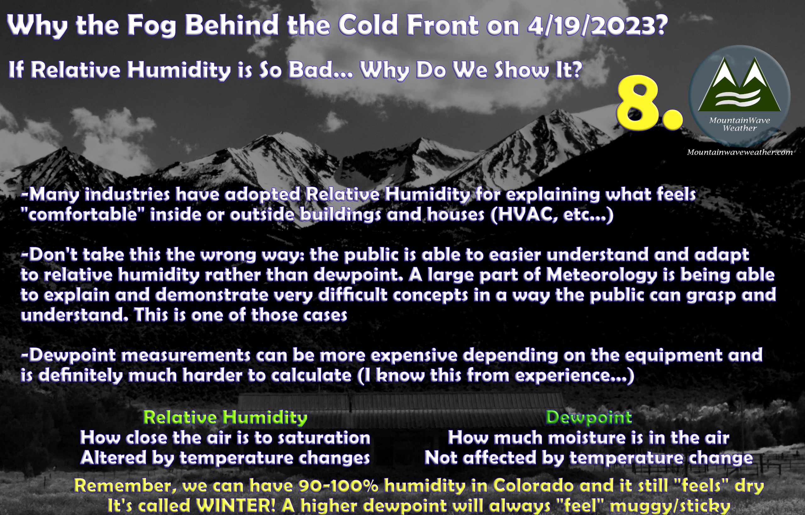
So while I don’t think relative humidity is going anywhere, I’d recommend checking the dewpoint as well and having a basic understanding of what it’s telling you.
Summary
Hopefully you enjoyed this explainer. I tried to keep things short and engaging!
If you’d like to see more explanations like this, be sure to let me know on Facebook!
