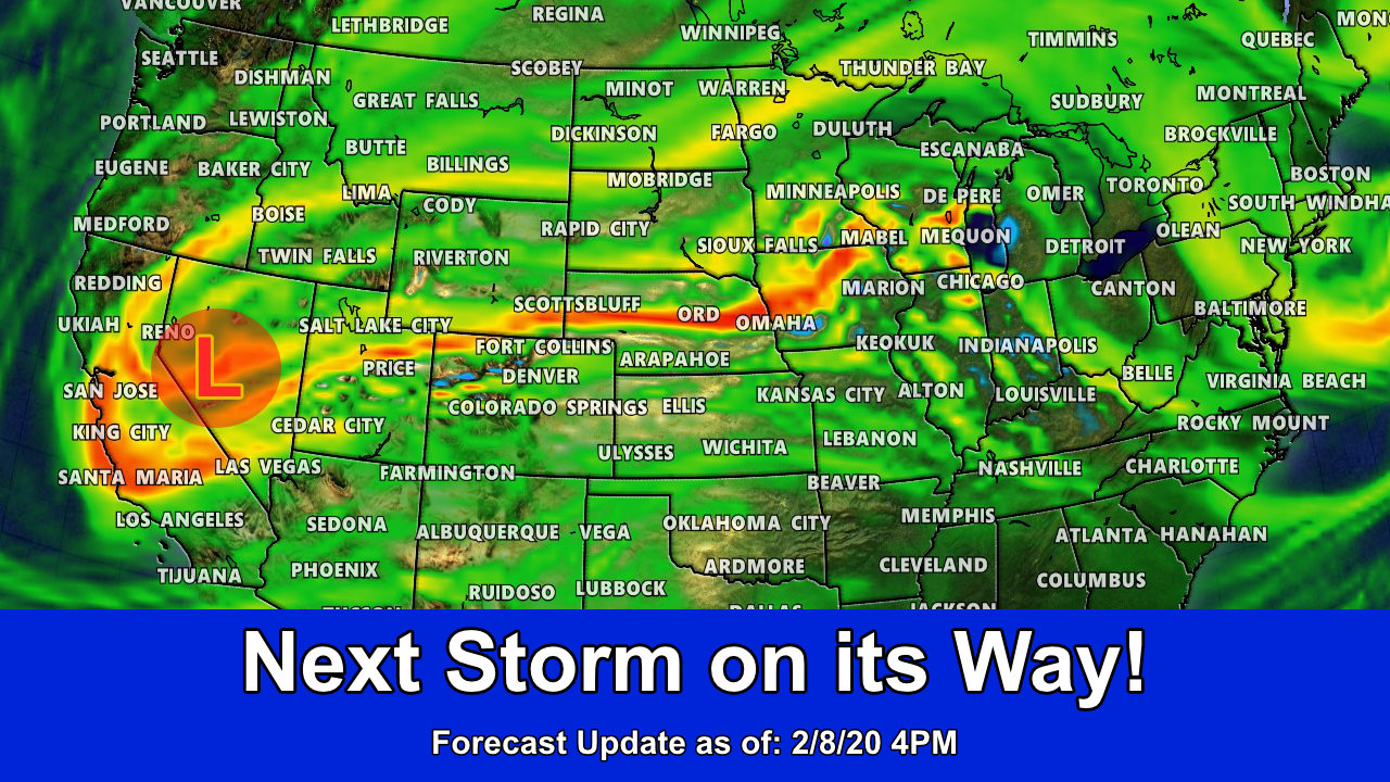
Oh goody, a fairly straight-forward storm for us to handle after the mish-mash that our last storm turned out to be. A trough is currently digging into the area out to our West and as it moves East that means we will have another shot at snow! (There’s really no such thing as a straightforward storm to forecast in Colorado!)
For the most part this is a more classical looking type of storm system than our last. We see quite a few strong troughs dig into the West and move across Eastern Colorado. Models are a bit confused in terms of how much upslope establishes and how long that sticks around and even those with higher snowfall aren’t showing a lot of support for their own solutions.
One thing we will want to keep an eye on is the potential for a “banded” snowfall type event late Monday.

A strong southwesterly jet sets up late Monday. Some models show potential for banded snowfall… we will have to see if that actually sets up.
Essentially the weather looks unsettled on and off from Sunday through nearly Thursday this week. It means that several waves will move through and with each comes a chance for additional snow. While none of these systems looks impressive as of yet, when we have unsettled patterns like this delivering consistent storm systems it may just be a matter of time before things line up for another good snowfall event.
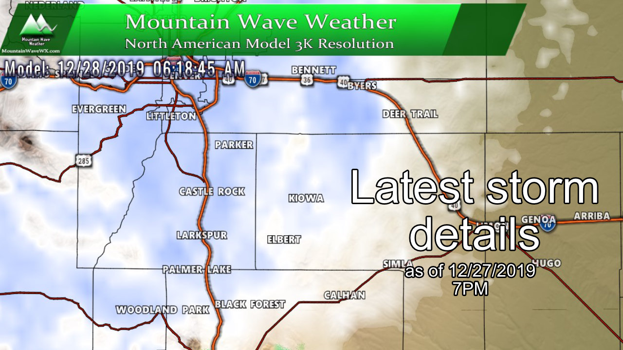
Here’s the details!
Storm Discussion (Impacts/Timing/Hazards/Trends)
Timing
- Saturday night
- A cold front slides into the area late on Saturday night. Expect an increase in winds along the front but the atmosphere looks pretty dry and takes awhile to saturate behind the front. Small chance of snow showers Saturday night but probably less than 10% chance.
- Sunday
- Widely scattered snow showers possible early Sunday morning near sunrise. Models don’t show an increase in snow until mid/late morning
- Snow showers will be possible throughout the day on Sunday and into the evening hours
- Models show unsettled weather with chances for snow through about 8-10PM Sunday night before tapering off
- Monday
- Models are somewhat mixed in what happens Monday. Nearly all show continued chances of snow but some heavier than others
- Some models show potential for banded snowfall late Monday and into Tuesday
- We will have to keep an eye on further data, especially because there is a chance the Monday evening commute could be impacted by more snow
- Tuesday
- Quieter day before next storm moves in
- Wednesday Storm
- Stay tuned for additional forecast details on that storm
*Forecast is fluid, keep an eye on our forecasts and we will be sure to pass along any changes if things change!
Snowfall Amounts
- See below for more specific details
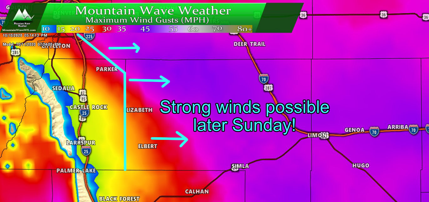
- Storm has a southerly bias, I’d expect the higher snowfall amounts South of Denver
- Will need to keep an eye on Palmer Divide for a possible slight uptick in snow totals in the forecast
- Any wobble in the storm track could change this significantly
Impacts
- The area to watch most for impacts will be South of Denver, along the Palmer Divide and towards Colorado Springs
- Snow on Sunday could cause wet/slushy/icy roads depending on which areas see the most snow
- Also keep a close eye on potential travel impacts Monday night. Still remains to be seen on timing for this; but keep an eye on details for the evening commute
Expected Snowfall
Palmer Divide
Snowfall through Tuesday afternoon shown below. We’re not expecting as much from this storm system as the last… it’s a different type of storm and the center of the storm moves well South of Colorado. As such, we will see some light upslope develop to get moisture squeezed out of the atmosphere but we don’t see a very strong signal for a ton of snow out of this one.
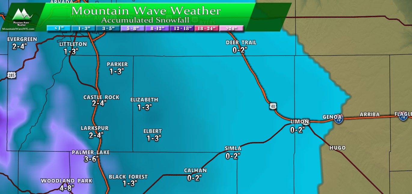
Palmer Divide expected snowfall through Tuesday PM
Northern Colorado
Not expecting much North and East of Denver. As I said above, and I’ll discuss below; this storm is sliding further to the South. We would expect to see downslope conditions take over in and around Denver and to the North and East. This means the atmosphere may remain a bit drier and squeezing moisture out will be more difficult in these locations. I’ve painted the gradients below, generally 0-2 inches across most of that area. One thing I’ll be watching is the Denver area closely, I think ares right in and around town (and especially on the West side) could end up more in the 1-3 inch range. Keep an eye on our forecasts for any changes around that number!
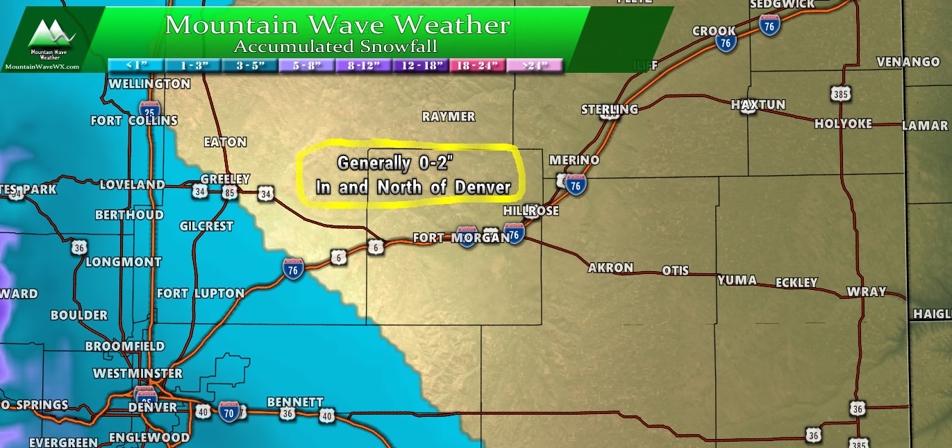
Northeastern Colorado expected snowfall through Tuesday PM
Southern Colorado
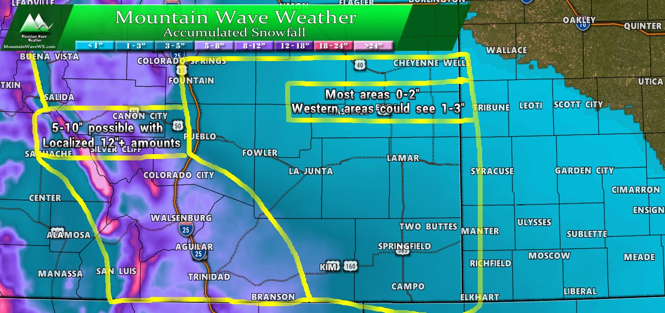
Southern Colorado expected snowfall through Tuesday PM
Summary
We’ve seen this type of storm system before and forecasting these is relatively straight forward. Like most storms of this type, the wildcards still remain with the track of the storm. It shows too far South on many models to be a decent impact as of right now, what we will watch for in the nexxt 12 hours is do the models have it wobble to the North and does the current positioning (and subsequent positioning) of the storm match up with what models have been saying.
For now, be prepared for more snow and cold on Sunday through the day and potentially again later Monday… and potentially again on Wednesday…
It’s going to be a busy week on the weather front, keep an eye out here for any forecast changes/updates!

Thanks John!