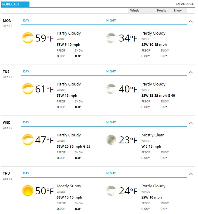
Palmer Divide Weekly Outlook 12/13/2021
I’ve posted the forecast front and center because while you may see a lot of warm temperatures and dry conditions, there is one aspect of weather that will dominate the forecast this week. It’s one you’ll need to be aware of too, because it may be quite strong at some points throughout the week and may cause some issues from travel conditions to power outages.
Wind is going to be the main talking point of the forecast this week!
 Let’s dive into some of the details:
Current Weather Alerts
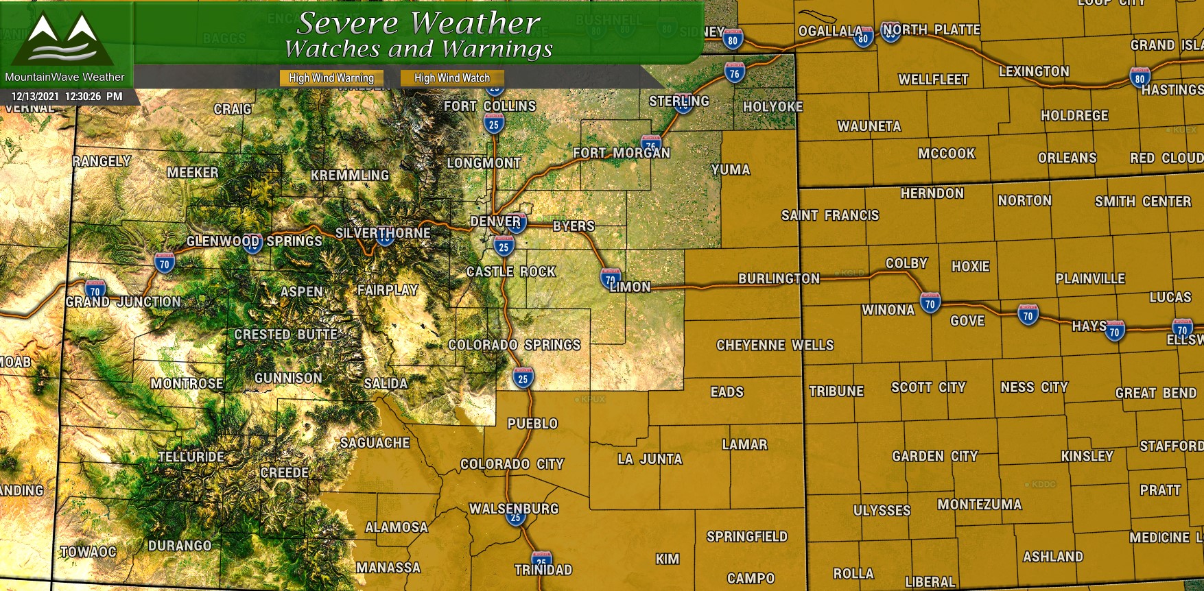
...HIGH WIND WATCH REMAINS IN EFFECT FROM LATE TUESDAY NIGHT
THROUGH WEDNESDAY AFTERNOON...

* WHAT...Southwest winds 30 to 40 mph with gusts up to 70 mph
  possible.

* WHERE...The Interstate 25 Corridor from Pueblo County
  southward to Raton Pass, and all of the southeast plains.

* WHEN...From late Tuesday night through Wednesday afternoon.

* IMPACTS...Damaging winds could blow down trees and power
  lines. Widespread power outages are possible. Travel could be
  difficult, especially for high profile vehicles. Areas of
  blowing dust and reduced visibility will be possible,
  especially on the plains east of I-25.

PRECAUTIONARY/PREPAREDNESS ACTIONS...

Monitor the latest forecasts and warnings for updates on this
situation. Fasten loose objects or shelter objects in a safe
location prior to the onset of winds
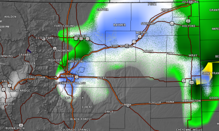
You’ll notice the current High Wind Watch includes mainly areas South and Southeast of the Palmer Divide. Models don’t all agree yet on who sees the strongest wind. The Nam3k which I talk about below sees a lot more areas with strong wind, but the Euro keeps it all South of the Palmer Divide. We will keep an eye on things in case they change.
The watch area right now includes the areas with highest confidence for strong winds.
Strong/Damaging Winds Possible on Wednesday
Conditions will be breezy on Monday and Tuesday, so don’t rule those days out. But the wind on those two days will pale in comparison to what is coming potentially on Wednesday.
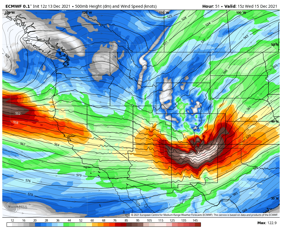
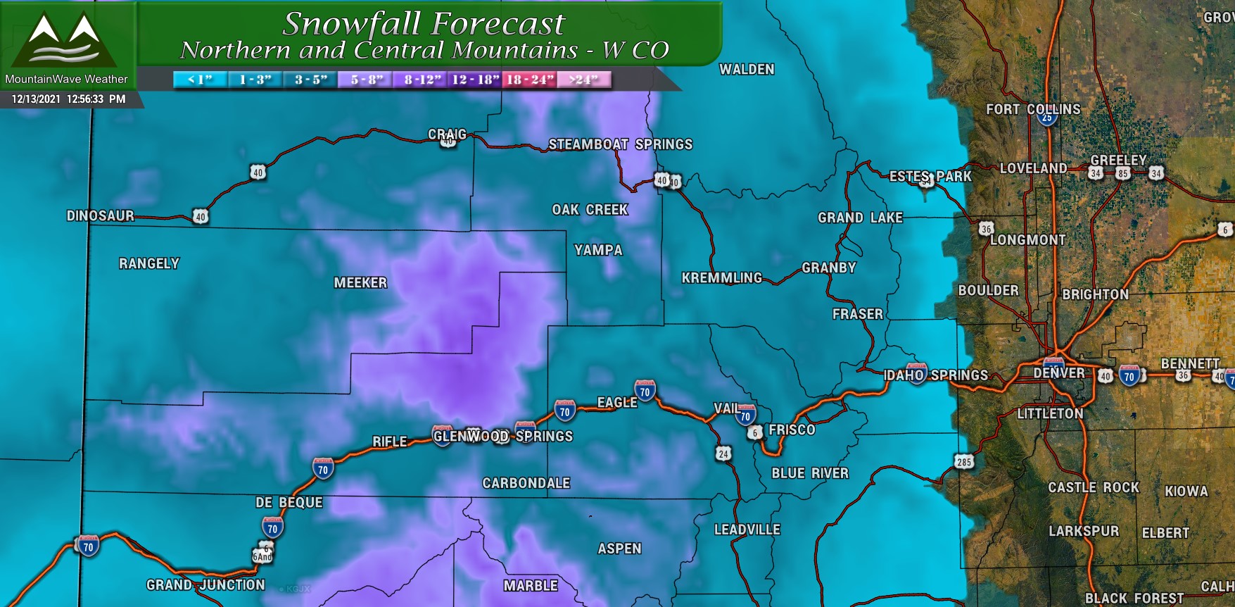
The Euro shown below for 500mb winds (mid and upper level) shows an open trough moving through Colorado on Wednesday. This storm is fairly quick moving so it won’t linger, but its positioning means the mountains will see the bulk of the moisture again for this one. What it will do is throw a ton of wind along the front range, especially in the foothills, elevated areas like the Palmer Divide and Southeastern Colorado.
Expect a 12 hour window of high winds on Wednesday, with calming conditions by evening.
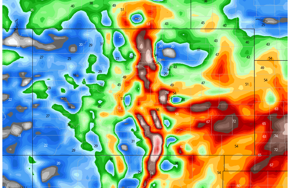
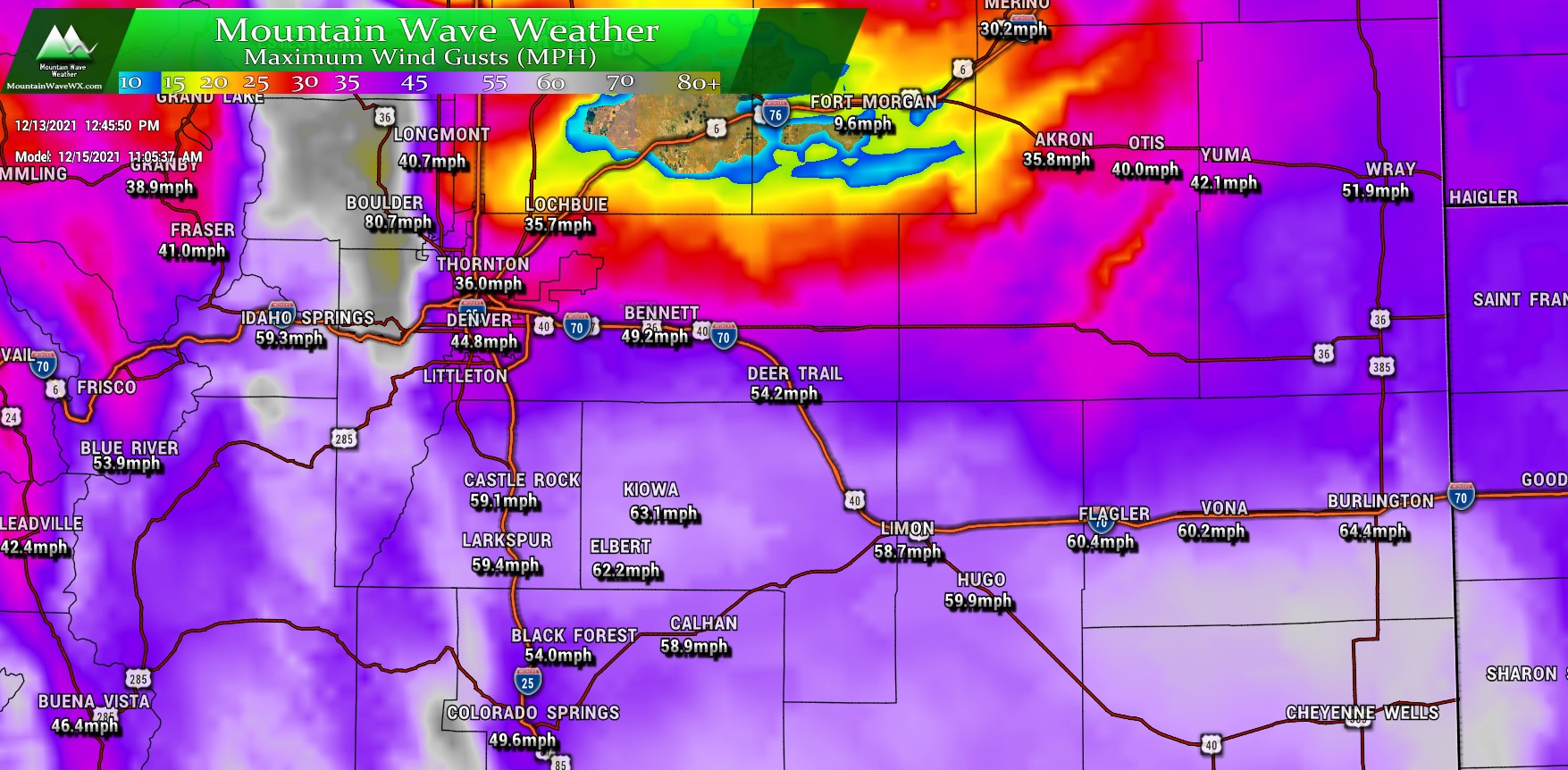
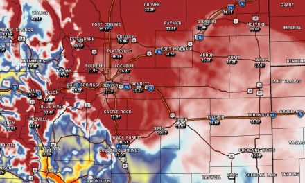
I’ve attached the Nam3K model’s thinking (below) on peak wind gusts around 11AM on Wednesday. You’ll notice the areas with potential for highest wind gusts are the Front Range Foothills, the Palmer Divide and Southern and Southeastern Colorado.
Front Range Foothills: Wind gusts in excess of 80MPH – High confidence of strong winds
Palmer Divide: Wind Gusts between 60-70MPH – Medium confidence of strong winds (model disagreement)
Southern and Southeastern Colorado: Wind Gusts in excess of 70MPH – High confidence of strong winds
**Many of these wind gusts equal Category 1 Hurricane Strength**
Our concern here is that there will be a long duration of strong winds, prime time is between 5AM and 5PM Wedneseday.
High Wind Event Messaging
These notes are for you if you live along the Front Range Foothills, Palmer Divide or Southern or Southeastern Colorado
Be prepared for a long duration of strong and damaging wind.
Timing: 5AM – 5PM Wednesday December 15, 2021
Impacts:
Strong winds could create difficult travel
- Strong crosswinds could effect lightweight and high profile vehicles
- Blowing dust could reduce visibility
Strong winds could cause damage
- Power outages are possible
- Lightweight or prone items could be picked up and tossed about
High Fire Danger
- Low humidity and strong winds could contribute to extreme fire behavior
- Any fires that start will likely grow rapidly out of control
Preparedness:
- Tie down any items that could blow away
- Be prepared for difficult driving conditions
- Be prepared for possible power outages
Ag and Ranchers: have all preparations for property and livestock completed by Tuesday evening!
Summary
Not a lot of moisture expected for the front range this week, but the mountains should receive a bit more snow, probably the heaviest in the areas that saw snow this past weekend. Front range mountains may not do so well…
In terms of our high winds down here. We will keep watching the storm; we should have another larger update on the website on Tuesday and Wednesday. Any quick updates or changes in weather alerts will be posted on Facebook and Twitter.
Stay tuned!
