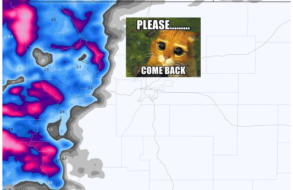
Here’s the latest storm update as of this morning/afternoon’s data. The main energy of the storm is arriving to the North of Colorado and pushing moisture into the mountains. Expect conditions to deteriorate further up there for the rest of today and most of the day tomorrow. Closer to home, this storm is looking more and more like a non-event for us unfortunately. Many major models are now showing little to no snowfall accumulation for the Front Range.
As such, this will be the last major update for this storm: I’ll have little tweaks and information as needed on Facebook and will have a recap of snow totals some time on Saturday.
Weather Alerts
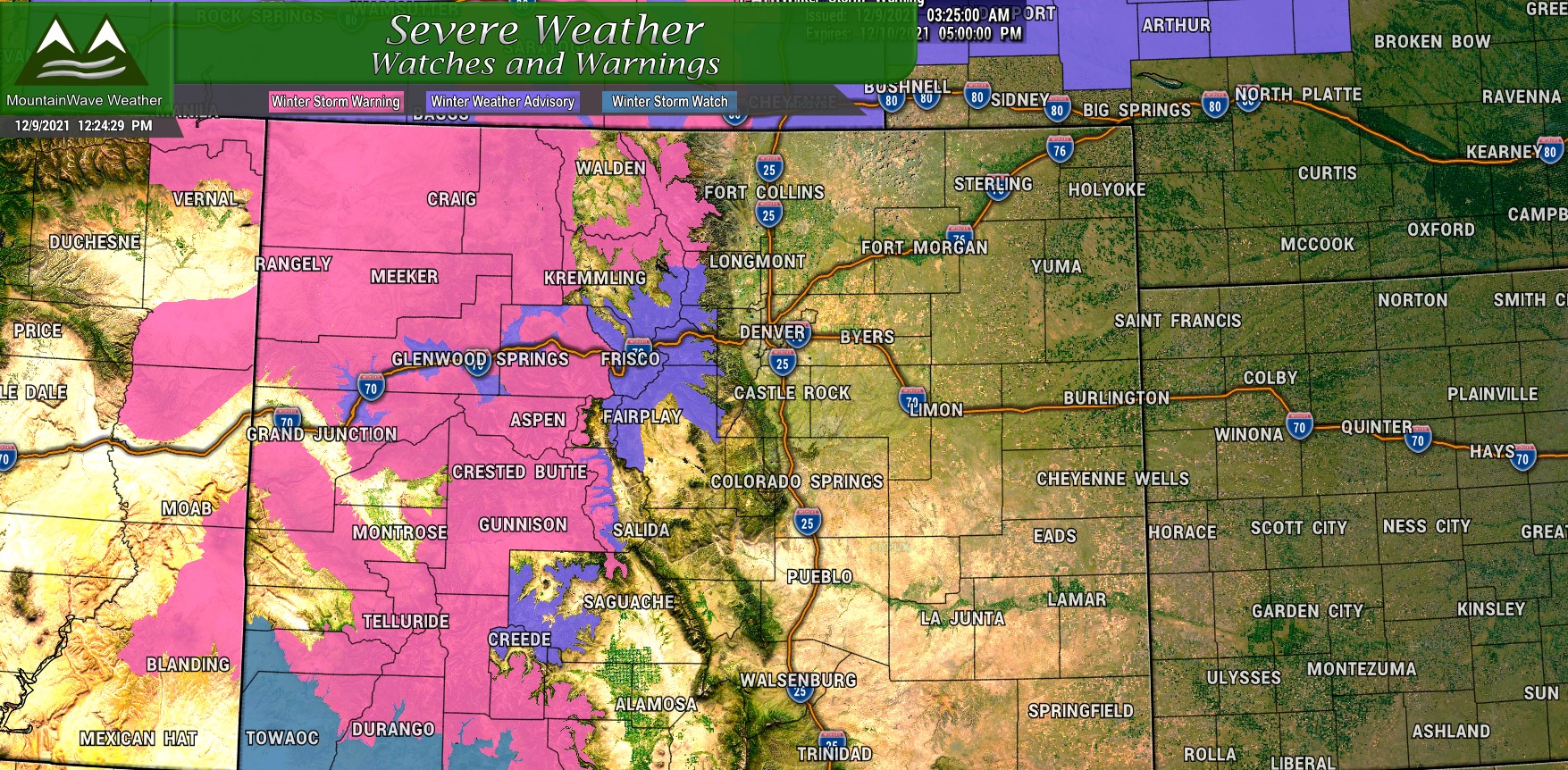
Winter Storm Warnings and Winter Weather Advisories are still in effect for the high country through 5PM tomorrow. Be prepared for difficult to impossible travel conditions.
The Finer Details: Timing, Impacts, etc…
Mountains
Timing: Snow showers ongoing in the mountains. Transitions to heavier snow after 2PM. Heavy snow continues through 3PM Friday, snow showers will lighten up after 5PM Friday with scattered snow continuing for some areas through Saturday morning.
Impacts: Roads will be icy and snow packed. Strong winds will reduce visibility. Travel will be very difficult in most areas with a few select areas seeing impossible travel and road closures.
Plains
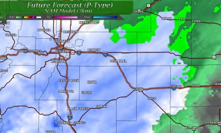
Timing: Snow showers will be very scattered and light in nature. Expect window for any snow to be early Friday morning through Friday afternoon. Due to the scattered nature of snow showers, not all areas will see snow.
Impacts: We are expecting minimal impact to travel across the Palmer Divide, Urban Corridor and Northeastern plains. Gusty winds may temporarily reduce visibility due to blowing dust or snow. Major snowfall accumulation is not expected.
Updated Snowfall Forecasts
Palmer Divide
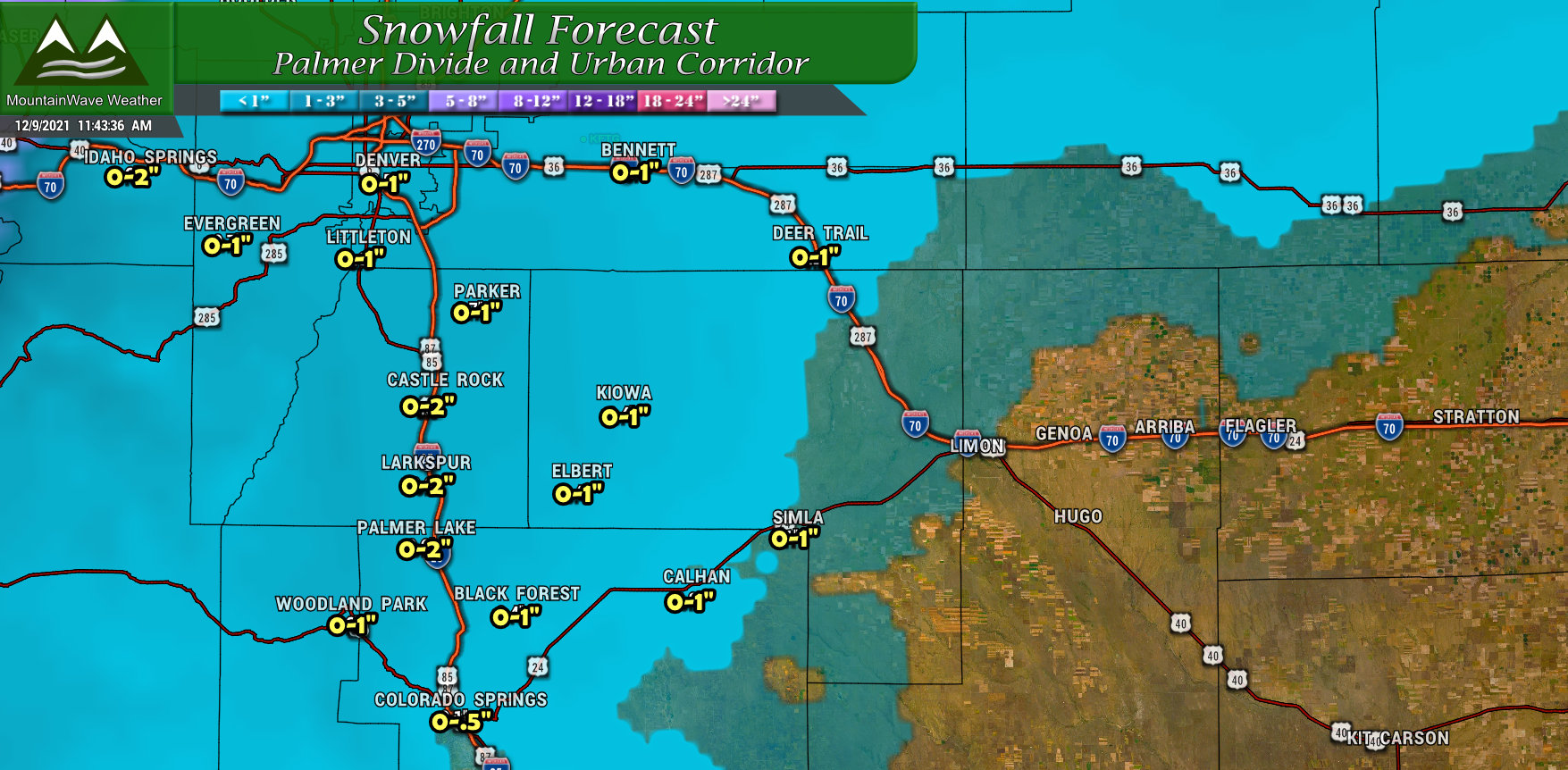
Not many changes here, mainly just dropped snowfall ranges a bit. Left them at 0-2″ along a few favored areas of the Palmer Divide in case we see a bit more sustained upslope and push past that 1 inch mark. It will be quite rare for areas to see over 1 inch though.
Northern Colorado
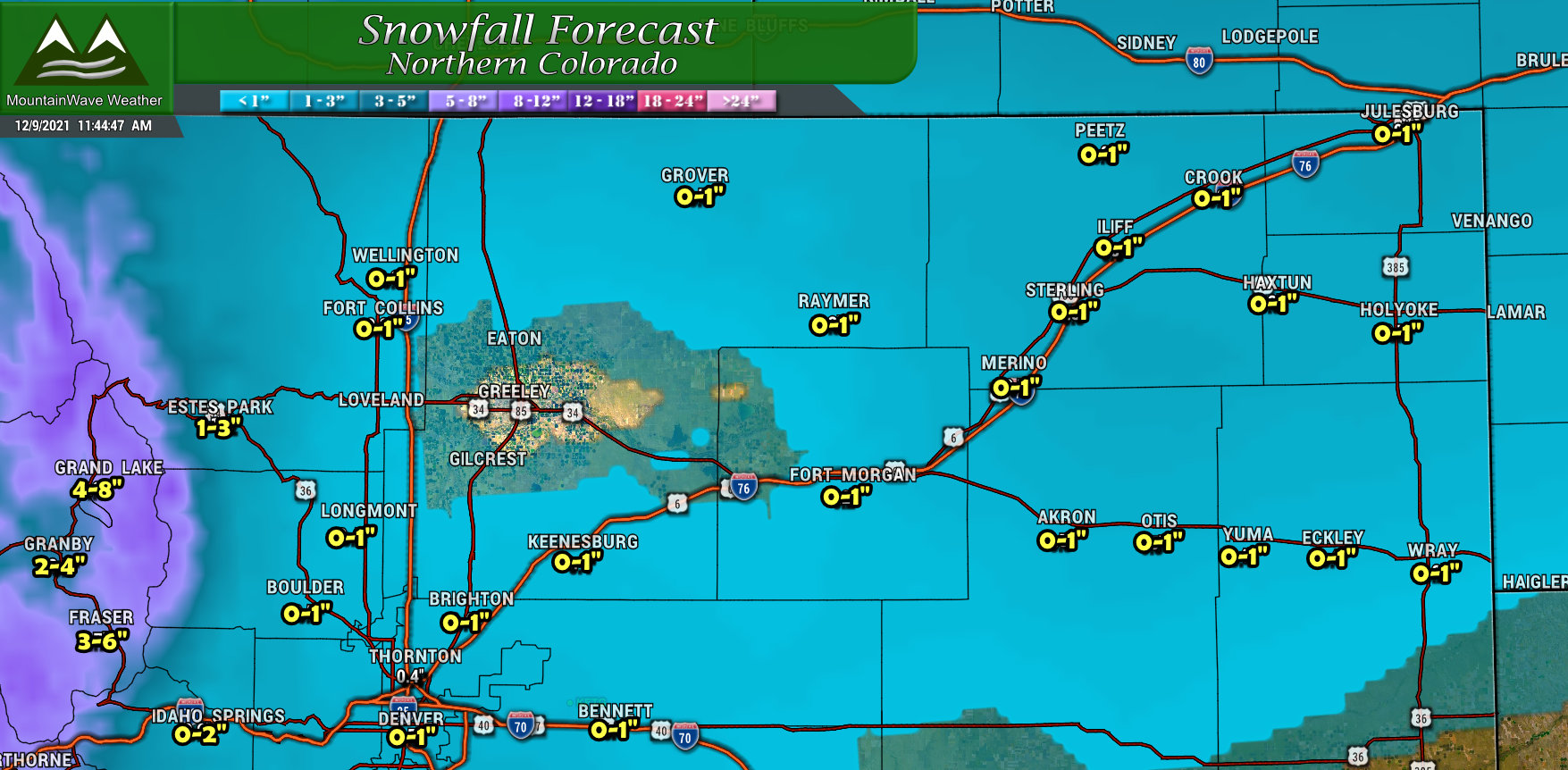
Similar to trends in other areas of Eastern Colorado, snowfall totals have been lowered across Northern Colorado. Many areas will see little to no snow accumulation, those that do – a dusting is probably what you will see at most.
Southern Colorado
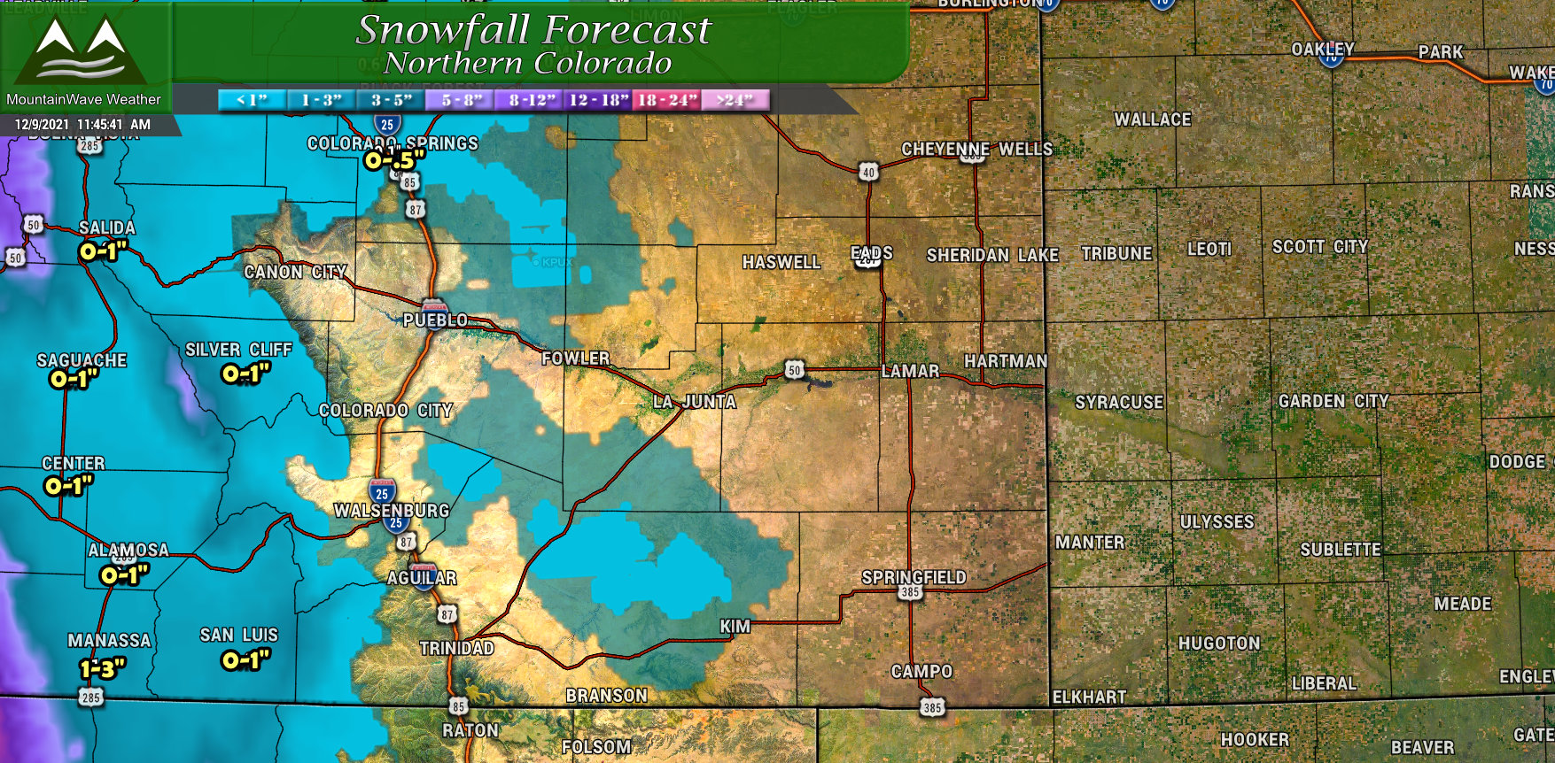
No real changes here, forecast is similar to the past few updates. Minimal snow for Southern and Southeastern Colorado due to the storm track.
Northern/Central Mountains and Western Colorado
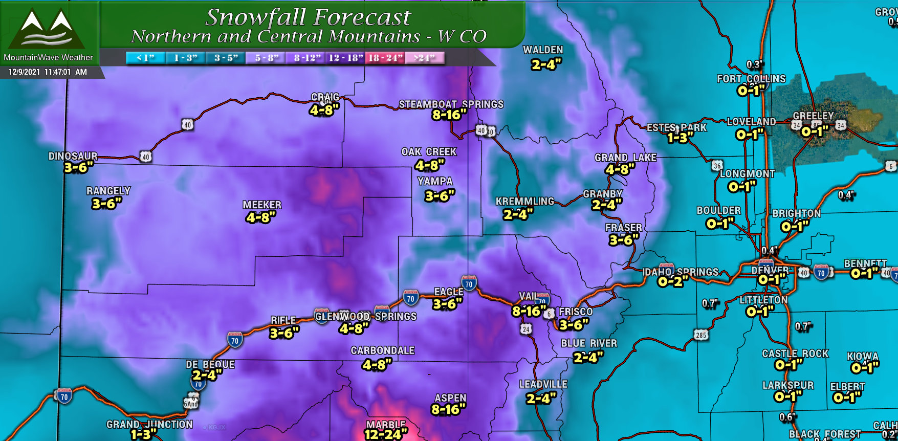
The first thing you may ask is “why do snow totals look lower for the mountains? Did something change?” Nope, this is snowfall predicted from today through tomorrow, many areas saw a few to several inches of snowfall last night, so this updated graphics shows the ranges we expect through tomorrow morning ON TOP of what they already received last night. If you’re looking for a storm total snowfall (including last night into Saturday morning) you can refer to the last forecast:
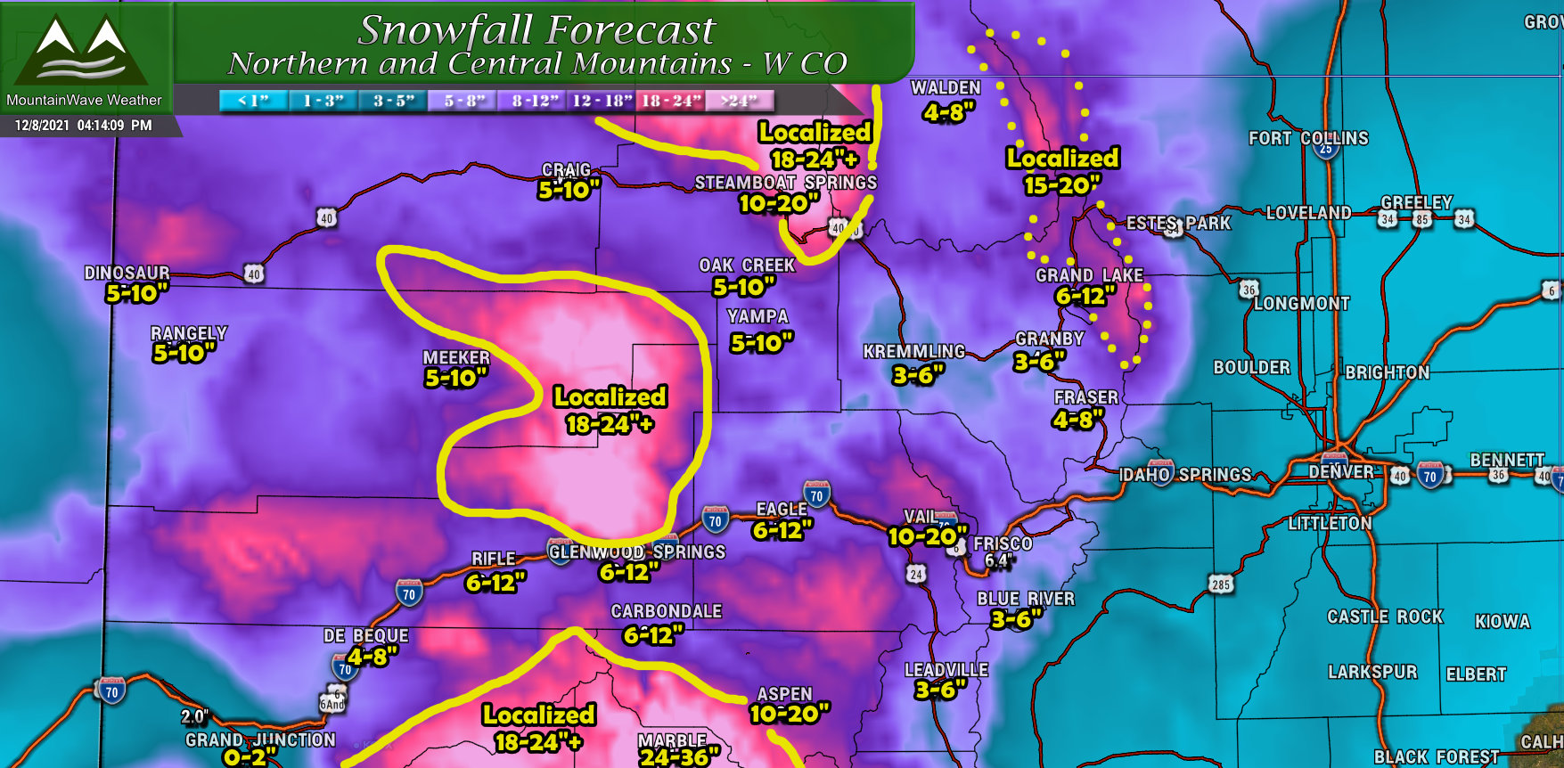
Storm total snowfall expected from 12/8/2021 through 12/10/2021
Final Thoughts
Oh well, we still have a few stretches of unsettled weather coming up so we can all hang on that hope for better chances at snow going ahead.
Still, we will have to keep an eye on each storm, the Northern bias with nearly every snow producing storm this year is something we can’t ignore and unfortunately means we will be fighting the odds for decent snowfall along the front range for quite some time.
