As is typical, we have a rollercoaster of weather in store for this week. We’ll see fire weather, thunderstorms, rain and snow – all in the same week. Isn’t spring in Colorado great?
Here’s the details to get you through the week:
Weather Highlights
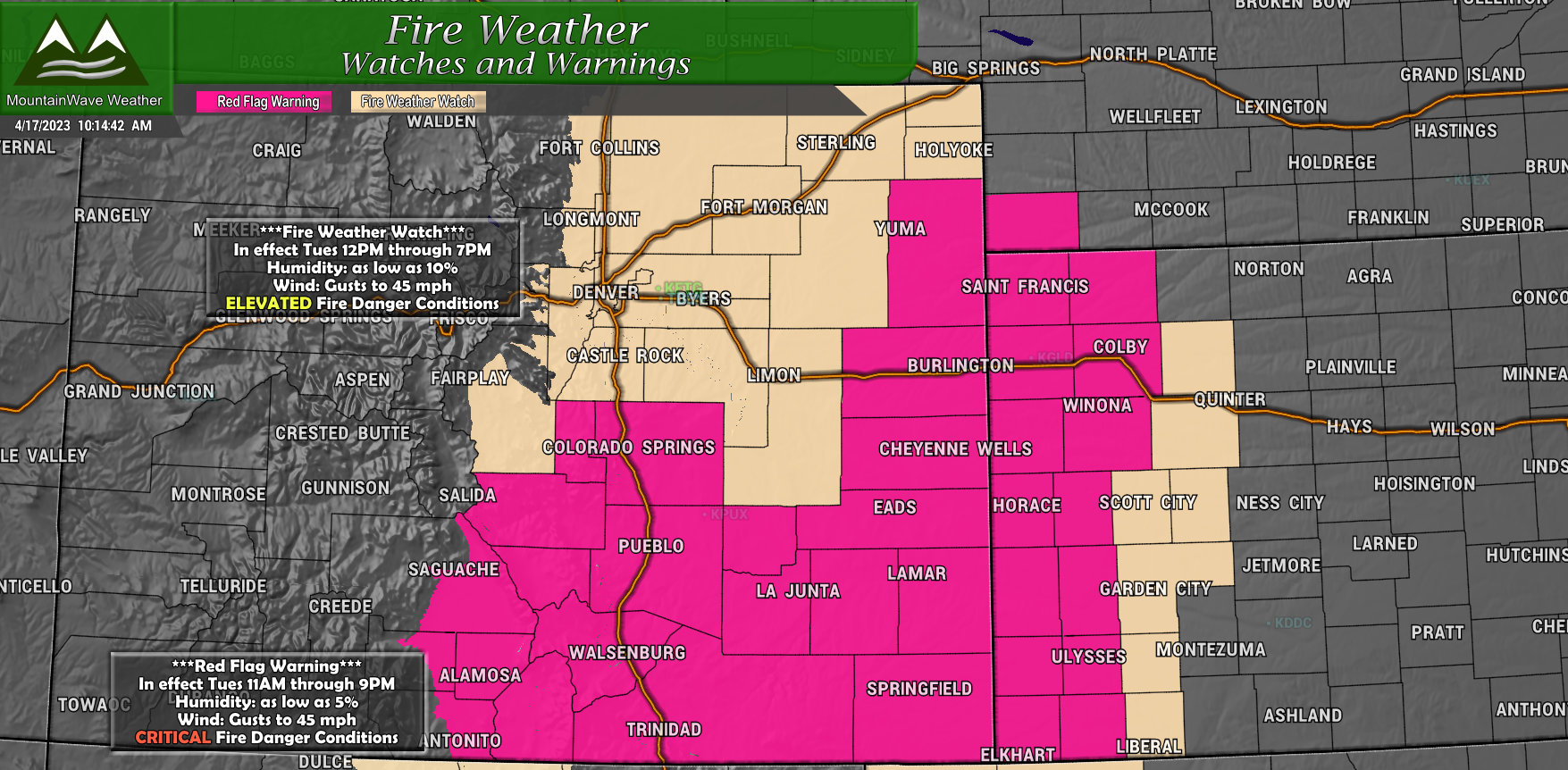
Red Flag Warning
11AM through 9PM Tuesday April 18, 2023
Includes Southern and Southeastern Colorado
Wind gusts to 45mph
Humidity as low as 5%
Critical Fire Weather Conditions – any fire starts will likely grow rapidly out of control. Do not burn, weld, throw cigarettes out the window and call 911 to report fire immediately.
Fire Weather Watch
12PM through 7PM Tuesday April 18, 2023
Includes Northeastern Colorado, Front Range and Palmer Divide
Wind gusts to 45mph
Humidity as low as 10%
Elevated Fire Weather Conditions – any fire starts could grow rapidly out of control. Do not burn, weld, throw cigarettes out the window and call 911 to report fire immediately.
This Week’s Weather Setup
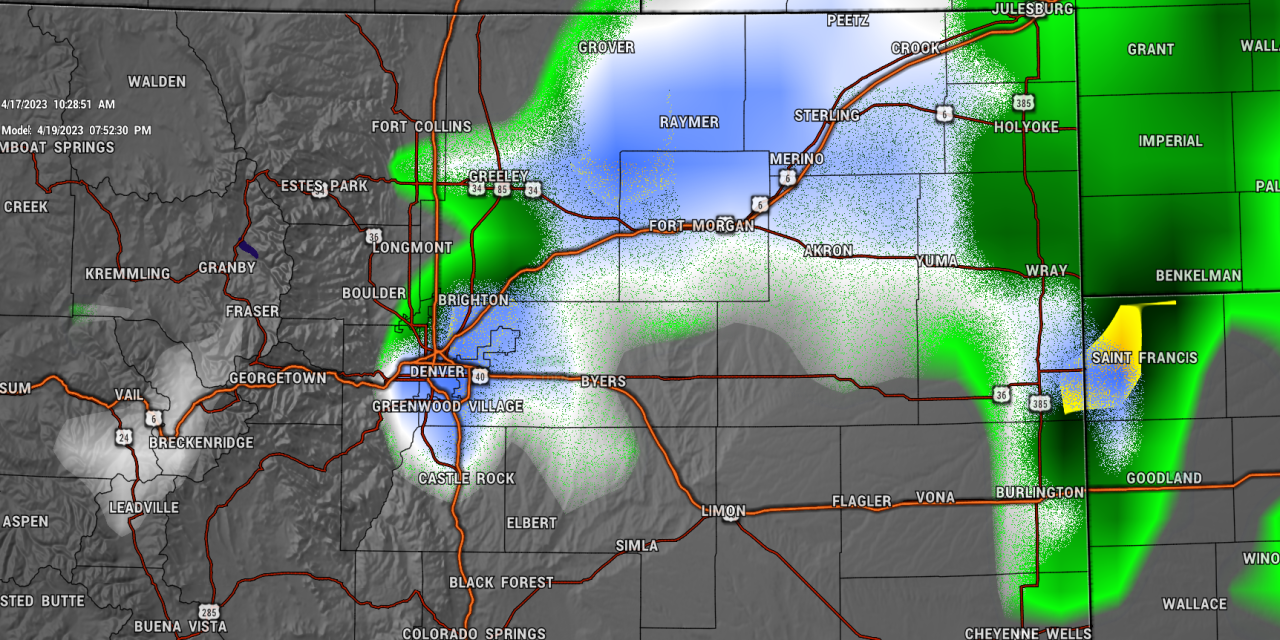
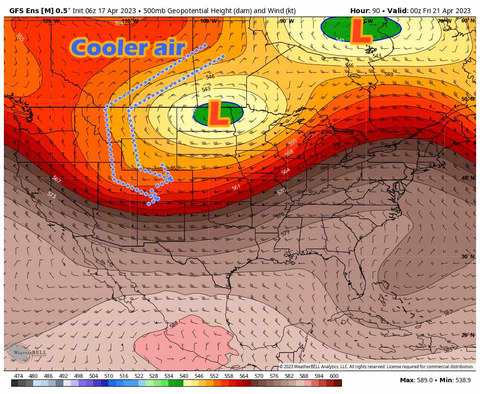
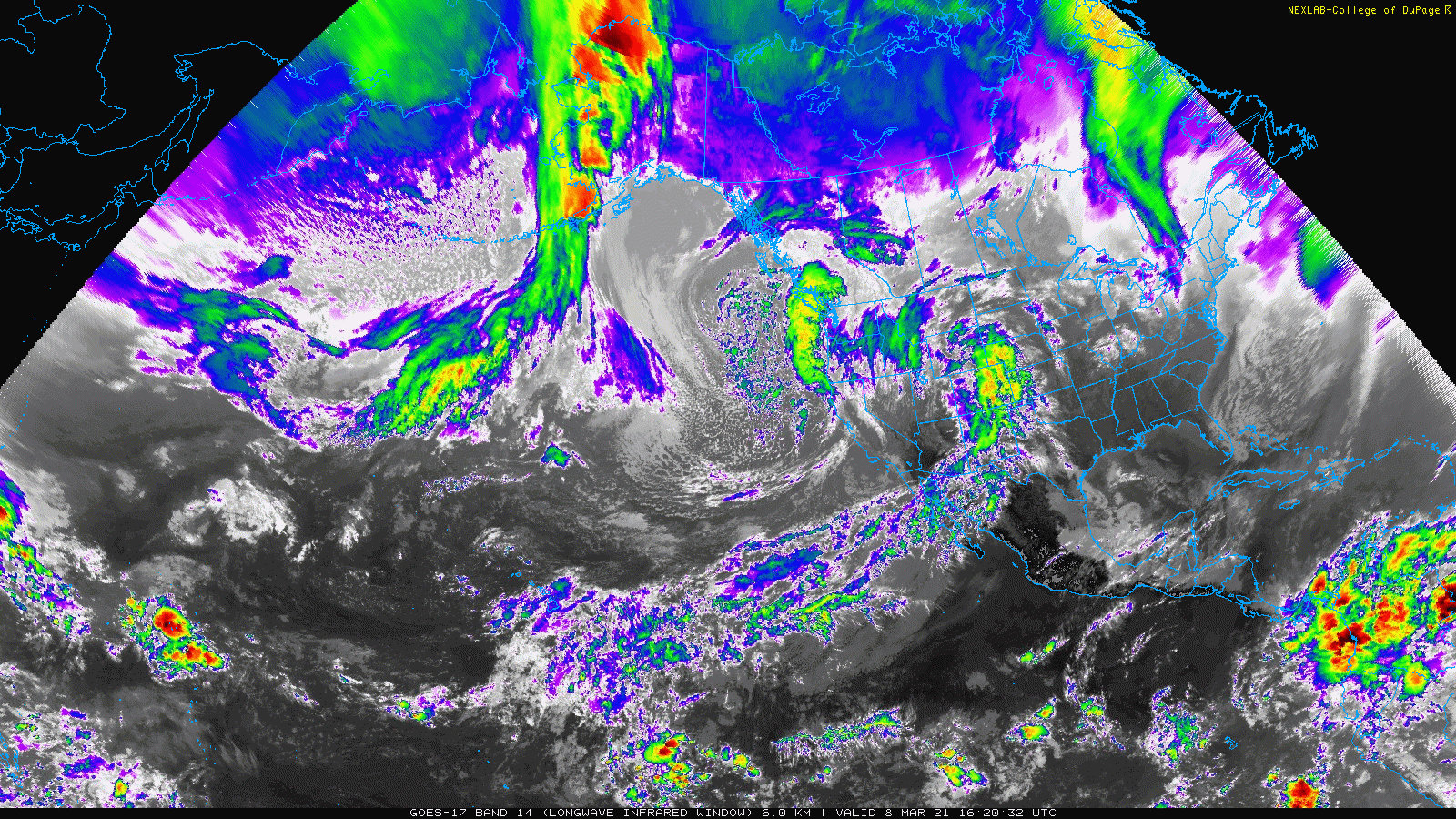
Monday and Tuesday we will remain under ridging aloft – meaning warm and dry conditions until a storm system begins to strengthen to our North by midweek. A strong low pressure system will swing through Wyoming and strengthen into the Dakotas. This storm track is too far North for us to be looking at any major-type storm for our area, but we will see winds on Tuesday and Wednesday along with shots of moisture from late Wednesday through late Friday.
Here’s a quick snapshot, followed by the forecast.
This Week’s Forecast
I’ve attached this week’s forecast for Castle Rock and surrounding areas below. As always, add or subtract a few degrees on temperature depending on your location/elevation to get a ballpark number for your location.
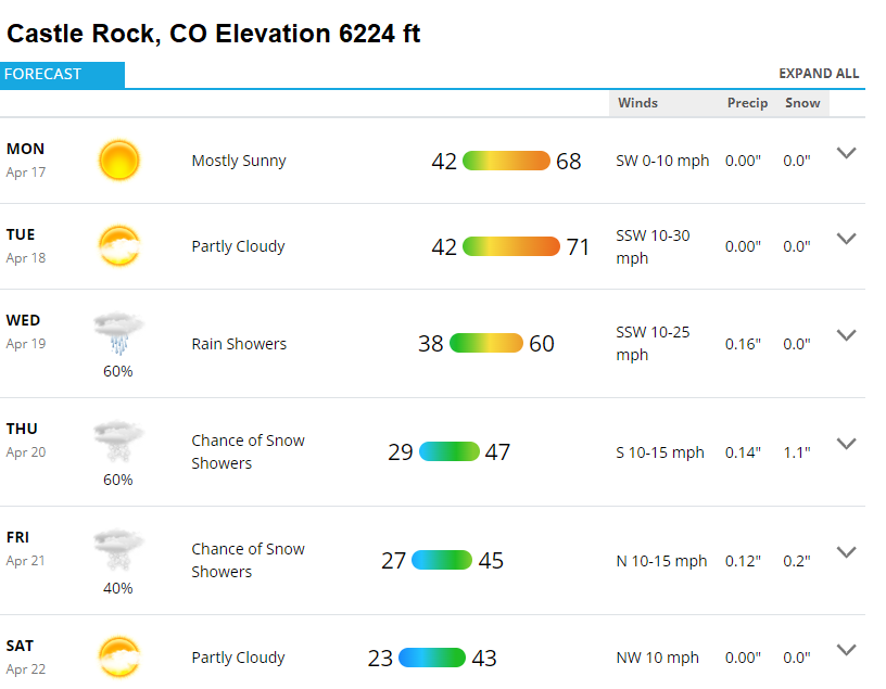
Monday-Tuesday
Monday and Tuesday will be nice with temperatures right around 60 degrees and mostly clear to partly cloudy skies. Monday, the wind looks pretty tame, but we will see winds picking up quite a bit on Tuesday in advance of the next storm system slated to arrive starting on Wednesday.
Wednesday – Friday
The second half of the week looks unsettled. Temperatures will be much cooler and many higher elevation areas will see another shot at snow. This longer duration period of unsettled weather means that snow will possibly accumulate and melt over several days, timing and amounts are still very much up in the air due to the marginal temperatures… but at this time some sort of snow accumulation is looking likely for the Palmer Divide and much of the Front Range.
Hazards to Watch Around the Country
While we’re not quite in full summer break/travel season yet, I find the graphic below useful when planning what types of weather impacts you may deal with if you’re heading anywhere across the country in the next week.
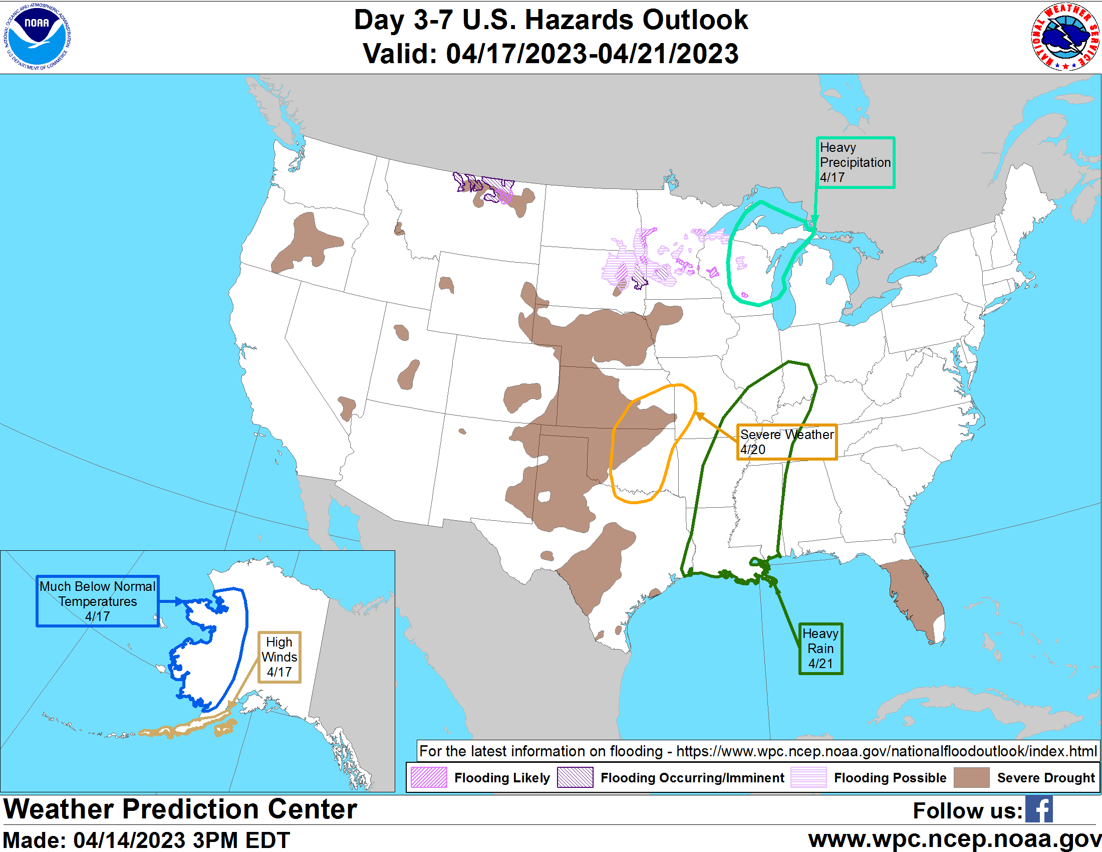
The weather highlighted above and the area and date expected are shown:
Severe Weather
Kansas, Missouri, Oklahoma, Texas – April 20, 2023
Heavy Rain
Louisiana, Arkansas, Mississippi, Tennessee, Kentucky, Illinois, Ohio – April 21, 2023
Heavy Freezing Precipitation – Ice/Snow
Montana, North Dakota, South Dakota, Minnesota, Wisconsin – April 17, 2023
Severe Drought
Colorado, Nebraska, Kansas, Oklahoma, Texas, Florida, Wyoming, Iowa – Ongoing
Blowing dust/fire weather/visibility could impact travel
Wrap-Up
That’s it, stay tuned for details on snow/impacts/timing for the mid to late week storm. I’ll make sure to keep you updated!
