Summer continues in Colorado this week as our warm temperatures and mainly dry conditions look to continue. One thing to keep an eye on is the exceptionally warm temperatures that will be found on the plains this week; a decent amount of areas may be around or above 100 degrees as we get into the middle of the week.
Strong High Pressure Continues
The 500mb height anomalies from the Euro are shown below as a way to get a good idea on what’s going on in the atmosphere this week. You don’t need to know the super science-y specifics with this product other than oranges and red are pressure above to well above normal and generally means warm and dry weather. The blues and greens are lower than normal pressure and can give an idea where the storm track is and what areas are more likely to see cooler or more unsettled conditions.
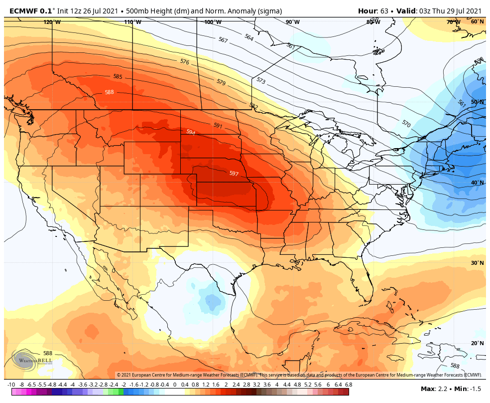 You’ll notice the strong high pressure ridge has slid to the East a bit from last week but high pressure still dominates the Western United States for most of this week. This means much of the Western U.S. will continue to experience hot and dry conditions… those areas in the Dakotas, Nebraska and parts of Wyoming and Montana may see record breaking heat. For Colorado, this doesn’t necessarily mean we will be high and dry, due to the positioning of the high and a low pressure system (if you can call it that) over Mexico we may see monsoon moisture sneak in to the state. I’d put my bets on some of the mountain areas picking up that moisture instead of the plains but we will have to see.
Rain in the Forecast?
Models are showing some chances at rain over the next 7 days, but I’m not sure how excited I am about those prospects yet. The high pressure system should be far enough out that we could sneak some thunderstorms in here and there but I remain skeptical about any widespread chances for rain East of the Divide. Like I mentioned above, I believe that the mountains and areas Northwards into Wyoming have a better shot over the next week of meaningful amounts of rain. That being said, things still look spotty in the Colorado mountains.
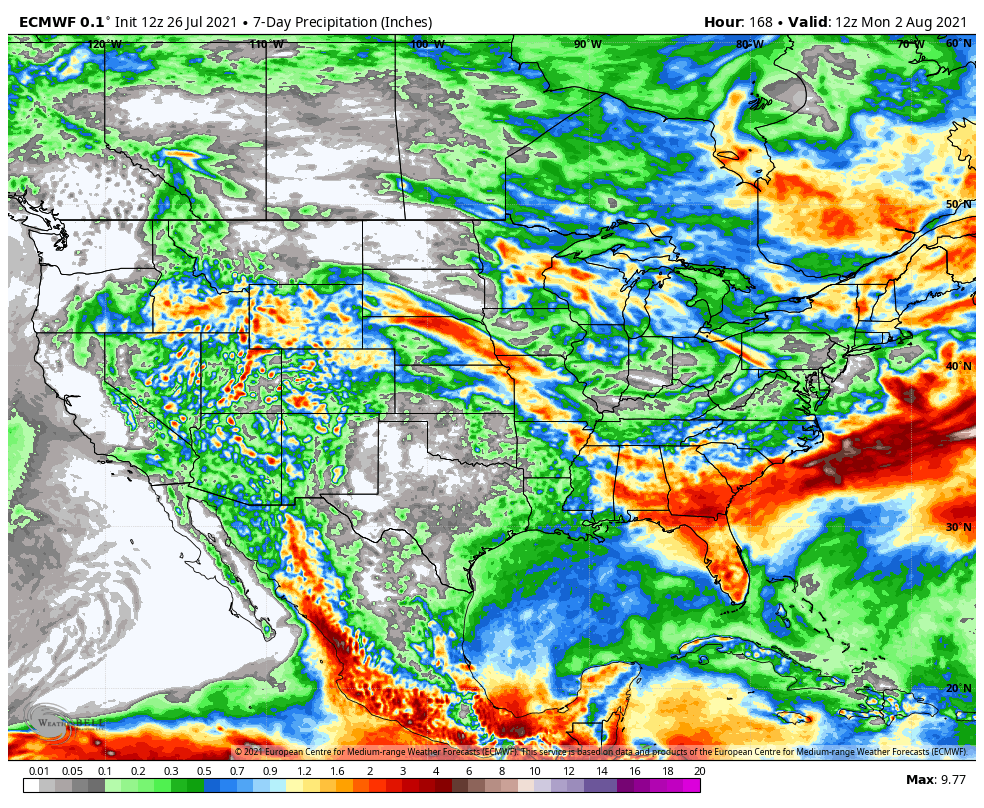
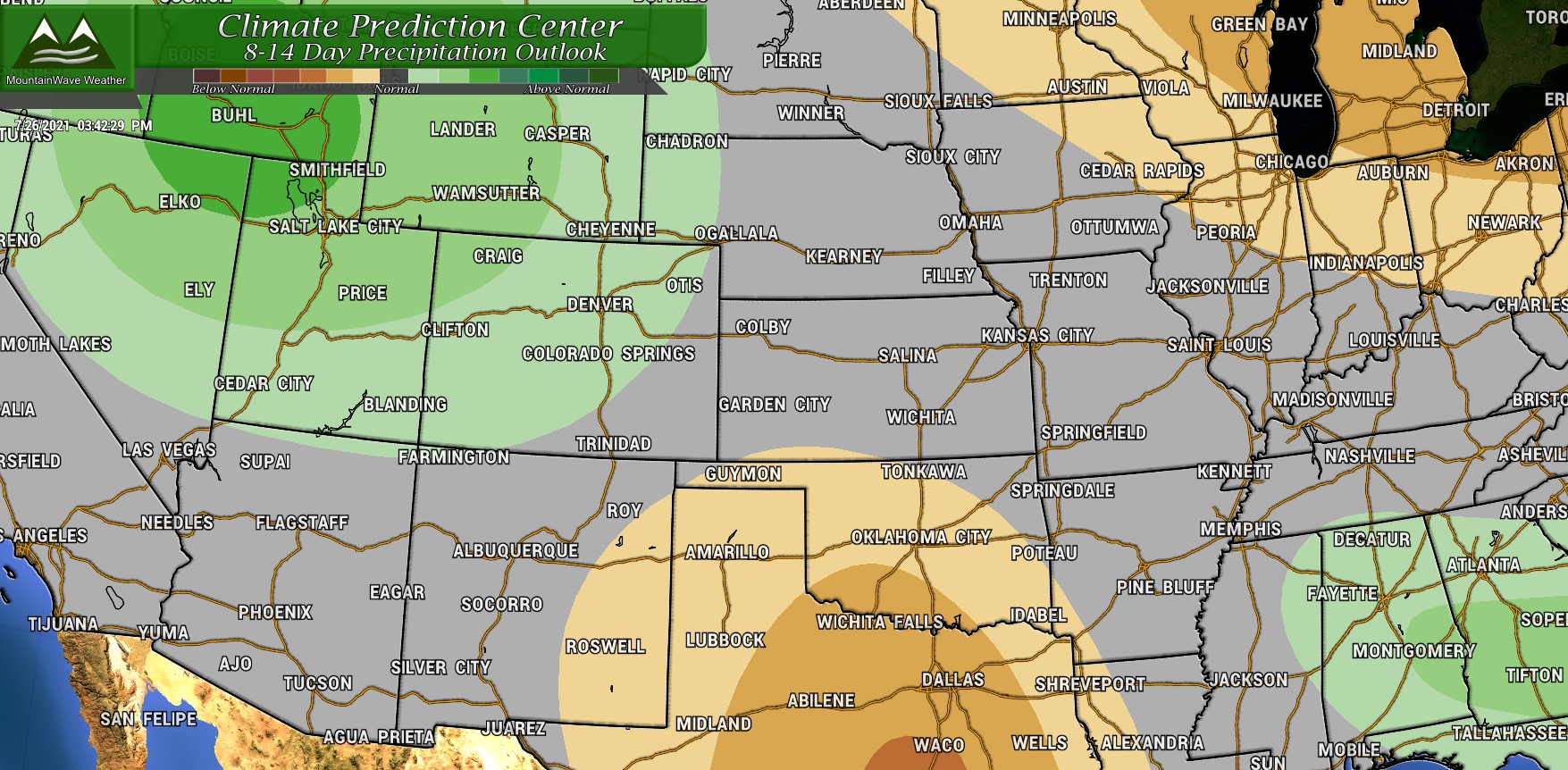
The CPC has some areas of the West highlighted for better chances of above average precipitation… Colorado for the most part is very much on the border line meaning there is not great confidence in rain chances over a widespread area. Monsoon flow will still bring hit and miss showers to the high country – so expect travel issues around the burn scars and highways to close if they experience any mudslide activity.
Turn Up the Heat!
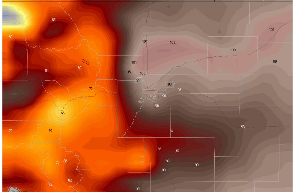
I’ve attached the Euro’s thoughts on high temperatures for the next 7 days or so… the location is Centennial Airport so as always, add or subtract a couple of degrees depending on your elevation. Temperatures look quite toasty through the week, pay special attention to heat on Wednesday… a lot of models have many areas in Eastern Colorado hitting 100 degrees so it’ll be warm!
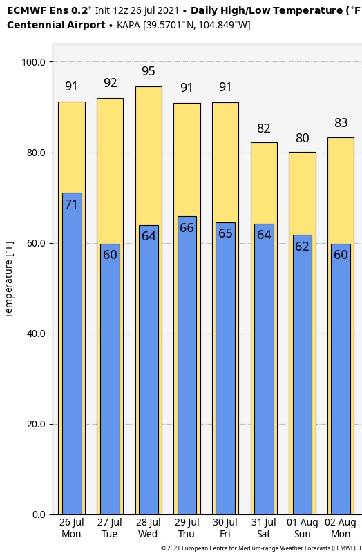 You may be asking what about that cooldown going into next weekend… something to definitely keep an eye on but, as you know with these models 7+ days out is a pretty far stretch to say that is what will happen with any degree of accuracy.
That being said, there is quite a bit of model agreement on cooler conditions to start off August. We’ll keep a close eye on that and pass along any updates.
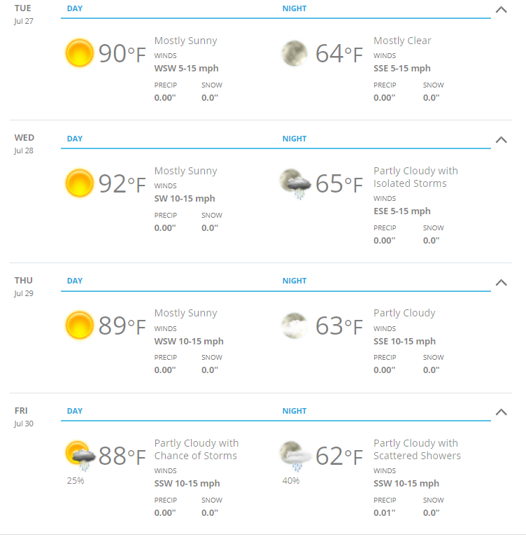
Here’s a quick look at the Castle Rock specific forecast for the week for planning purposes:
Another “broken record” forecast for this week… as we enter the late days of summer this isn’t to be unexpected. I’ll keep an eye on things and hopefully we have something a bit more fun in our forecast next week 😉 Stay tuned!
