Winter Weather Highlights
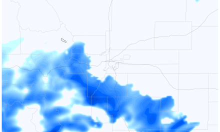
No change as of this morning. The Winter Weather Advisory issued for the front range and Palmer Divide begins Thursday night at 6PM, last all day Friday until midnight. 3-6 inches of accumulation is what they call for in most areas shaded in the advisory area (purple) Again, there is still a lot of uncertainty for specific areas so that’s something to consider.
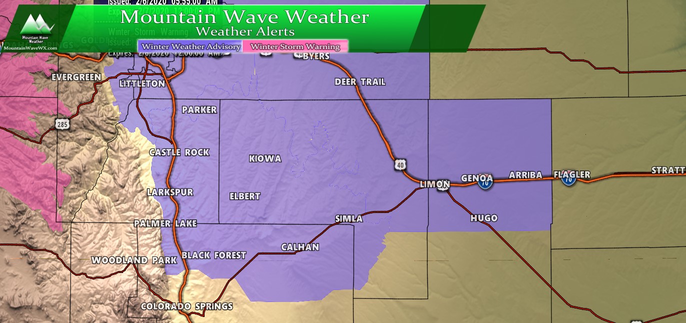
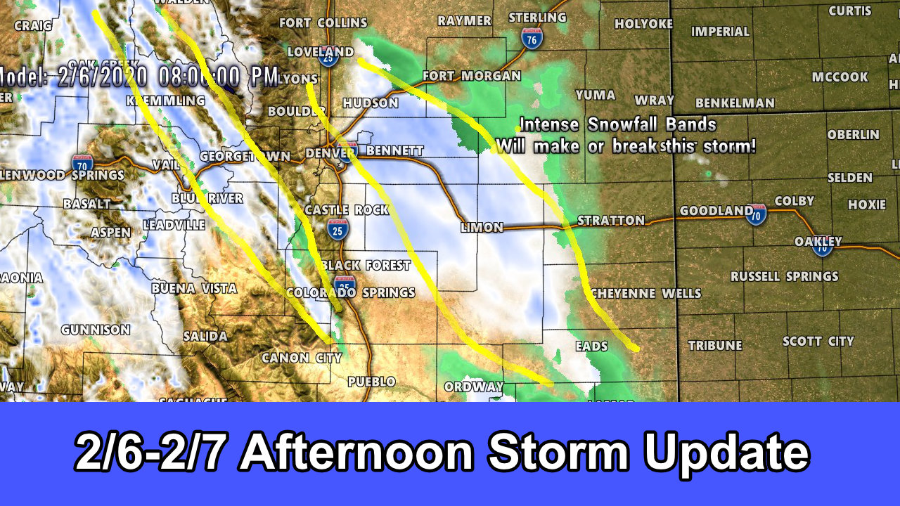
Palmer Divide winter weather highlights as of 1PM 2/6/2020
Remember, a Winter Weather Advisory is issued for conditions that will make travel difficult in some areas. It is not considered as severe as a Winter Storm Warning, but they both have their own criteria and under certain conditions they can be as serious as the other.
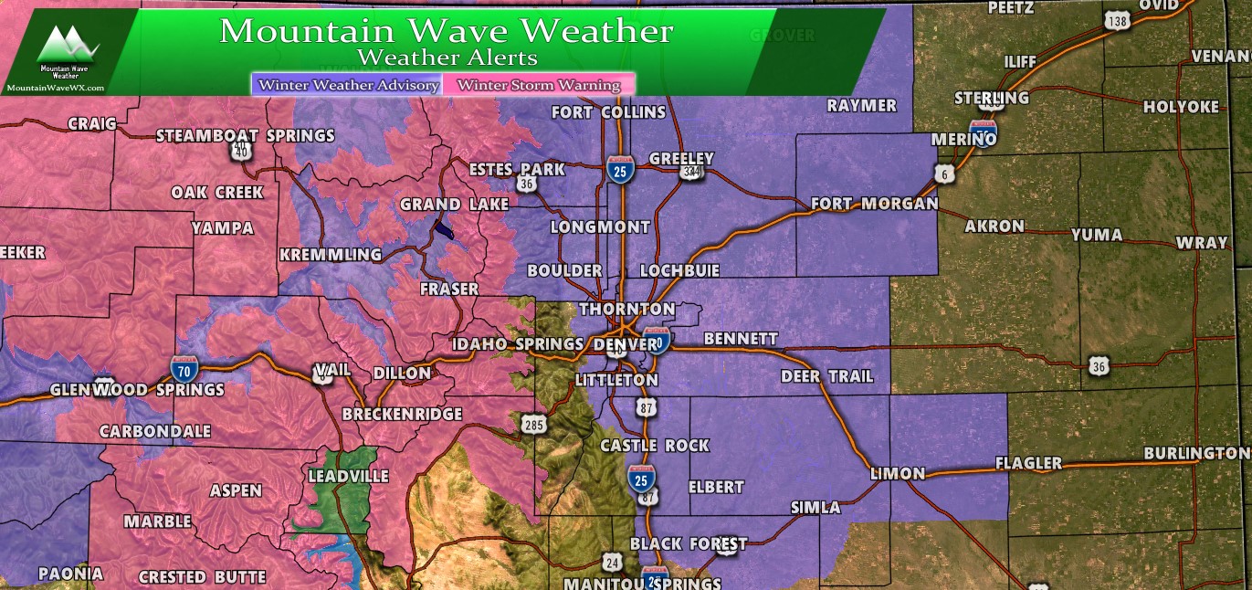
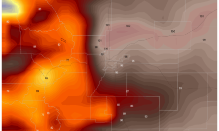
North/Central Colorado Winter Weather highlights as of 1PM 2/6/2020
Your biggest area of concern if you’re travelling today or tomorrow is the mountains. The Winter Storm Warning in those areas is issued for 24-36 inches of snow in some areas. The warning is up because if you become stranded, conditions could be potentially life-threatening between the heavy snow, high avalanche danger and extreme cold (wind chills below -30) Please take that advisory seriously and consider delaying travel unless an emergency. If you must travel be prepared and have winter survival gear in your car and be able to stay put without help for awhile if needed.
Sounds rather alarming; well this is a big snow storm even by Colorado Mountain standards.
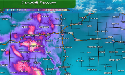
Models: Still No Help
As expected, models continue to bounce things around quite a bit and are somewhat useless. They all show differing soloutions at this point so we cannot rely on them for anything more than a low-medium forecast confidence. Nevertheless; here’s what the latest ones are showing.
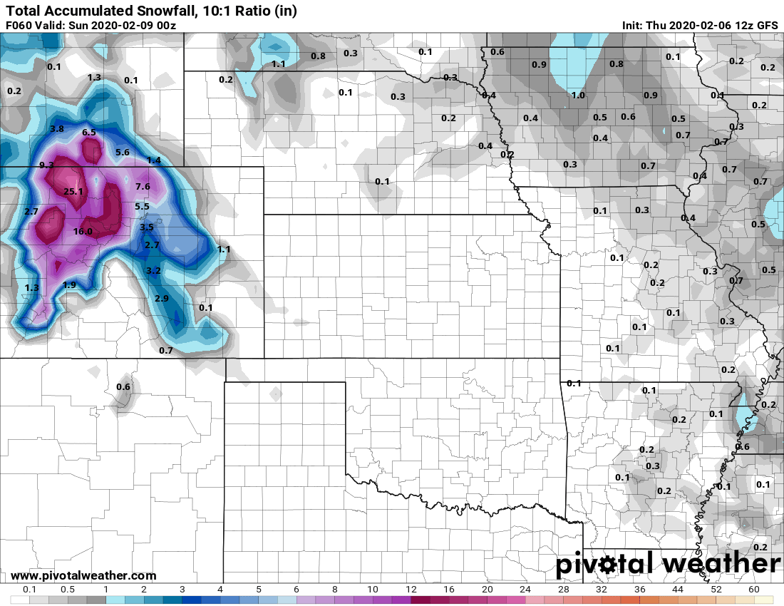
GFS predicted snowfall through Friday PM
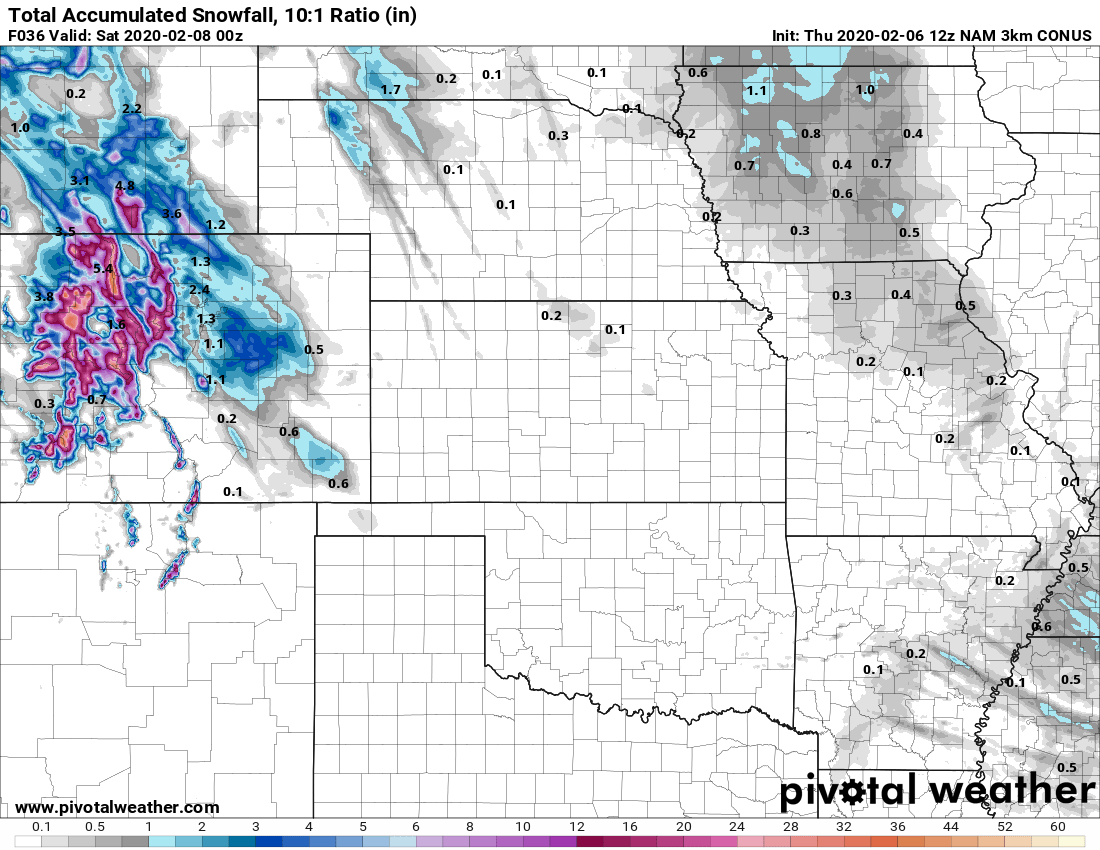
Nam3K predicted snowfall through Friday PM
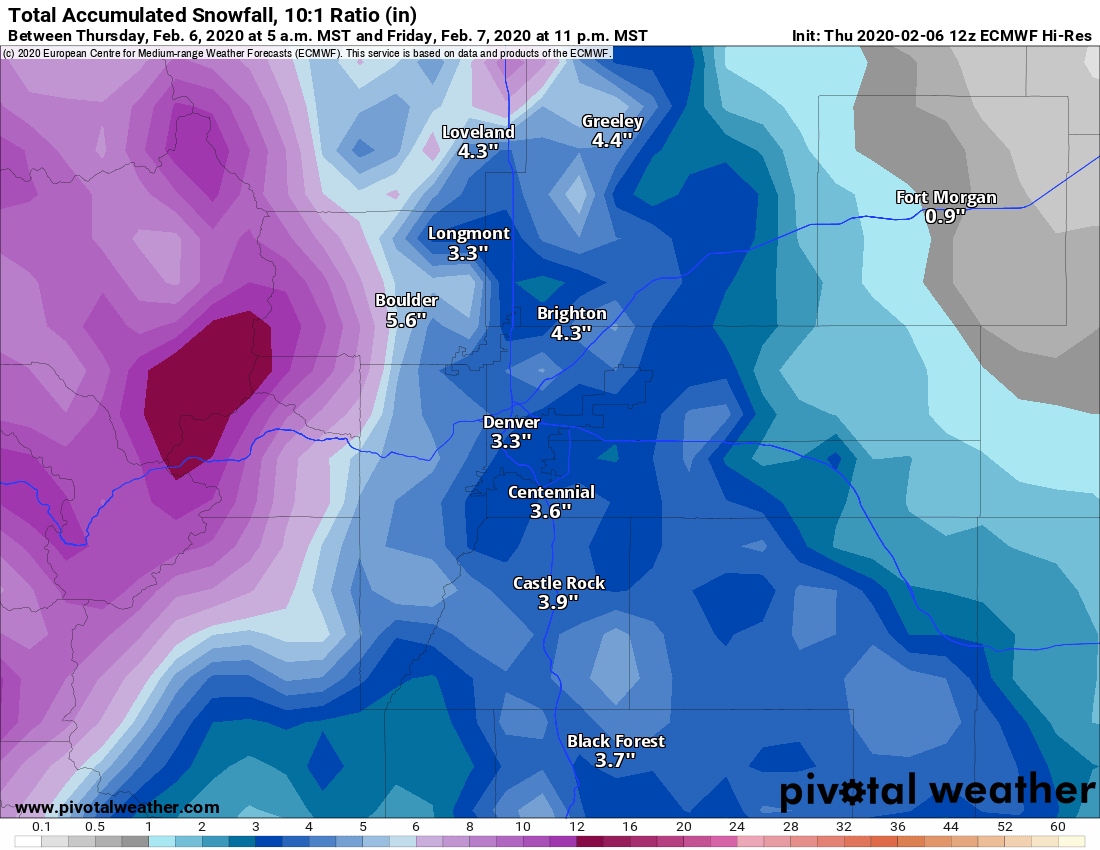
Euro High Res – zoomed in on front range – snowfall through Friday PM
As you can see, not a lot of help. None of these models has been consistent meaning the solutions you see above are very different than the solutions that ran this morning. With all of this madness, we can’t predict this storm very well… frustrating for sure but we do have a few other things to look at that can be helpful in these types of situations.
Probabilistic Forecasts to the Rescue?
Since we can’t get a good idea from the models which areas will see the best snow (or any at all) we can look at something else to help us understand a bit better what the odds of any certain snowfall situation could be.
Below is the chance of an area seeing a certain amount of snow or greater. Notice those are pretty good percentages across the Palmer Divide for 1 or even 2 inches, but drops off pretty drastically over 4 inches.
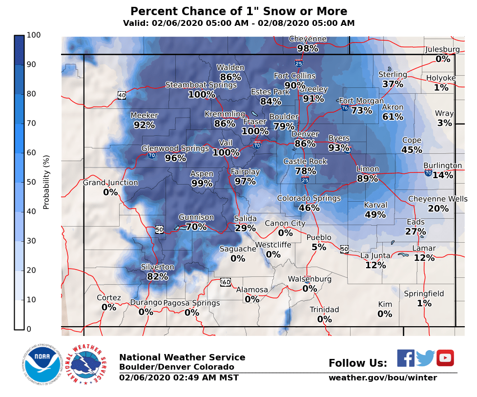
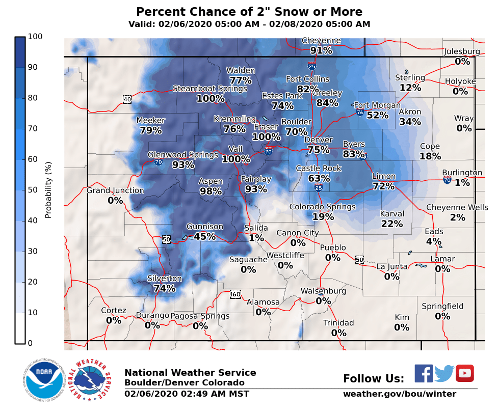
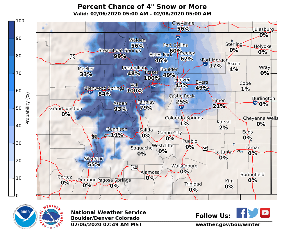 The best way to read these is to understand that lower snowfall amounts are the highest probability solution. Castle Rock for instance has only a 3% chance of seeing 6 inches of snow or greater. That doesn’t mean that it couldn’t happen, it just means that it’s very unlikely. The wildcard here is where the heavy snowfall bands set up, any area under those for a prolonged time will be in the low odds section and will see higher snowfall amounts. Again, we can’t really tell where those are going to be, we can just say to be prepared.
Note: the higher snowfall probabilities in Elbert County… something to watch for!
With that, our snowfall forecast thinking hasn’t changed from this morning, so I’ll repost it. We still have medium/high forecast uncertainty with these numbers as of right now. It’s about all we can do with this storm and the way it’s behaving
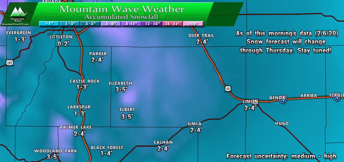
Still valid as of Thursday afternoon 1PM 2/6/2020
Summary
Look for another update this evening if needed. Should snow total forecasts change due to new data or something related I’ll post those here. For now, best to keep an eye out for this one. Main hazards:
- Slick/snowpacked/icy roads under heavier snowfall bands
- Low visibility under heavy snowfall bands
- Strong winds under heavy snowfall bands
And remember, odds are low that you’ll deal with any of that in your specific area unless the snow band sets up over you and parks there for a while. For 90% of the people reading this; the storm won’t be a big deal with little impact.
Stay tuned for further updates!

Can you tell the wind speed and the direction?