A somewhat active weather setup we have this week, but not just because of storms. Drought conditions continue to build across Colorado and with the addition of unusually warm temperatures we are beginning to see significant fire danger establish across the region. Here’s a quick look at all the weather alerts/advisories and severe weather risk areas:
May 19, 2020 Weather Advisories
Fire Danger
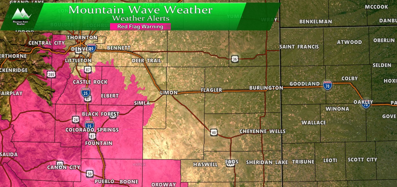
A Red Flag Warning is out for the area from 12PM – 8Pm today for extreme fire danger. Strong winds coupled with high temperatures and very low moisture content in the atmosphere (low relative humidity/ low dewpoints) means fire conditions will be critical throughout the period.
Per the NWS:
Low humidity and breezy winds will lead to critical fire weather
conditions this afternoon across South Park, the southern Front
Range Foothills, and the Palmer Divide. A slight chance of dry
thunderstorms is possible over these same areas which could lead
to fire starts
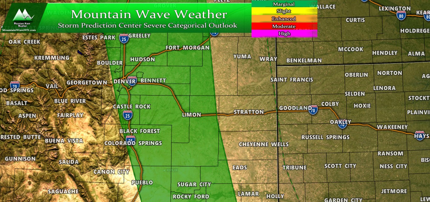
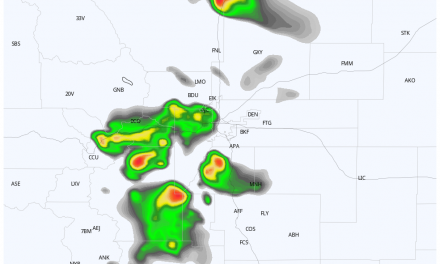
Severe Weather Threat

There is a Marginal Risk today in the SPC Outlook for severe weather. Overall the threat is pretty low, but of the spotty/isolated thunderstorms that are expected across the region this afternoon one or two could become severe. Moisture is obviously pretty lacking at the surface today (see the Red Flag Warning) but there is enough instability in the mid levels of the atmosphere that high based storms could develop. This means the primary threat would be strong winds/micro bursts from collapsing storms but some could have hail as well.
Due to the poor moisture at the surface, the tornado threat is very low but as always we could see weak/landspout tornadoes briefly along the Palmer Divide due to boundary setup and terrain interaction. Any of those that form will be very short lived.
Summary
Not the most exciting thunderstorm day for severe weather, the main threat in the next day or two in the severe weather department will be the Red Flag Warnings issued in the area. A Red Flag Warning will continue on Wednesday May 20 for a lot of the same areas due to dry conditions with above average temperatures. Sadly, if we don’t see sustained precipitation over the coming weeks, we may have a lot of this until the monsoon sets up in late July.
That means we could be seeing a lot of heat and fire activity through the remainder of May and into June/July
