Not a ton of forecast changes for this morning as everything look’s relatively on track. The most important thing we were able to do is tighten up the snowfall forecast and eliminate some of the less likely numbers out of those ranges. Additionally, timing has shifted just slightly but is still largely unchanged from the update posted late last night.
Here’s the latest details including the improved snowfall forecast a bit further down the page (all of this data is valid as of 8AM this morning 3/13/2021)
Winter Weather Highlights
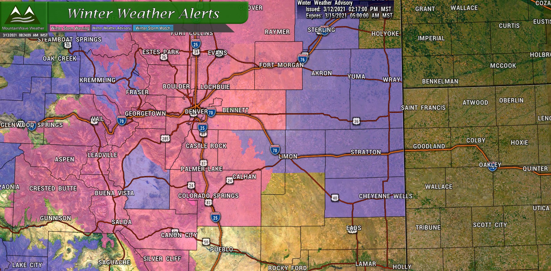
Winter Weather Alerts as of 3/13/21 8AM
.WINTER STORM WARNING REMAINS IN EFFECT UNTIL 6 AM MDT MONDAY…
* WHAT…Heavy snow expected by late this morning and continuing into Sunday. Total snow accumulations of 12 to 24 inches expected, with locally heavier amounts possible near Boulder and Fort Collins. Winds could gust as high as 35 mph.
* WHERE…Fort Collins, Boulder and the western suburbs of Denver, Denver, Castle Rock, and Greeley.
* WHEN…Until 6 AM MDT Monday.
* IMPACTS…Travel could be very difficult to impossible.
* ADDITIONAL DETAILS…Conditions will deteriorate today as the storm arrives, but the most severe conditions will likely hold off until Saturday evening.
If you must travel, keep an extra flashlight, food, and water in your vehicle in case of an emergency. The latest road conditions for Colorado can be obtained by calling 5 1 1 or by going to www.cotrip. org
The messaging from the NWS is not dissimilar to what we’ve been saying for the past 24 hours now, snow will start a bit later in the day Saturday and deteriorrating conditions will be possible. The heavier stuff with higher impacts does not look likely until the evening hours.
Storm Location This Morning
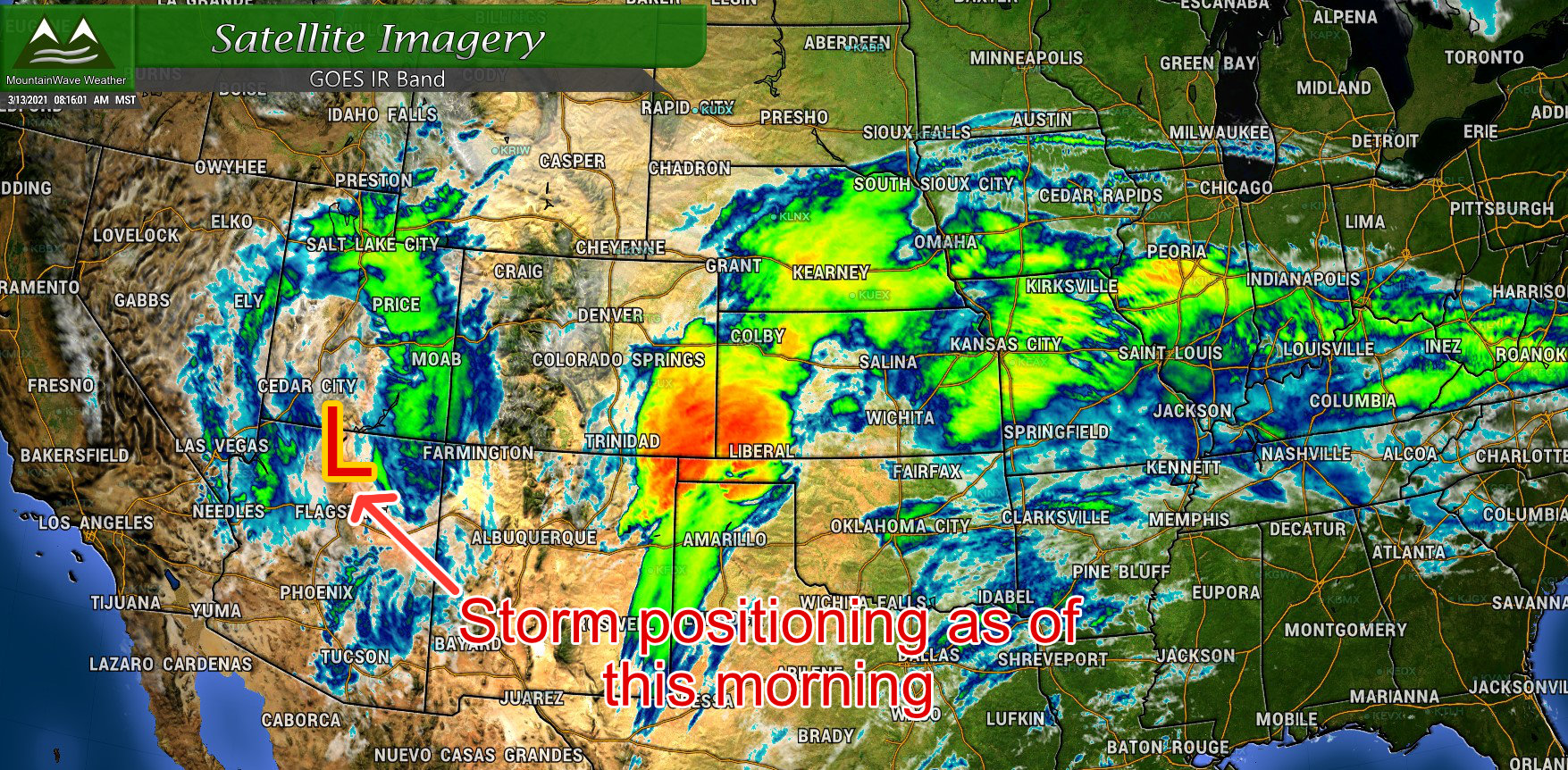
There’s a lot of chatter on social media this morning around “where is the storm?” and “it fell apart, major BUST!” Folks, the storm is not here yet. It continues to slow down and we can see it’s positioning on satellite this morning over Southern Utah/Northern Arizona. We won’t see any of that heavier snow out of this until it crosses the mountains and re-organizes on the plains… upslope will not kick in for us until that happens.
The word of today is PATIENCE
Storm Timing
Not a lot of shift in overall timing, but shifts in when the worst impacts could be were observed in modeling last night.
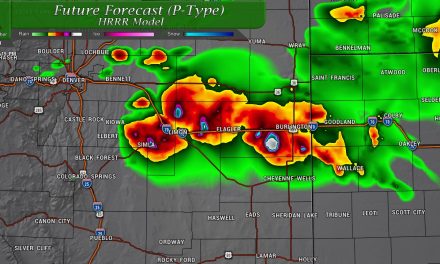
Here’s a look at the HRRR for 9AM this morning… not much going on.
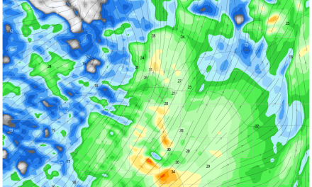
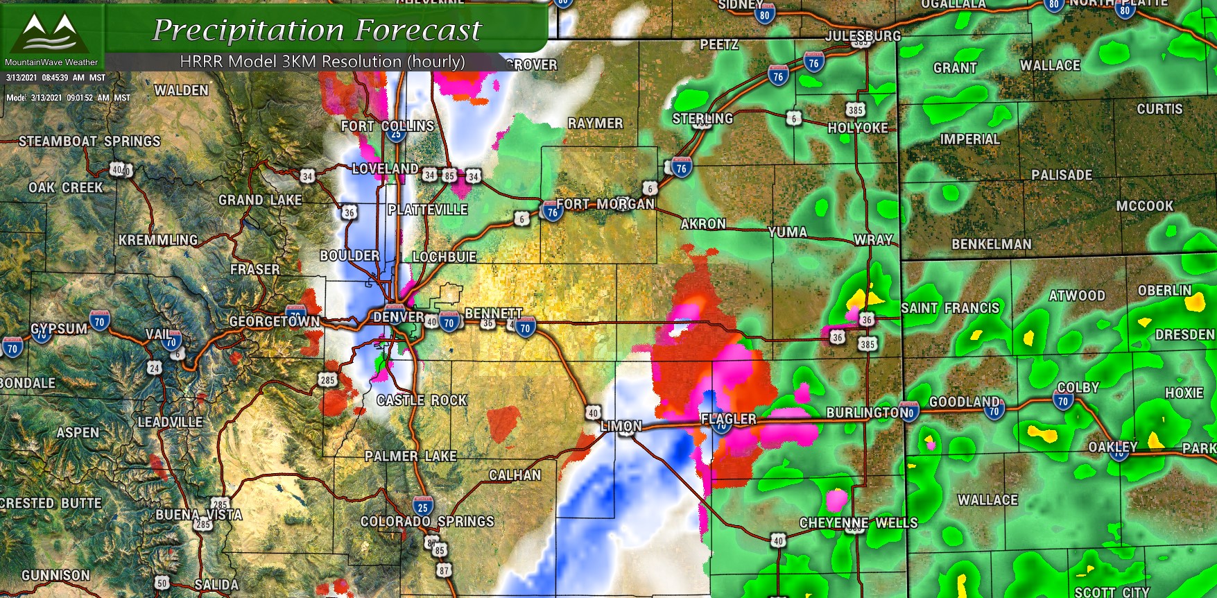 …but look what happens just after lunch time.
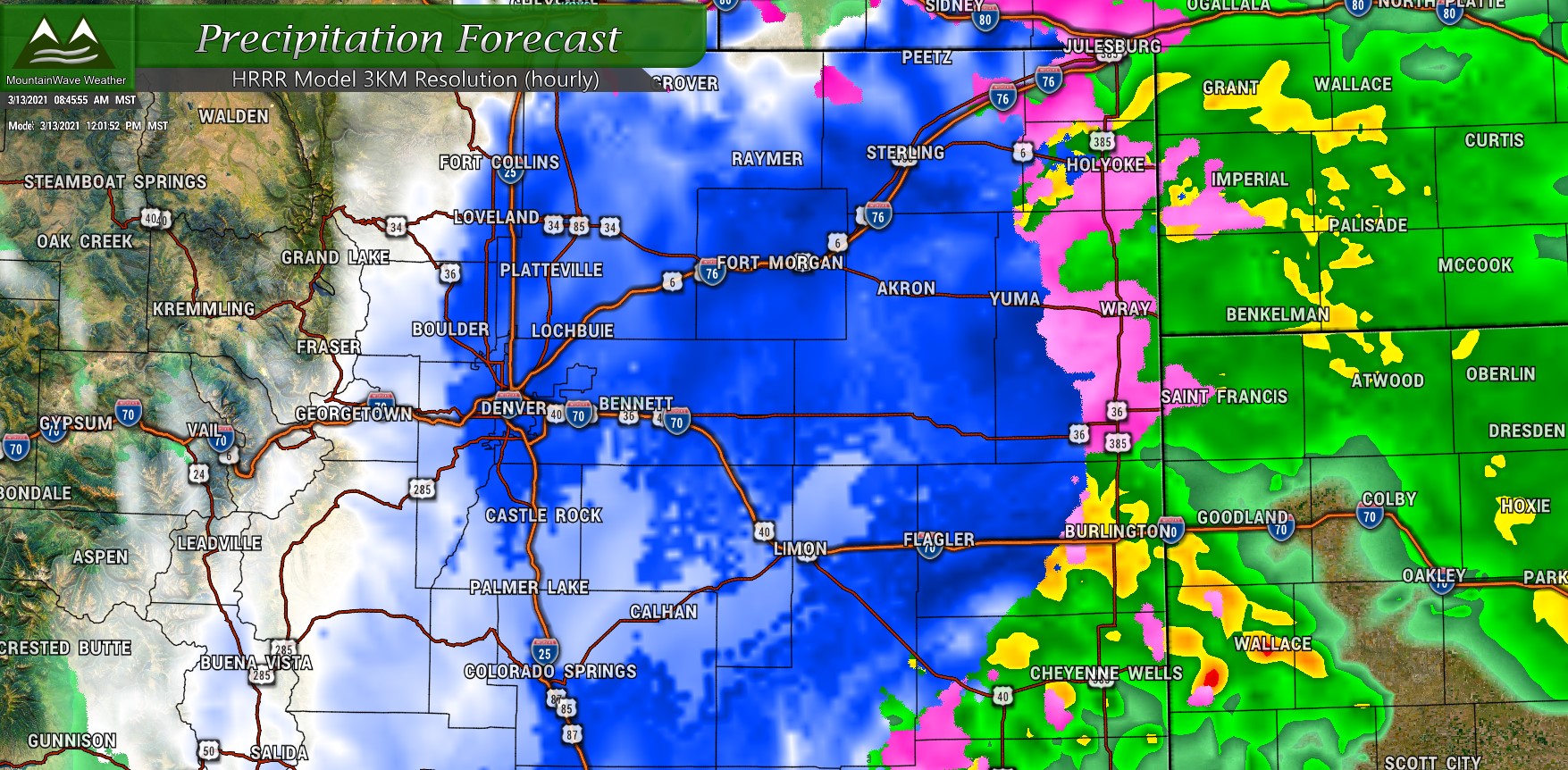
This is the latest run of the HRRR so it’s fairly current. Different models still have slightly different timing overall but things are coming into alignment.
Here’s the latest look at timing of impacts via the National Weather Service
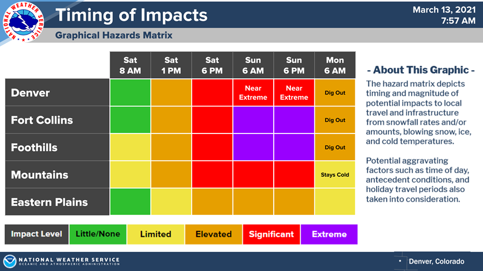
The message here is largely the same if you caught my late update last night: the storm is not here, don’t let your guard down and do any last minute preparations or traveling this morning.
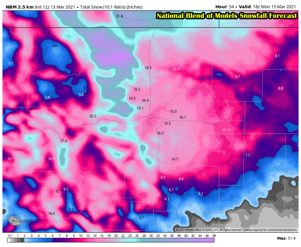
Snowfall Forecast
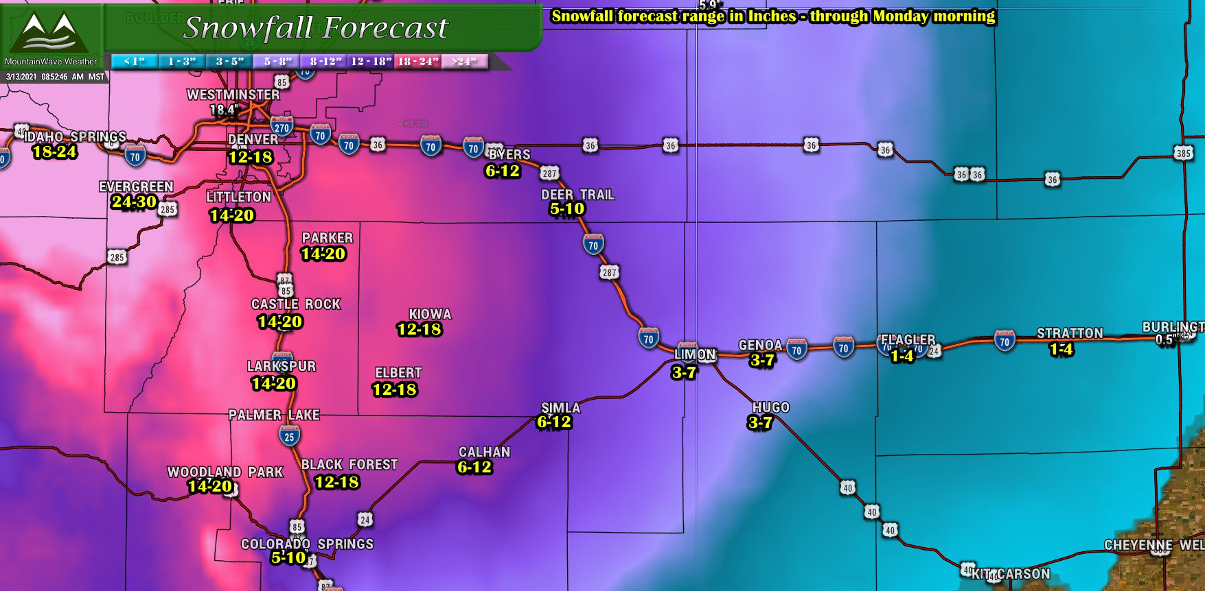
Palmer Divide
Not a whole lot of changes to forecasted snowfall for the Palmer Divide/South Denver/ Eastern Colorado areas. I’ve tightened up the snowfall ranges a bit, reducing the high end of the range as those areas look less probably with data we see this morning. Doesn’t mean that this storm could still bust through those and end up over those ranges, it’s just looking less likely at this point.
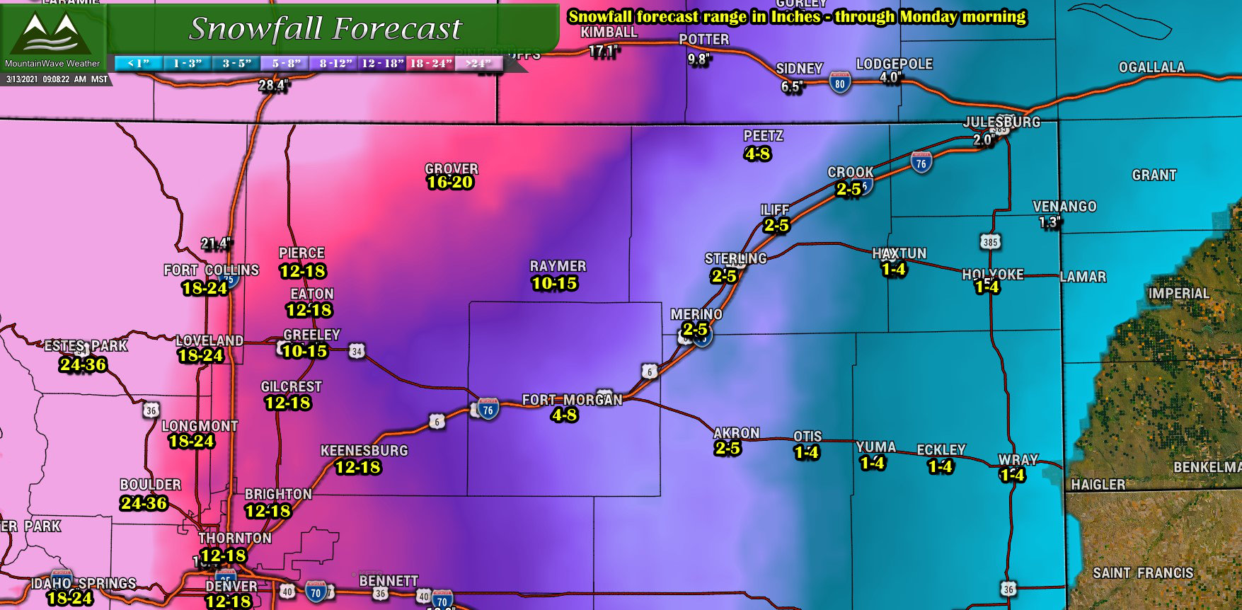
Northern Colorado
Little changes in Northern Colorado’s snowfall forecast this morning as well. The winners with this storm will be areas along and West of I-25, with the foothills West of Fort Collins, Estes Park and Boulder racking up high snow totals. As you move Eastward, snow drops off a bit but still healthy totals until you get a bit further out.
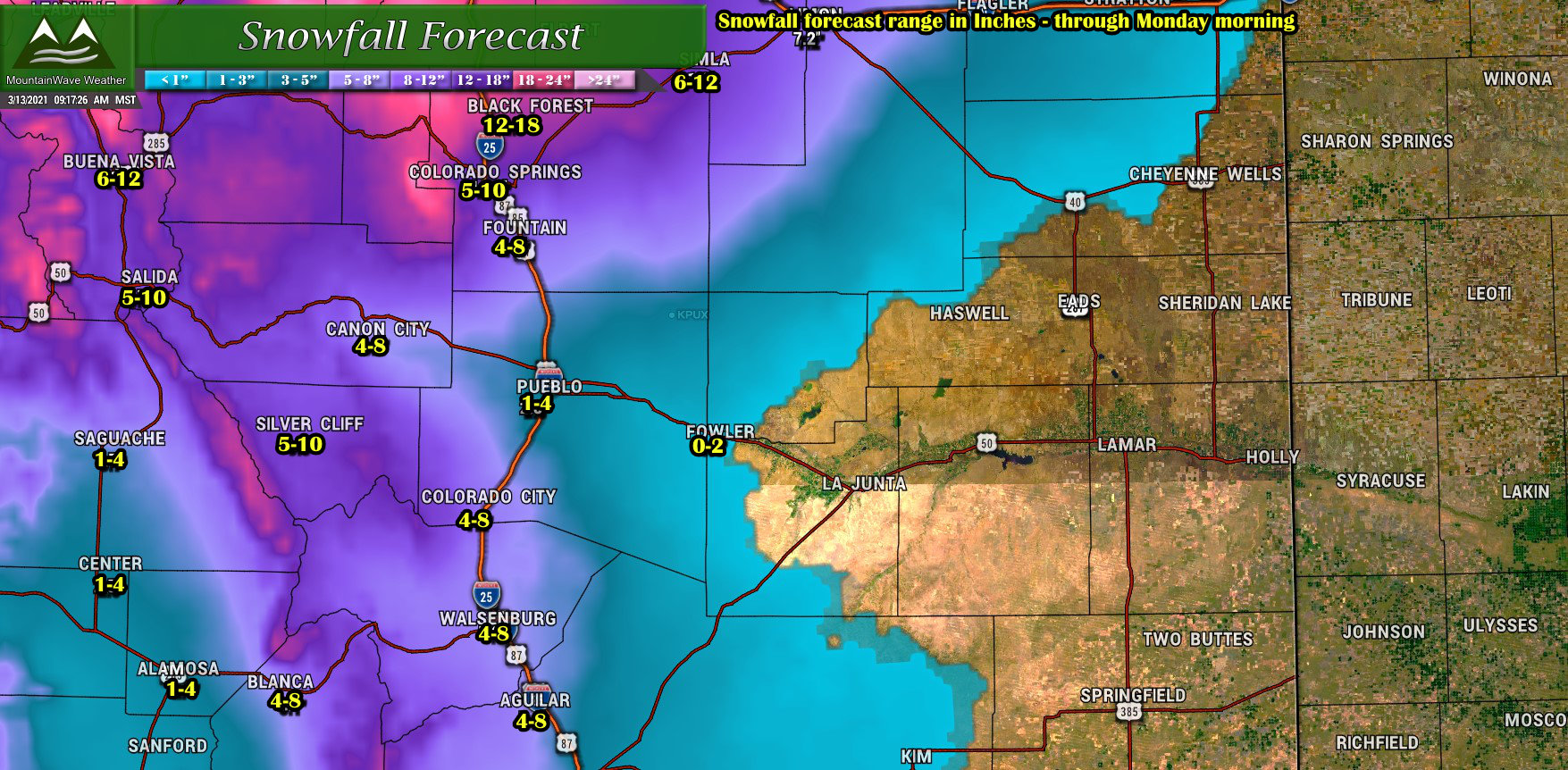
Southern Colorado
Even with a slightly more favorable track, Southern Colorado will see the biggest difference in snowfall depending on where you are. Areas in and around the springs look to do a bit better than the forecast was showing yesterday and the mountains and foothills West continued to see strong snow totals forecast. As you move Eastward, the snow quickly drops off as dry-slotting and the overall positioning of the storm makes a difference out that way.
Summary
This will most likely be the last major forecast update on this storm As it arrives in throughout the day Saturday we switch from a “Forecast” mode to an “observation” mode. All we can really do at this point is continue to monitor the storm and see how it does, when the snow flies and settles we will either be right or wrong.
My goal is always to be right, but if not as close to right as possible. Weather is unpredictable, things can happen that can really mess up a forecast. That’s the fun part though, if this was easy and everyone was right all the time – I don’t think I’d find weather terribly fascinating.
For the rest of the day, get your travel and/or preparation done by lunch time – then hunker down, sit back and let’s see what happens. I’ll have smaller posts/updates out today as things evolve but no more big forecast posts at this point.
Stay warm, stay safe!

