A dynamic and interesting weather pattern will set up across the Western U.S. this weekend and into next week. For Colorado that means we will see a roller coaster ride between strong ridging (and near record warm temperatures) this weekend, followed by an arctic blast into Monday and Tuesday with a decent chance of snow. From what I’ve seen the local TV and radio stations have already boarded the hype train and I’ve heard people throwing out snowfall totals well over a foot for a lot of areas. You guys know me, I’m not super excited about this one just yet, let’s take a look at this weekend and then I’ll tell you why!
Strong Ridge This Weekend = Near Record Warmth/Dry Conditions
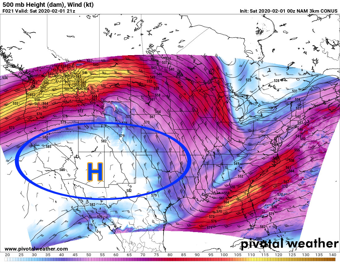
2PM Saturday 2/1/2020 500mb upper air over the U.S.
A large ridge of high pressure has built into the Western U.S. and will influence our weather over the weekend. This means for the front range we will see very warm temperatures and dry conditions. Some areas may see a good breeze as downslope off the mountains will be possible. With that dew points will drop and some areas could see higher fire danger, mainly those areas that haven’t seen a lot of precipitation over the past few days/weeks.
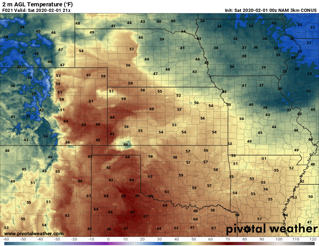
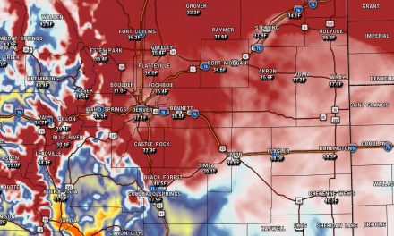
The warm air accompanying this ridge will move into Colorado on Saturday and Sunday. For Saturday, most areas will see temperatures top out around the upper 50’s to mid 60’s depending on your elevation. Most areas along the Palmer Divide will max out in the upper 50’s.
Sunday is slightly warmer with most areas along the Palmer Divide in and around 60 to the low 60’s. Denver could reach near 70 degrees!
Strong Storm System Late Sunday – Tuesday
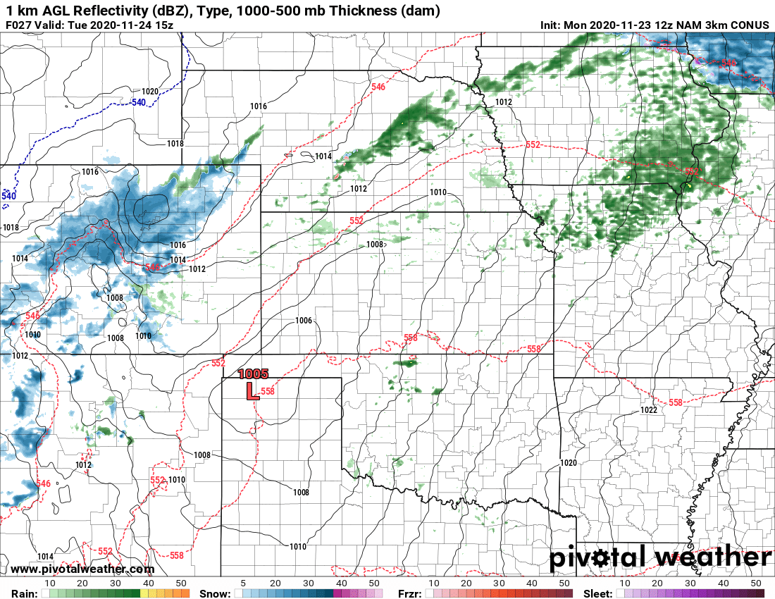
Sunday PM
At some point very late on Sunday night a cold front will drop through the front range and cause temperatures to drop considerably. You’ll notice the cold air by the time you wake up Monday morning. Some models show a slight chance of precipitation with the advance of the front, we will have to keep an eye out for spotty freezing rain early Monday morning.
Monday
Other than the chance of freezing precip early in the day, any other showers through the day Monday look spotty at best. By evening hours we should begin to see the snow crank up a little bit more. With the timing right now, we will have to watch both the Monday morning commute and Monday evening commute for possible impacts, we should get a better handle on timing and severity of impacts in the next day or two. For right now, just be aware of it.
The bulk of the snow at this time looks to hit later Monday and into Tuesday morning.
Tuesday
Snow continues early Tuesday morning to about mid-day. We will have to keep an eye on the Tuesday morning commute for possible impacts, stay tuned for more information on that!
Potential Snowfall
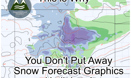
Remember, we are still a few days out so these numbers are likely to change. Keep checking back on our site or facebook for changes to the forecast. For right now the storm doesn’t look major, but notable. It has a decent chance of being a bit bigger than the past couple we’ve had in terms of snowfall, but the impacts still could be a headache. Here’s a map of what we expect as of right now along the Palmer Divide and a few more locations in and around the area listed below.
WPC expected total snowfall through Tuesday PM 02/04/2020
Preliminary Snowfall Forecast Range
| City | 24-48+ hour Forecast Range | Within 12-24 hour Forecast Range | Actual Amount |
|---|---|---|---|
| Castle Rock | 3-7 | ||
| Parker | 3-7 | ||
| Highlands Ranch | 0-2 | ||
| Elbert | 2-5 | ||
| Elizabeth | 2-5 | ||
| Kiowa | 2-5 | ||
| Centennial | 3-7 | ||
| Denver | 3-7 | ||
| Larkspur | 3-7 | ||
| Monument | 2-5 | ||
| Black Forest | 2-5 | ||
| Littleton | 3-7 |
Summary
We will definitely want to keep an eye on this one, at this time it looks like it could be a rather decent sized storm in terms of snowfall and cold air, but not one I’d consider major. A lot of the models have trended slightly downward with snowfall this morning overall so that’s a pattern I’ll have to keep an eye on as we get more data in throughout the day.
For now, be prepared for much colder air and snow that may impact travel Monday morning (possible) and Monday night through Tuesday morning (most likely impact timeframe)
Of course, I’ll be posting updates as new information comes in or when a forecast change/update is needed. Stay tuned!
