Kicking Off the Week
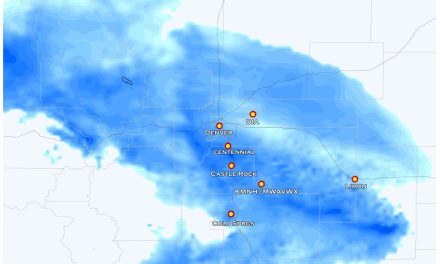
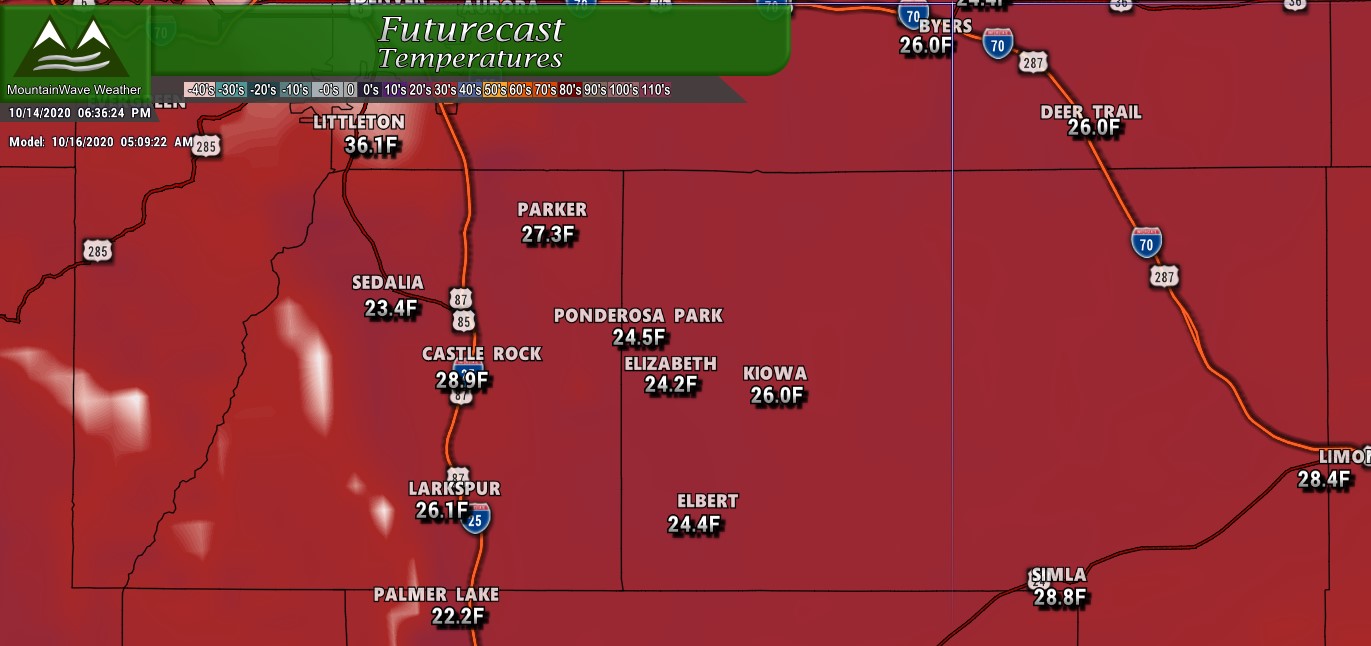
Castle Rock, Colorado forecast first half of the week
The first half of the week will start off in true “Spring” fashion with warm temperatures and dry conditions. Areas that have seen less moisture over the past few weeks will need to keep an eye out for elevated fire conditions, but winds look relatively light through Monday and Tuesday. By Wednesday, we see a bit of a cooldown in advance of our next storm system(s), yes there’s more than one thing on our radar as we end out the week.
Specific details are still up in the air, but suffice to say the period from Thursday – Sunday looks unsettled to say the least.
Model Hype
There’s been a ton of interest in this week’s storm system, primarily because of the wildly outlandish snowfall models people have been posting online. I know it’s easy to get worked up about things like this, but at this range those models must be taken with a huge grain of salt. Here’s a little explainer on why.
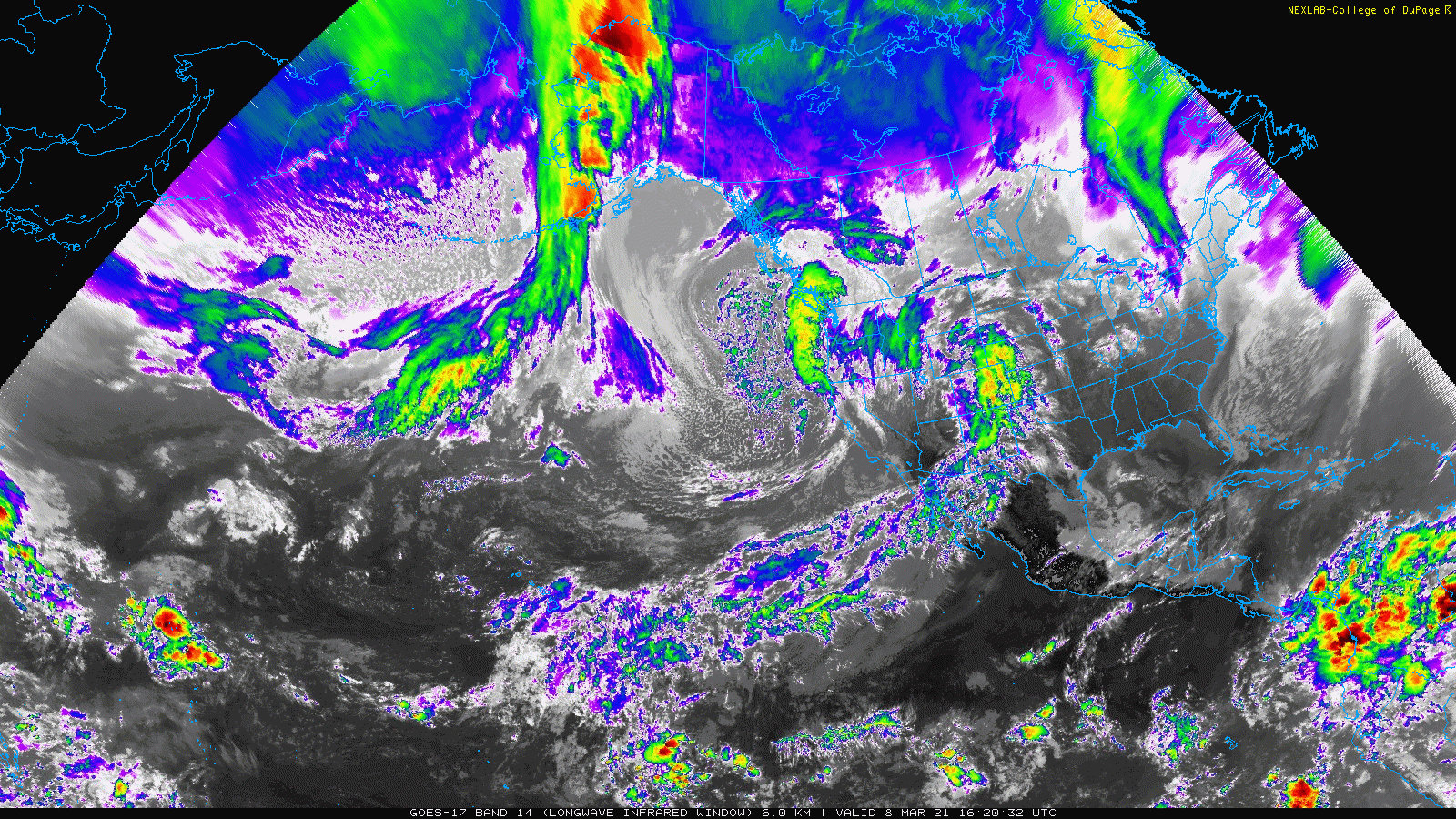
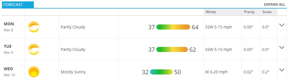
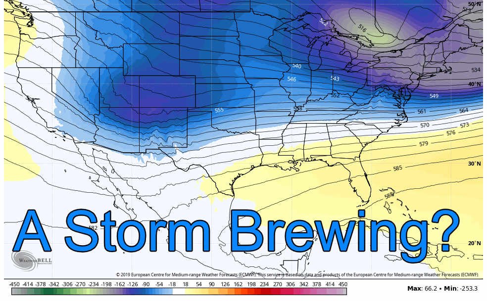
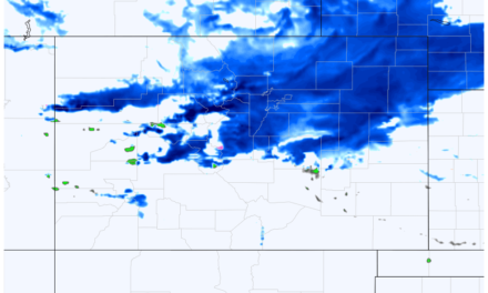
Shown below is this morning’s satellite imagery with the approximate position of the feature that will be responsible for this storm should it come together. Here’s a few things to note:
- The upper level feature has not even yet formed into the trough that will be responsible for our storm, should we see it. How this storm evolves will be a major part of how it plays out in Colorado, this includes how it moves across the mountains, the track it takes and how strong it can get should it reform on Colorado’s Eastern Plains.
- Notice that this feature is still over water, models rely on surface observations to come up with their “solutions” on what they believe the storm will do. The problem is while this feature is over water, there is not a lot of weather stations to sample how this storm is evolving
- Over water with less sampling means models struggle to come up with accurate solutions (confidence is very low on any storm at this point)
- While the models try to resolve this storm with little data, we would expect to see wide fluctuations or ridiculous solutions – so again while this is over water any model predictions must be looked at cautiously
- As the storm moves onto land we will see more data coming from a larger array of weather stations and models will start to get a better handle on this storm
Long story short: model confidence should be low at best with any solution you are seeing right now!
What We Can’t Ignore
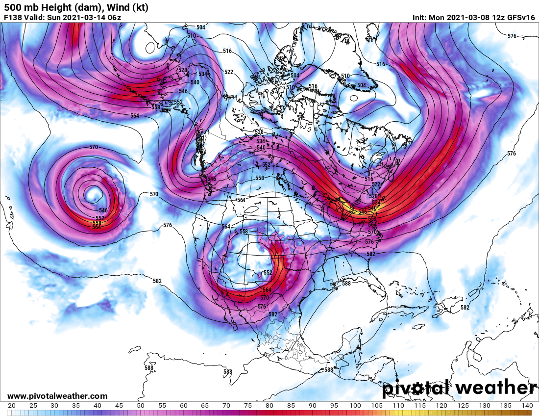
While forecast confidence is still overall low, we can’t ignore the fact that our two longer range models (the GFS and Euro) both agree on some type of significant storm. The Euro is especially worth keeping an eye on as it tends to have the better accuracy rating at further timelines… that being said it has struggled a bit more than usual this year.
If you recall our large “bomb cylcone” event a couple of years ago, you’ll remember models picked up on it about 5-6 days out and stayed very consistent with it all the way through the storm’s arrival. We could be seeing a similar situation here… but we will have to keep an eye on the trends as the storm comes on shore. That will give us a much better boost on confidence with this storm system, until then we simply don’t know.
What To Do and Watch For
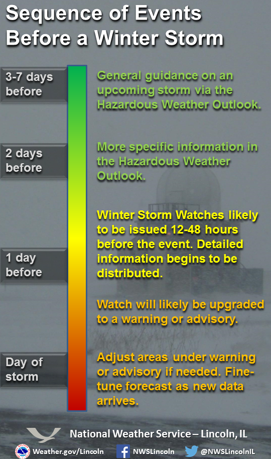
Currently with this storm we are in the Wait and See Phase. Until we get better data with this storm system we can only watch and keep an eye on the forecast. Keep in mind, a lot of the models you are seeing today are either worst case scenario or very unlikely. My recommendation is to keep a close eye on the forecast in the next couple of days, if we start to see Winter Storm Watches issued that will be your cue to start preparing for this storm.
Ag and Ranching Interests
Preparation for these folks can take a bit longer than the average person in a suburb. For these folks it’s best to prepare and nothing happens versus not being prepared and a large storm hits.
- Make sure there’s enough food available for animals (time to stock up this week if not)
- Make sure there’s enough water for animals, be sure to have a way to keep their water filled and unfrozen during the storm (make sure tank heaters work and hoses are unfrozen)
- Have shelter available, bring animals in from pasture 24-48 hours in advance of the storm
Ranchers, be sure to have your severe weather preparations completed by no later than Thursday night.
Summary
You’ll notice I did not post any snowfall models… that’s because the actual snowfall numbers these models are spitting out right now are nearly useless. Until we get this storm on shore with better data for our models forecast confidence in any amount you see (whether 0 inches of snow or 50 inches) is extremely low… in other words it’s hype.
One thing I can say is that the storm should at least have your attention (it has mine) so keep an eye on the forecast and updates this week. If this thing continues to hold together, I’ll be sure to put in the extra hours, pump out plenty of updates and keep you ahead of this thing with good, facts based, grounded and non hype weather forecasting.
Thank you for following along!
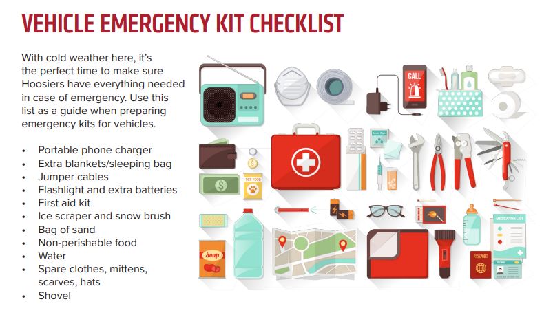
Travel plans this weekend? It’s a good time to check and make sure your vehicle emergency kit has everything it needs!

I actually don’t get/see TV weather reports. I am flying on Thursday. Are we expecting precipitation on Thursday morning?
Hi John,
I miss seeing your common-sense explanations and accurate forecasts since I left Facebook for other platforms months ago, and want to know if Mountain Wave Weather is on any other social media where I can follow?