The good news if you’re tired of back-to-back consecutive snowfall events is that we are seeing convincing signs in the atmosphere that the pattern is starting to change. The bad news is that these shifts don’t happen instantly and generally take a period of time before they really kick in. So we may still have a bit more unsettled weather in our future but things are starting to change!
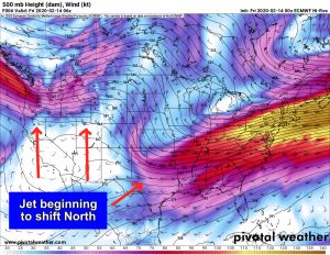
The Euro upper air (500mb) is showing a similar pattern to the other medium/range lower resolution models in that we can start to see the jet stream migrating a bit back to the North. This means that we will open up the Southwestern part of the U.S. to ridges of high pressure and as those build in and move across Colorado we will begin to see bouts of more “stable” weather!

 The Weekend
Friday
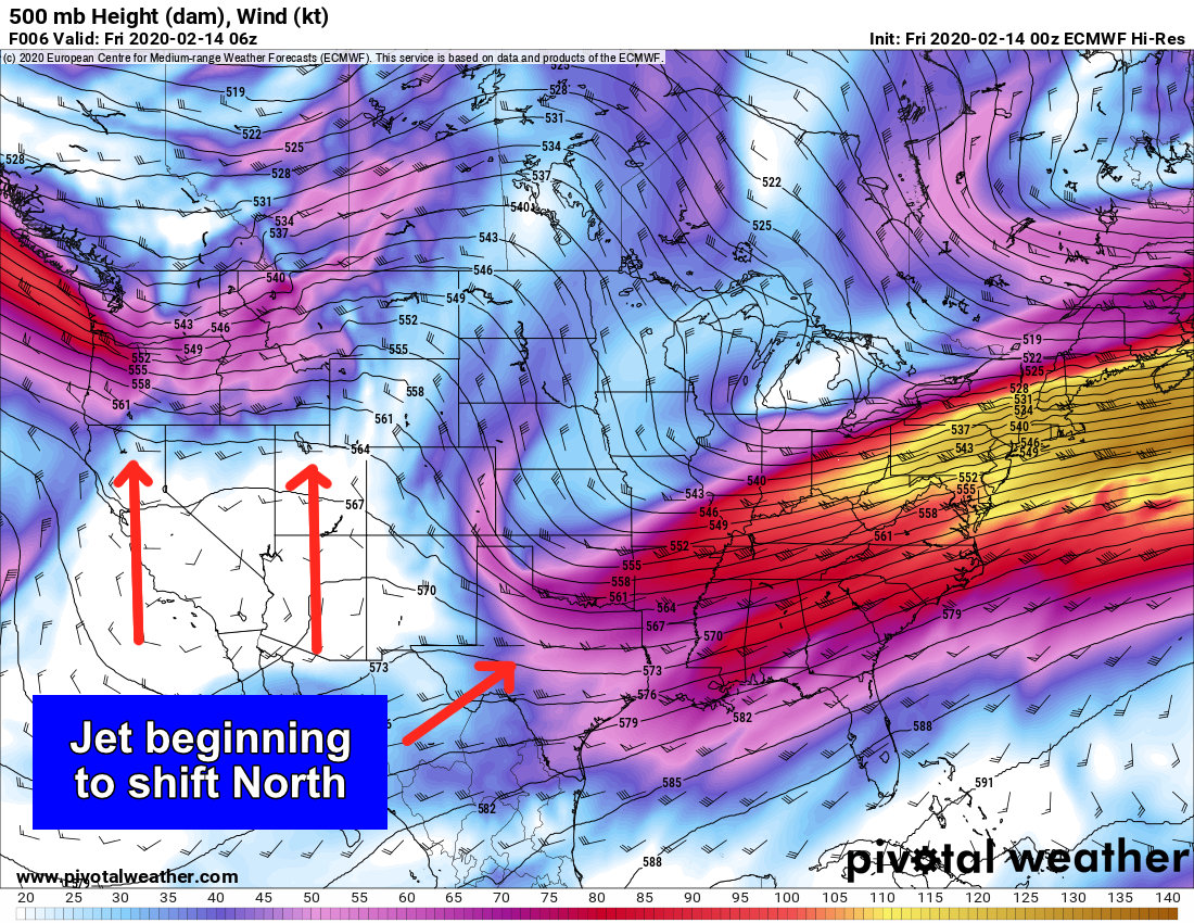
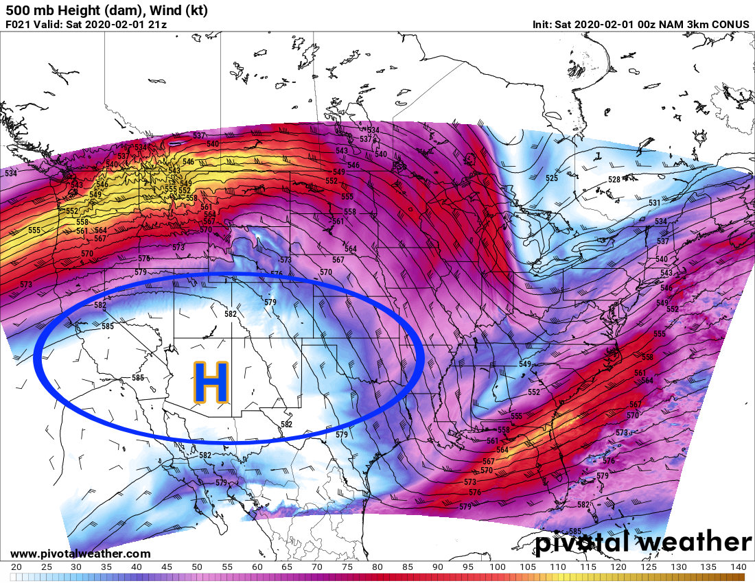
Temperatures will top out in the mid to upper 40’s along most areas of the Palmer Divide with a few 50’s here and there. The image above is from the Euro model of today and as you can see a short -term ridge is building to our Southwest. This will allow quieter and warmer weather to spread across most of the state.
Saturday
Late Friday a cool front will move through bringing cooler temperatures for the day on Saturday. Expect highs to top out in the low 40’s in most Palmer Divide areas with higher elevations possibly not making it out of the 30’s. Skies will be mostly sunny/ party cloudy during the day but breezy conditions will be possible in some locations.
Sunday
A tad warmer on Sunday under partly cloudy skies. Highs look to be in the upper 40’s to near 50 during the day with breezy conditions possible. We don’t expect any snow through the day on Sunday so get out and enjoy it! As the next storm system moves in overnight, we could see a spotty snow shower after 10-11PM but don’t expect much accumulation through the night.
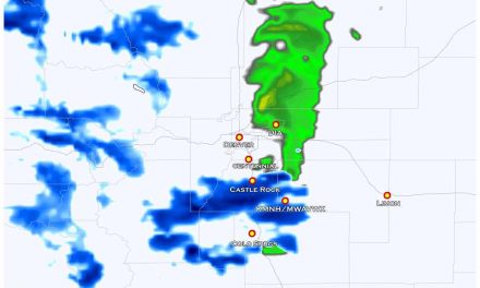
Monday – Next Storm To Watch
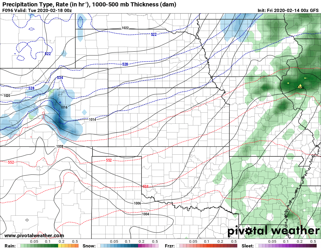
I posted the GFS surface map from late Monday because as a snow lover the Euro equivalent makes me sad…
There’s been a lot of buzz on TV lately and social media about next week’s storm. At this point in time it’s too early to give specific details on this storm so please keep that in mind when you hear folks talking about specific snowfall amounts and timing. Here’s a few bullet-points of what we are watching and what to keep an eye on over the weekend:
Model Uncertainty
- Our two main models (Euro/GFS) that we can see at this time do not agree at all on this storm.
- This means that any forecast you see right now has a very high degree of uncertainty
Overall Trend
- So far, the overall trend with each model run (for both models even though they are far apart on solutions) is to decrease the snowfall along the front range
- If you take the trend with some of the other data we see it’s showing this storm being less of an impactful event for Colorado’s front range.
- BUT! Remember, any forecast right now is a high degree of uncertainty! 😉
Timing
- This far out there’s a lot of wiggle backwards and forwards 6 or so hours on this storm’s arrival but generally Monday is the day you want to keep an eye on
A Few Other Tidbits
- As this storm is coming on the tail end of a larger scale pattern change we can’t say it’s going to be a major storm, but we also can’t write it off yet either.
- With the jet doing what it is now, I’d expect several large shifts in this storm over the next few days… sometimes it may shift into a better position for a big storm while other times it may shift out completely where it becomes a non-event. Keep that in mind when you see forecasts this weekend, I expect to see a lot of “model bounce”
My recommendation right now: watch the forecast over the weekend and be prepared for an impact on Monday just in case. I’ll keep you updated on time/impact shifts through the weekend but I won’t have specific details until probably late Saturday/early Sunday. My other recommendation is to get weather from a good source, I’ve already seen a lot of “hype” building around this storm (not sure why though.)
For now we wait! Until the next update, enjoy the warmer and dryer weather!
