What is the Probability of a White Christmas in General?
The National Weather Service puts together this handy graphic to help illustrate which parts of the country have the best chance of seeing a white Christmas based on data and records kept over the years.
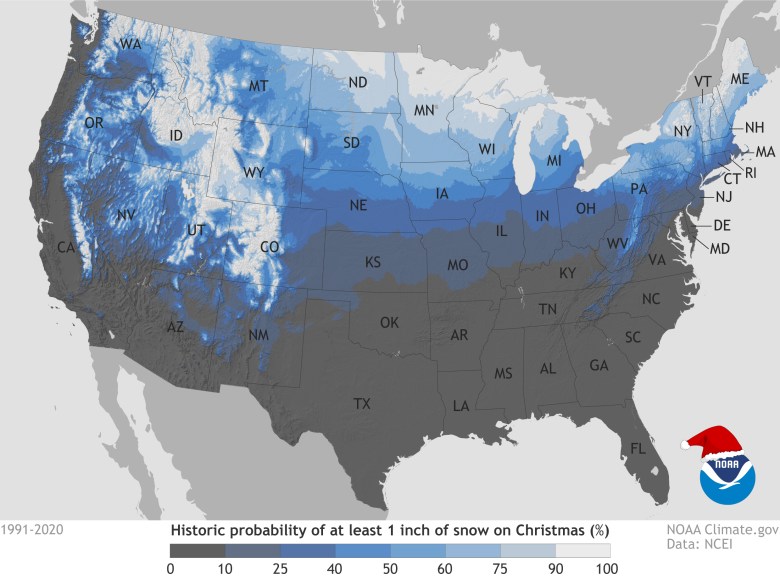
By definition, a white Christmas is one in which there is at least 1 inch of snow on the ground Christmas morning (December 25)
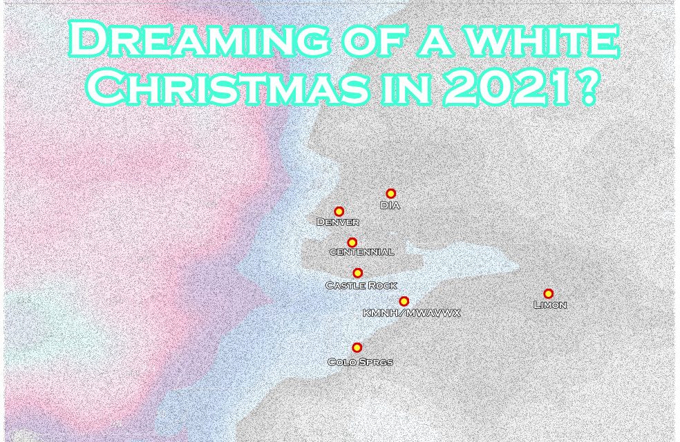
If we zoom in the data a bit below we can see the probabilities for specific locations a bit more clearly:
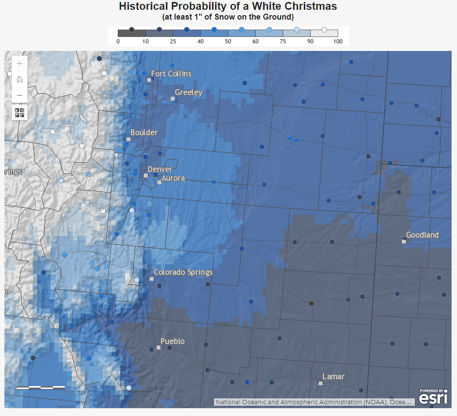
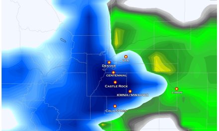
Denver: Between 25-40%
Castle Rock: Between 40-50%
Colorado Springs: Between 25-40%
Many of the higher elevations of the Palmer Divide fall within the 50-60% range!
What Are Our Chances in 2021?
Like many weather related questions in Colorado, this will really just depend on where you live. The mountains (as always) have the best chance of seeing a white Christmas as many of those locations already have at least an inch or more on the ground.
Closer to home, here’s the weekly forecast for Castle Rock:
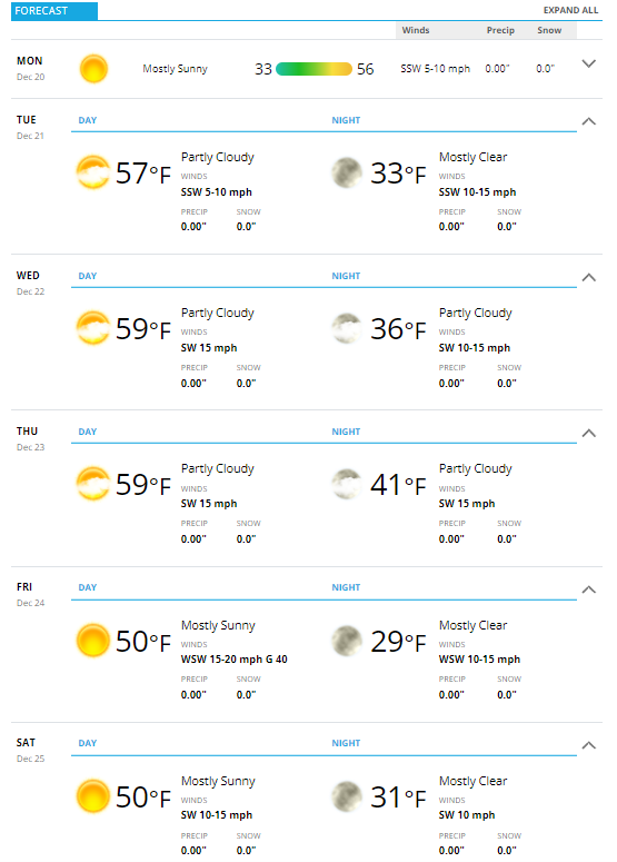 You’ll notice the lack of cold temperatures or any snowflakes in the forecast. That data pulls from a specific model so it tends to bounce a bit, especially the further out you go. So we will have to go to the big boys to get a better idea.
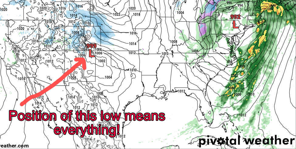
Let’s zoom out to get a better idea of if we see any storms moving in during the Christmas timeframe:
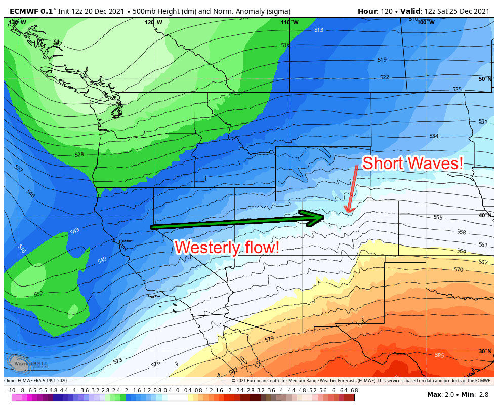 The upper pattern as shown by the Euro above shows a couple of interesting weather features. Colorado is caught between a large trough to the North and high pressure to our South. The gradient isn’t particularly strong, so we won’t be looking at a high wind event like we saw last week, but breezy conditions are possible. A push of westerly flow should send moisture towards the mountains so they should see a bit of fresh snow to end the week.
The sad part is, Westerly flow is rarely beneficial for snow East of the Continental Divide, but enter the Wild Card! See the squiggles? Those are often referred to as a “short wave” trough and they can sometimes cause banded snowfall across the area. That being said, conditions have to set up right and temperatures will have to play ball… which is my other concern…
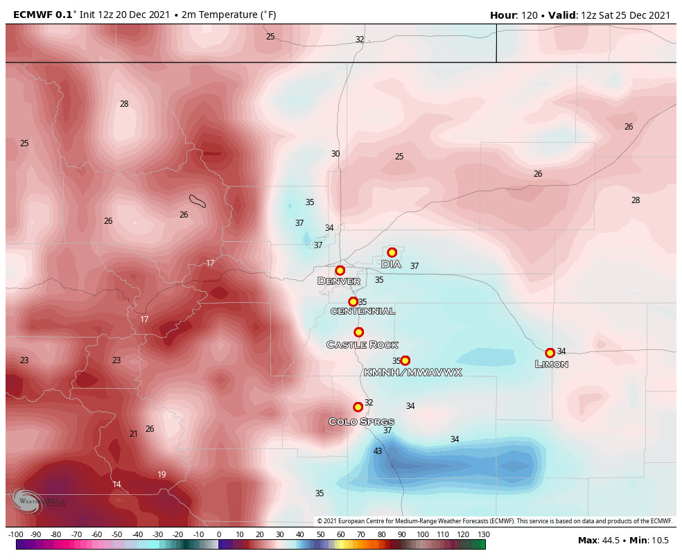
Here’s the 5AM temperatures Christmas morning. Borderline for snowfall and accumulation at best
and if we look at the temperature anomalies for both Christmas Eve and Christmas Day we see this…
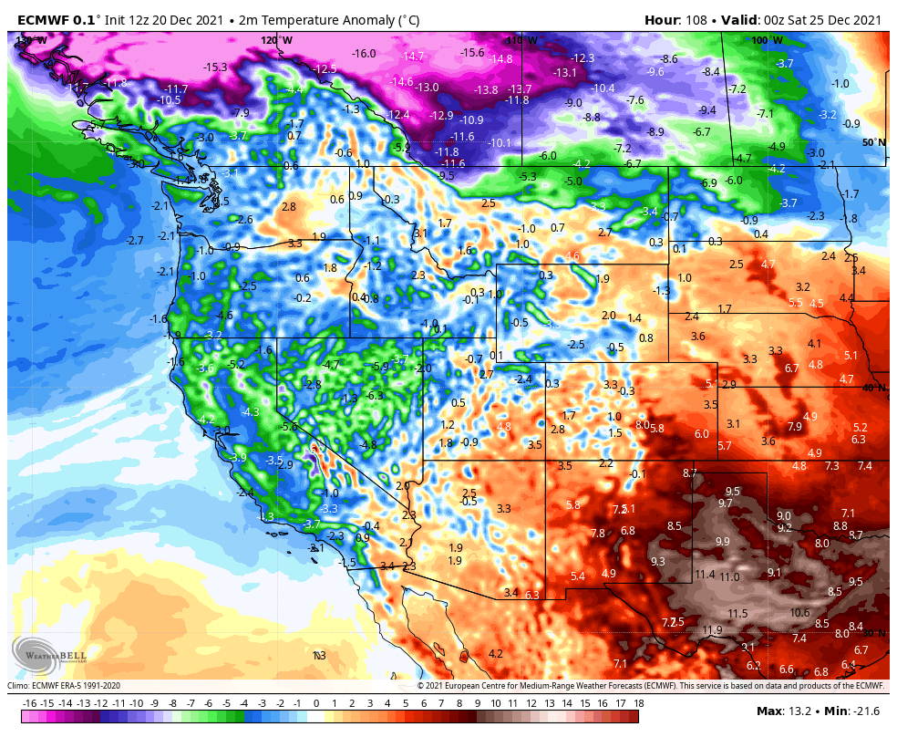
High temperature anomalies for Christmas Eve December 24, 2021
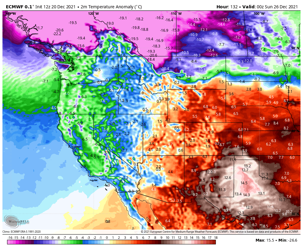
High temperature anomalies for Christmas Day December 25, 2021
What do the Models Say?
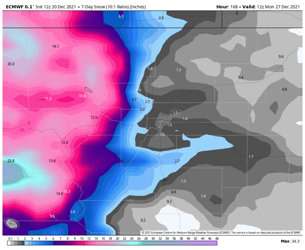
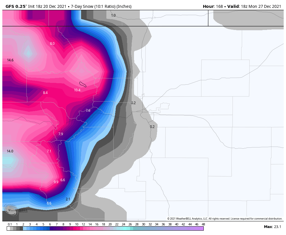
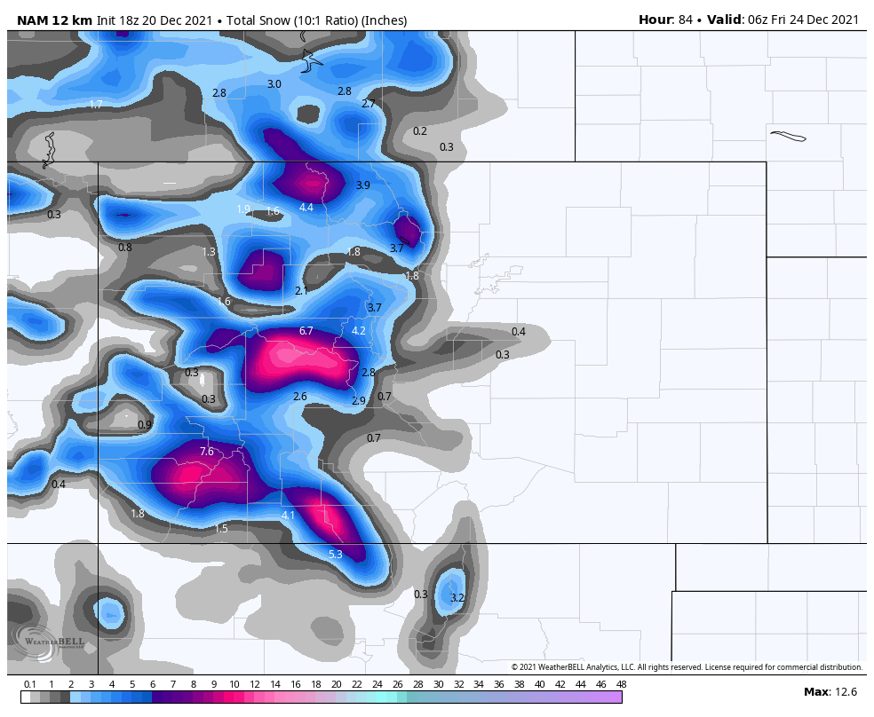
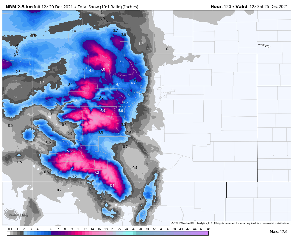
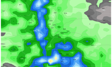
If you’re looking at pure model data for snowfall (not ever a good idea for a forecast, but take this data in combination of the data I’ve presented above and you’ll get closer to the forecast I’m thinking…
Euro
GFS
NAM (not fully in range yet!)
 National Blend of Models
So What Does it all Mean?
**Remember, the golden rule is at least 1 inch of snow has to be on the ground for it to be considered a “white Christmas.”
Denver’s Chances of a White Christmas?
Very Unlikely, less than 5% chance
Castle Rock’s Chances of a White Christmas?
Unlikely, less than 15% chance
Higher Elevations of the Palmer Divide (+7,000 feet in elevation) Chances of a White Christmas?
Possible but unlikely, less than 25% chance
Colorado Springs Chances of a White Christmas?
Very Unlikely, less than 5% chance
Colorado Mountains Chances of a White Christmas?
Highly likely, 80-100% chance depending on snowpack conditions and location
Just like any forecast though, these probabilities can be a bit fluid depending on what data we get in through the week. For now we will say the chances are not 0%, but with the data we have coming in it looks unlikely may places East of the Continental Divide see a white Christmas.

Hi John. Do you see anything of interest maybe happening next month?