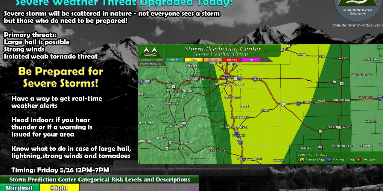
The latest SPC outlook has been released for the 11AM update and as I suspected, parts of the front range of Colorado have been upgraded form a “Marginal Risk” to a “Slight Risk” which means that while severe weather threat is still low – it will be a bit more widespread and storms could be a bit stronger this afternoon.
Here’s the latest map showing the areas of concern:
You’ll notice the “Slight Risk” area encompasses most of the Front Range and Palmer Divide regions in Colorado.
Primary threats with these storms will mainly be:
- Large Hail
- Strong daytime heating and a decently cool middle and upper atmosphere means lapse rates will be quite high
- This means instability is high, hail will be able to cycle in stronger storms longer and grow larger
- Strong Winds
- Collapsing storms and outflow boundaries means strong wind gusts will be possible in and around stronger thunderstorms
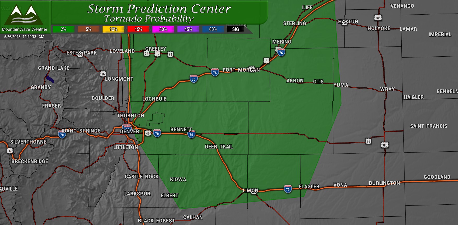
- Tornadoes
- There is a small (2% chance) of tornadoes across Northeastern Colorado
- For the Palmer Divide, areas into Elbert County and to the North into Arapahoe County have the highest chance of seeing a tornado
- Any tornadoes that form should be fairly weak in strength and likely won’t last long
Timing
For the Front Range and Palmer Divide, primetime for storms is the typical 12PM – 6PM window.
If you have outdoor plans, have a way to get weather alerts and have a plan if you need to move indoors.
If you need a refresher of what Severe Thunderstorm Outlook Categories mean… you can see that here!

