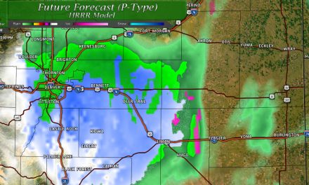
A potentially active day in store as a short-wave trough moves through the area and later a bit of a cold front – both of these feature will destabilize the atmosphere and allow for thunderstorms to build. Severe weather is possible and while the chances are not super high that any one area sees a severe storm, coverage will be adequate enough this afternoon that many folks will need to keep a close eye on weather conditions.
Here’s the latest…
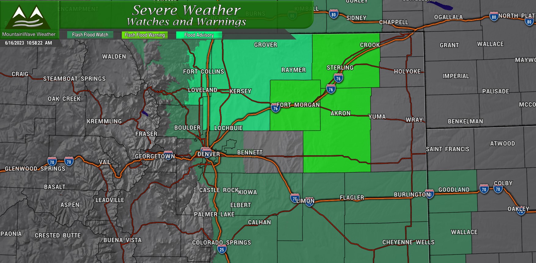
Weather Watches/Advisories/Warnings
A **Flash Flood Watch** is in effect for many areas along the Front Range including the Palmer Divide.
This watch is in effect from 12PM through 10PM on June 16, 2023
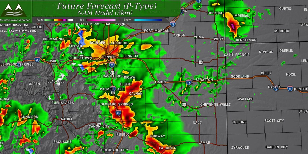
Numerous showers and thunderstorms will develop this
afternoon and continue into this evening. The stronger storms
will be capable of producing 1 to 2 inches of rain in an hour
or less, and there may be repeated rounds of heavy rainfall.
While the highest threat will be over the Palmer Divide and
in the Cameron Peak burn area, flash flooding will also be
possible in urban locations including the Denver metro area.
Severe Weather Threats
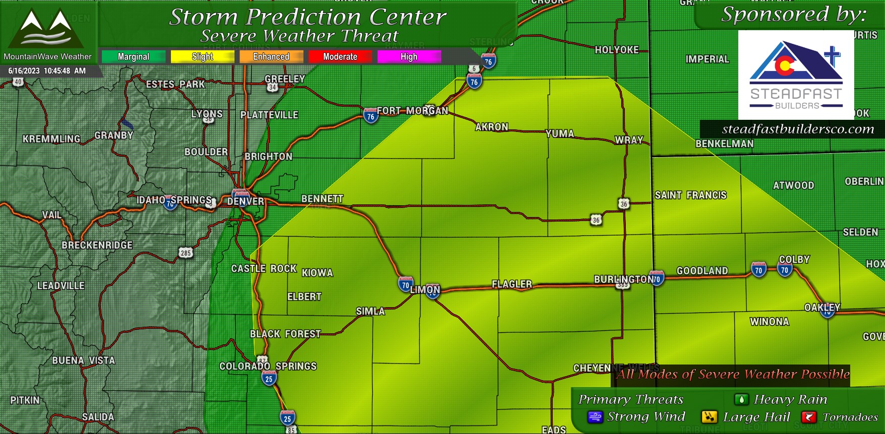
Categorical
The Storm Prediction Center has included most of Eastern Colorado in a Slight risk for severe thunderstorms this afternoon. This is not a particularly high level so severe storms won’t be what we would call “widespread” but there will be enough of them around to cause some headaches.
Closer to the foothills and the far Northeastern corner of the state a lower “Marginal” risk is designated, the amount of severe storms seen in those areas will be less but the possibility is still not zero.
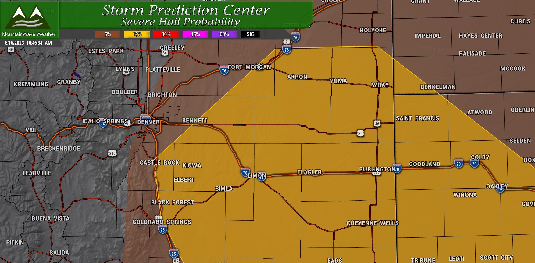
Hail
Hail will be a primary threat for this afternoon’s storms. The higher risk areas have about a 15% chance of seeing large/severe hail within 25 miles of a point.
Hail must be 1 inch or greater in diameter to be classified as severe, so many of these storms will likely have small hail in them – but only some of them will grow larger and potentially cause damage.
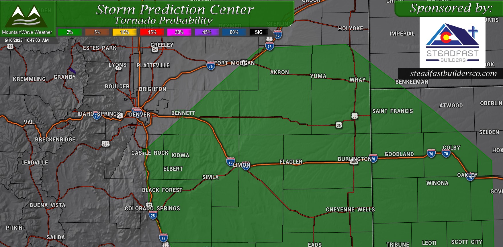
Tornadoes
There is a small chance for tornadoes this afternoon. The overall risk is low at about 2% but it will be there.
Focus would likely be along any boundaries that set up along the Palmer Divide and ranging to the North and East. Areas like Aurora, Parker and DIA often see spin-ups in storm setups like we will see today. Additionally, Castle Rock, Kiowa, Elizabeth and Elbert will all need to stay alert for brief tornadoes as well.
Timing and Impacts
Be prepared!
Threats today:
- Hail
- Lightning
- Flooding
- Tornadoes
Make sure you have somewhere to move inside to if bad weather threatens. Do not attempt to drive across flooded roadways!
Timing
A bit of a longer duration event possible today. Prime time for storms is between 2PM-10PM with multiple waves possible.
We will update if needed later this afternoon!
