Got quite the interesting late spring storm system setting up for this week. I discussed a bit of the atmospheric setup we expect to see here, but today I’ll take a crack at the preliminary snowfall forecast. As always, these numbers can change a bit so take them with a grain of salt. Instead, focus on the areas more likely to see snow vs those that may not, the maps will help with that.
Let’s get to it!
Snowfall Forecast *Preliminary*
Please keep an eye out for changes in the next 24-72 hours
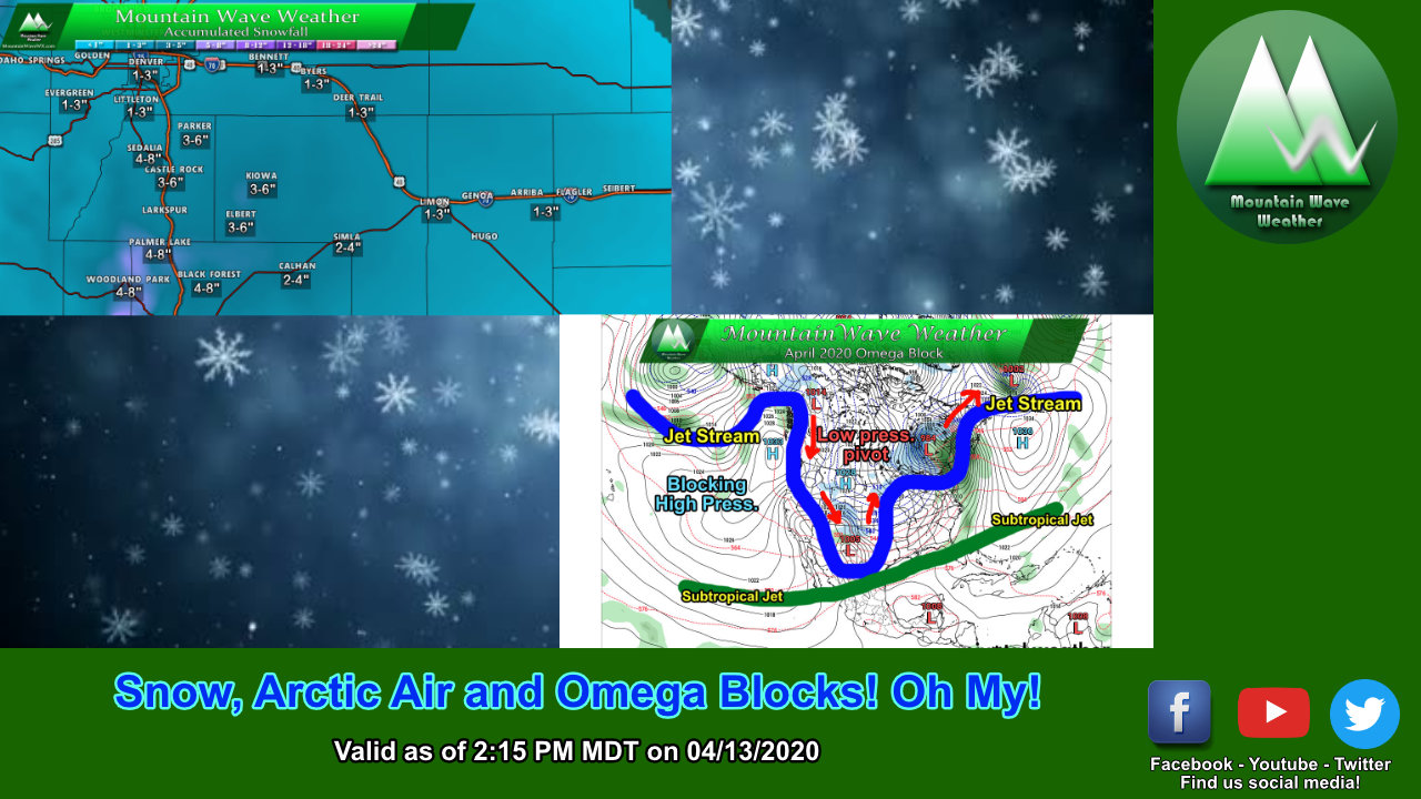
Palmer Divide
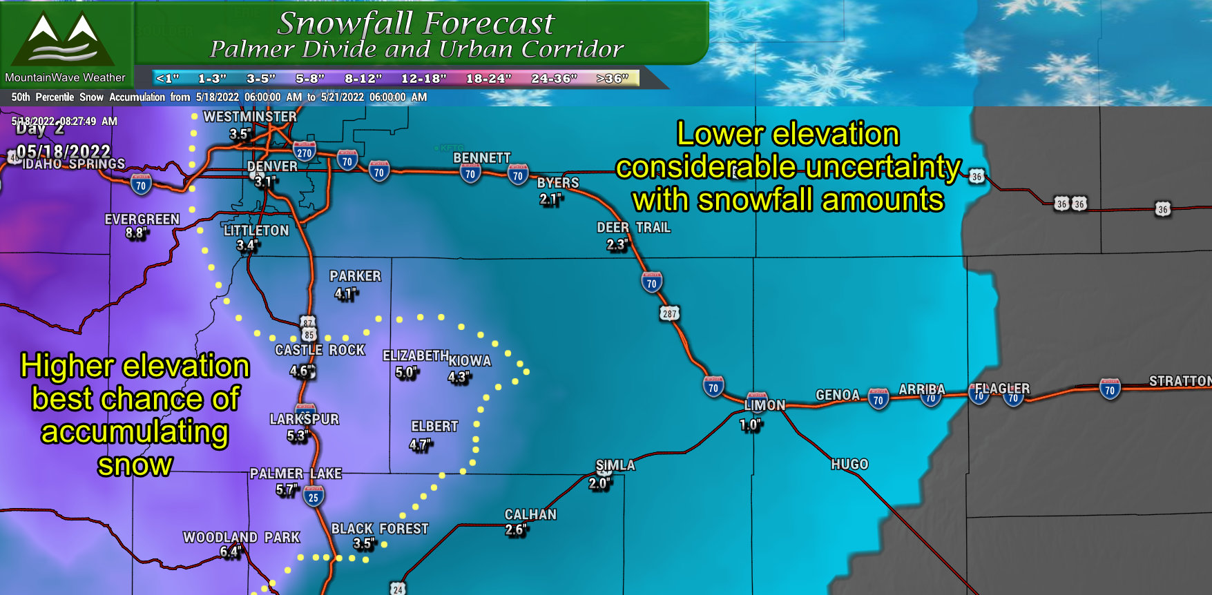
The areas that stand to do best with snow from this storm are the higher elevation locations of the Palmer Divide and Front Range foothills. Being an upslope-type storm, we have favored the areas that typically see the best snow accumulation during storms like this. The elevation factor will be critical, anything above about 6,500 feet we see as the best chance for accumulating snow. From 5,500 to 6,500 snow accumulation is likely but lower amounts are possible – likewise if the storm trends a few degrees colder those areas could bump up significantly.
Northern Colorado
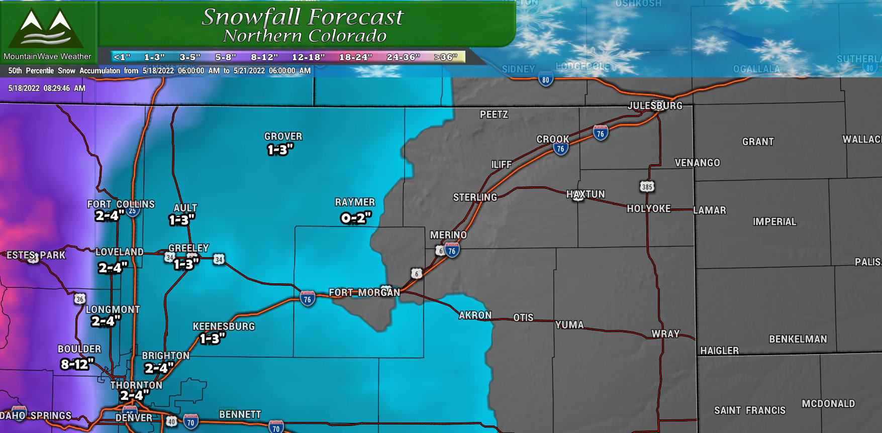 For Northern Colorado, the same parameters will apply… anything higher elevation West of Interstate 25 stands to have the best shot at snow with the foothills and mountain locations getting a significant amount of snow. Elsewhere across the plains, lesser snow accumulation is expected but moisture will still be decent – most of it will fall as a rain/snow mix and snow that does fall will mostly melt.
Northwest Colorado
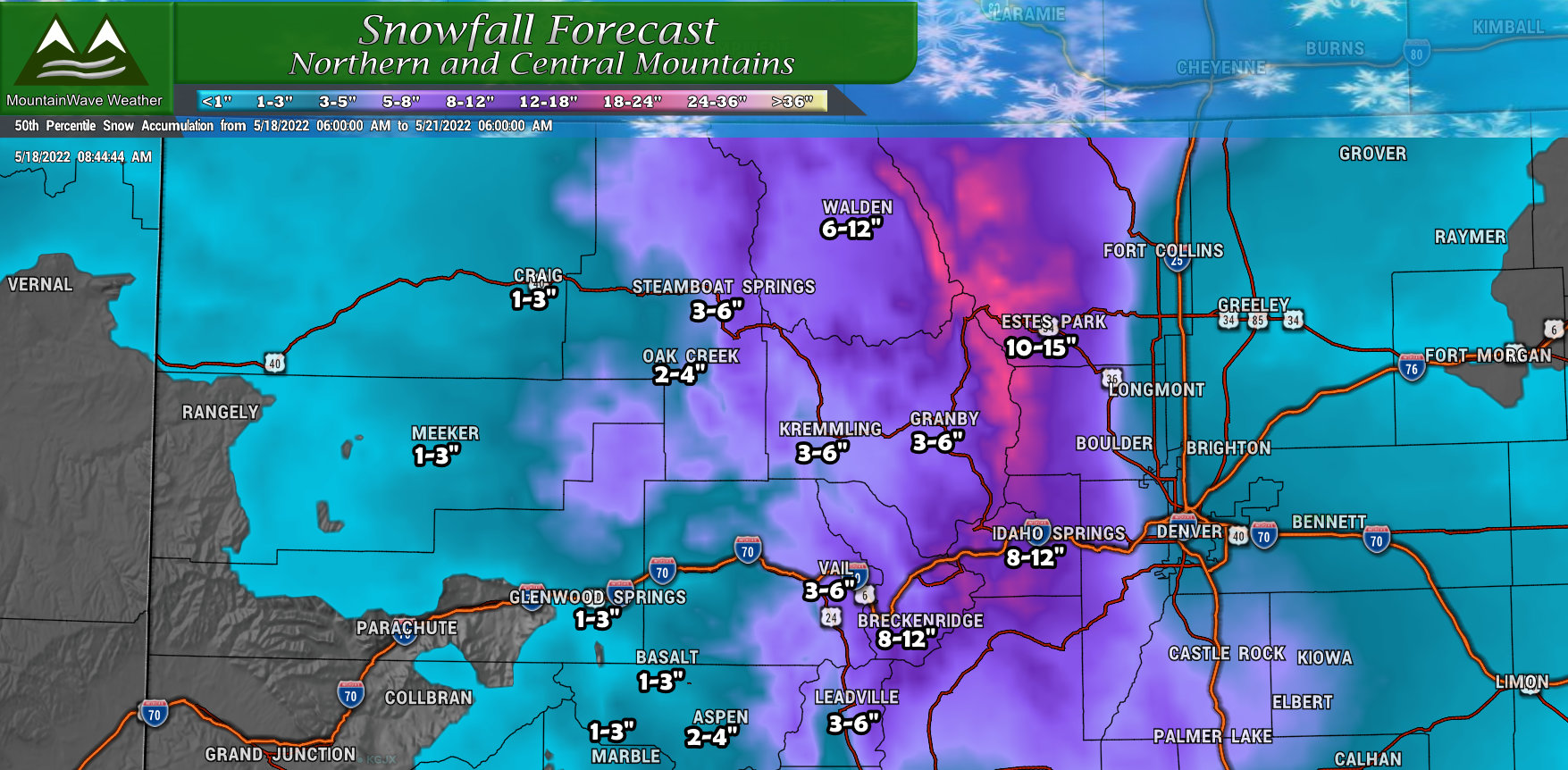
Big winners in terms of snow will be the mountains along the Continental Divide. A lot of these areas could see 12+ inches of total snowfall accumulation with spotty areas pushing the 2 feet marker. For the few ski areas left open and for our overall snowpack numbers, this will be a welcome sight to keep things from melting too quickly. Keep in mind though, this will be heavy, wet, spring cement snow, so expect a workout if you go skiing.
Southern Colorado
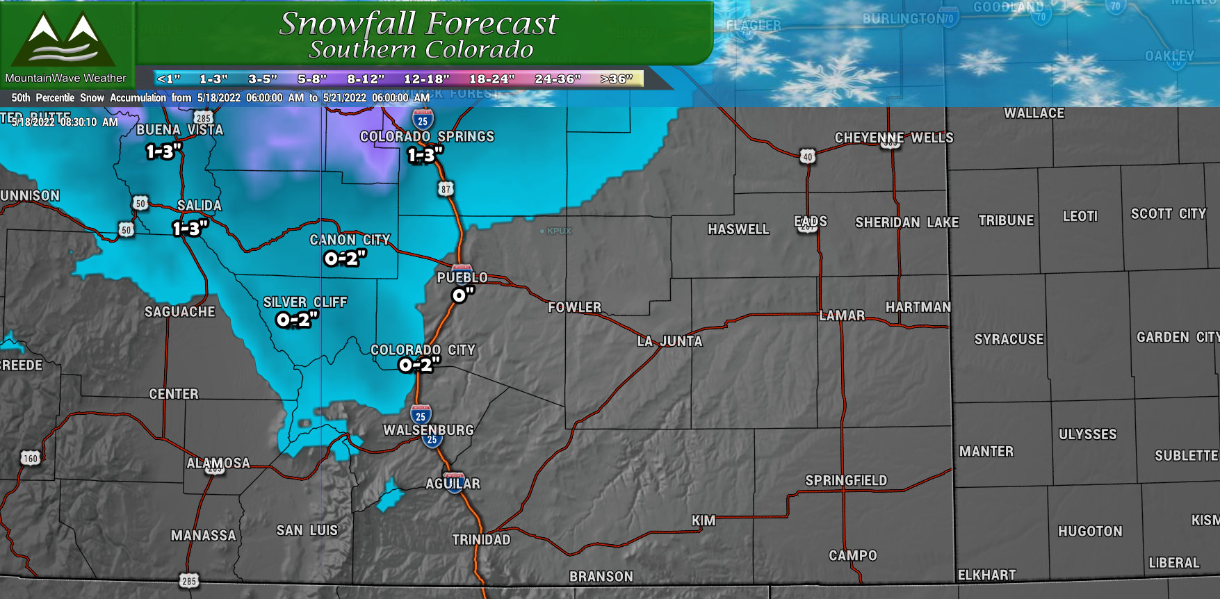 Sadly, Southern Colorado will miss out on most of the snow, but not all of the moisture so that’s a bit of good news. The problem is the surface low will set up over Southeastern Colorado meaning those areas could see more wind and less moisture. For those drought-stricken areas, this is a bit of a downer.
Southwest Colorado
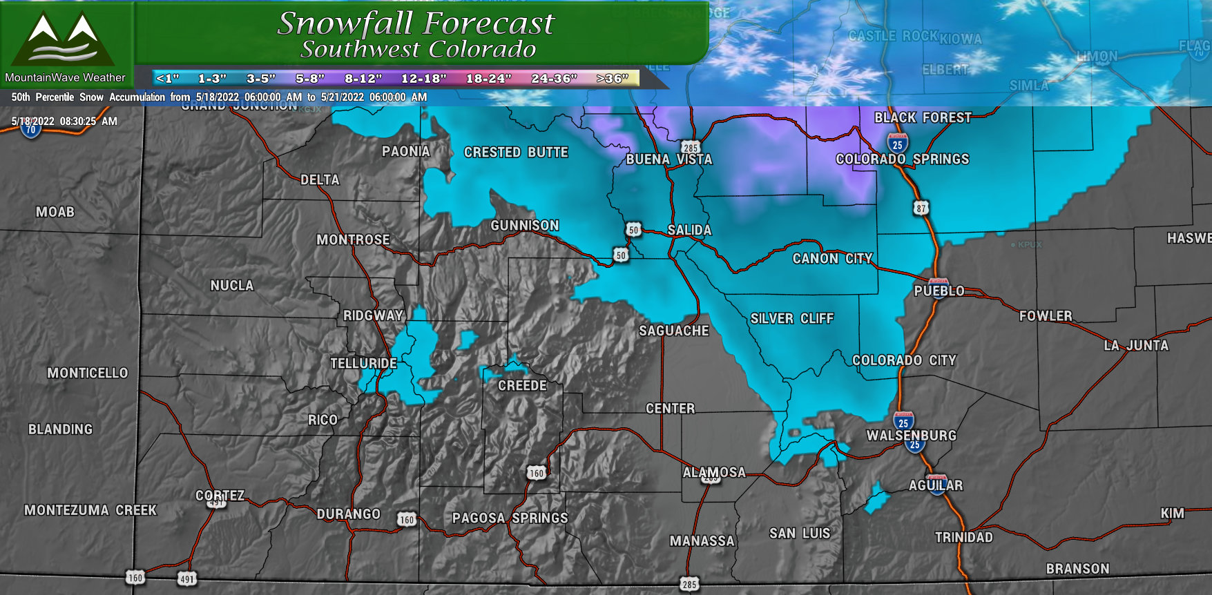 Similarly to Southern Colorado, the Southwest part of the state won’t see much in terms of snowfall.
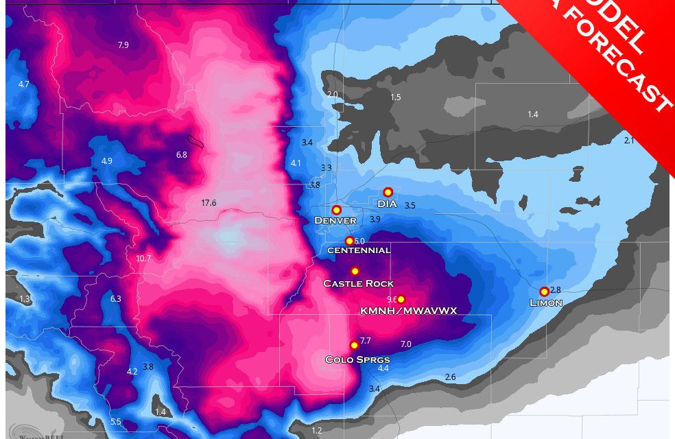
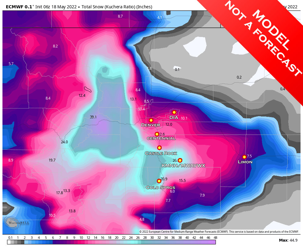
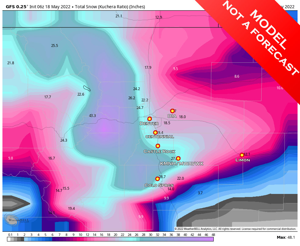
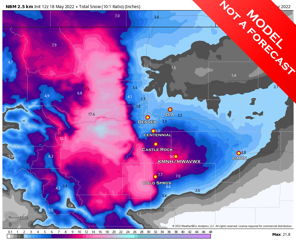
Model Madness
I had to put disclaimers on all of these graphics, lest people go bat-$#!% crazy about the amount of snow we could get… but won’t…
Another disclaimer – when looking at model data like this you have to remember they don’t always account for warm ground/melting/high sun angle which means the later we get in spring the more likely these products are to drastically over-estimate snowfall accumulation.
Euro Determinisitic
GFS Determinisitic
NBM
Now that you’ve seen that madness, let me hit you with a dose of reality!
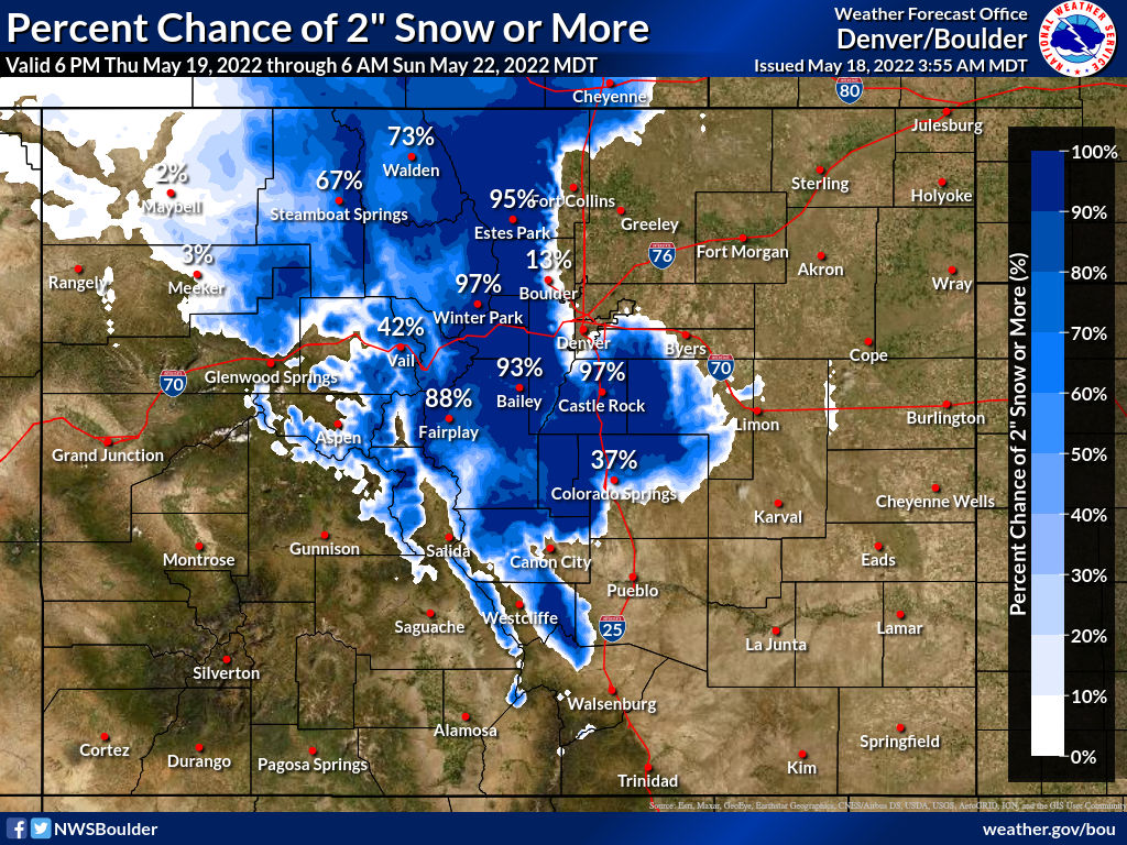
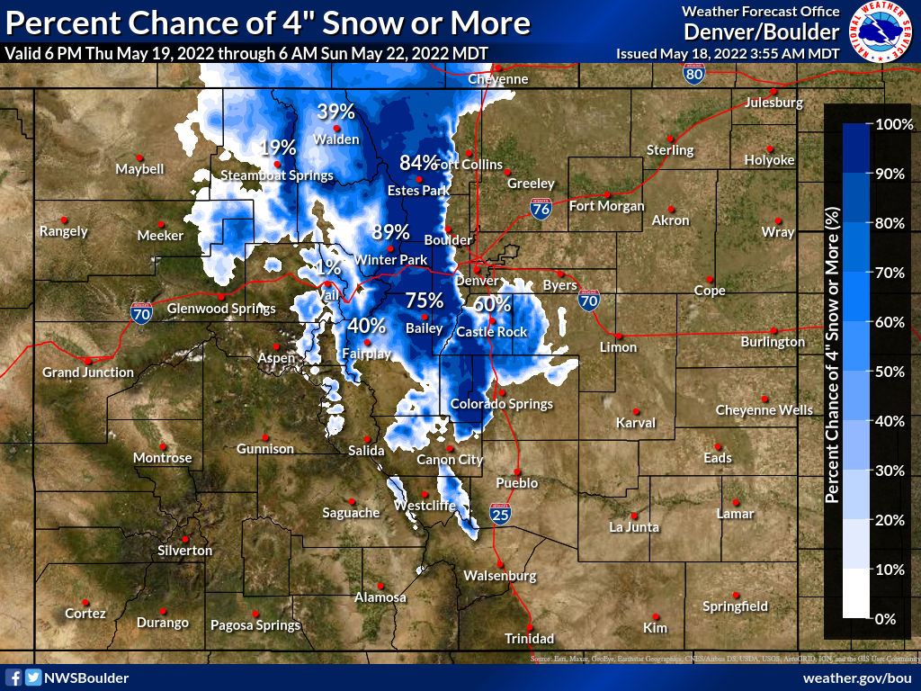
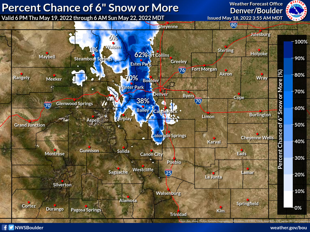
Probabilistic Forecast
This product is put together by the National Weather Service and while it relies on model data for a baseline, it get’s a healthy dose of human based forecasting that tends to smooth out outliers. I like this product for this storm system because it probably takes into account the level of melting we will see throughout the storm’s duration; meaning I think it’s closer to where we actually end up in terms of total snowfall. You’ll notice my snowfall forecast mirrors this a bit closer than pure model data.
Probability of a location seeing more than 2 inches of snow:
Probability of a location seeing more than 4 inches of snow:
Probability of a location seeing more than 6 inches of snow:
Summary
So the main story here is prepare for colder temperatures on Friday, Saturday and Sunday with wet conditions Friday and into Saturday. Many areas will see snow, some will accumulate a bit, some will accumulate a lot. We are still nailing down the finer details and obviously as the shorter range/higher resolution models come into range we’ll get a healthier dose of data to pull from.
Stay tuned for any forecast updates and I’ll be posting the weather alerts along with more information on the freezing conditions coming up – you’ll have plenty of time to get prepared!
