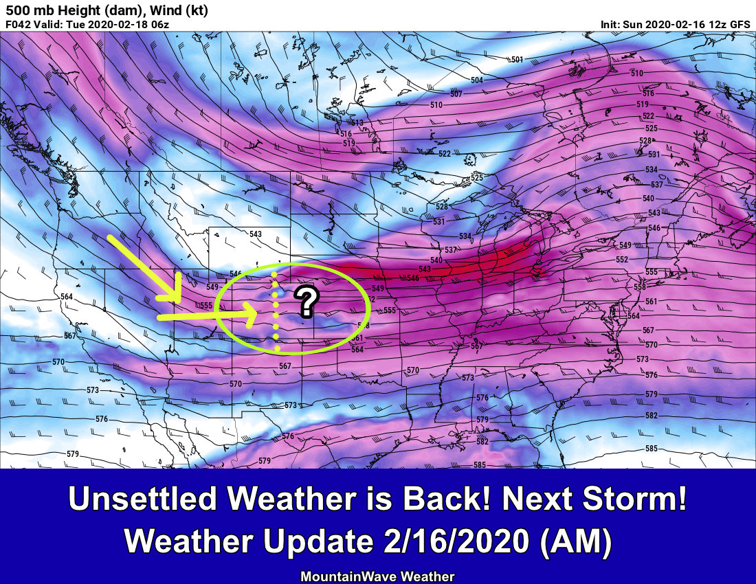
What we have on tap this weekend is one of the more difficult forecasts I’ve made in awhile. Why? Mainly because there are so many moving parts with this thing, and all of them have to come together perfectly for this storm to end up on the high end in terms of snow and impacts.
If one level isn’t moved the right way, if one thing doesn’t set up properly… well… let’s just say the bust potential on this storm is pretty high (for both higher or lower snowfall totals.)
As such, I’ll present all the information and a preliminary forecast below, but remember a lot of this is on the lower side of confidence at this point – we’re not even at a medium confidence forecast yet. This will be likely one of those storms that we won’t entirely know what’s going to come of it until it gets here and we can see how it starts to behave.
In any case, here’s the latest!
Winter Weather Highlights
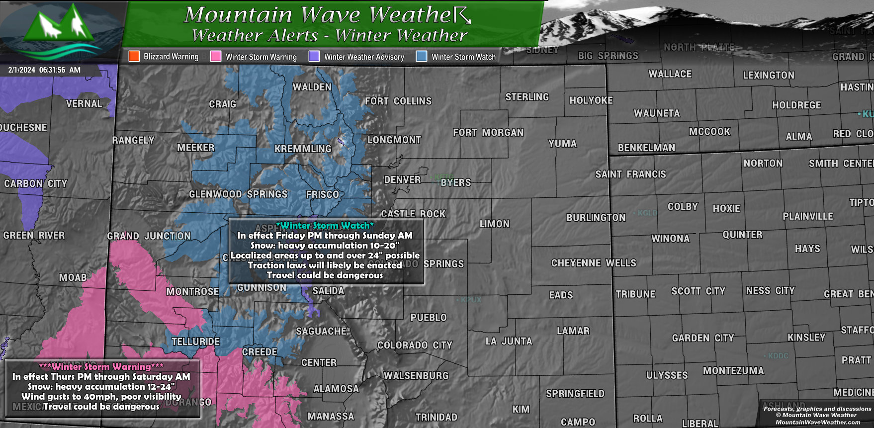
The Winter Weather Highlights are confined mainly to the mountains and foothills West of Denver and in Southwestern Colorado as of this morning, I imagine more will be on the way later today. Here’s what we have so far:
- Winter Storm Watch
- Heavy Snow 10-20″, localized up to 3 feet
- Runs from Friday evening through Sunday morning
- Travel could be very difficult to dangerous
- Traction control laws will likely be in effect, road closures are possible
- Winter Storm Warning
- Heavy snow 12-24″, localized up to 3 feet
- Runs from Thursday PM through Saturday AM
- Strong wind gusts to 40mph could cause poor visibility
- Travel is not recommended – travel will be dangerous
Denver and the front range will likely see some sort of highlights out in the near future. Still lots of uncertainty so I imagine NWS is holding off until last minute to see what type of highlights they’ll go for.
Stay tuned for updates!
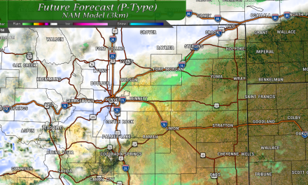
Snowfall Forecast
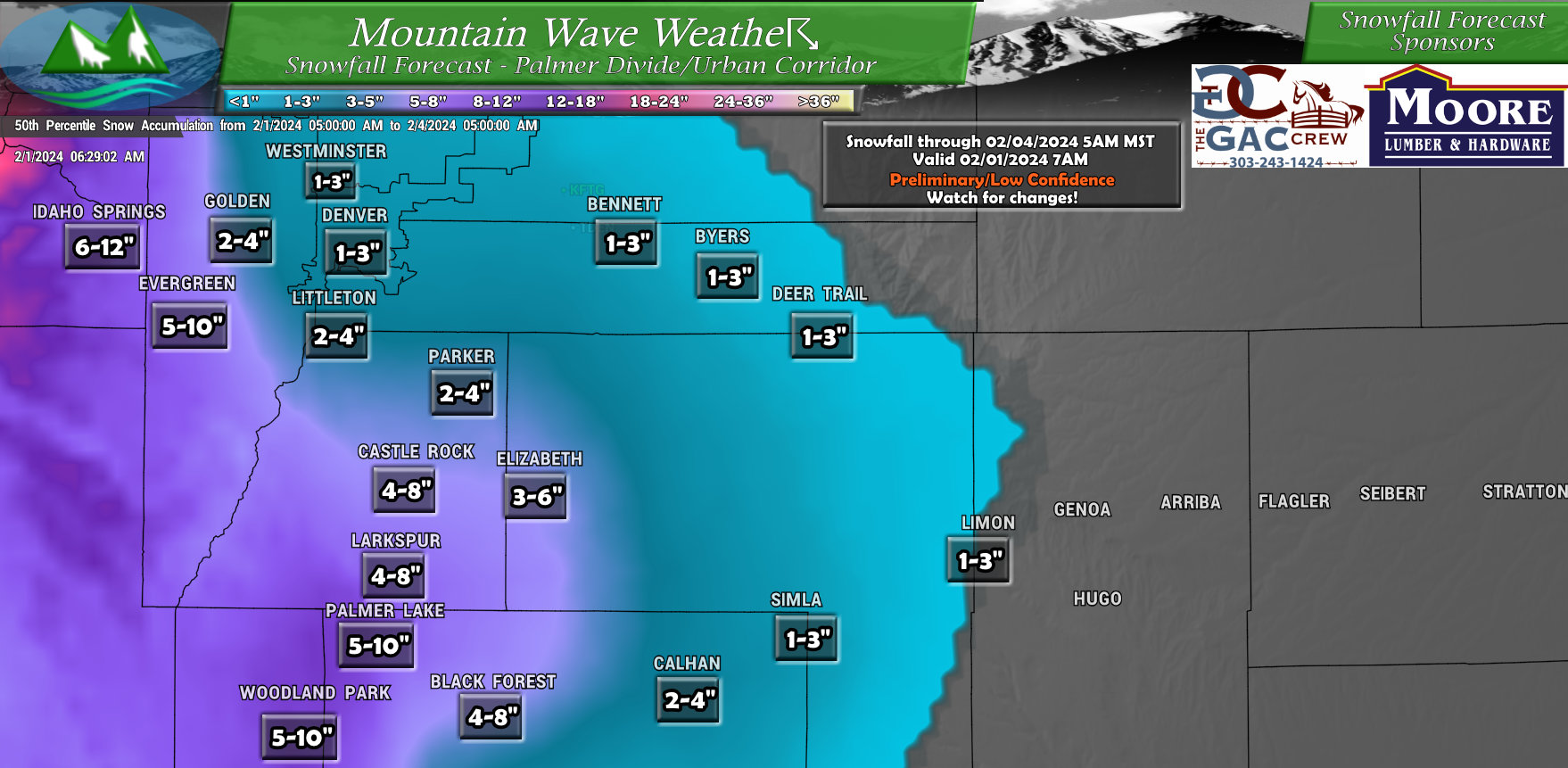
Keep in mind when you look at these numbers, there’s still considerable uncertainty across the front range on snowfall amounts… especially for areas below about 6,000 feet. Keep this in mind, the forecast confidence in snowfall amounts is still low at this point and is likely to change. Keep checking back for updates.
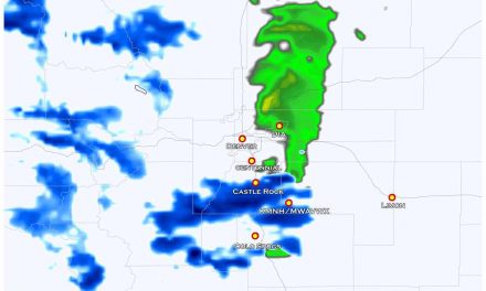
Palmer Divide/South Denver/ Urban Corridor (I-25)
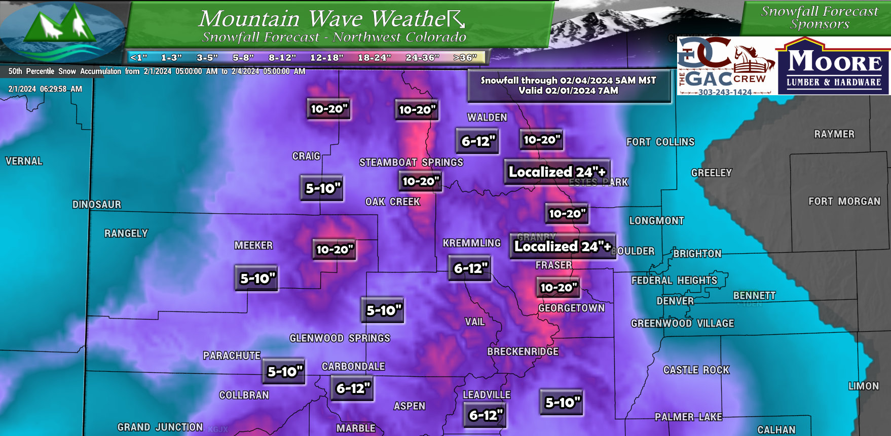
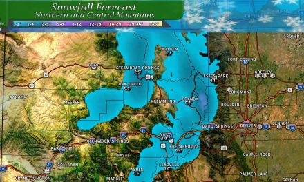
Northwestern/Western Colorado
Southwestern Colorado
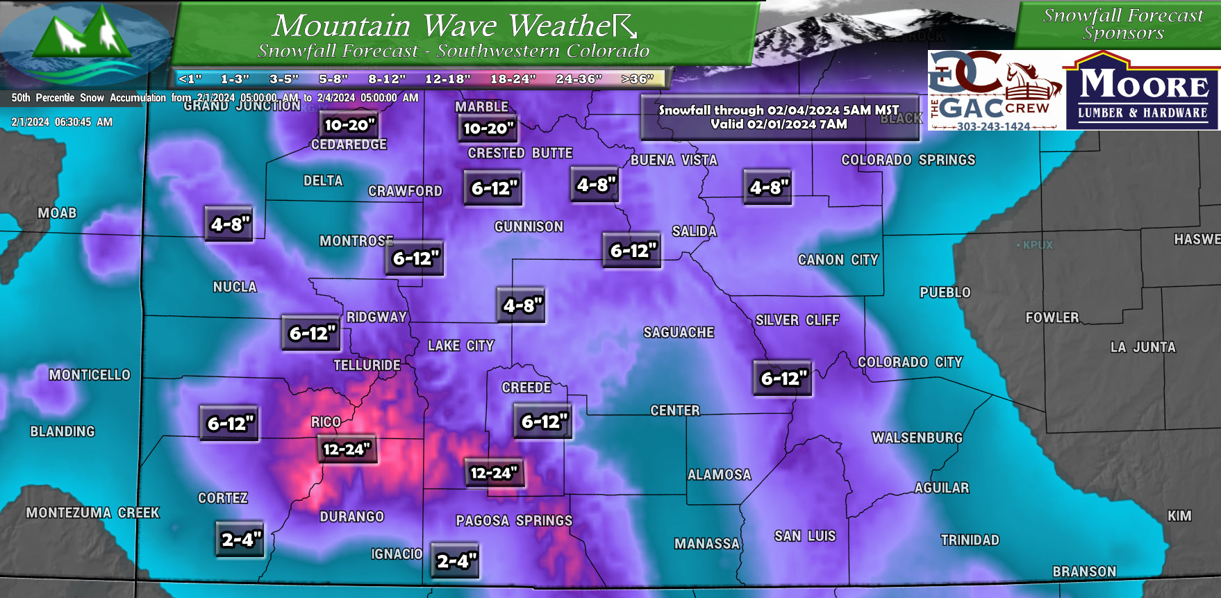
Other locations
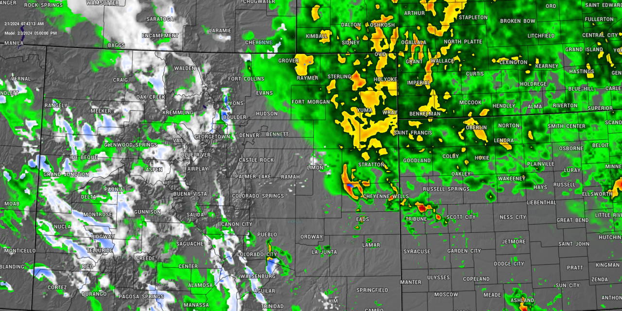
You’ll notice i didn’t post Northeastern and Southeastern Colorado.
As this storm system will highly be altitude/elevation dependant for snow, I’m not seeing big changes for much meaningful snow for those locations. Rain however, is still possible and for some areas like Northeastern Colorado – likely.
My Thoughts (IMPORTANT!)
Even though the overall uncertainty is high for snowfall amounts, I’d still recommend preparing for a larger storm. Reason being, if this thing drastically overperforms on snow – it could have the potential to be a LARGE and HIGH IMPACT storm.
You can still wait for the watches to be posted, but keep this in mind if you need a bit of extra time (like the ag folks, etc…)
Just my two cents!
Potential Timing and Impacts
As most models continue to change the speed of this storm, we will need a bit more time to sort out those finer details on this storm system. What we can say is this:
- Rain/snow starts late Friday or into Saturday morning
- Changeover to snow, especially at higher elevations (lower confidence in low elevations)
- Saturday and Sunday are primary impact days – Saturday may have the most impacts (this could change)
Stay tuned for further updates on the timing and impacts of this storm.
Summary
So, still lots of stuff to iron out. This storm is very tricky so as I mentioned above – we may not know a lot about what’s going to happen until the storm system gets here and starts doing what it does.
Still, there is no reason not to be prepared, prepare for a larger storm just in case – but realize it may not materialize. I know that’s vague, and I hate being vague… but it’s the best we can do right now.
