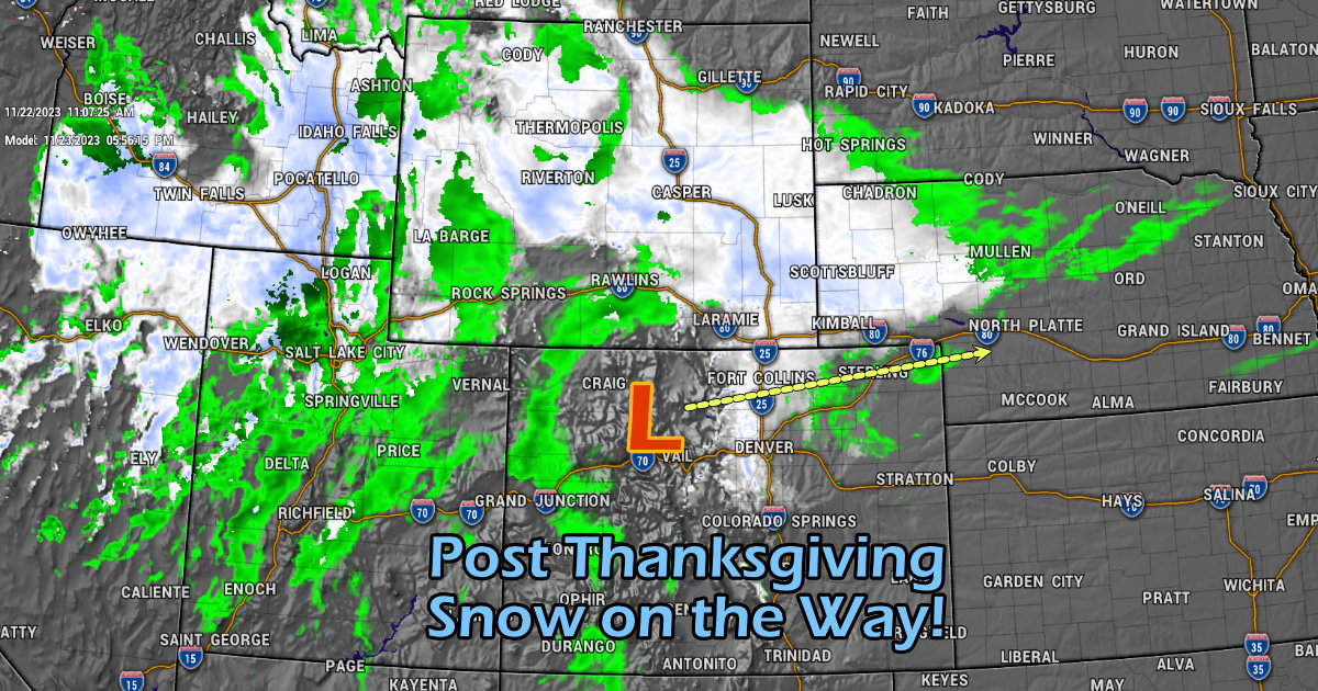
Welcome to mid-November and Happy Thanksgiving. We’ve got a Winter Storm heading our way and it will likely create travel impacts for some, others won’t see much from it – but here’s the latest information as of this morning.
Note: while I usually stick to Colorado and nearby areas for forecasting, I will mention a few other potential “problem areas” nearby to Colorado as it’s a heavy travel holiday.
Current Winter Weather Highlights
Colorado
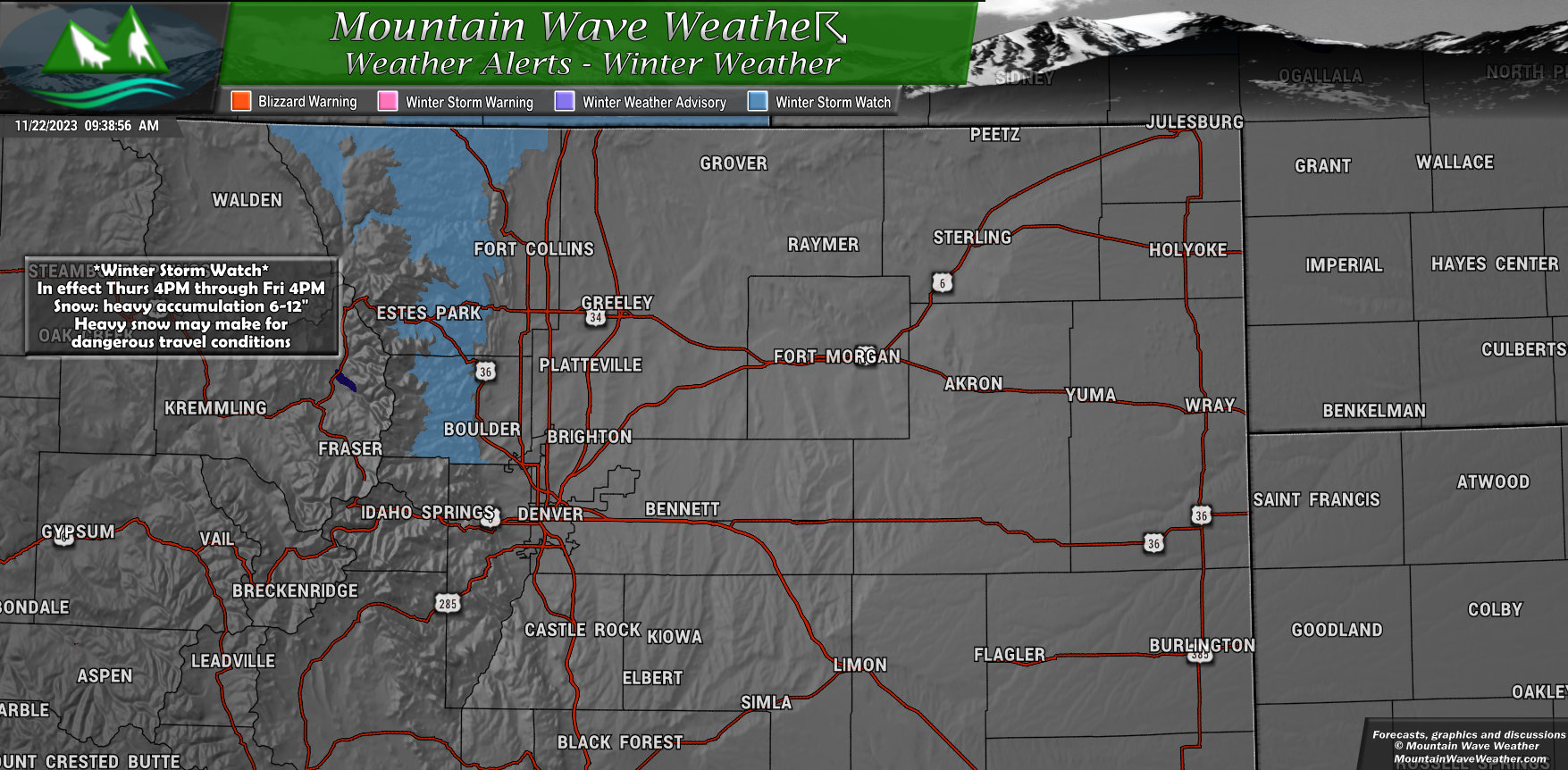
A *Winter Storm Watch* is in effect from Thursday afternoon through Friday afternoon.
Mainly includes areas West of Boulder, Loveland, Fort Collins.
Snowfall up to 12″ is possible, these areas may have travel difficulties due to the snow and deteriorating road conditions.
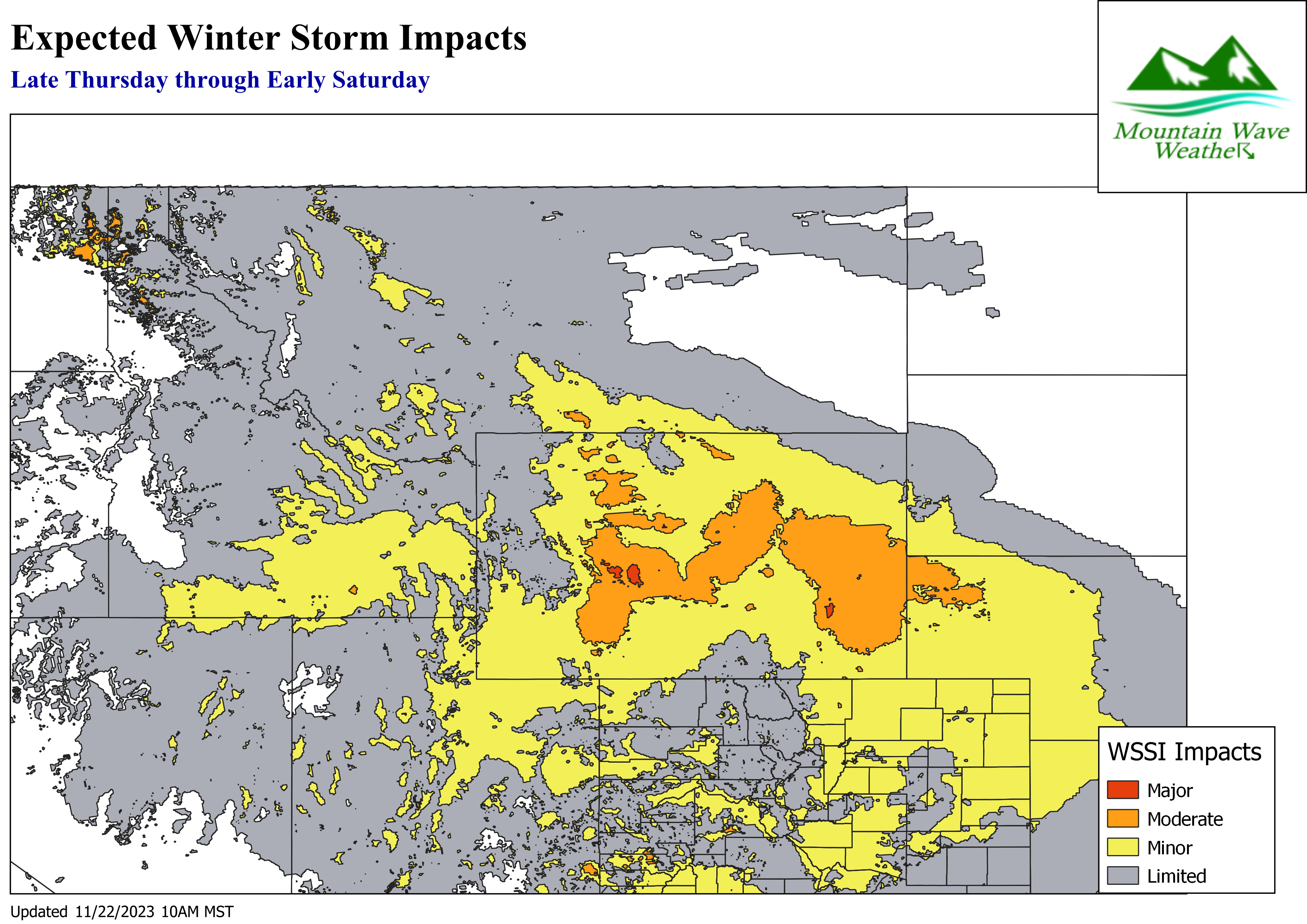
Rocky Mountain Region – North
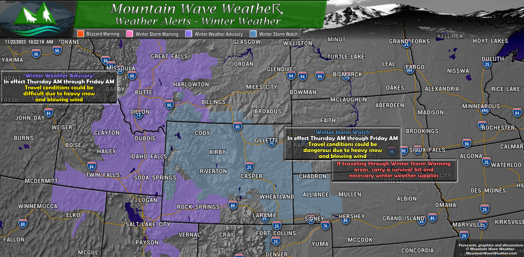
If you are traveling into Utah, Wyoming, Montana or Idaho, you’ll need to stay up-to-date on the forecast there. Some areas may experience heavy snow and strong winds. This would make travel in some areas fairly dangerous and getting stranded is never a good thing!
Wyoming especially: heavy snow and remote areas mean if you are driving through Wyoming you should expect road closures and make sure you have a winter survival kit in your car in case you are stranded somewhere.
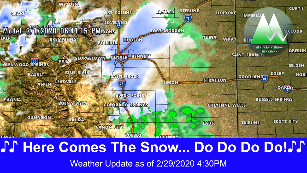
Snowfall Forecast
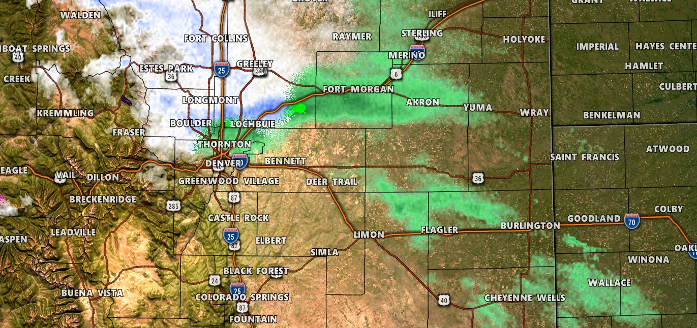
Palmer Divide/Denver/Urban Corridor
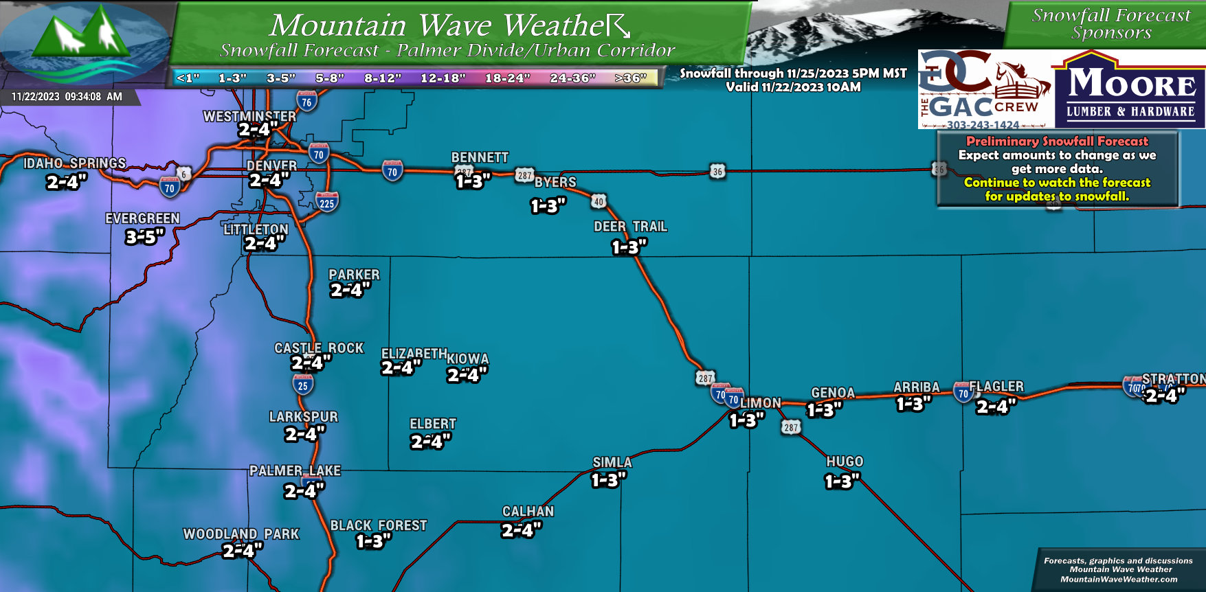
Nothing major in terms of snow along the Front Range. Most should end up in the 2-4″ range with higher amounts the further North and West you go. The foothills to the West of Castle Rock, Denver and Boulder could see decent amounts of snow out of this one.
Northeastern Colorado
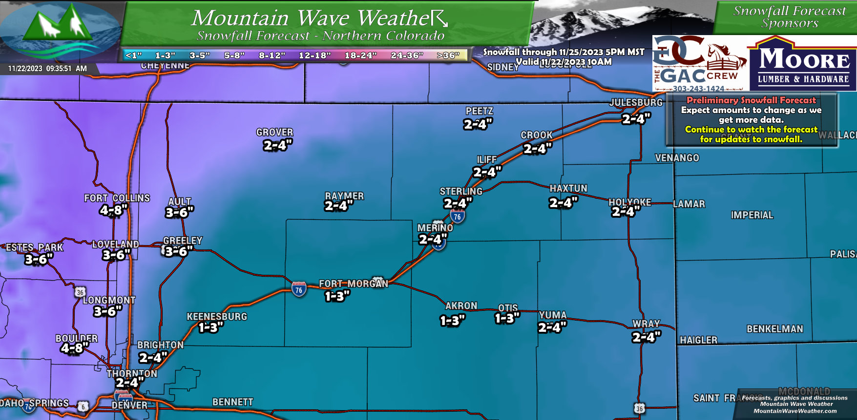
Keeping with the trend, Northeastern Colorado will see light accumulation but areas further North and West of I-25 will see hefty amounts of snow. Some areas to the West of Fort Collins, Loveland and Estes Park could see 12-14″ in localized areas.
Northwestern Colorado
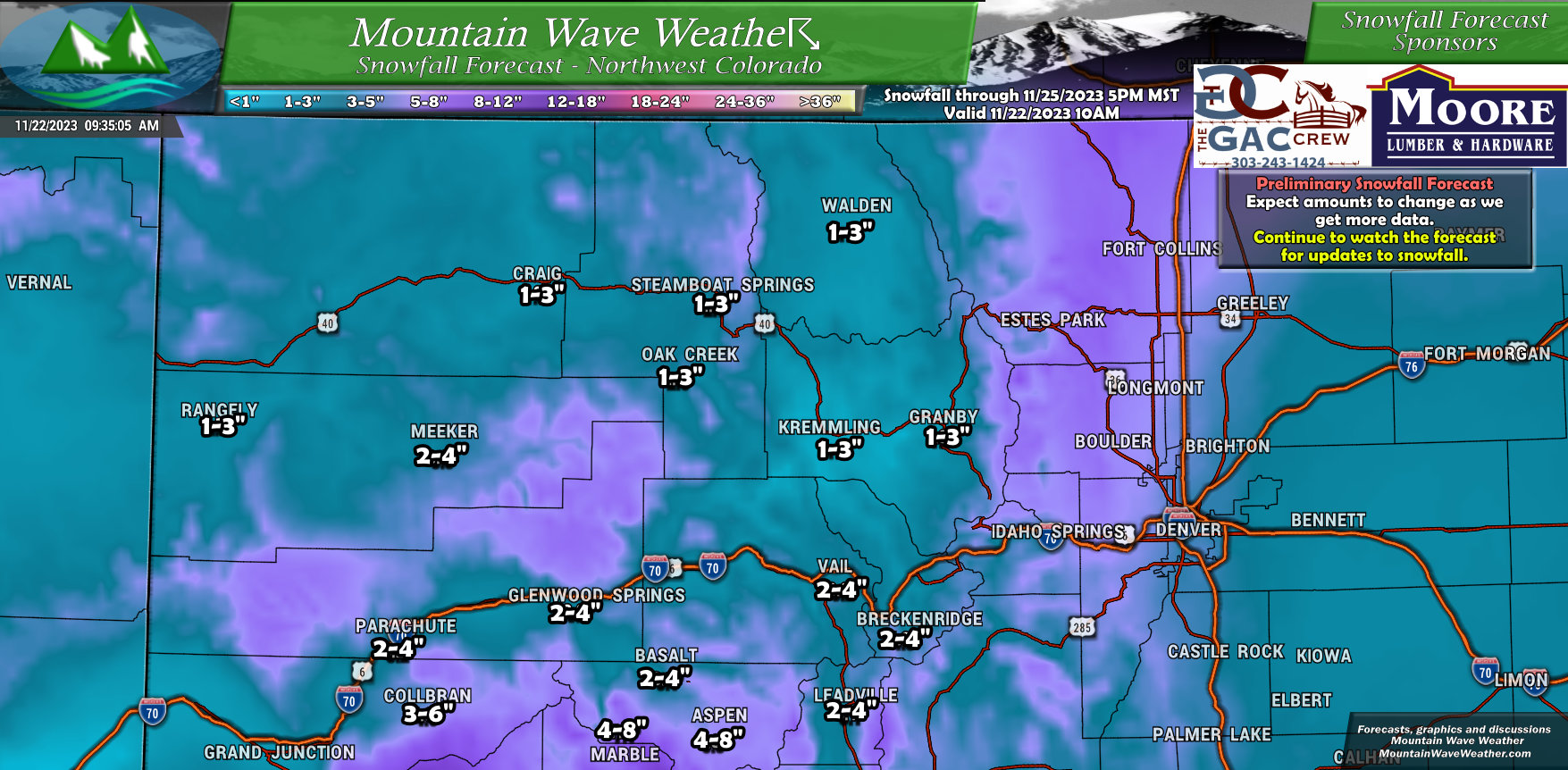
A quick bit of snow for the mountains and badly needed for the ski areas… but outside of the locations around the Continental Divide – I don’t see a ton of snow for many areas with this storm.
Southeastern Colorado
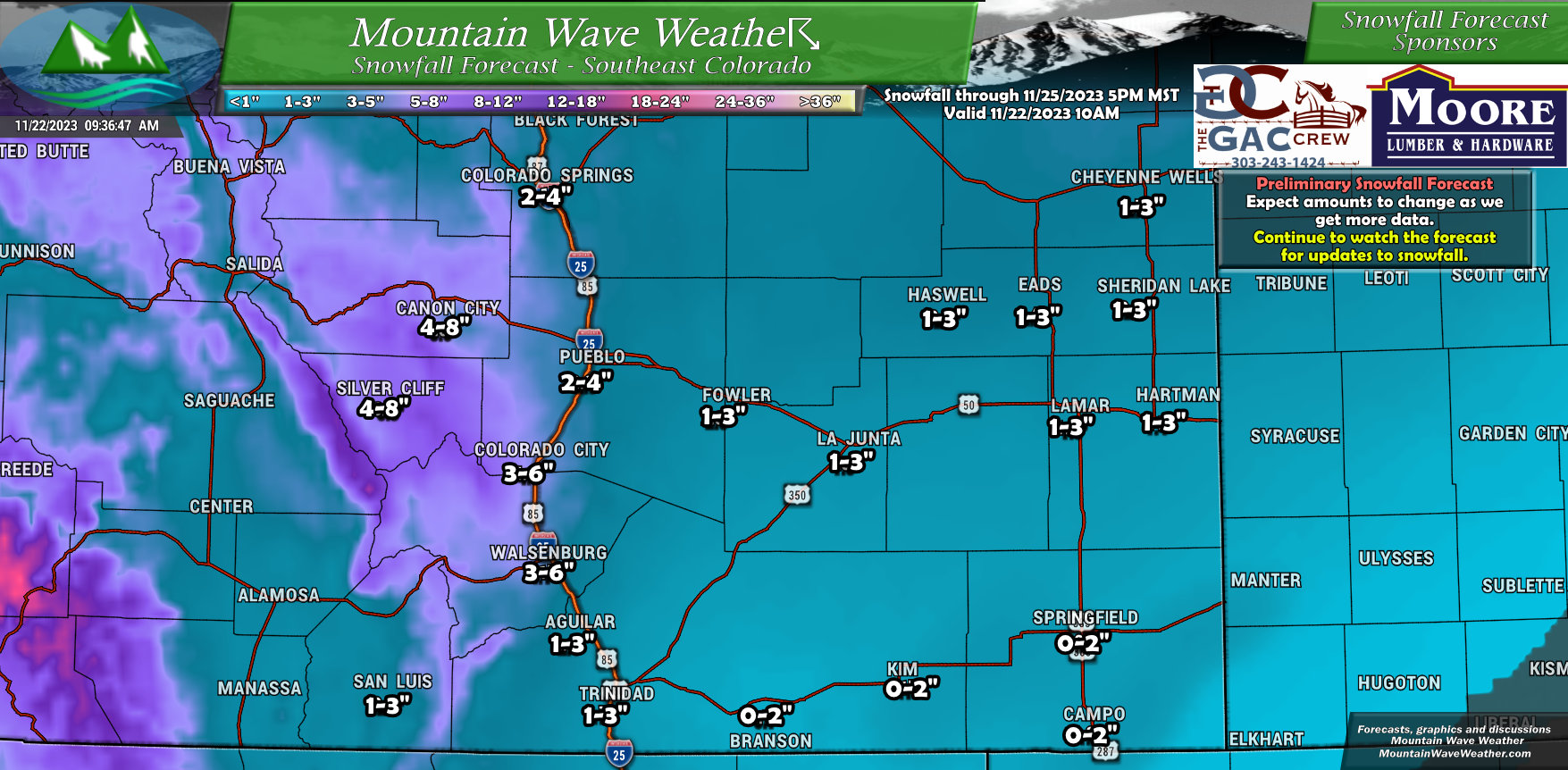
Not much for Southeastern Colorado outside of mountain locations West of I-25 and Pueblo/Colorado City.
Southwestern Colorado
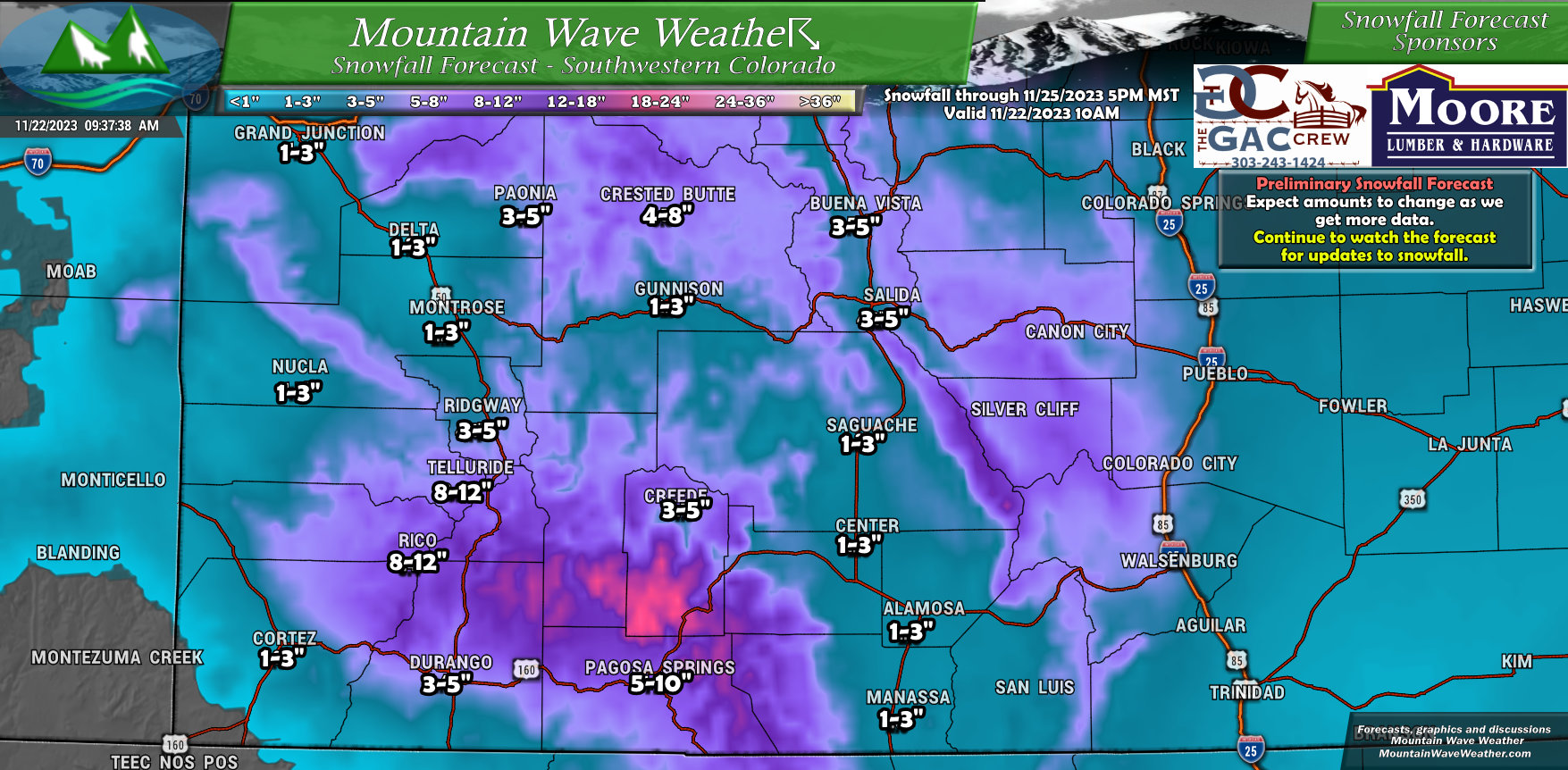
Now we’re talking… some parts of Southwestern Colorado could see some pretty hefty snowfall out of this storm.
Valleys and lower elevation areas won’t see much but some of those areas between Telluride and Pagosa Springs could be looking at 10-20″ when all said and done.
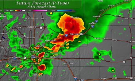
Timing/Impacts
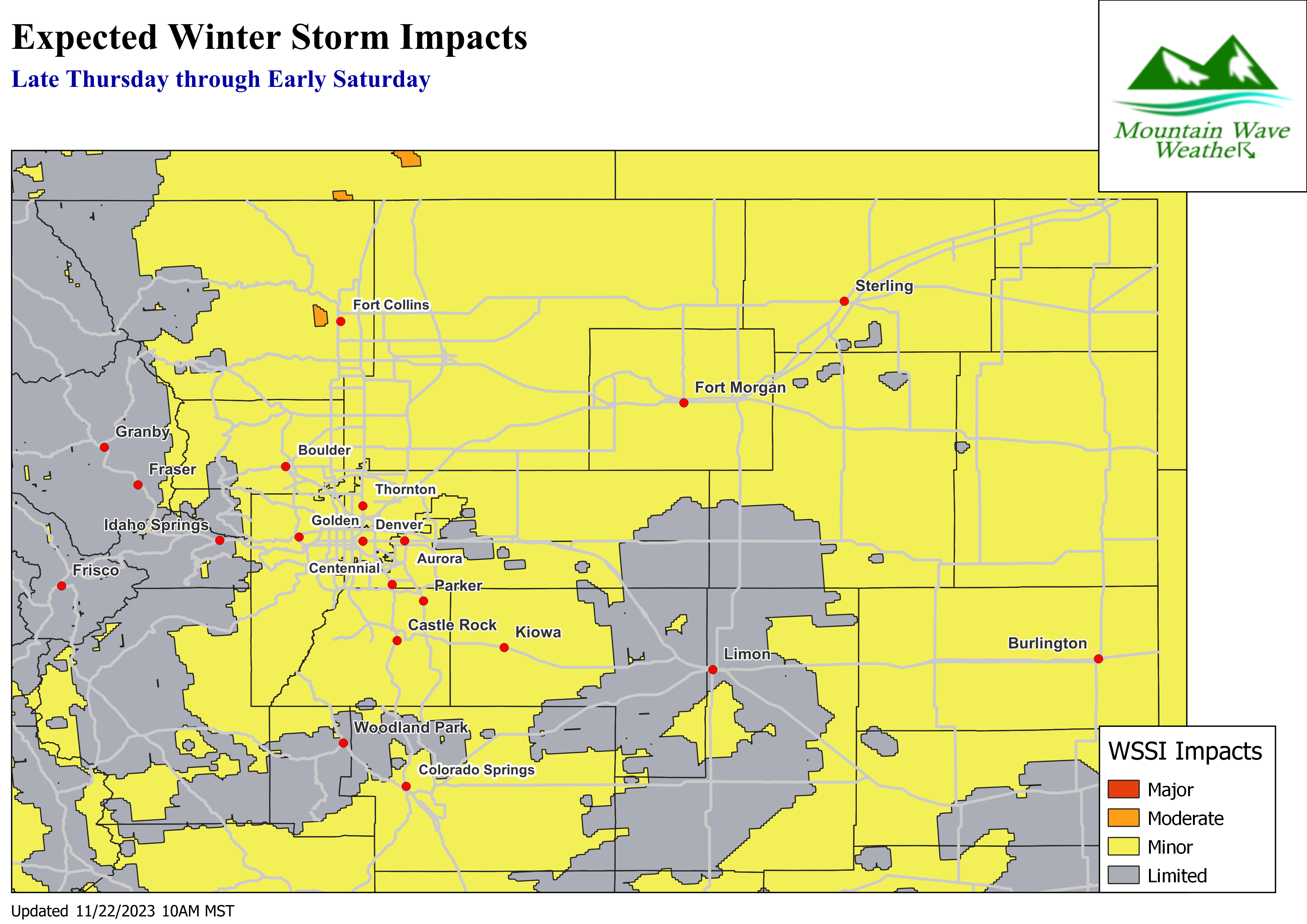 The Winter Storm Severity Index paints mainly minor and limited impacts across much of Eastern Colorado, and while I think that will be the case for most… I do believe pockets of moderate impacts will be possible. This storm has a lot of cold air to work with so roads will collect snow quickly and temperatures will allow roads to freeze quickly as well.
Very likely this graphic will be updated to reflect that later in the day on Wednesday or Thursday.
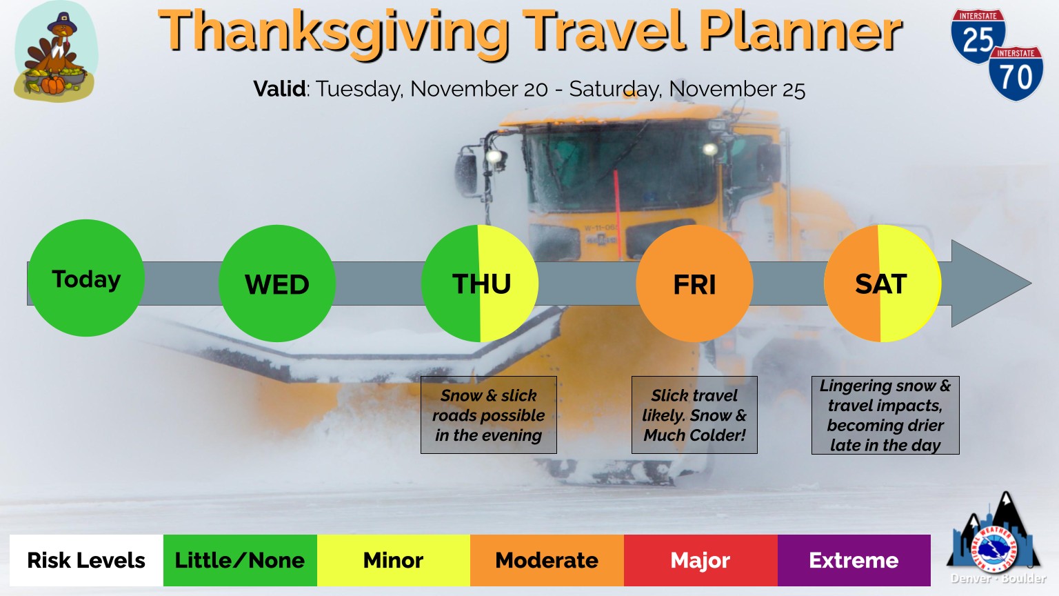
If you are driving around Friday and Saturday, be prepared for rapidly changing road conditions!
If you are traveling outside of Colorado – again the areas to keep your eye on are West and North of the state.
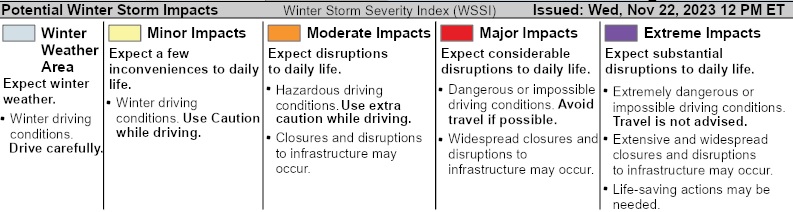
If you need a refresher on what these levels mean:
Summary
Not a major storm by any means but with the combination of travelers, heavy traffic, cold temperatures and quickly accumulating snowfall… this system has the potential to cause some headaches on Friday and Saturday.
Stay tuned for further forecast updates and enjoy the warm weather for today (Wednesday!)
