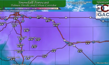
The big story yesterday was the line of severe weather that effected many areas up and down the front range. As usual, storms were spotty and not everyone saw the benefit of heavy rain or the scariness of large hail. Below is the 24 hour observed rainfall interpolated and layered on a map. You can see the Palmer Divide (especially Douglas county and El paso county) were the big winners in terms of rainfall with many areas receiving over an inch of rain in a very short period of time.
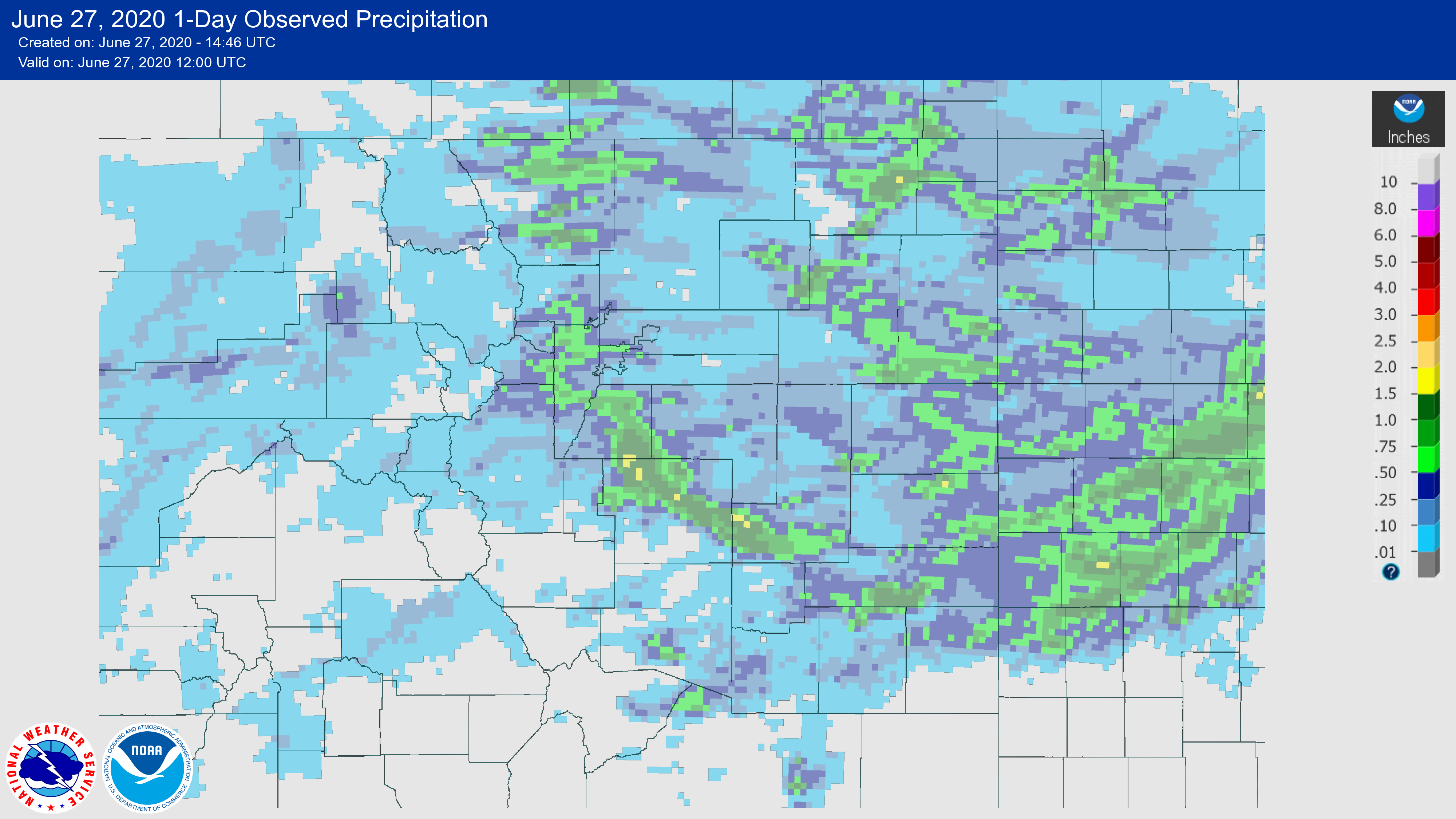
Some Observed Rainfall Amounts
Air Force Academy: 1.42 inches
Black forest: 0.87 inches
Castle Pines: 0.99 inches
Castle Rock: 1.26 inches
Elbert: 0.33 inches
Lone Tree: 0.12 inches
Monument: 0.9 inches
Parker: 0.15 inches
As you can see, the rain was very hit and miss. If you didn’t fall under these storms you probably didn’t see a whole lot of moisture yesterday.
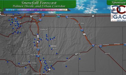
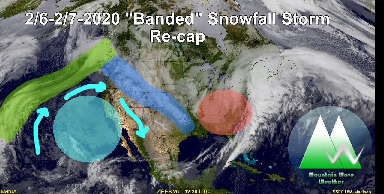
Models Nearly Nailed It!
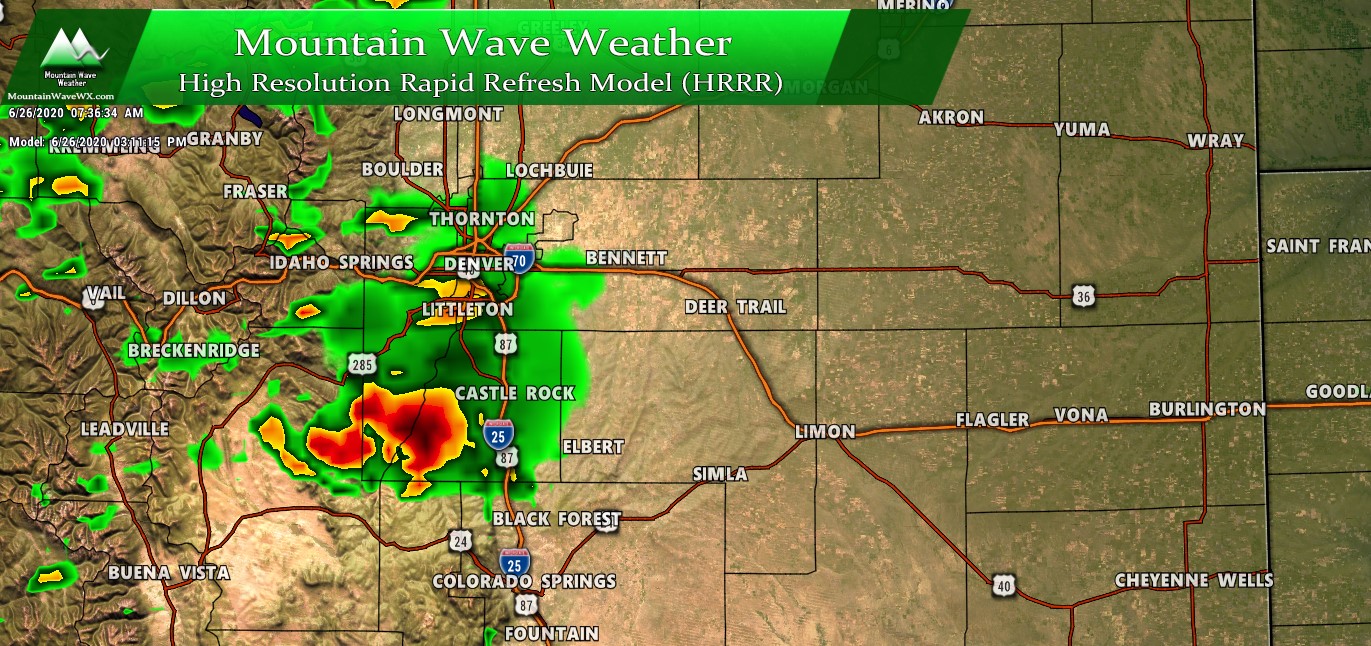
This screenshot was taken at 7:30AM on 06/26/2020 and showed the forecast at a little after 3PM
The HRRR model wins the gold star for yesterday as it was pretty spot on where the heaviest storms hit. In terms of timing however, it was off by about an hour or so… won’t dwell on that too much as models often struggle with either positioning, timing or both in some cases.
This model in particular had a large storm impacting Castle Rock and quite a few portions of the Palmer Divide with nearly every run yesterday which gave us higher confidence that the Palmer Divide would be the “bullseye” for this severe weather event… and it was!
A Few Other Thoughts/Observations About the June 26,2020 Severe Storms
- Timing
- Storms popped about an hour or so earlier than originally forecast
- The early release of energy in the atmosphere may have actually tempered these storms down a bit – less tornado/large hail risk
- Atmosphere Setup
- The instability was very strong for Colorado and tornadoes early in the storm cycle were possible but the window was narrow.
- Once storms matured there was only about a 60 minute window of good conditions for tornaodes… once storms began to merge and bow the tornado threat dropped. Several wall clouds and even a funnel cloud or two was spotted but beyond that no tornado touchdowns reported
- Instability was sufficient for strong updrafts and we should have seen much more widespread/large hail but that didn’t materialize for a lot of places (for the reasons I spoke about above)
Storm Chasing!
In what has been a very quiet year for storm chasing this year, I was finally able to get out and do a bit of storm chasing yesterday. We had plenty of company, I saw tons of other storm chasers out there and even stumbled upon a Storm Chase Tour Group.
Here’s a few pics and notes about what I saw:
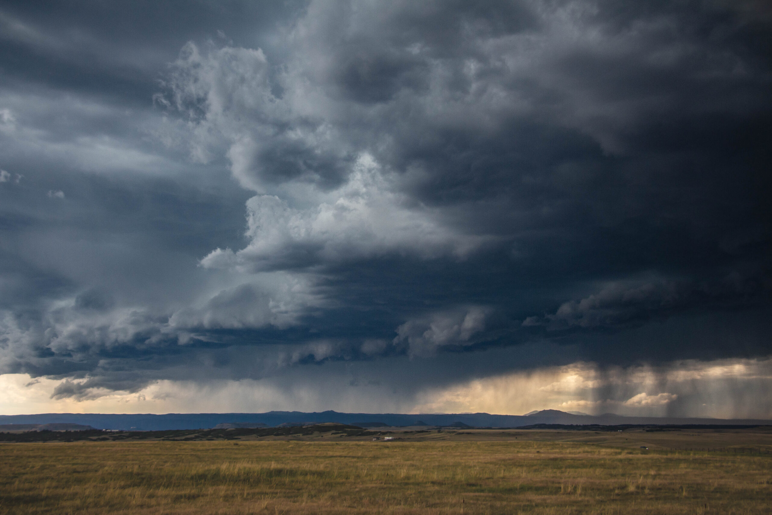
Close to home! One of my favorite parts about living where I do high on the Palmer Divide is that I rarely have to venture very far to observe some pretty awesome thunderstorms. This was taken near my house while the storm was moving over Castle Rock.
Structure day! When we sit back and enjoy the storm structure of these magnificent storms we often call that a “structure day” or just “structure.”
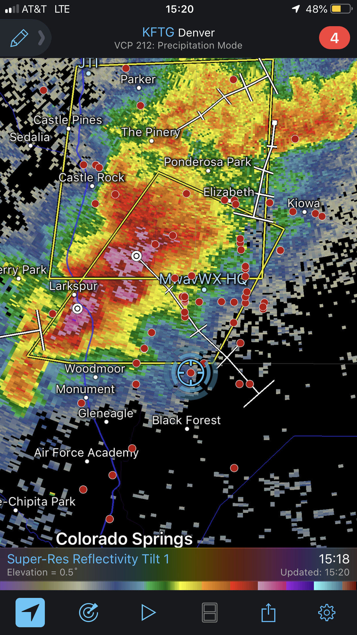
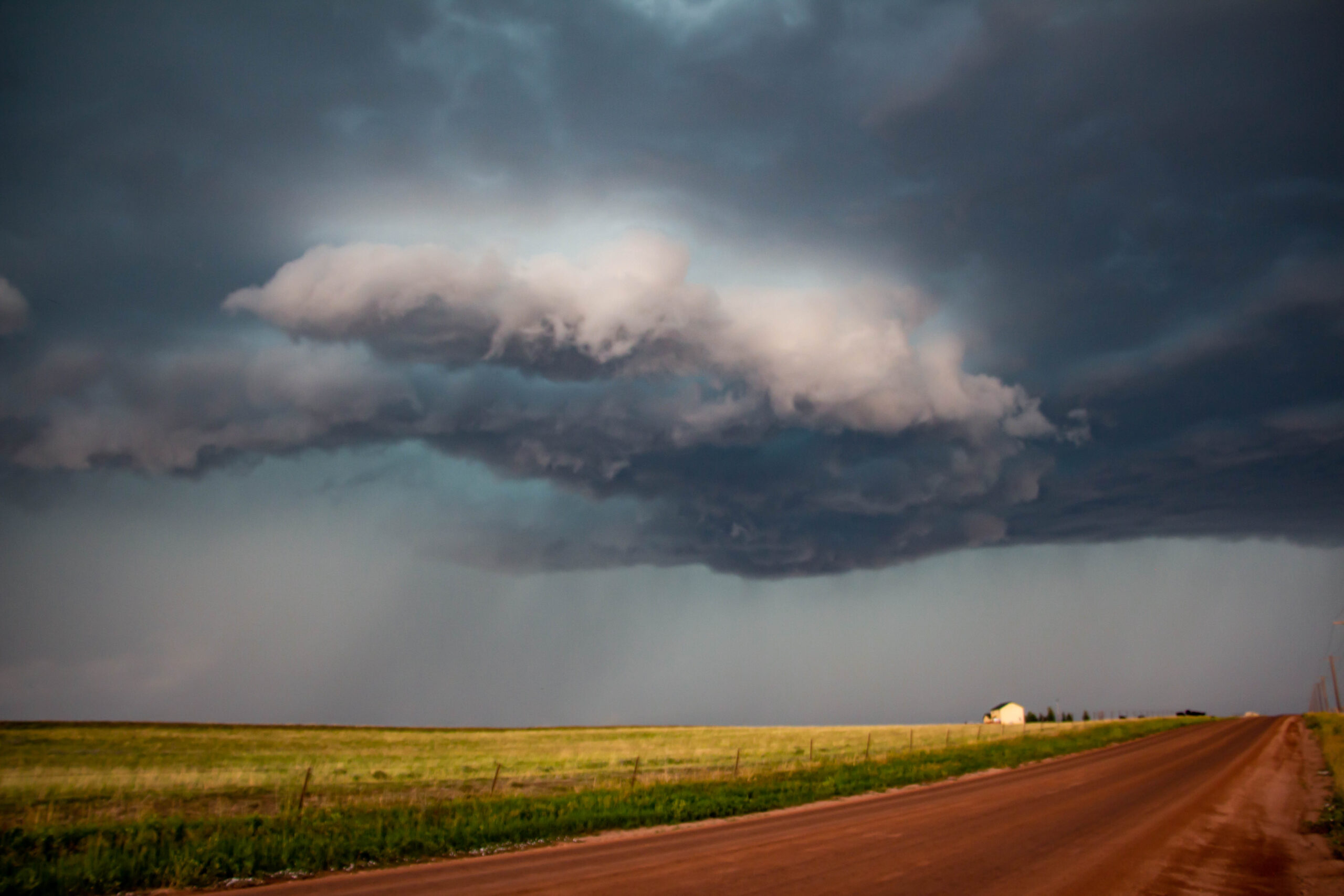
Outrunning the hail. We use a host of different radar products to ensure that we can stay away and out of the larger, more destructive parts of the storm. In this case, we are maneuvering South along one of the inflow notches so we can stay ahead of the larger hail and get a better position on the storm.

Shooting the gap! When we wanted to move back North we found ourselves with hail closing in on both sides – I decided we try to shoot the gap in between two of the larger hail cores. Timing was perfect and we avoided the larger hail and came out on the back side of the storm relatively unscathed!
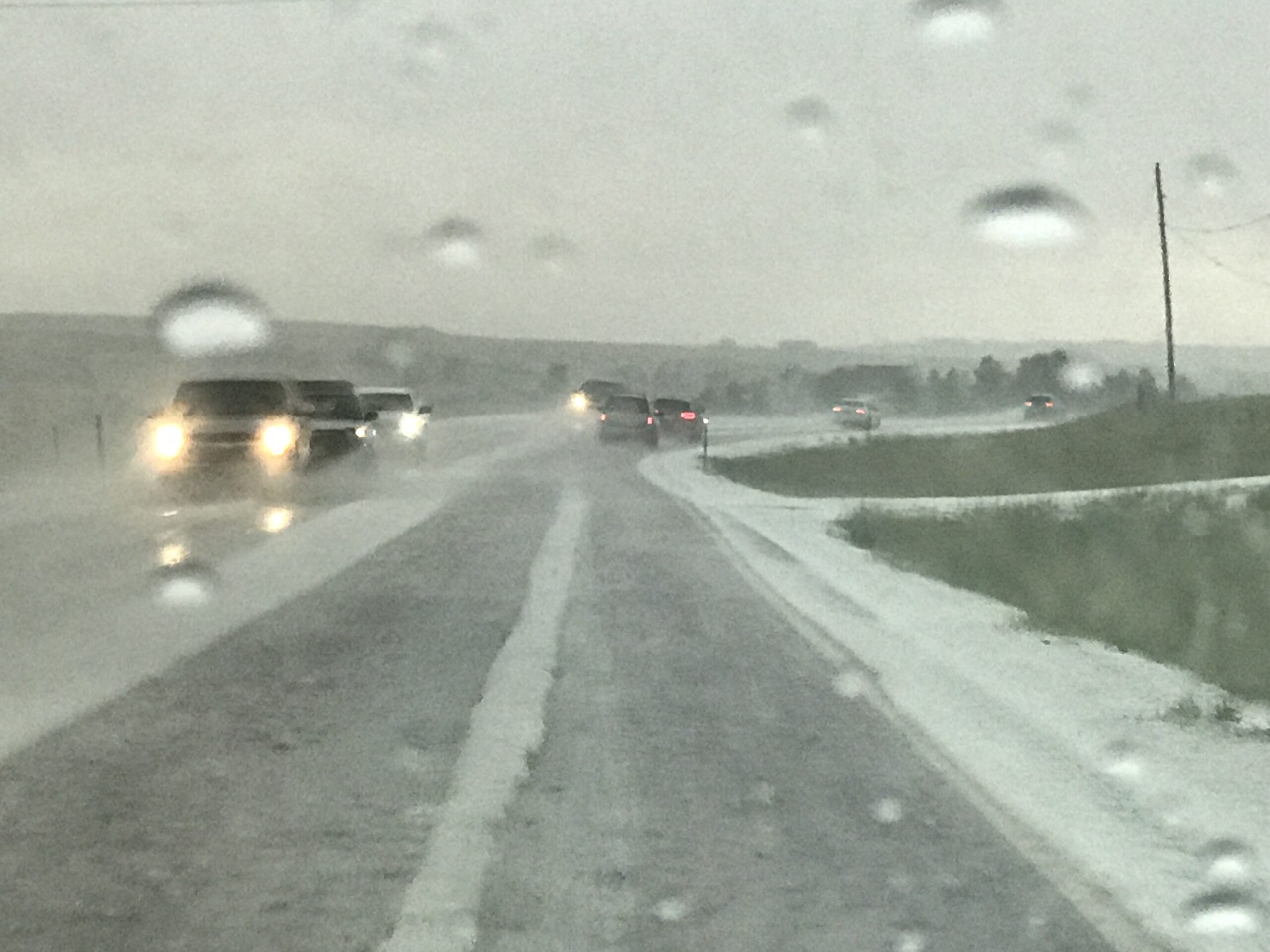
If you’re new to Colorado – don’t be surprised that we usually need snowplows in June.
Summary
A relatively exciting day in a long line of relatively boring days in terms of weather around here. As we look forward there is another smaller chance of severe storms today (06/27/2020) but nowhere near the threat of yesterday.
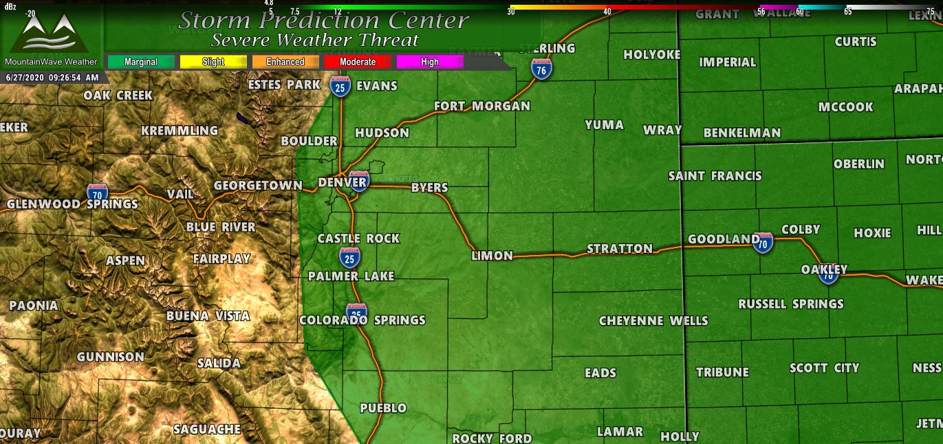
Just make sure to keep an eye out this afternoon for any storms. They won’t be as widespread as yesterday but the chance will still be there for a very isolated strong/severe thunderstorm.
