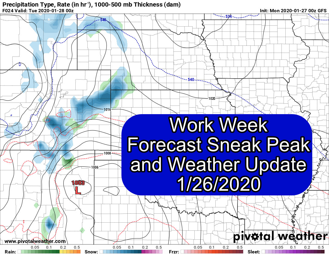
This weekend turned out to be a bit busy so I wasn't able to spend a lot of time in front of the computer forecasting until late this Sunday evening. We have 2 shots at storms this week, they're not going to be much to worry about but at this point we will take any moisture we can get!
Since I don't have time to write another article this evening, I've posted the Workweek forecast that supporters Ascent Level and above get each and every week. Consider this a nice "sneak preview" and if you want to sign up you can do so by clicking on the image below!

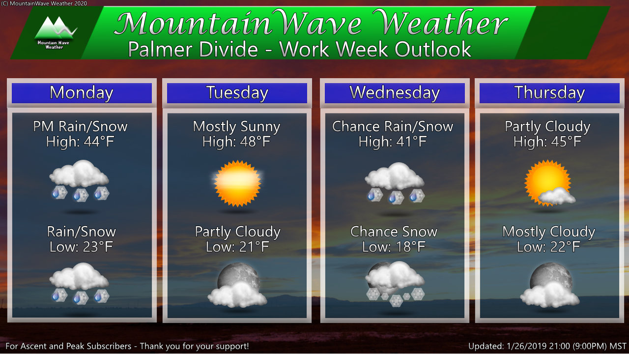
Week of January 26, 2019 - January 31, 2020
Daily Outlook
Outlook Discussion
Additional Comments/Discussion
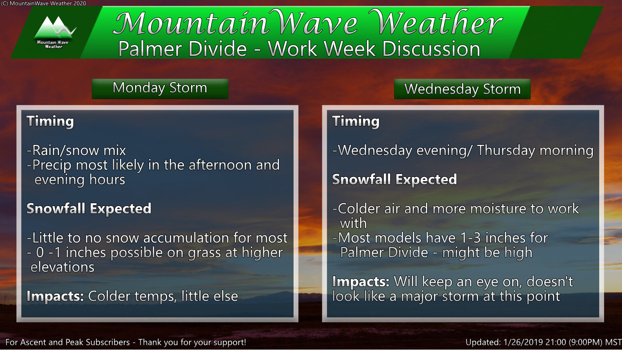
This week should feature at least a little bit more interesting weather than we've seen the past few, but still not much to write home about. The good news is we have at least 2 chances at moisture this week. They're not great chances and it won't be much, but at least it's something! Monday will start off fairly decent but will be noticeably cooler than what we've enjoyed the past few days. At this time it looks like the best chance for precipitation is in the afternoon and evening hours. Call it between 11AM and 11PM for the best shot; precipitation will generally be light and spotty for most areas.
After clearing on Tuesday our next disturbance rolls through later in the day Wednesday and into Thursday. This mid-week storm looks very similar to the Monday storm but it has a little bit more cold air and moisture to work with. That being said, this will be another minor storm most likely, most models have a good bit of the Palmer Divide between 0-2 inches and 1-3 inches.
We are not expecting significant travel impacts along the Front Range from either of these storms.
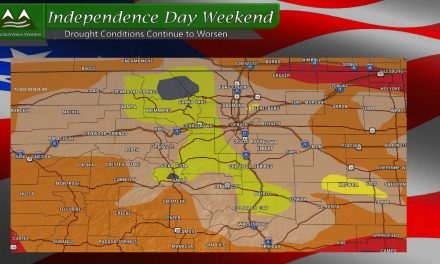
So, not much for this week but at least it's something... it's getting awfully dry and crispy around here!
As always, we will keep an eye on both these storm systems for any changes, so be sure to check back here every so often for any updates.
