Colorado weather will be running the gambit today, as it typical in spring. We have Winter Weather Advisories in place, thunderstorm outlooks and some possible light travel impacts.
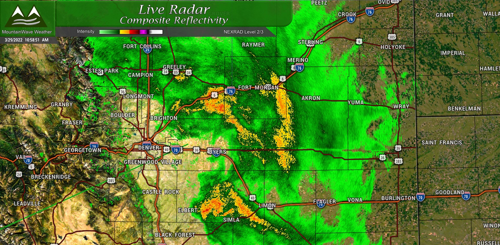
Live look at the radar around 11AM shows the areas of heavier precip.
Here’s the latest on our next storm system already moving through the area today!
Winter Weather Highlights
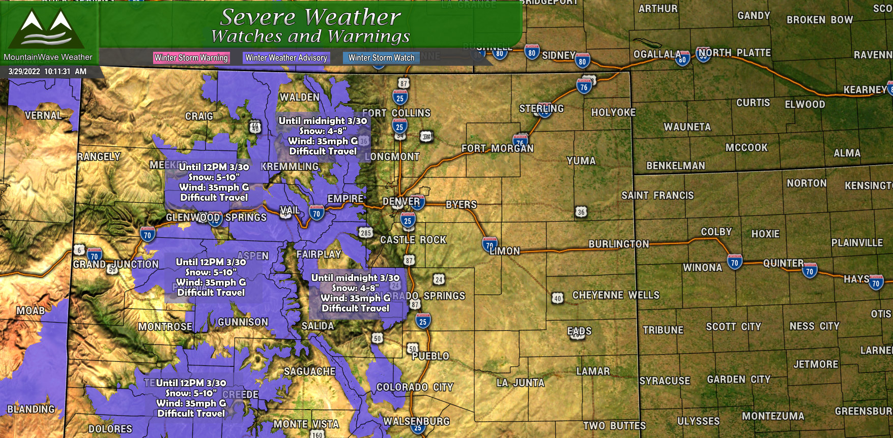
There are a few highlights issued for this storm, mainly in the mountain locations for Colorado. A Winter Weather Advisory is in effect for the front range mountains and areas close to the continental divide through midnight. These areas will see 4-8″ of total snow accumulation with winds gusting to 35mph, this will make for difficult travel conditions at times throughout the day and into tonight.
Further West and South, a Winter Weather Advisory is in effect until 12PM tomorrow (3/30/2022) for up to 5-10″ of snow and wind gusts to 35mph.
The only areas eastward I can see getting and advisory out of this would be the front range foothills or higher elevation sections of the Palmer Divide. As of right now it doesn’t look like conditions will warrant it but that could change as more model data comes in.
Storm Impacts/Timing
There’s a lot of moisture with this storm, which is great news! Due to the warmer temperatures a lot of areas will experience rain through most of the day today. Once the sun goes down tonight and temperatures drop, that’s when things get a bit more interesting.
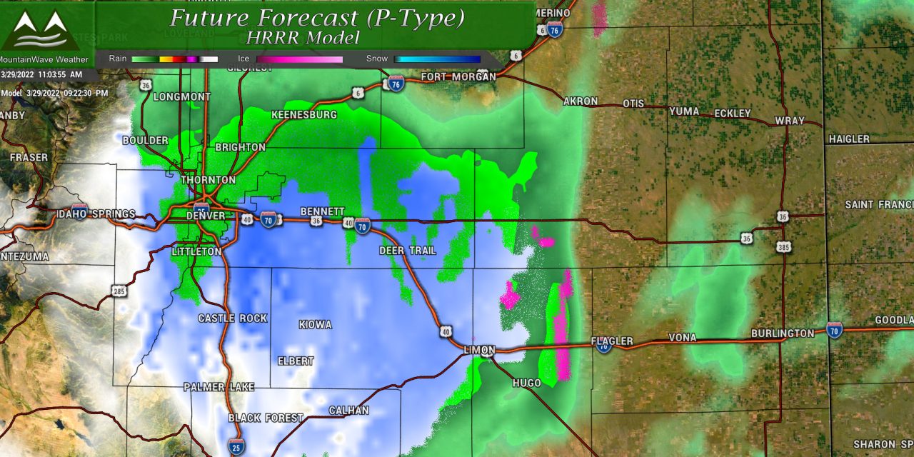
Rain Changing to Snow
For the higher elevations of the Palmer Divide, this looks to occur sometime around or after 8PM. The snow could be heavy at times due to instability and a lot of lift. If road conditions deteriorate for this area it will most likely be after that changeover.
If the roads get slushy and travel is impacted it looks fairly limited overall but don’t be surprised to see some quick and heavy bursts of snow along the Palmer Divide. Any impacts to the roads will most likely be overnight with quick recovery into the morning. With temperatures this warm, de-icers work pretty well at getting the roads cleared up quickly after the heavier snow lets up.
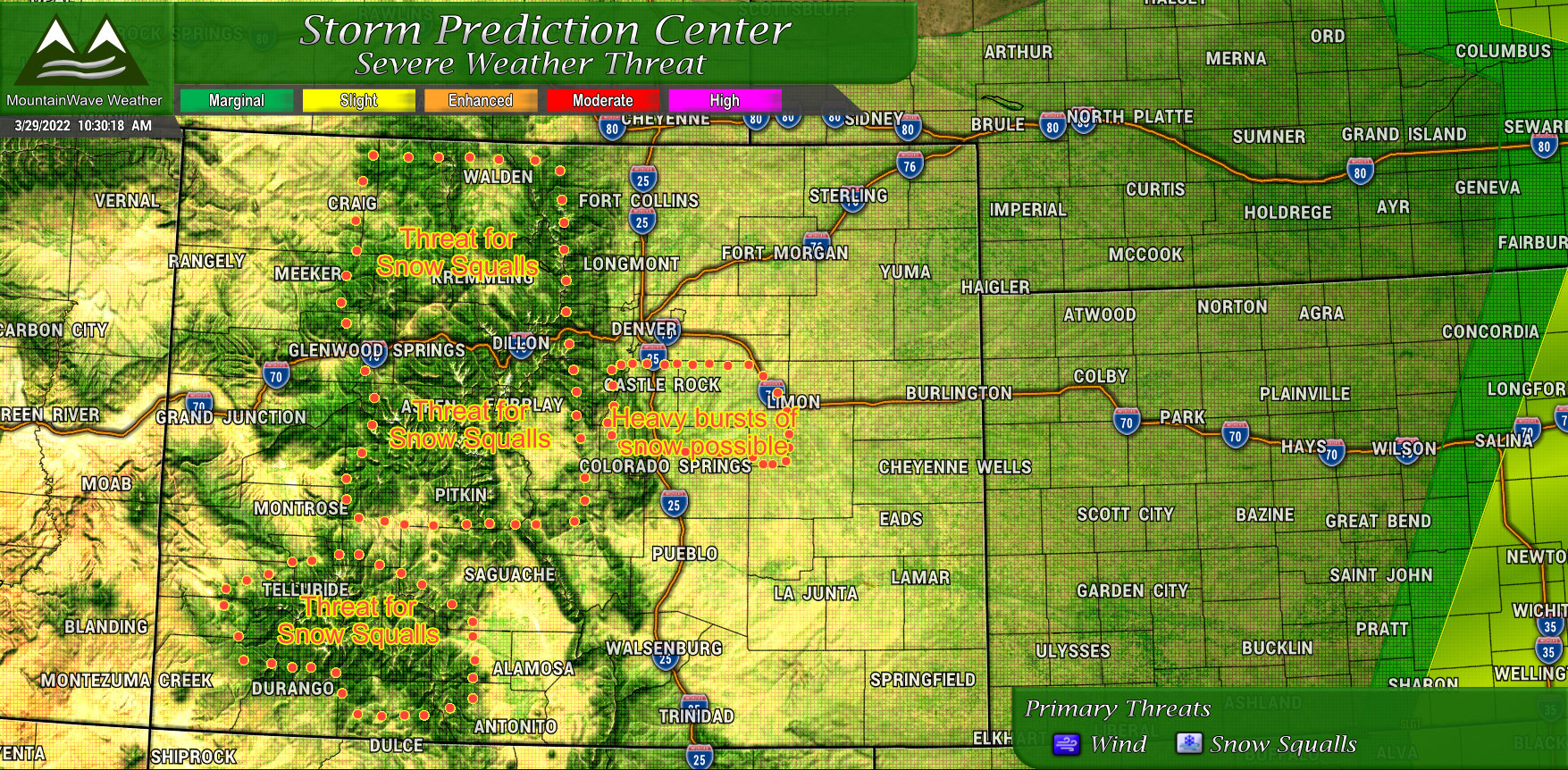
Thunderstorm/Snow Squall Threat
There is a general thunderstorm threat outlined by the SPC for today over Colorado. With a threat level like this, we don’t expect any severe weather in terms of hail or tornadoes, but the strong instability and lift can cause snow squalls this time of year.
I’ve outlined the main areas of concern in the SPC graphic below. Driving through any of the highlighted areas today – be prepared for rapidly changing conditions.
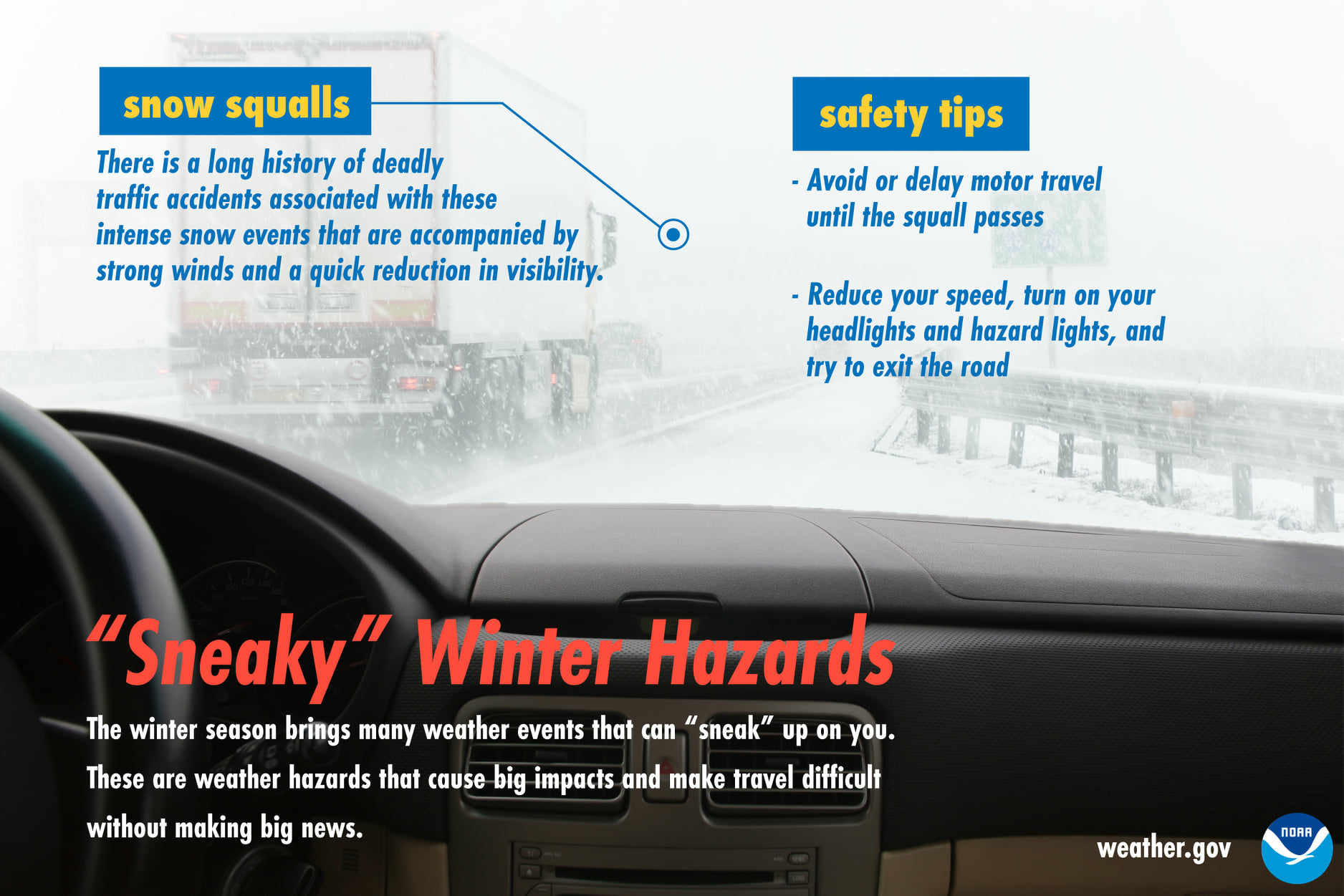
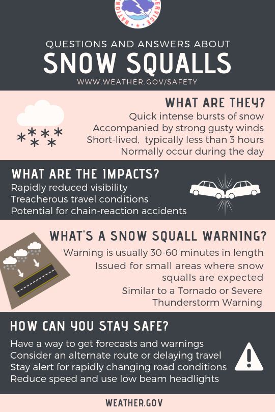
Caught in a Snow Squall? Here’s What to Do!
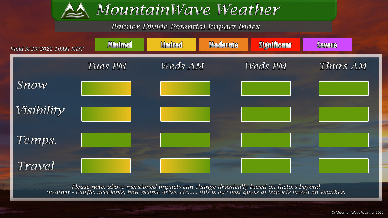
Summary
A nice storm on tap with a decent amount of beneficial moisture. Doesn’t look like anything major in terms of impacts but keep an eye out on the Palmer Divide and Mountains this afternoon for some travel headaches and rapidly changing conditions. Shouldn’t be enough to shut things down by any means but could cause a few travel headaches here and there.
Take it slow and you should be just fine. Stay warm, stay safe!

