Latest Updates as of This Morning
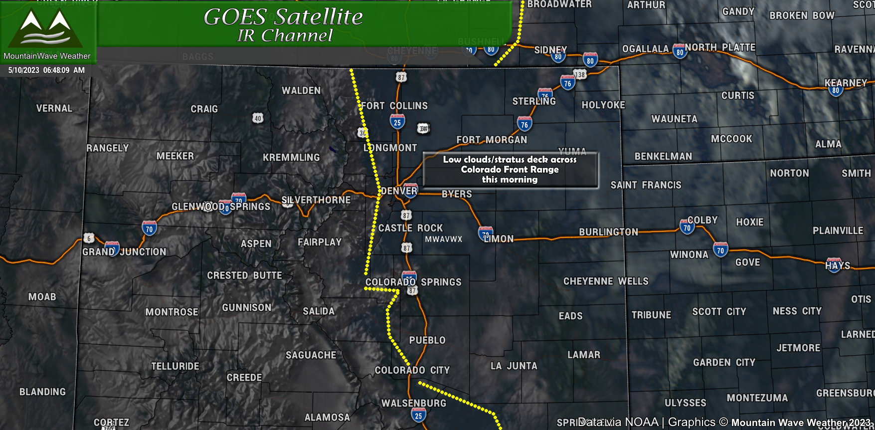
Low stratus clouds draped in across the area this morning. This will help act as a “lid” on the atmosphere and keep storms from firing too early. This is important because the energy to fire storms is all primed in the atmosphere and now we will add heating and continue to build that energy into the afternoon. Once that energy releases, it will do so explosively and we will kick off some fairly large storms across the area.
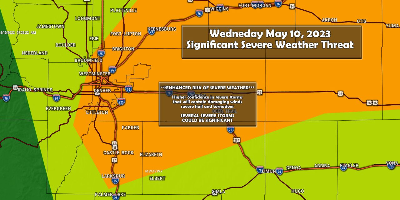
This is one of the more significant setups in the atmosphere in Colorado in several years so don’t take today lightly! Be ready, be prepared and stay weather aware this afternoon!
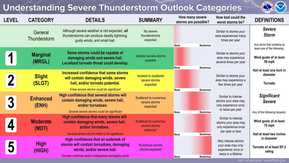
As quick reminder as a primer for information below, here’s the SPC categories and what they mean:
Storm Prediction Center Outlook
Hail
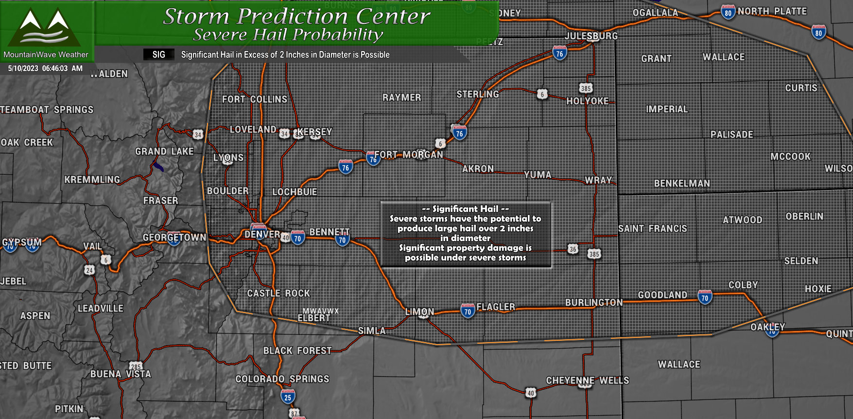
Hail is going to be the primary threat today from severe storms and unfortunately the atmosphere is primed for very large hail potential. The SPC Outlook paints another higher risk area at around 30% as seen in the image below.
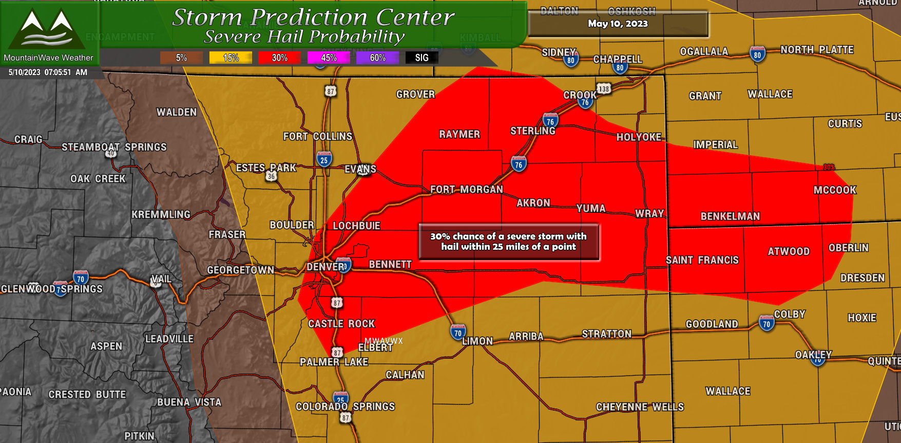
Additionally, a significant hail outlook area has been outlined which states an area where hail could reach 2 inches or more in diameter. This is significant because hail this large can cause serious damage to property and could potentially threaten lives – injuries to people caught out in these storms are common when hail gets this large.
Tornadoes
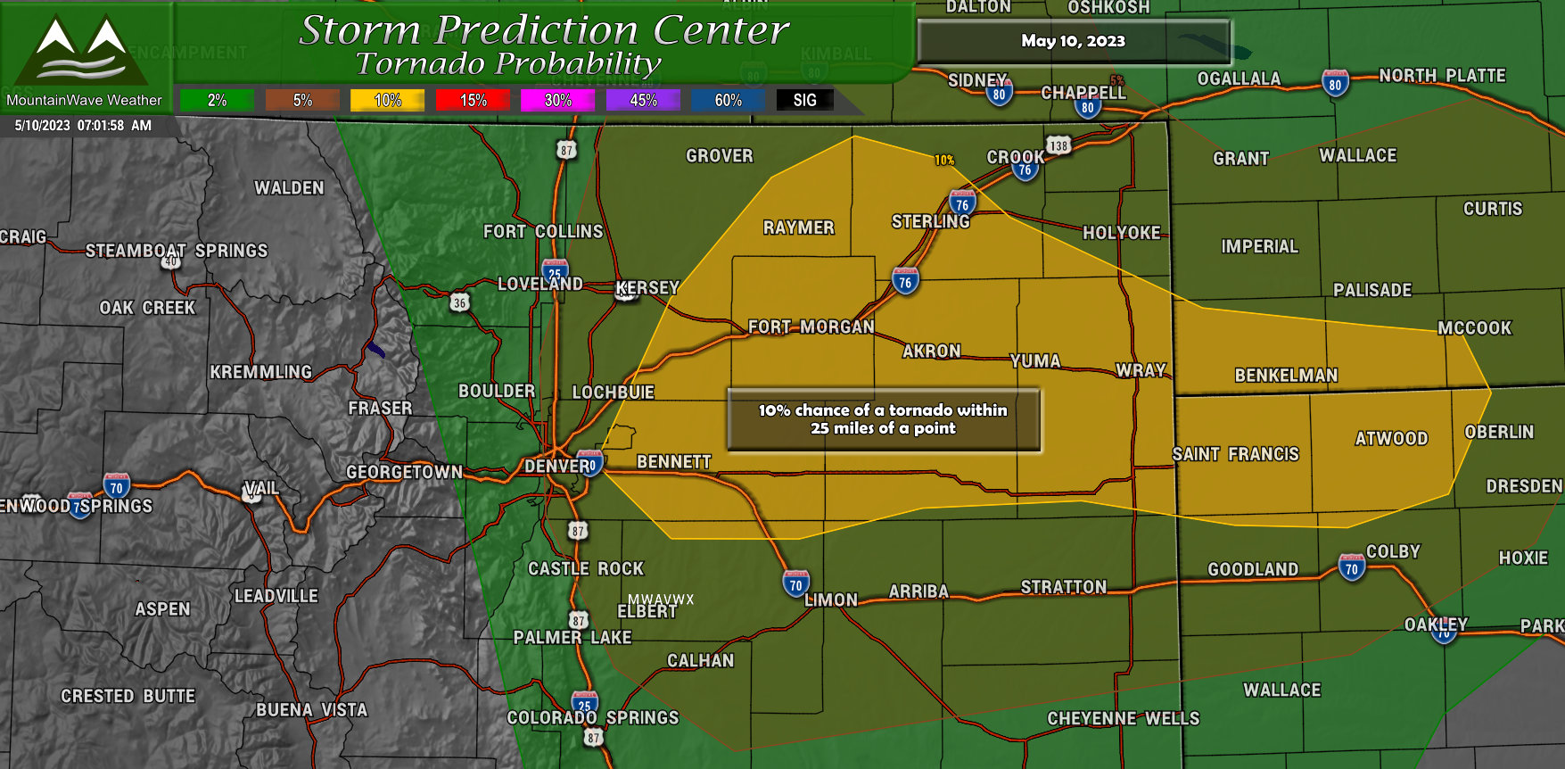
The tornado threat is fairly notable today, conditions will be favorable for tornado development especially just North of the Palmer Divide, East of Denver and into Northeastern Colorado. The Storm Prediction Center has painted a 10% risk, which means areas in the yellow have a 10% chance of seeing a tornado within 25 miles of a point within that area.
That doesn’t seem like a high probability and it really isn’t overall… but it is quite high for Colorado. Off the top of my head I cannot remember the last time Colorado had a 10% tornado risk day. So we need to stay very heads up today!
Wind
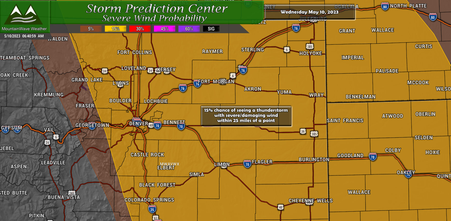
There is a damaging wind threat with these storms, but this will be on the lower end of the threat/significance level. Our primary attention will be on the hail and tornado threat, but don’t rule out gusty and damaging winds.
Summary
Most important messaging today:
- You need to stay weather aware! Have a way to get warnings and alerts – apps on your phone are a great way to get this information. Additionally many counties can/will send out alerts through programs like CodeRed
- If a warning is received, take quick actions to protect life and property
- Know where to go at your home and office if a tornado warning is issued
- Large damaging hail is also possible – property damage could result under these storms
I’ll have any other information up as needed and as I can – but for realtime severe weather alerts your best source of information is the National Weather Service or those phone apps.

I live in the meadows and have a 3:40 appt. Wondering if there’s anything definitive for this specific area as far as what the weather will be around that time? Will be out 3:30-4:30 or 5