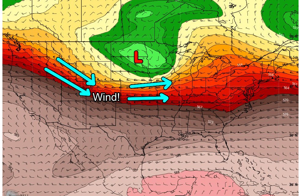
Wind is going to be the big story this week as a series of storm systems move through to our North. This means while the mountains may see a bit of moisture, it doesn’t look too great for us along the plains East of the Divide.
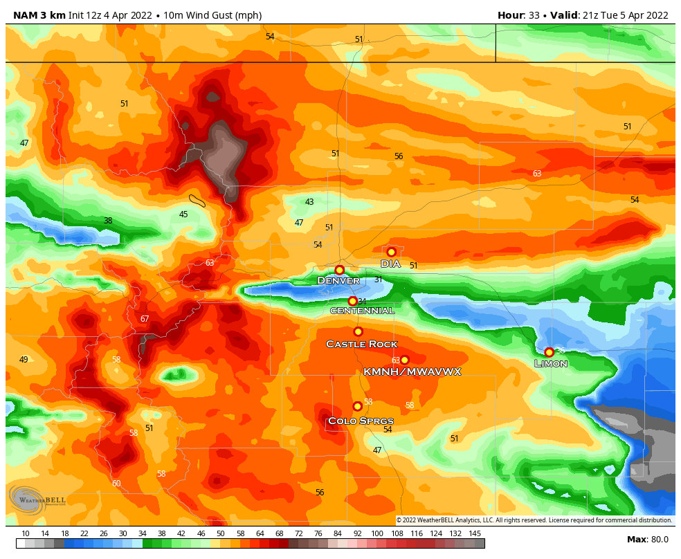
Forecast wind gusts around 3PM on Tuesday 4/5/2022 – Nam3k Model via Weatherbell Analytics
Strong winds are expected to develop and many highlights have been issued for the next day or two in advance of the storm system. Here’s some details on what to expect…
Weather Highlights

High Wind Watch
Locations: Front range, urban corridor, plains in North Central and Northeastern Colorado, Palmer Divide, Pikes Peak Region, Colorado Springs Metro Area
Timing: 4/5/2022 9AM through 4/5/2022 9PM
Impacts: Sustained winds 30-40mph with gusts up to 60-65mph. Strongest wind gusts likely across the Palmer Divide East of Castle Rock and into Western Elbert County. Strong winds may cause downed tree branches and power outages. Travel may be difficult for high profile and lightweight vehicles.
High Wind Warning
Locations: Front range foothills, West of Denver and Northern Colorado North and East of Fort Collins.
Timing: 4/5/2022 9AM through 4/5/2022 9PM
Impacts: Sustained winds 35-45mph with gusts between 60-80mph. Strongest wind gusts likely up against and near the foothills. Strong winds may cause downed tree branches and power outages. Travel may be difficult for high profile and lightweight vehicles.

Winter Weather Advisory
Locations: Rabbit Ears Pass, Rocky Mountain National Park and the Medicine Bow Range, and The Mountains of Summit County, the Mosquito Range, and the Indian Peaks. Elkhead and Park Mountains. Gore and Elk Mountains/Central Mountain Valleys and West Elk and Sawatch Mountains
Timing: 4/4/2022 9PM through 4/6/2022 12AM
Impacts: Snow and blowing snow will reduce visibility to a quarter mile or less. Travel could be very difficult. Widespread blowing snow could significantly reduce visibility
Who Gets Snow?
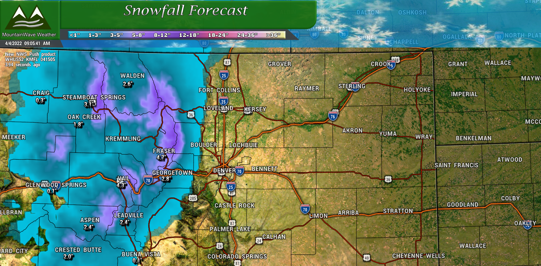
You can see from the snowfall map above the highest snowfall amounts will occur in the mountains along the Continental Divide and a few favored peaks throughout central Colorado. As of right now, we are not expecting any snowfall accumulation to make its way over the Divide and into Eastern Colorado.
Honestly, most of the moisture will most likely stay in the mountains, with only a few scattered showers making it over onto the Easter part of the state.
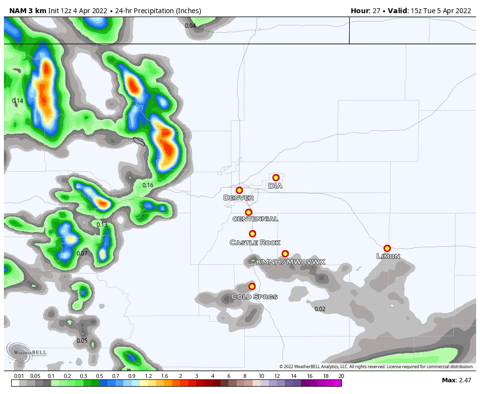
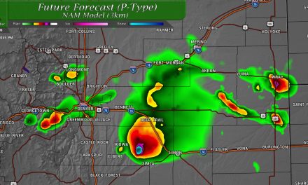
You can see per the 24hr precip total forecast from the Nam3k, only a few light showers put any moisture down across the Palmer Divide. Most of those showers will be south of Castle Rock and Eastwards into Elbert and El Paso County. As with all models, these areas aren’t exact but the overall messaging here is that moisture will be pretty hit or miss for most of us out East.
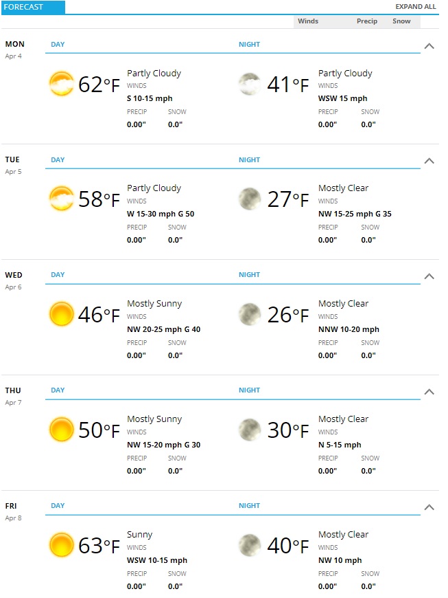
Weekly Forecast
Attached below is the forecast for Castle Rock and surrounding locations for this week.
You’ll notice, not a lot of moisture in the forecast for us sadly – and this is the time of year where we can start using more of that. It also won’t be particularly warm or unseasonably hot or cold for this time of year.
The winds will be up and down through the week with strong winds possible at times as I mentioned above.
Summary
In typical La Nina spring fashion, we look to have some wind on our way! Make sure you have preparations completed by late Monday night – strongest winds look to be East of I-25 so keep that in mind if you live in Eastern Douglas County, Northern El Paso County (east of I-25) and into Elbert County.
Not really seeing a bunch of moisture in our near future outside of a few chances for spotty showers.
If you’re a site supporter you can get a look at what we think April will be like weather-wise with our long range outlook here: https://mountainwaveweather.com/palmer-divide-region-long-range-experimental-forecast/
Additionally the seasonal snow tracker has been updated through end of March here: https://mountainwaveweather.com/mwavwx-seasonal-snow-tracker/
