A new storm system will begin to churn off to the West of Colorado. Many models have begun picking up on this and there’s a lot of agreement that it won’t be a big snowfall event for the front range for a couple of reasons. The EURO image below shows height anomalies from now through late Friday. Remember, orange and red means ridging or generally nice weather while blues and greens show troughing (low pressure centers) and generally mean poorer weather.
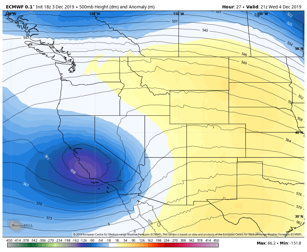
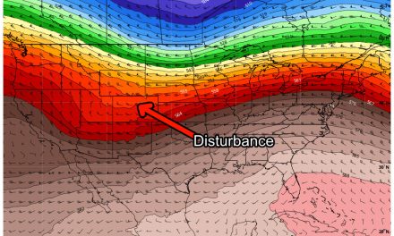
Euro 500mb height anomalies, notice the trough over California Wednesday afternoon. This will make its way overnight to Colorado into Thursday morning.
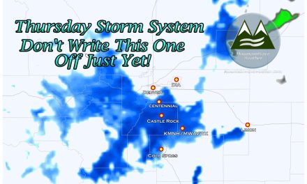
But… watch what happens to this trough Thursday morning:
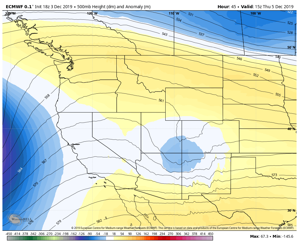
Euro 500mb height anomalies, by Thursday morning the trough is over Southern Colorado and falling apart. Models are not excited about snowfall along the front range.
A few things have to line up, but basically there’s just enough moisture and enough lift as the cold front ahead of the trough moves through to squeeze some snow out. If the lift is strong enough some areas could see some short but intense bursts of snowfall. That’s something we will have to keep an eye on! Also, because the trough is falling apart, colder air will be limited so we can expect marginal snowfall accumulation at best for a lot of areas.
So if models aren’t excited about this storm what’s the big deal?
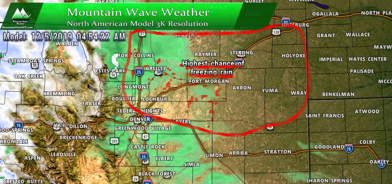
Two words: Freezing Rain!
While the models aren’t excited about snowfall, they do show a decent chance of freezing rain and possible ice accumulation early Thursday morning. By rush hour a lot of that has transitioned to snow, but with a nice layer of ice underneath.
Here’s the Skew-T, it’s a pretty solid representation that the atmosphere will be primed for freezing rain/fog for early Thursday morning.
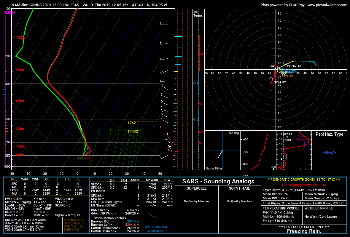
As we’ve seen several times this year, ice and only a little bit of snow can cause big problems. That’s why we will be looking at the Thursday morning commute as having potentially moderate or higher travel impacts.
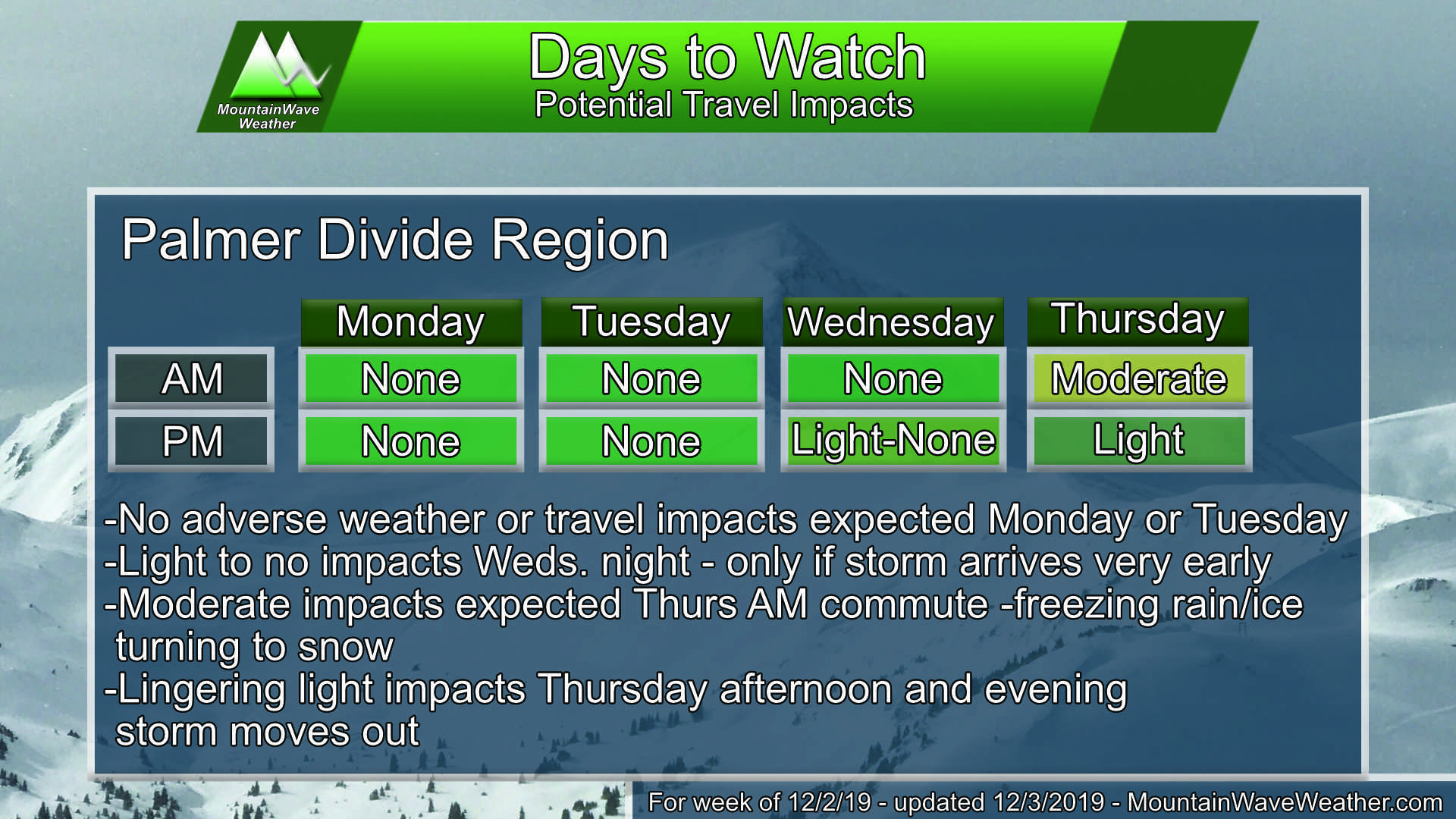
Above is a travel impact product that I’m experimenting with. It shows the potential days/times we are watching for most likely travel impacts and a description of what to expect throughout the week. This is still in beta but is part of a whole bunch of exciting new things I’m working on for the site for early next year!
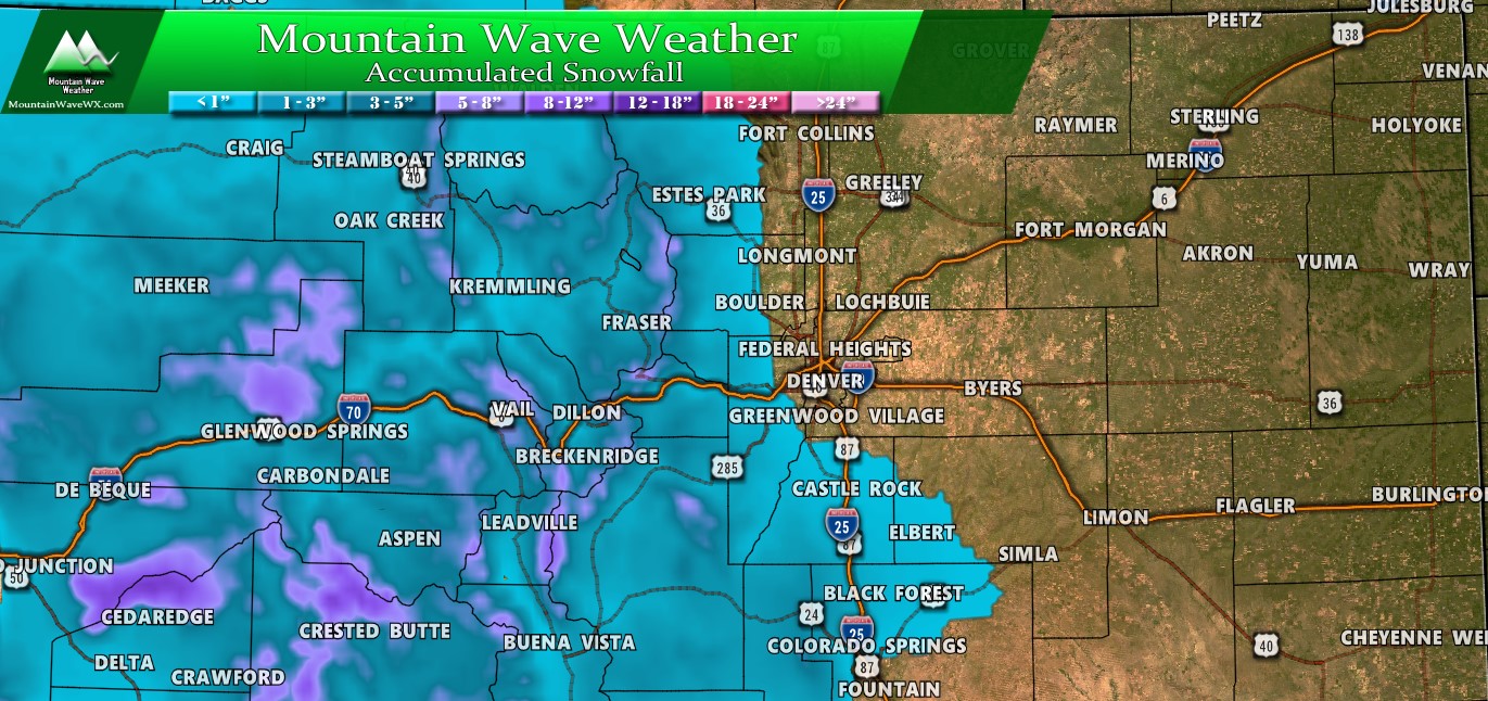
Snowfall
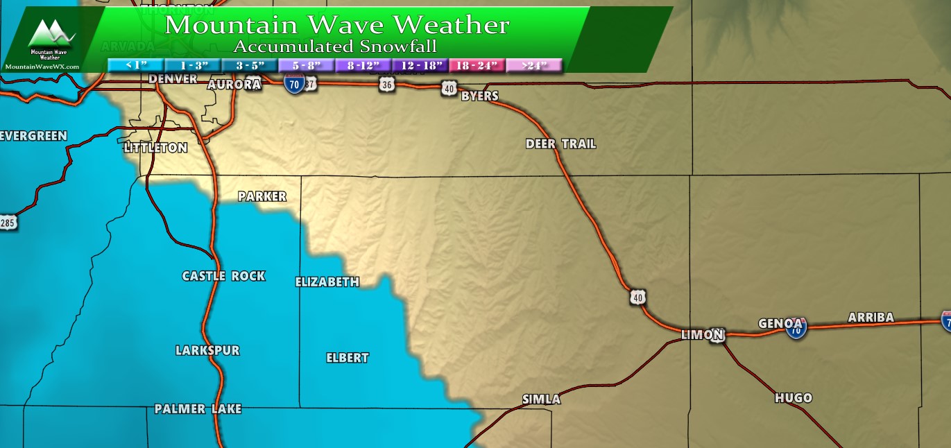
Not impressive in the snow department but here’s some rough numbers:
Palmer Divide (above 6,000 feet): 1-3″
Palmer Divide (below 6,000 feet): 0-2″
Metro Denver and Surrounding Suburbs: 0-2″
Mountains (along continental divide): 4-8″
Eastern Plains: o-T
The Takeaway
Overall not an impressive storm in the snowfall department, but I can foresee slick roads and ice causing havoc in some areas on Thursday morning. If you have travel plans or are commuting in to work, be prepared for a slower than normal drive and possibility of accidents making some of the roads a pain.
We will continue watching and update here as needed!

Thanks John!
Thanks for all your hard work!